My Store
Antique Middle Island, New York 1956 US Geological Survey Topographic Map – Suffolk County, Long Island, Sound Beach, Rocky Point, NY
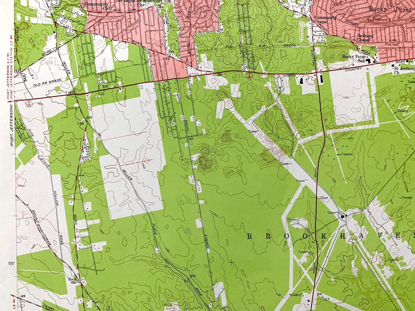
Antique Middle Island, New York 1956 US Geological Survey Topographic Map – Suffolk County, Long Island, Sound Beach, Rocky Point, NY
Beautiful, antique map of Middle Island, New York and surrounding Suffolk County area on Long Island. This is an authentic 1956 edition, 1958 print from the U.S. Geological Survey and is NOT a computer reproduction.
See what New York looked like over 65 years ago. Lots of intricate details and geological contours. Map even has little squares for every house that existed at the time. The USGS cartographers were very thorough back then!
Perfect for the historian, map-lover, the curious or just as a conversation starter. Wonderful and rare. Vintage maps such as these make great gifts.
Edition of 1956, printed 1958
Dimensions: 22" width x 27" height
----
Features
Cities & Towns: Middle Island, Brookhaven, Miller Place, Sound Beach, Woodhull Landing, Rocky Point Landing, Hallock Landing, Rocky Point, Shoreham, Gordon Heights, Ridge.
Points of Interest: Suffolk County, Long Island, Long Island Sound, Middle Island Game Farm, US Reservation Brookhaven National Laboratory, Twin Ponds, Artist Lake, Scotts Beach, North SHore Beach, Shoreham Beach, Washington Memorial Park, Rocky Point Pine Barrens State Forest location, and many more hills, streams, ponds, houses, schools, railroads, churches, roads, islands, coves, and beaches.
Condition: Very Good Vintage condition, commensurate with age. This map is in great shape for being over 60 years old. Light edge-wear, but this will add to vintage character when framed.
----
We will happily adjust shipping price for multiple purchases. Maps are rolled up and shipped in sturdy mailing tubes, never folded.
Couldn't load pickup availability
Share