My Store
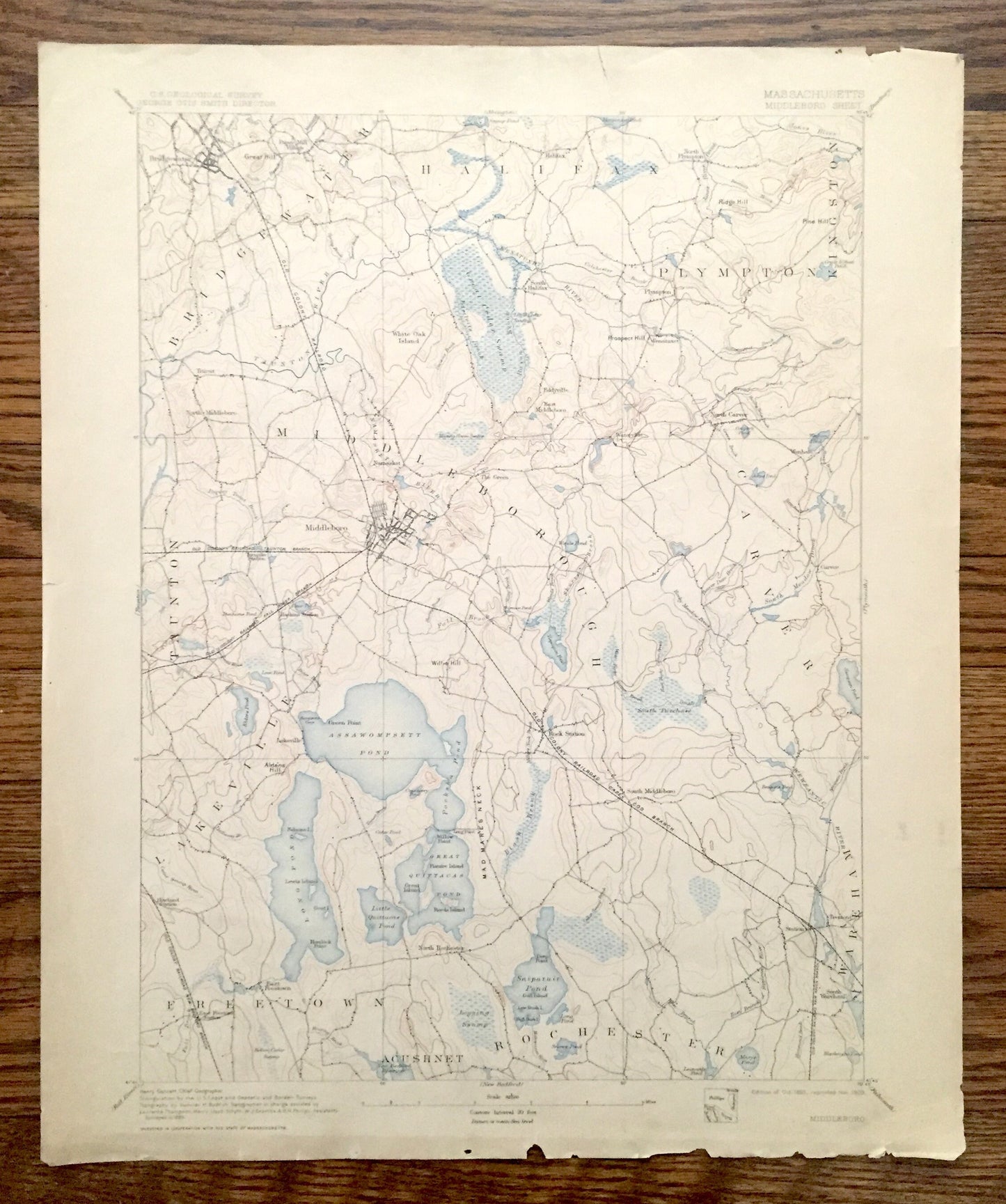
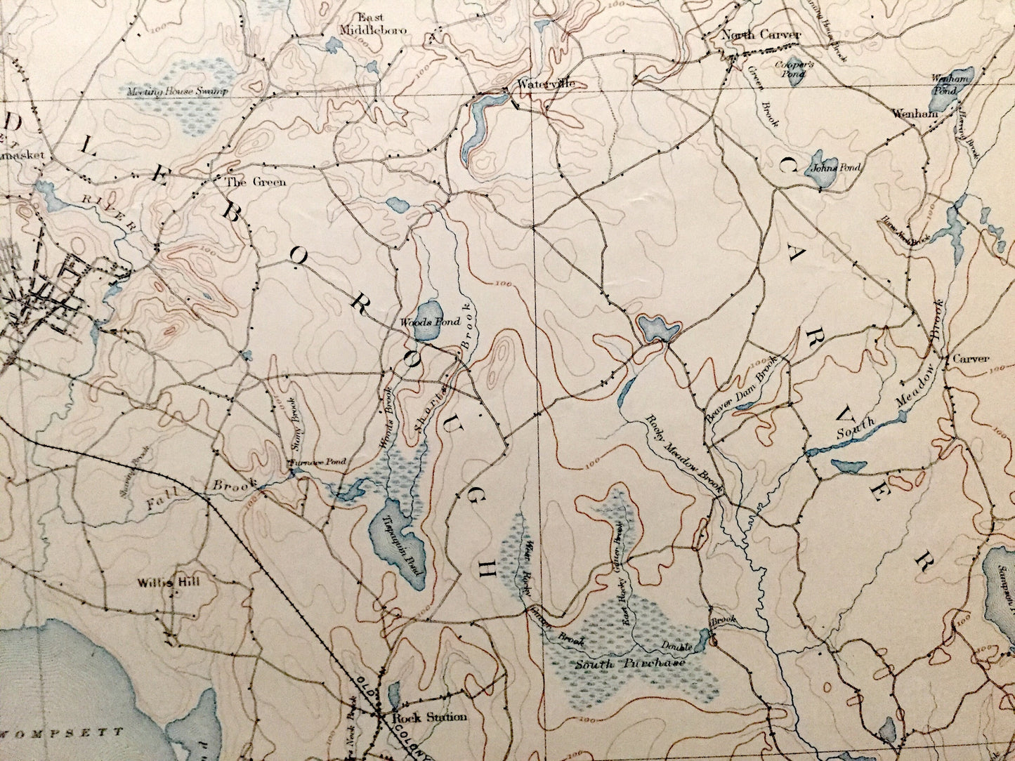
Antique Middleborough, Massachusetts 1893 US Geological Survey Topographic Map – Plymouth County, Halifax, Plympton, Lakeville, Carver, MA
Antique Middleborough, Massachusetts 1893 US Geological Survey Topographic Map – Plymouth County, Halifax, Plympton, Lakeville, Carver, MA
Beautiful, antique map of Middleborough (Middleboro), Halifax, Plympton and Carver, Massachusetts and surrounding Plymouth County area. This is an authentic 1893 edition, 1909 print from the U.S. Geological Survey and is NOT a computer reproduction.
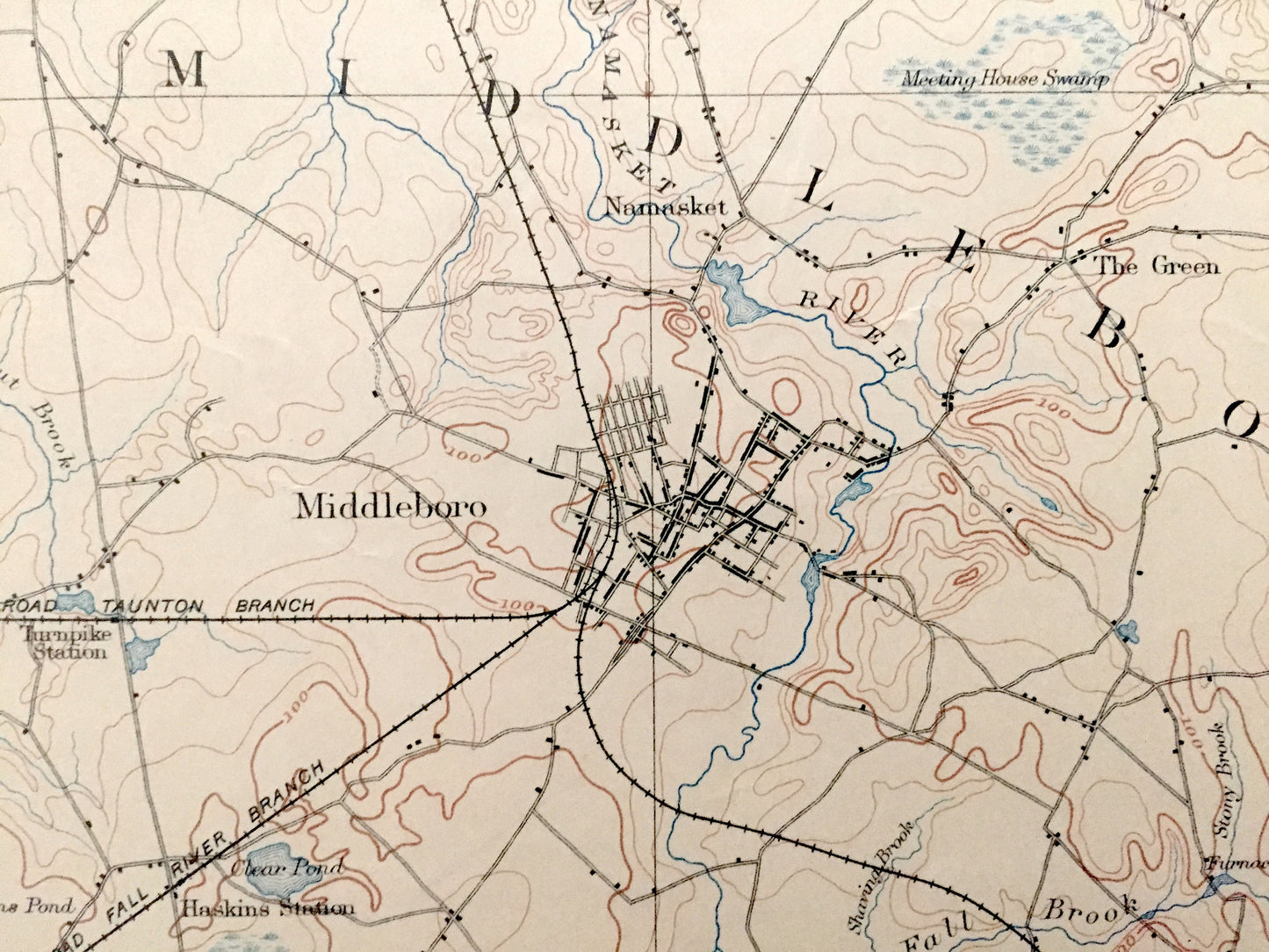
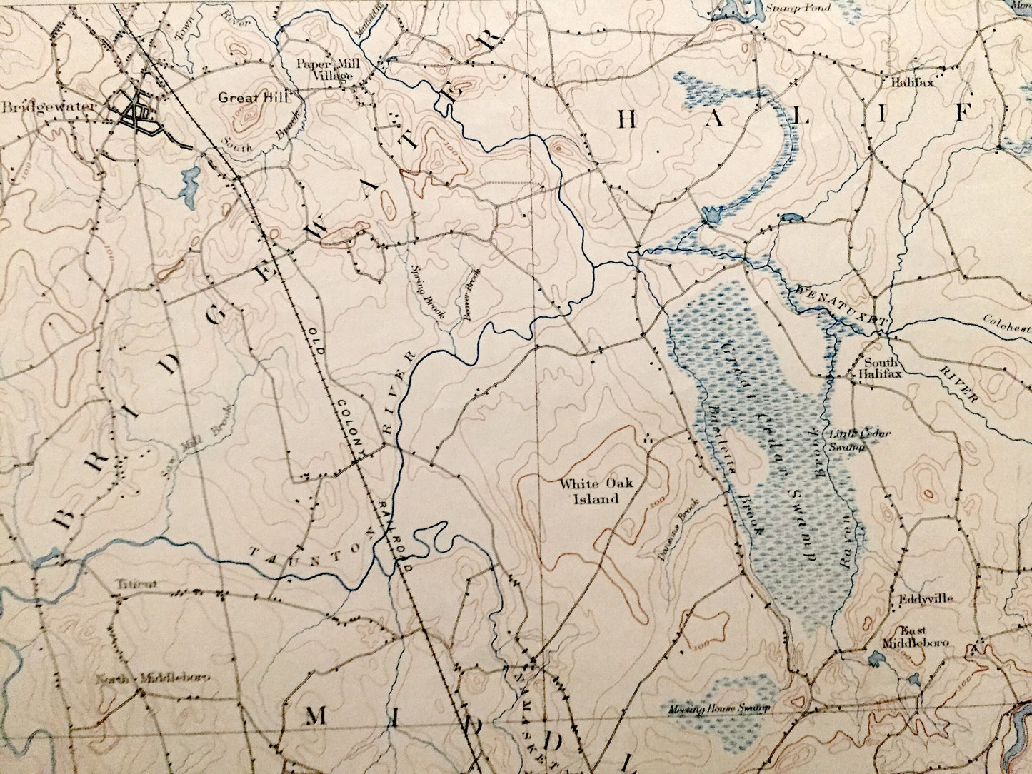
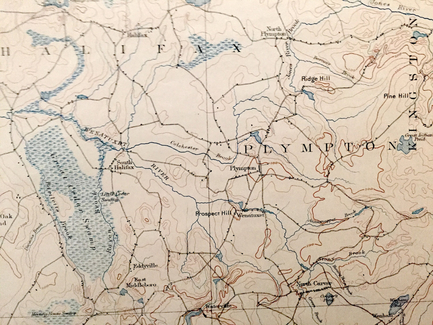
See what Massachusetts looked like over 125 years ago. Lots of intricate details and geological contours. Map even has little squares for every house that existed at the time. The USGS cartographers were very thorough back then! On the back is a description of topographic symbols and map guide.
Perfect for the historian, map-lover, the curious or just as a conversation starter. Wonderful and rare. Vintage maps such as these make great gifts.
Edition of 1893, printed 1909
Dimensions: 16 1/2" width x 20" height
----
Features
Cities & Towns: Bridgewater, Halifax, Plympton, Kingston, Middleborough, Carver, Lakeville, Wareham, Rochester, Acushnet, Freetown, Taunton.
Points of Interest: Paper Mill Village, Assawompsett Pond, Great Quittacas Pond, Long Pond, Old Colony Railroad-Cape Cod Branch, East Freetown Station, Mad Mare's Neck, and many more roads, houses, reservoirs, ponds, and hills.
Condition: Good Vintage condition, commensurate with age. This map is in great shape for being over 100 years old. Has some edge-wear but this will add to vintage character when framed.
----
We will happily adjust shipping price for multiple purchases. Maps are shipped fully-insured, rolled up in sturdy mailing tubes.
Couldn't load pickup availability
Share