My Store
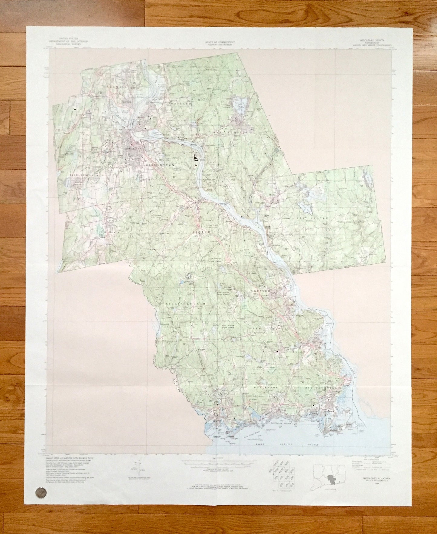
Antique Middlesex County, Connecticut WALL SIZE 1979 US Geological Survey Topographic Map – Old Saybrook, Westbrook, Middletown, Haddam, ct
Antique Middlesex County, Connecticut WALL SIZE 1979 US Geological Survey Topographic Map – Old Saybrook, Westbrook, Middletown, Haddam, ct
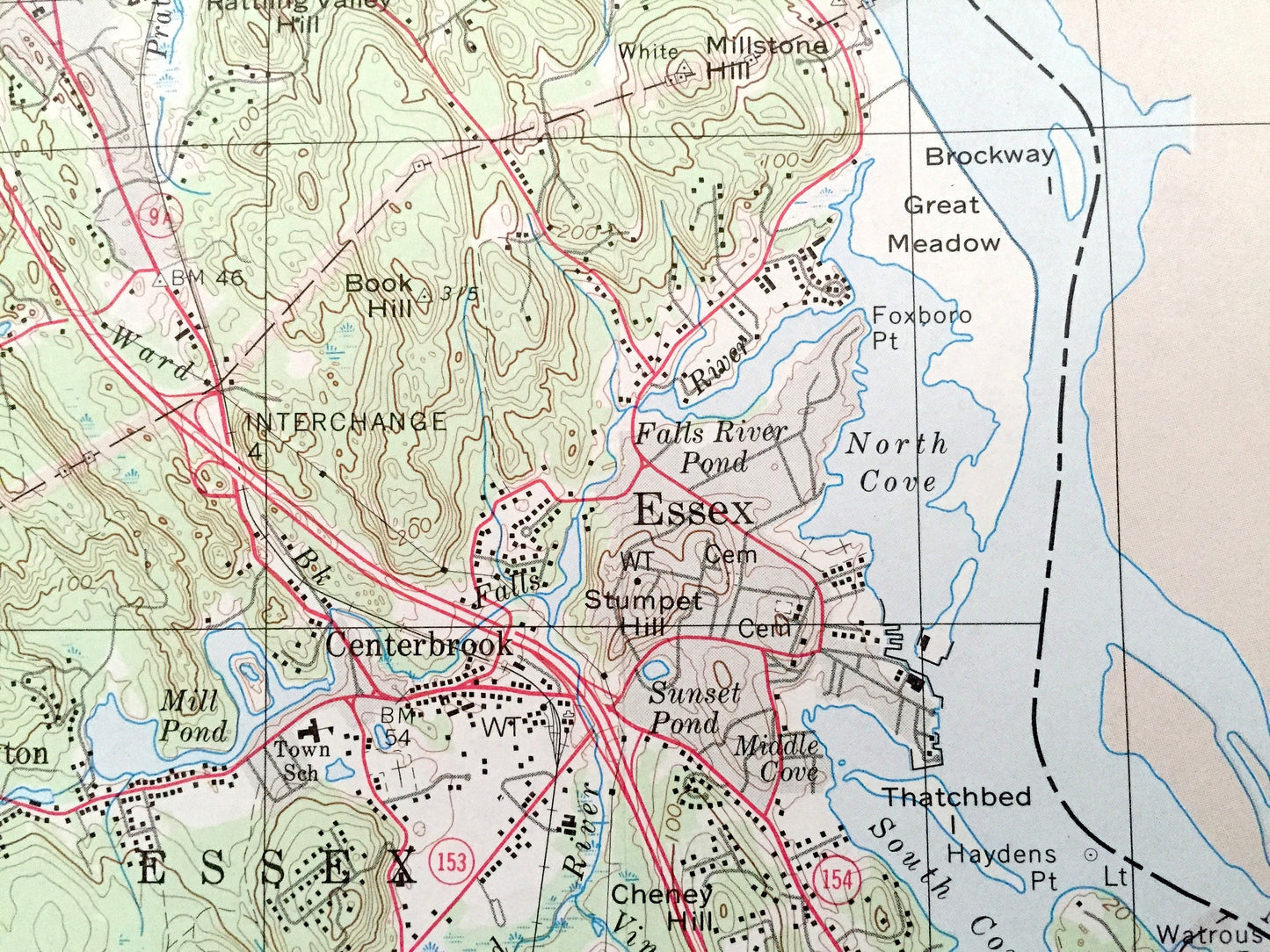
Beautiful, antique and *very large* map of Middlesex County, Connecticut. This is an authentic 1979 print from the U.S. Geological Survey and NOT a computer reproduction.
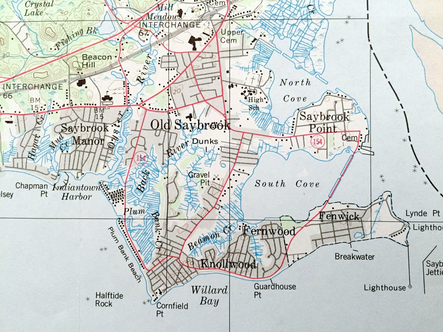
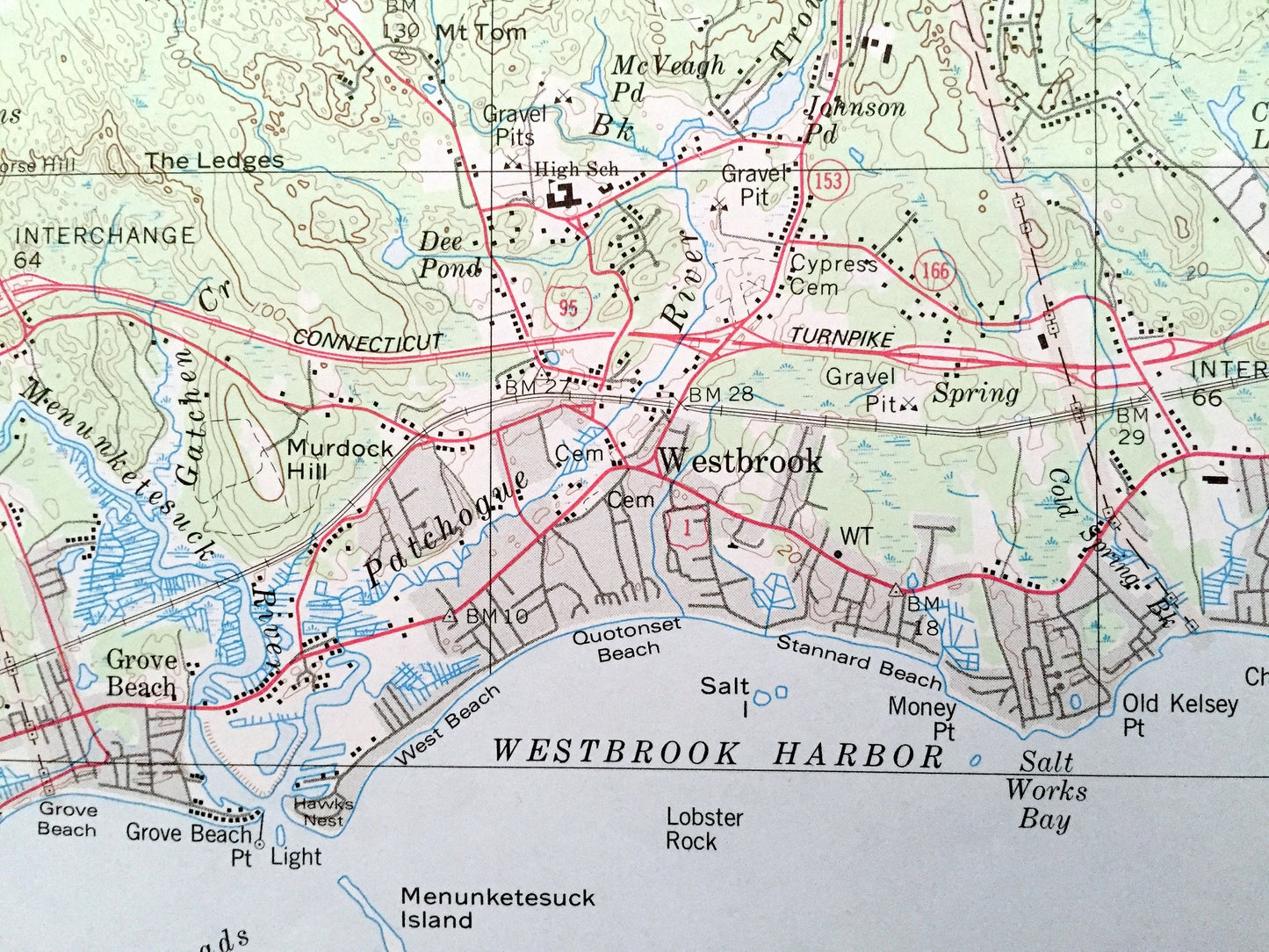
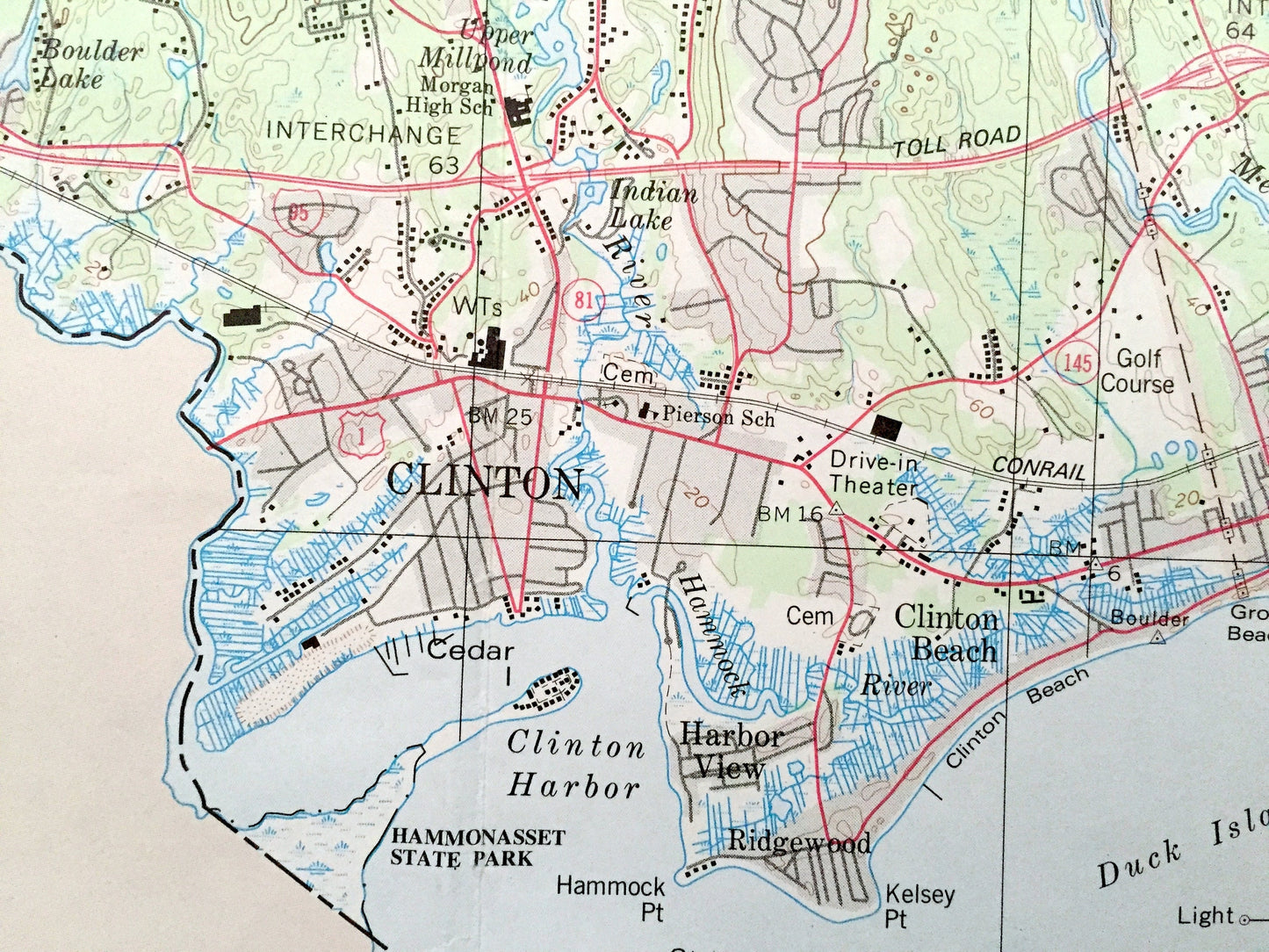
See what Connecticut looked like over 40 years ago. Lots of intricate details and geological contours. Map even has little squares for every house and building that existed at the time (no small feat for how large the map is). The USGS cartographers were very thorough back then!
This map is very large, about 3 feet by 4 feet, and the print is as detailed as the smaller USGS maps. The breadth of detail is incredible and would be the focal point of wherever it is hung. (See coin in the bottom left corner of the map in first photo for scale.) Verso is blank.
Perfect for the historian, map-lover, the curious or just as a conversation starter. Wonderful and rare. Vintage maps such as these make great gifts or office decoration.
Edition of 1979, printed 1979
Dimensions: 34" width x 42" height
----
Features
Towns & Cities: Centerbrook, Chester, Clinton, Cobalt, Cromwell, Deep River, Durham, East Haddam, East Hampton, Essex, Haddam, Higganum, Ivoryton, Killingworth, Middle Haddam, Middlefield, Middletown, Moodus, Old Saybrook, Portland, Rockfall, Westbrook, Fernwood, Saybrook Point, Fenwick, Knollwood, Saybrook Manor, Ivorytown, Centerbrook, Grove Beach, Winthrop, Pond Meadow, Harbor View, Clinton Beach, Rockfall, Bretton Heights, Goodrich Heights, Leesville, Lake Pocotopaug.
Points of Interest: Connecticut River, Long Island Sound, Westbrook Harbor, Hammonasset State Park, Cockaponset State Forest, Higganum Reservation State Forest, Devils Hopyard State Park, Millers Pond State Park, Pocotopaug Lake, Seymour State Park, Bashan Lake, Moodus Reservoir, Meshomasic State Park, Hurd State Park, Roast Meat Hill, The Ledges, Lake Hammonasset, Salmon River and many more mountains, peaks, hills, canyons, creeks, rivers, valleys, beaches, train tracks, schools, churches neighborhoods and streets.
Condition: Very Good Vintage condition, commensurate with age. This map is in great shape for being over 40 years old, next to no wear. Has folds as-issued, but these will flatten easily, and all will read as vintage character when framed.
----
We will happily adjust shipping price for multiple purchases. Map will be shipped folded and fully-insured.
Couldn't load pickup availability
Share