My Store
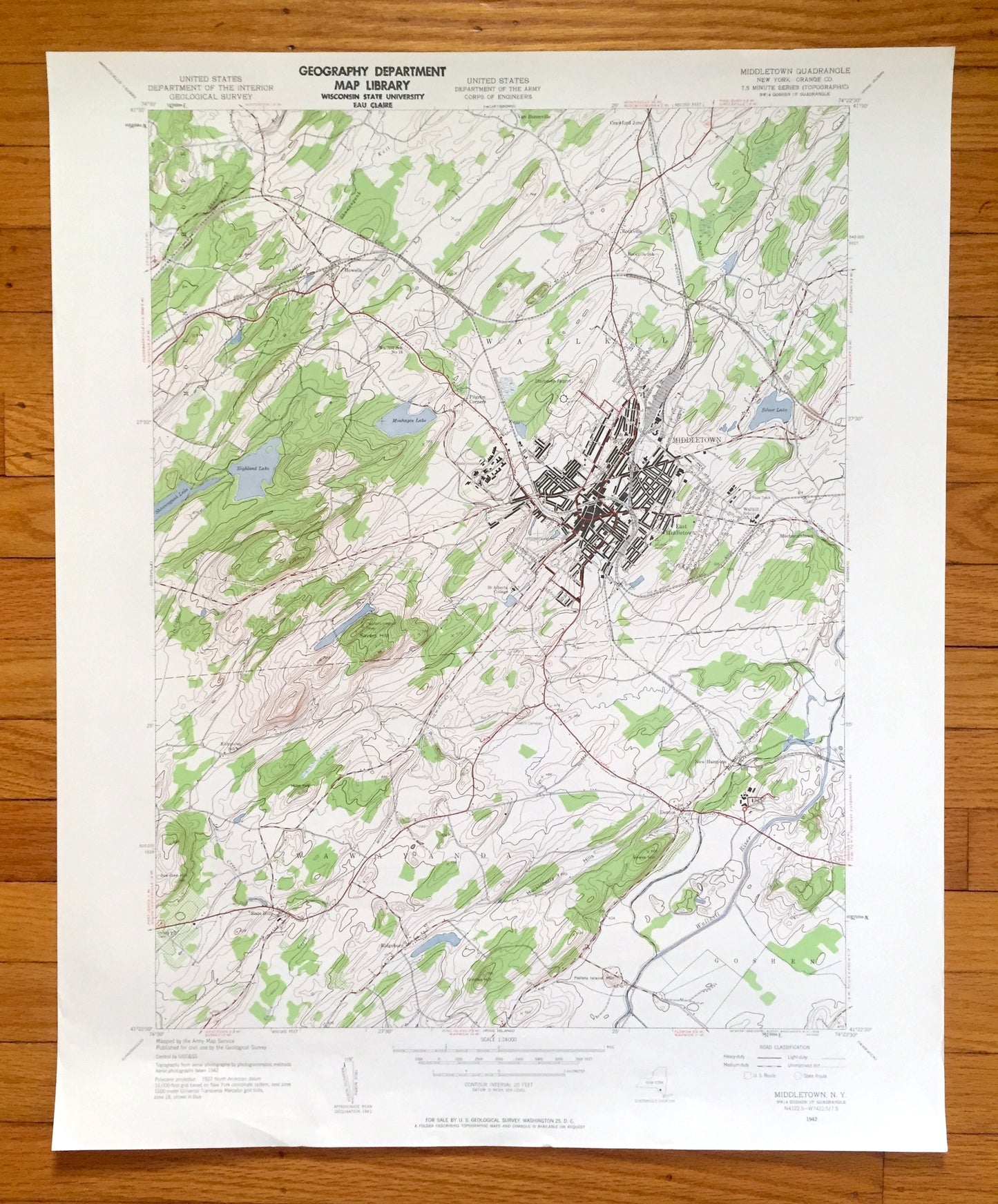
Antique Middletown, New York 1942 US Geological Survey Topographic Map – Orange County, Wallkill, Wawayanda, Goshen, Mechanicstown, NY
Antique Middletown, New York 1942 US Geological Survey Topographic Map – Orange County, Wallkill, Wawayanda, Goshen, Mechanicstown, NY
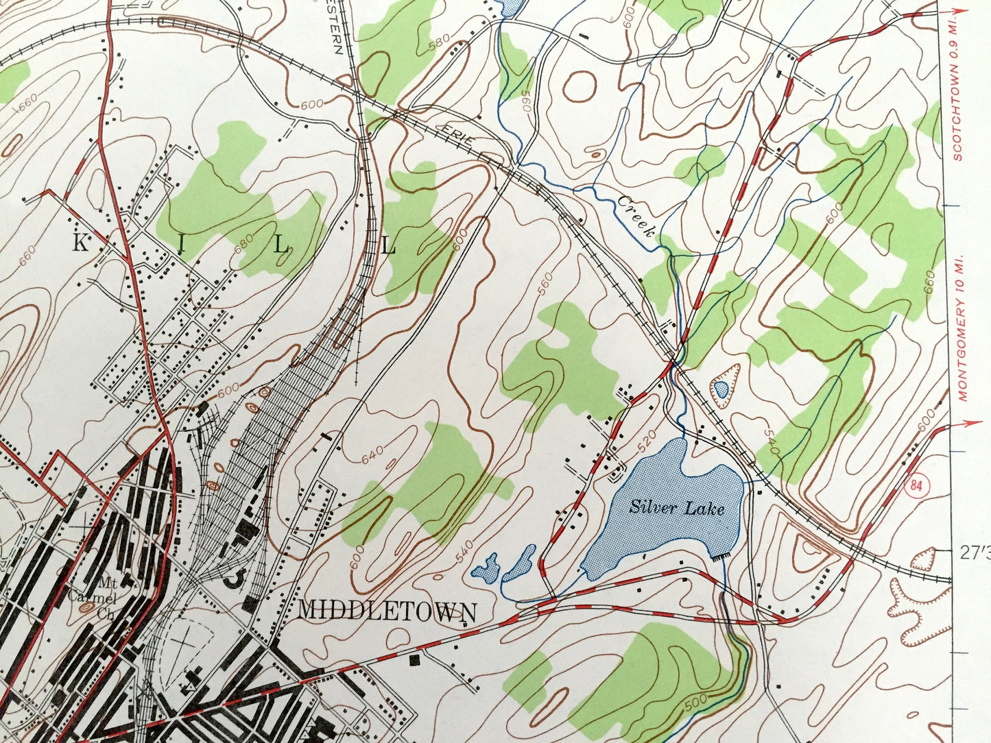
Beautiful, antique map of Middletown, New York and surrounding Orange County area. This is an authentic 1942 edition, 1959 print from the U.S. Geological Survey and NOT a computer reproduction.
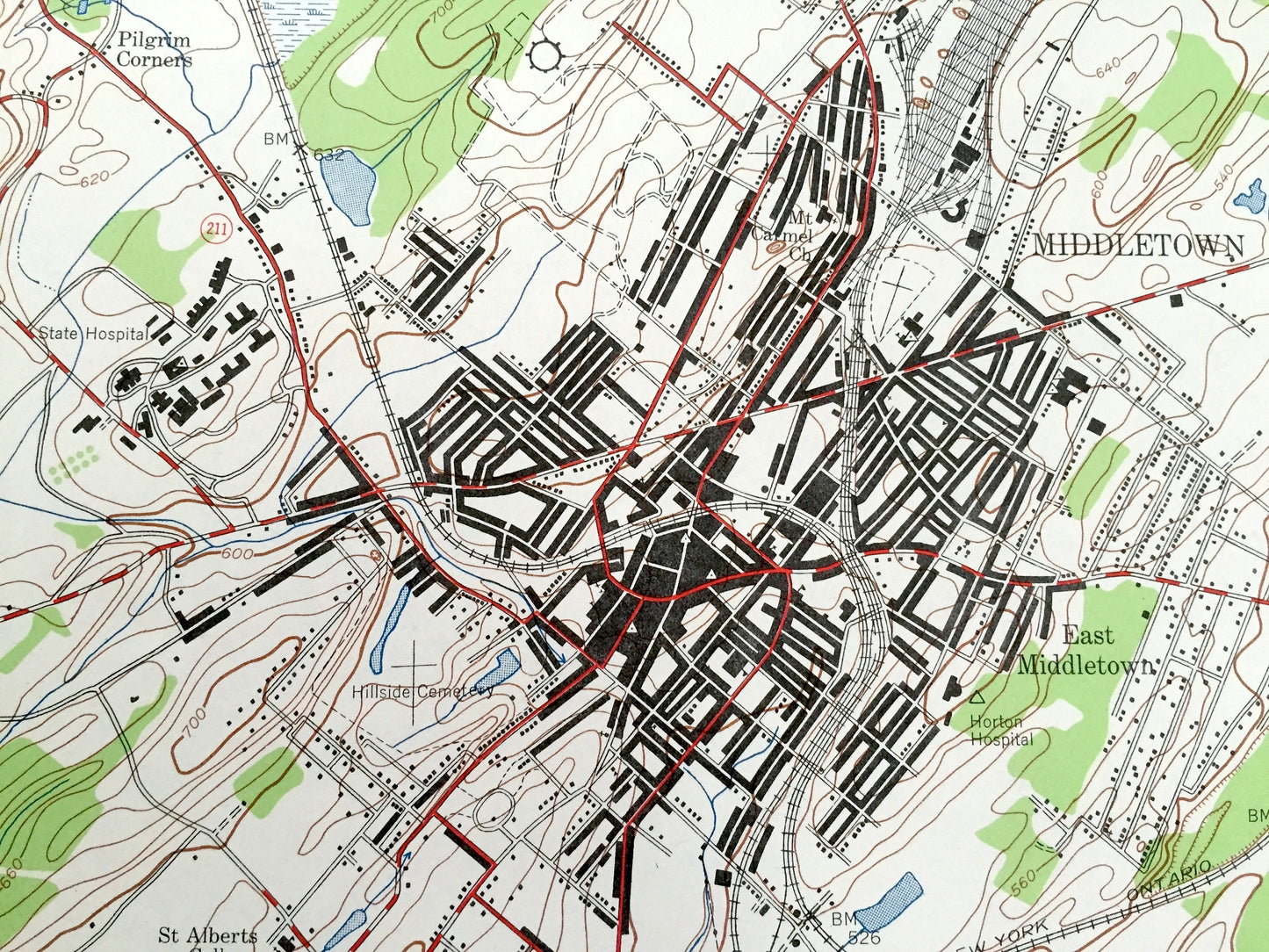
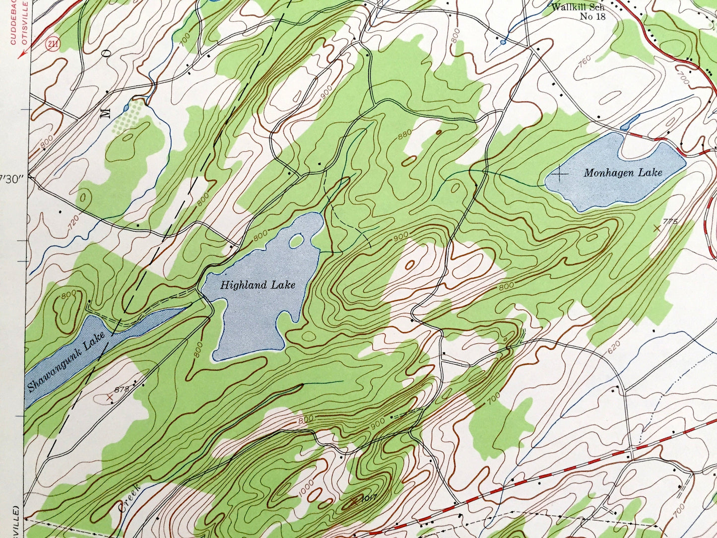
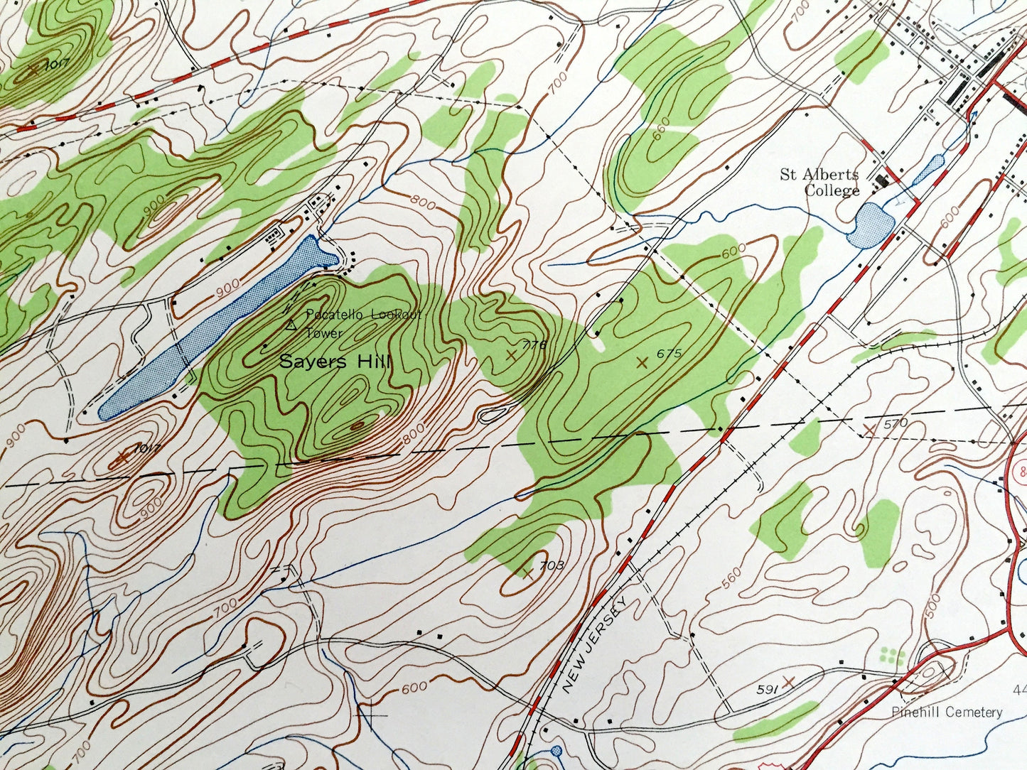
See what New York looked like over 80 years ago. Lots of intricate details and geological contours. Map even has little squares for every house that existed at the time. The USGS cartographers were very thorough back then!
Perfect for the historian, map-lover, the curious or just as a conversation starter. Wonderful and rare. Vintage maps such as these make great gifts.
Edition of 1942, printed 1959
Dimensions: 22" width x 27" height
----
Features
Cities & Towns: Middletown, Wallkill, Wawayanda, Goshen, East Middletown, Mechanicstown, Howells, Pilgrim Corners, Slate Hill, Ridgebury, New Hampton, Denton, Van Burenville.
Points of Interest: Orange County, Wallkill River, Monhagen Lake, Shawangunk Lake, Highland Lake, Sayers Hill, Silver Lake, Starhaven Airport, Huckleberry Hills, Joe Gee Hill, Pellets Island Mountain, St Alberts College, and many more hills, streams, ponds, houses, schools, railroads, churches and roads.
Condition: Good Vintage condition, commensurate with age. This map is in great shape for being over 60 years old. Has light edge-wear and ex-libris stamp in margin, all of which will read as character when framed.
----
We will happily adjust shipping price for multiple purchases. Maps are rolled up and shipped in sturdy mailing tubes, never folded.
Couldn't load pickup availability
Share