My Store
Antique Milford Square, Pennsylvania 1957 US Geological Survey Topographic Map – Upper Hanover, Marlborough, Bucks, Montgomery County, PA
Antique Milford Square, Pennsylvania 1957 US Geological Survey Topographic Map – Upper Hanover, Marlborough, Bucks, Montgomery County, PA
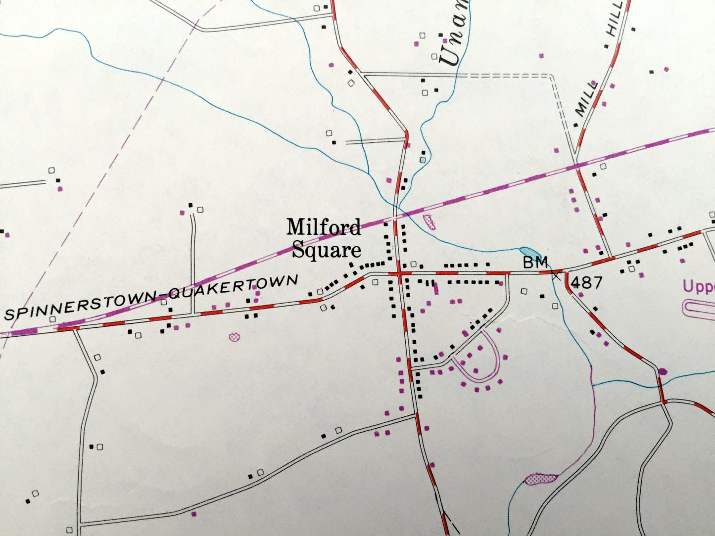
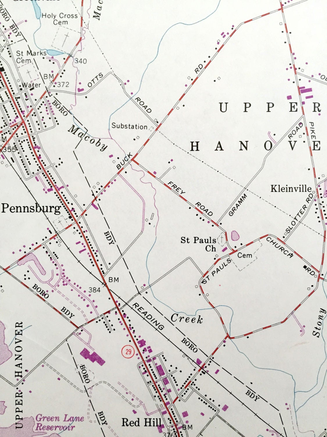
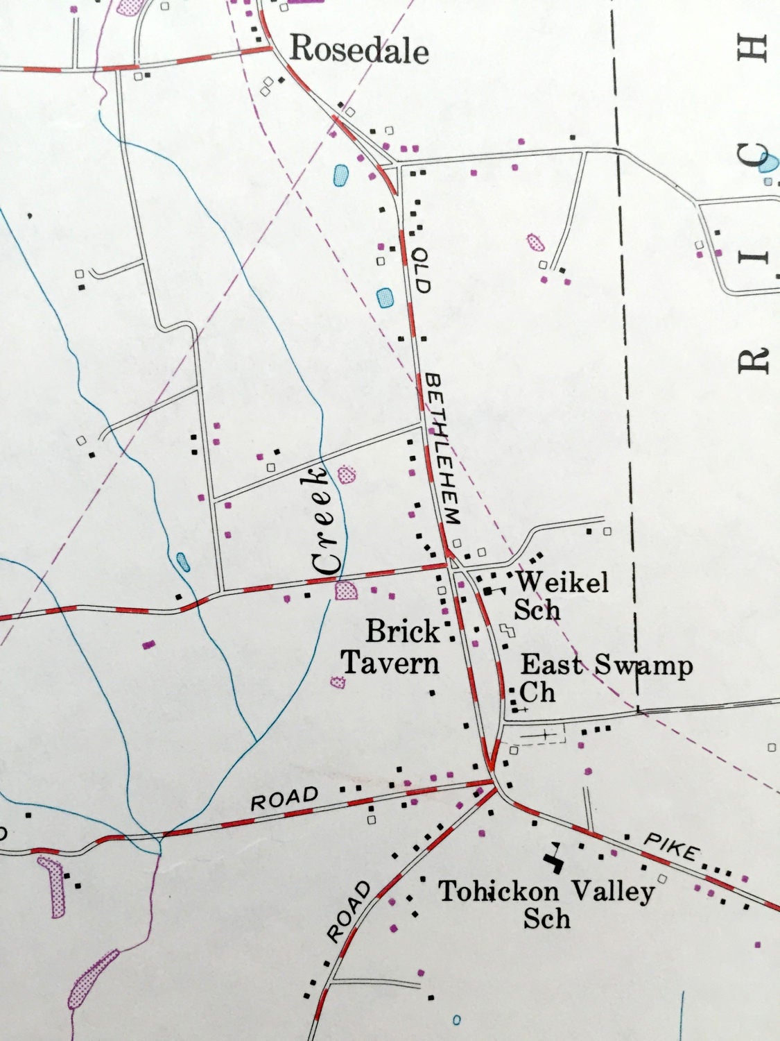
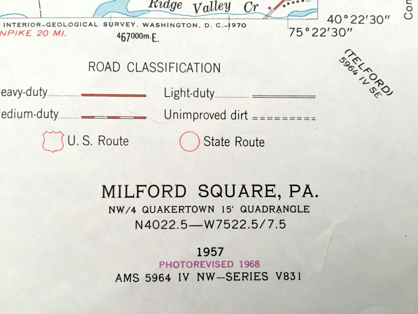
Beautiful, antique map of Milford, Milford Square, Lower Milford, Upper Hanover, Springfield and West Rockhill, Pennsylvania. This is an authentic 1957 print from the U.S. Geological Survey and NOT a computer reproduction.
See what Bucks, Lehigh and Montgomery Counties of Pennsylvania looked like 60 years ago. Lots of intricate details and geological contours. Map even has little squares for every house that existed at the time. The USGS cartographers were very thorough back then!
Perfect for the historian, map-lover, the curious or just as a conversation starter. Wonderful and rare. Vintage maps such as these make great gifts.
Edition of 1957, printed 1957
Dimensions: 22" width x 27" height
----
Features
Cities & Towns: Upper Milford, Hosensack, Krassdale, Upper Hanover, Kleinville, Pennsburg, Red Hill, Marlborough, West Rockhill, Milford, Trumbauersville, Brick Tavern, Springfield, Zionhill, Upper Saucon, Locust Valley, Richland, Spinnerstown, Mumbauersville, Geryville.
Points of Interest: Dillinger Station, Reading Railroad, Lower Milford School, Krassdale-Schwenksfelder Church, Men-O-Lan Camp, Camp Rockwood, Upper Bucks County Airport, Tohickon Valley School, Weikel School, Locust Valley Country Club, and lots more hills, streams, ponds, schools, churches, houses, and roads.
Condition: Very Good condition, commensurate with age. This map is in incredible shape for being 60 years old. Has some edge-wear, which will read as character when framed.
----
We will happily adjust shipping price for multiple purchases. Maps are rolled up and shipped in sturdy mailing tubes, never folded.
Couldn't load pickup availability
Share