My Store
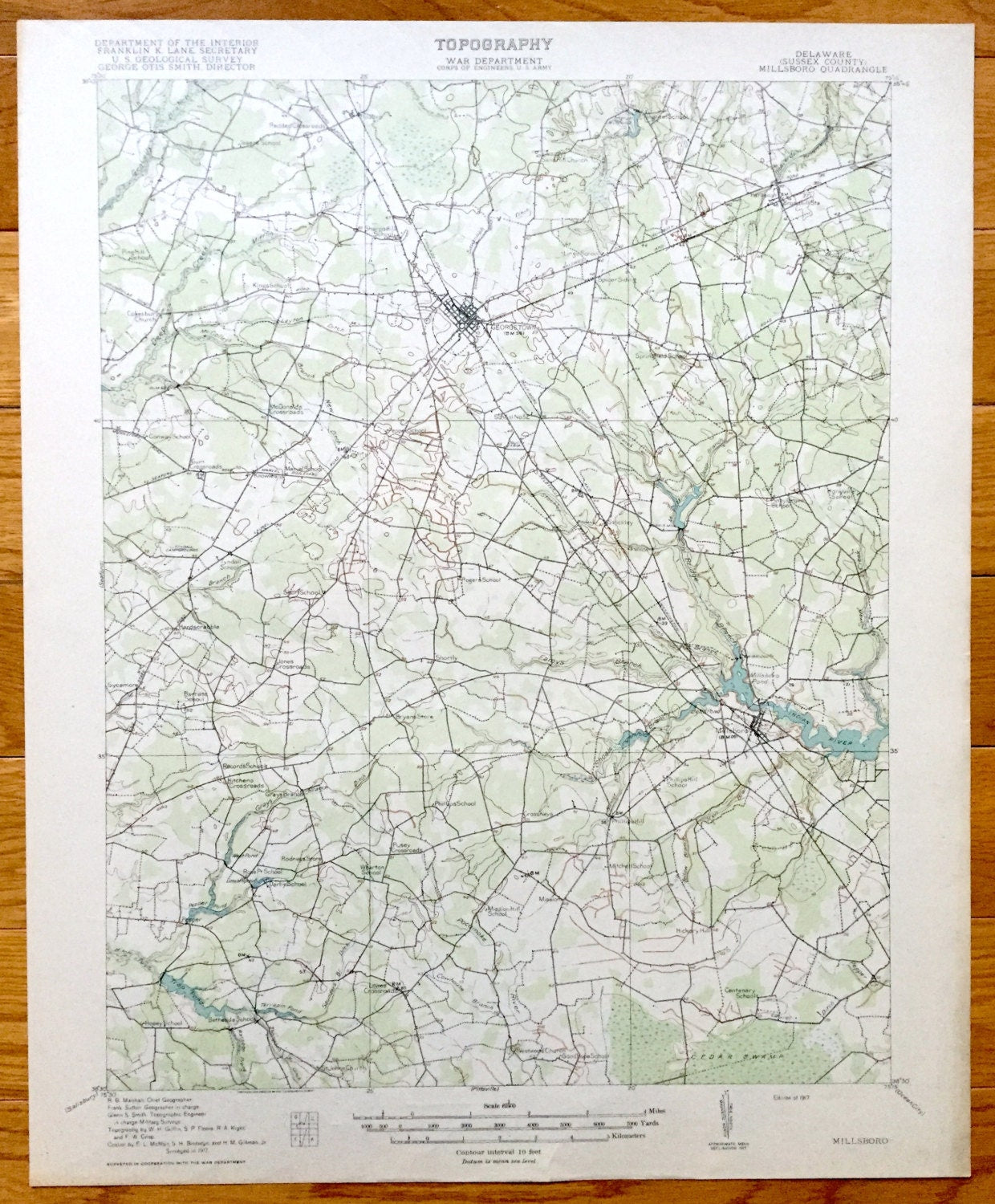
Antique Millsboro, Delaware 1917 US Geological Survey Topographic Map – Georgetown, Hardscrabble, Stockley, Mission, Phillips Hill, DE
Antique Millsboro, Delaware 1917 US Geological Survey Topographic Map – Georgetown, Hardscrabble, Stockley, Mission, Phillips Hill, DE
Beautiful, antique map of Millsboro and Sussex County, Delaware. This is an original authentic 1917 print from the U.S. Geological Survey and NOT a computer reproduction.
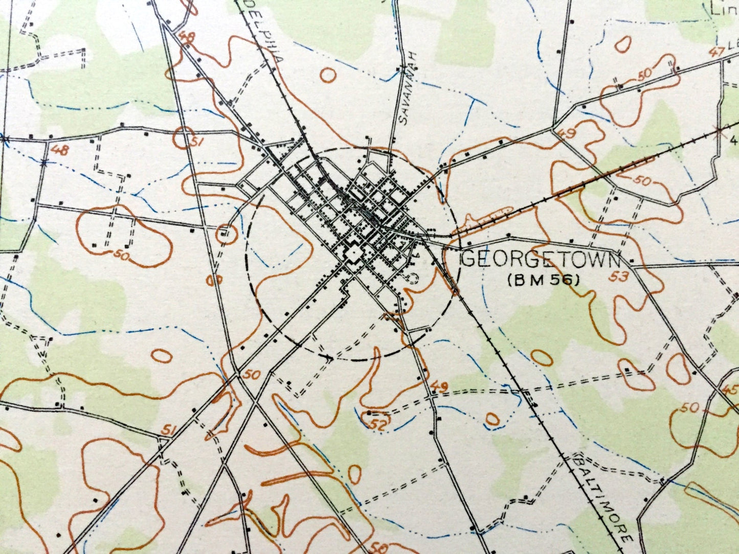
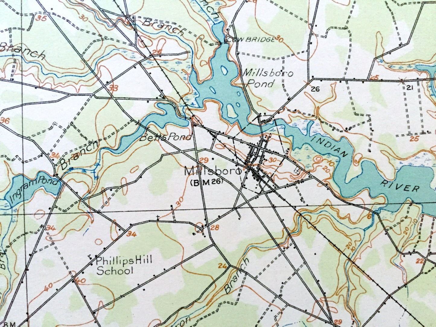
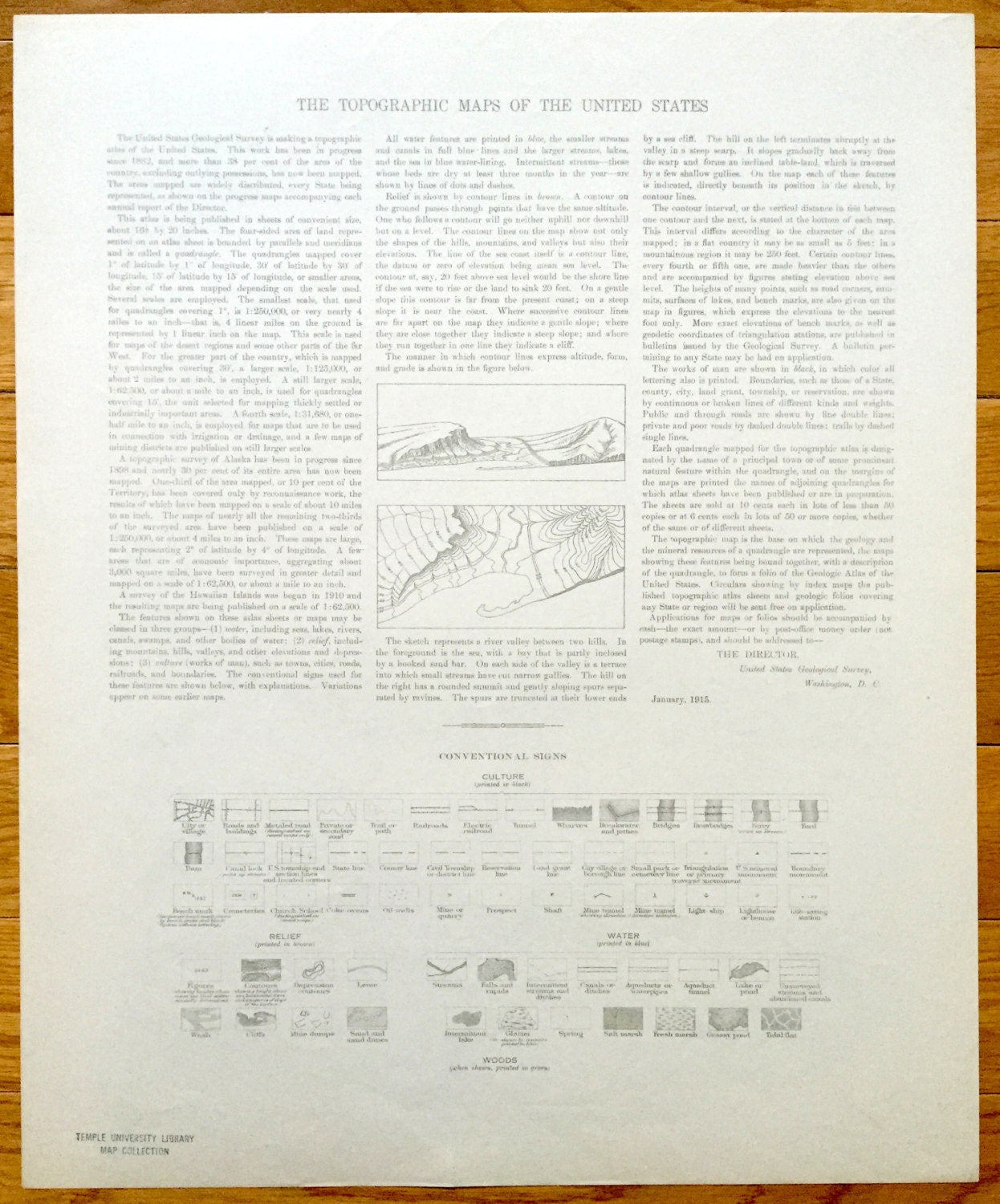
See what Millsboro and Georgetown looked like over 100 years ago. Lots of intricate details and geological contours. Map even has little squares for every house that existed at the time. The USGS cartographers were very thorough back then! On the back is a description of topographic symbols and map guide.
Perfect for the historian, map-lover, the curious or just as a conversation starter. Wonderful and rare. Vintage maps such as these make great gifts.
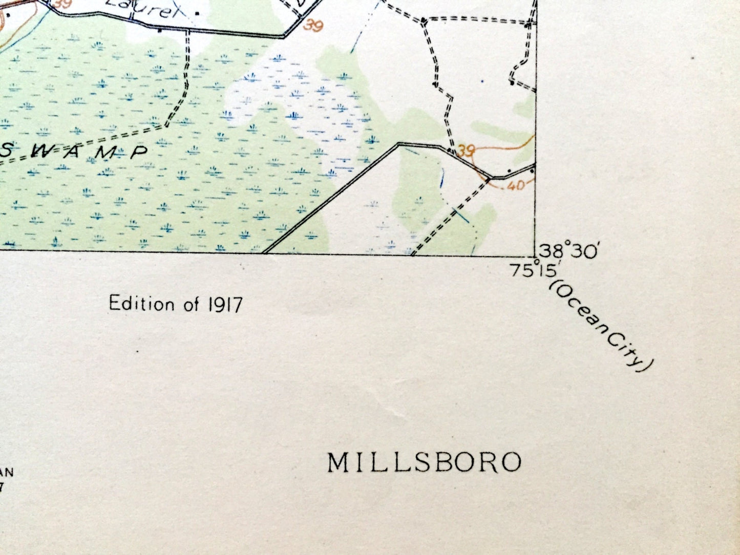
Edition of 1917, printed 1917
Dimensions: 16 1/2" width x 20" height
----
Features
Cities & Towns: Georgetown, Millsboro, Hardscrabble, Stockley, Mission, Phillips Hill, Sycamore.
Points of Interest: Cedar Swamp, Morrismill Pond, West Pond, Pepper Pond, Terrapin Pond, Deep Creek, Marvel School, Lingo School, Sand Hill Church, Ingram Mill Pond, Ingram School, Indian River, Baltimore and Washington Railroad, Trap Pond, Tyndall Campgrounds, Pepper School, and lots more hills, creeks, towns, schools, and roads.
Condition: Very Good Vintage condition, commensurate with age. This map is in incredible shape for being over 100 years old.
----
We will happily adjust shipping price for multiple purchases. Maps are rolled up and shipped in sturdy mailing tubes, never folded.
Couldn't load pickup availability
Share