My Store
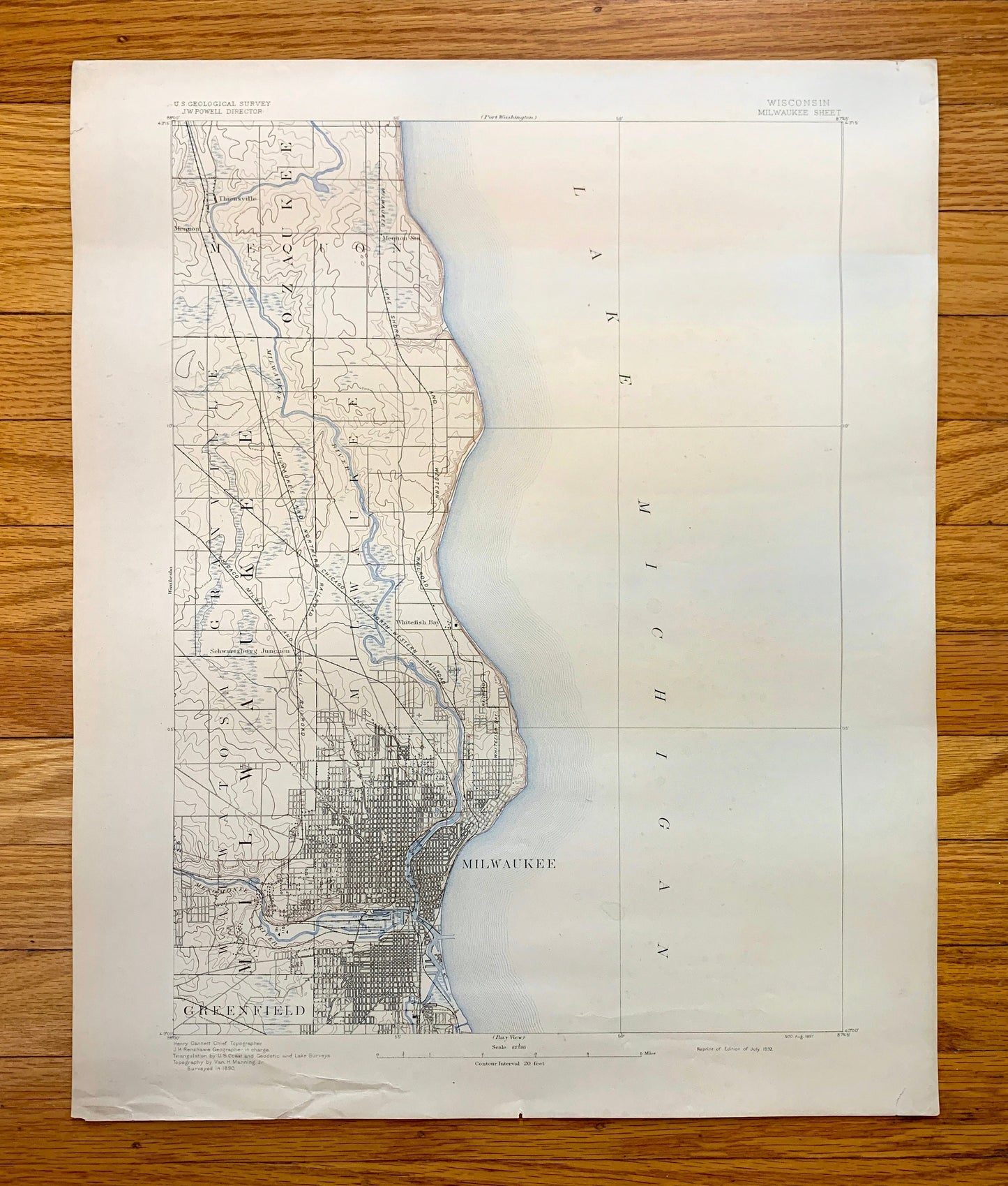
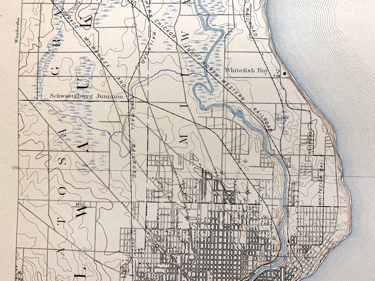
Antique Milwaukee, Wisconsin 1892 US Geological Survey Topographic Map – Ozaukee County, Lake Michigan Brown Deer Whitefish Bay Menomonee WI
Antique Milwaukee, Wisconsin 1892 US Geological Survey Topographic Map – Ozaukee County, Lake Michigan Brown Deer Whitefish Bay Menomonee WI
Beautiful, antique map of Milwaukee, Wisconsin and surrounding Milwaukee & Ozaukee County area on Lake Michigan. This is an authentic 1892 print from the U.S. Geological Survey and is NOT a computer reproduction.
See what Wisconsin looked like over 130 years ago, before Lake Wisconsin was formed. Lots of intricate details and geological contours. Map even has little squares for every house that existed at the time. The USGS cartographers were very thorough back then!
Perfect for the historian, map-lover, the curious or just as a conversation starter. Wonderful and rare. Maps such as these make great gifts.
Edition of 1906, printed 1950
Dimensions: 16 1/2" width x 20 1/4" height
----
Features
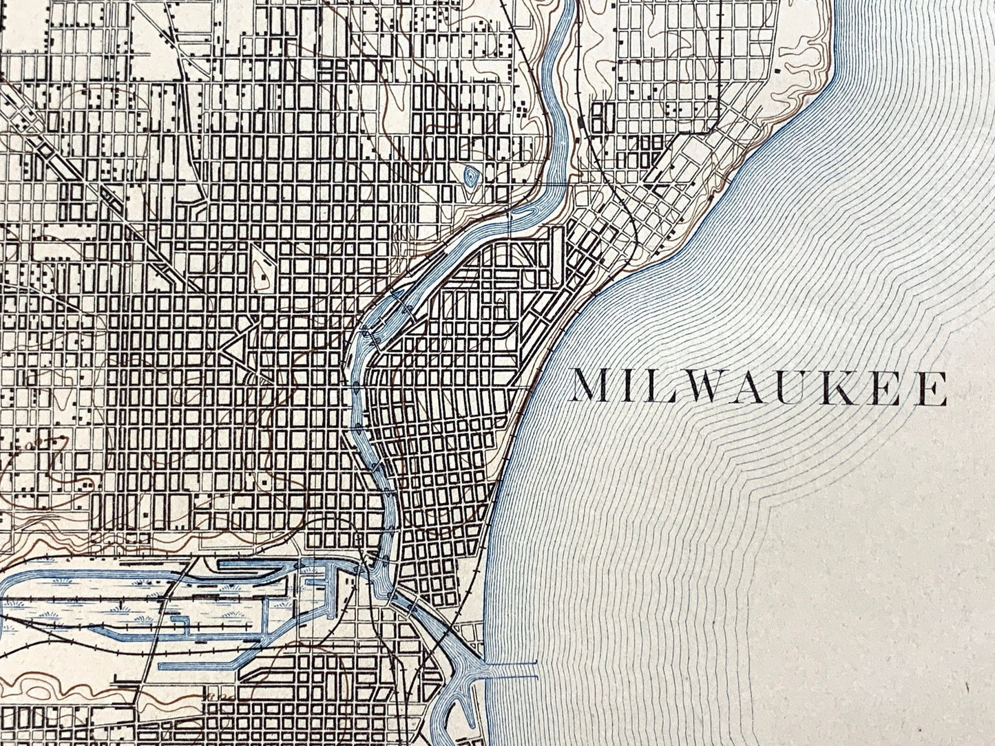
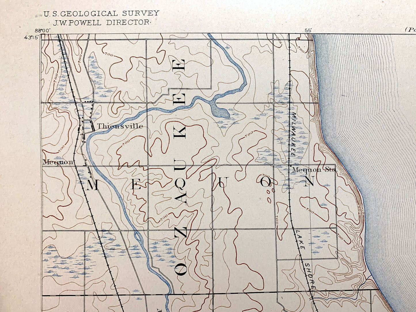
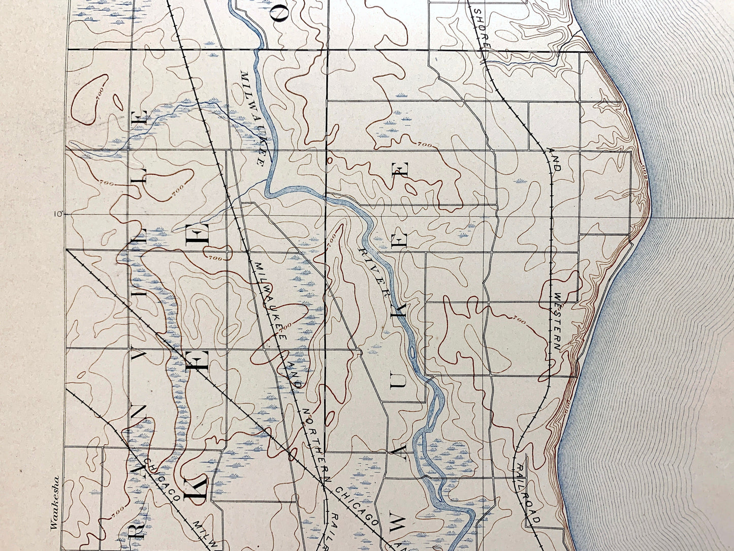
Cities & Towns: Milwaukee, Mequon, Granville, Waowatosa, Greenfield, Thiensville, Brown Deer, Dillman, Silver Spring, North Milwaukee, Whitefish Bay, Berthelet, Lindwerm, West Allis.
Points of Interest: Milwaukee County, Ozaukee County, Lake Michigan, Milwaukee River, Whitefish Bay, North point, Fox Point, Menomonee River, Lake Park, and many more hills, brooks, towns, schools, churches, roads and train tracks.
Condition: Good Vintage condition, commensurate with age. This map is in great shape for being over 130 years old. Has some wear, toning, foxing and small tears at margins, but this will all add to vintage character when framed.
----
We will happily adjust shipping price for multiple purchases. Map will be shipped folded to preserve integrity.
Couldn't load pickup availability
Share