My Store
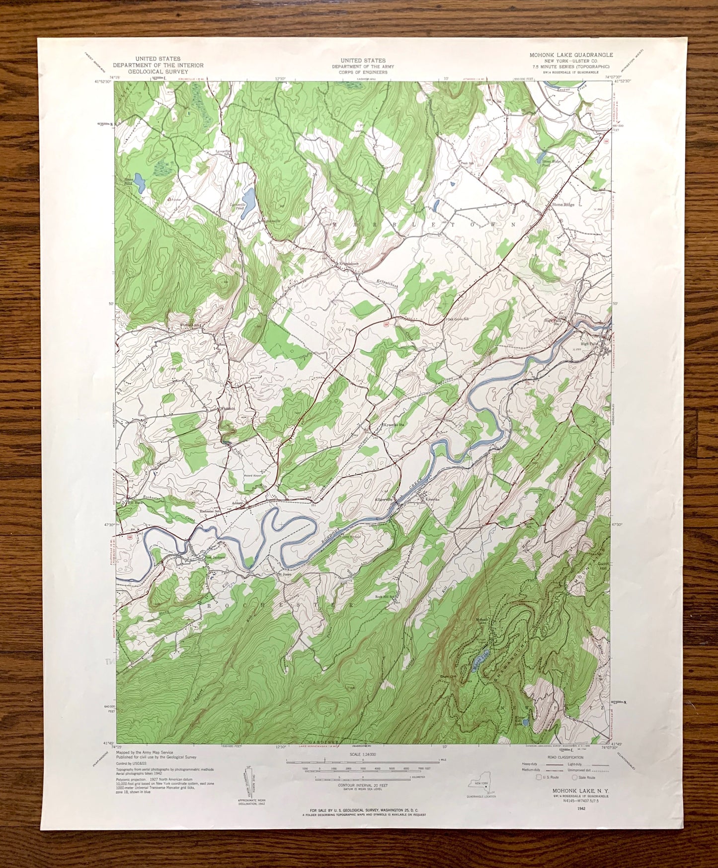
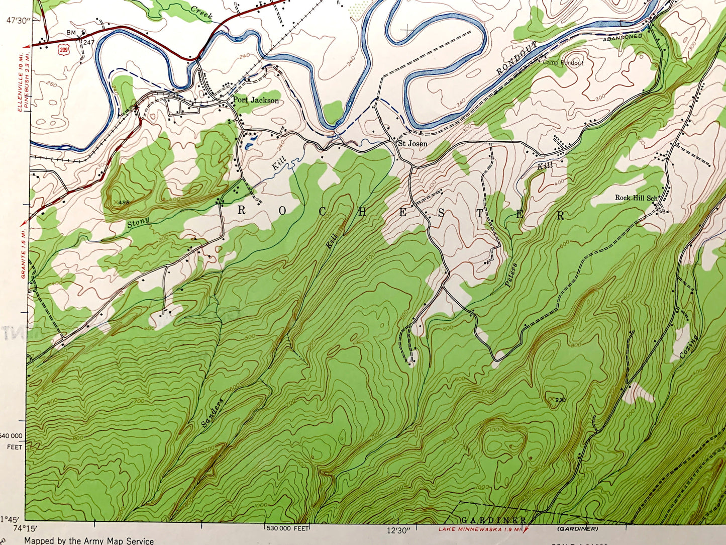
Antique Mohonk Lake, New York 1942 US Geological Survey Topographic Map – Ulster County, Marbletown, Rochester, New Paltz, Kripplebush NY
Antique Mohonk Lake, New York 1942 US Geological Survey Topographic Map – Ulster County, Marbletown, Rochester, New Paltz, Kripplebush NY
Beautiful, antique map of Mohonk Lake, New York and surrounding Ulster County area. This is an authentic 1942 edition, 1959 print from the U.S. Geological Survey and NOT a computer reproduction.
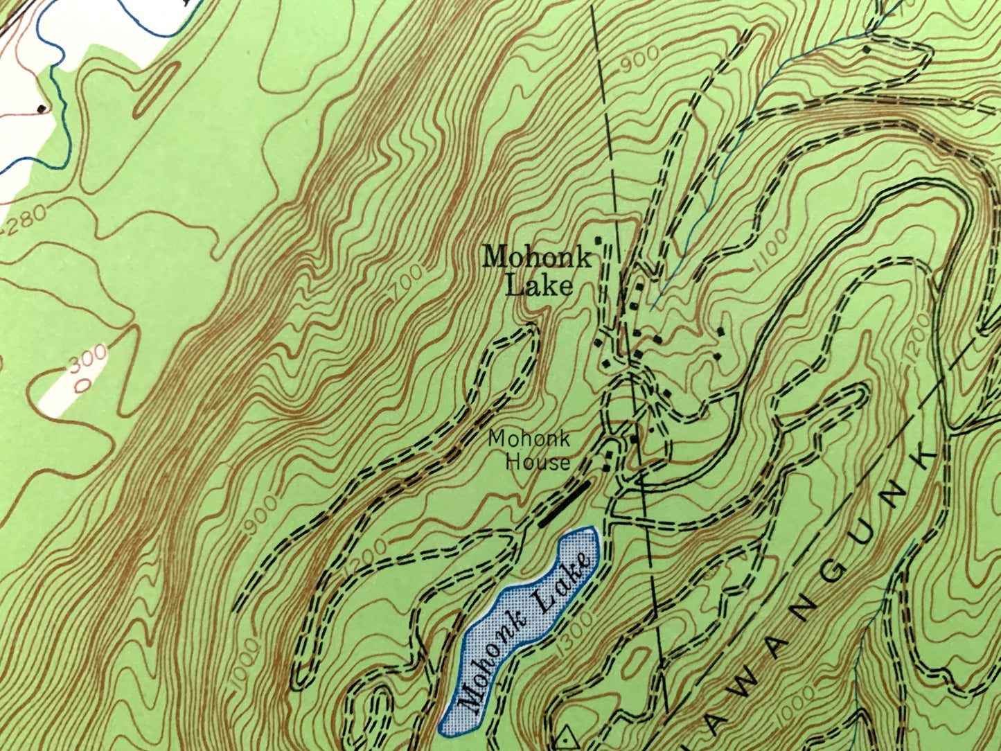
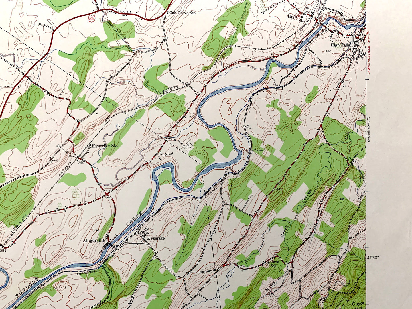
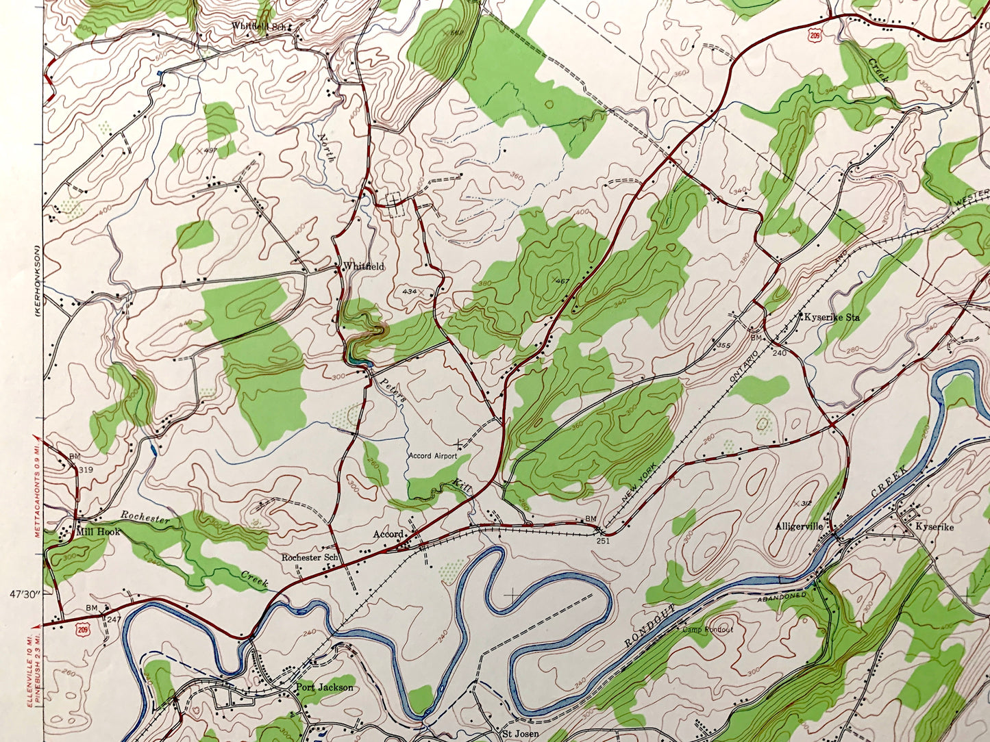
See what New York looked like over 80 years ago. Lots of intricate details and geological contours. Map even has little squares for every house that existed at the time. The USGS cartographers were very thorough back then!
Perfect for the historian, map-lover, the curious or just as a conversation starter. Wonderful and rare. Vintage maps such as these make great gifts.
Edition of 1942, printed 1959
Dimensions: 22" width x 27" height
----
Features
Cities & Towns: Mohonk Lake, Gardiner, High Falls, St. Josen, Mill Hook, Olive, Stone Ridge, Whitfield, Accord, Alligerville, Lyonsville, Kyserike, Marbletown, Rochester, New Paltz, Kripplebush.
Points of Interest: Ulster County, Shawangunk Mountains, Catskill Park, Rondout Creek, Rochester Creek, Duck Pond, Lyonsville Pond and many more roads, railroads, houses, ponds, hills, creeks, and lakes.
Condition: Very Good Vintage condition, commensurate with age. This map is in great shape for being over 60 years old. Has light edge-wear, but this will add to vintage character when framed.
----
We will happily adjust shipping price for multiple purchases. Maps are rolled up and shipped in sturdy mailing tubes, never folded.
Couldn't load pickup availability
Share