My Store
Antique Moncure, North Carolina 1970 US Geological Survey Topographic Map – Lee, Chatham County, Cape Fear, Haw River, Blacknel, Haywood NC
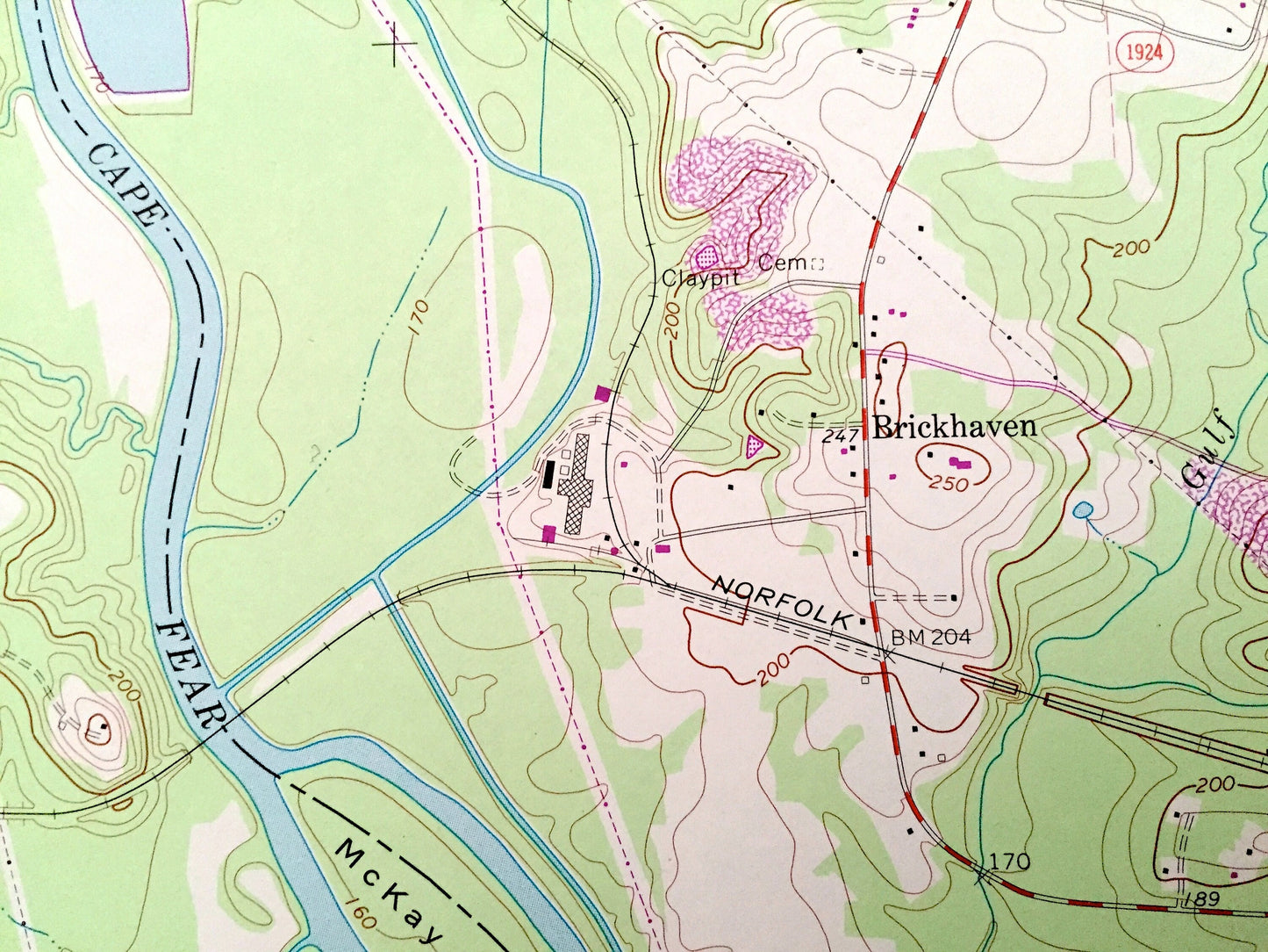
Antique Moncure, North Carolina 1970 US Geological Survey Topographic Map – Lee, Chatham County, Cape Fear, Haw River, Blacknel, Haywood NC
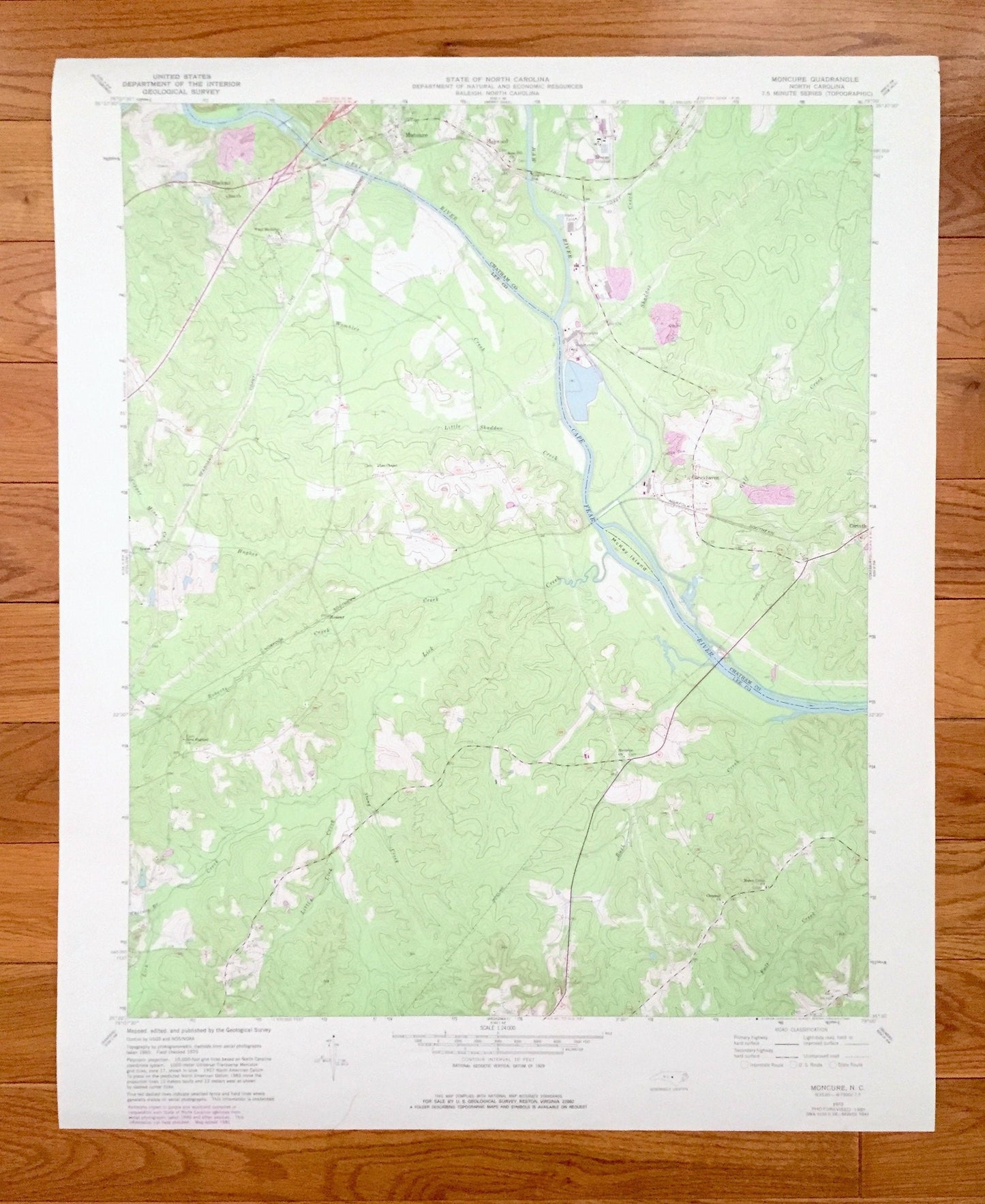
Beautiful, antique map of Moncure, North Carolina and surrounding Chatham & Lee County area on the Cape Fear River. This is an authentic 1970 edition, 1982 print from the U.S. Geological Survey and NOT a computer reproduction.
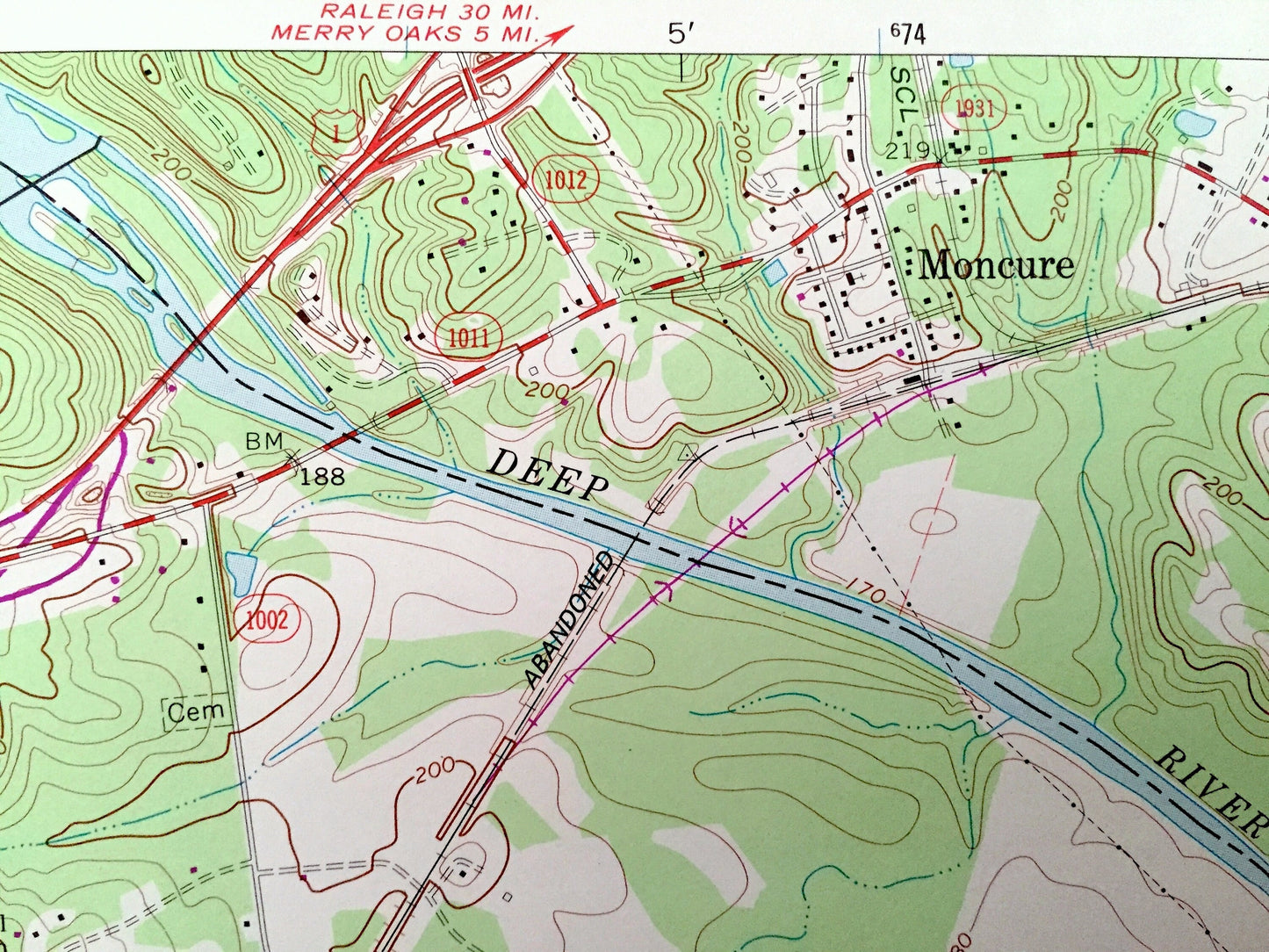
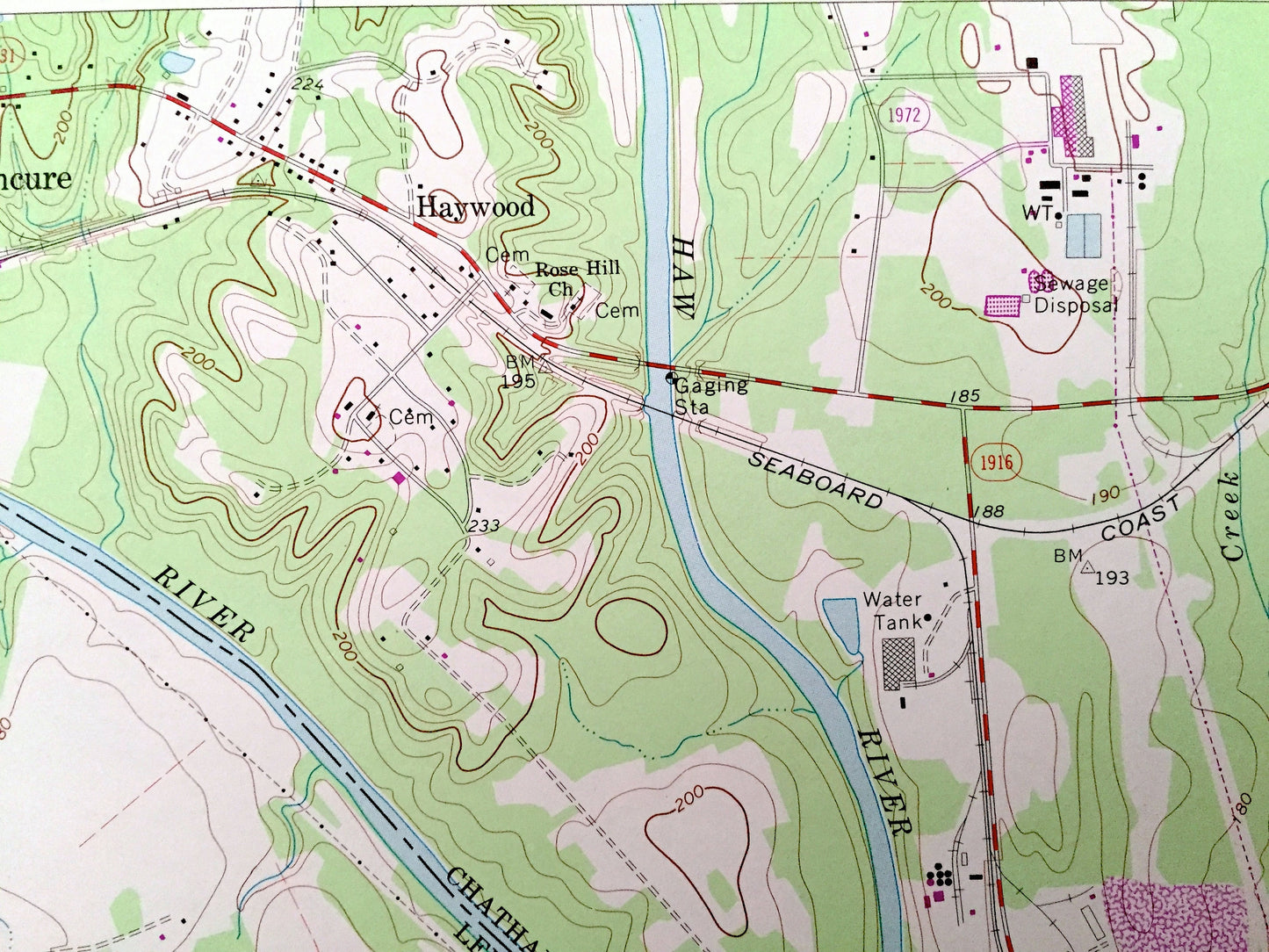
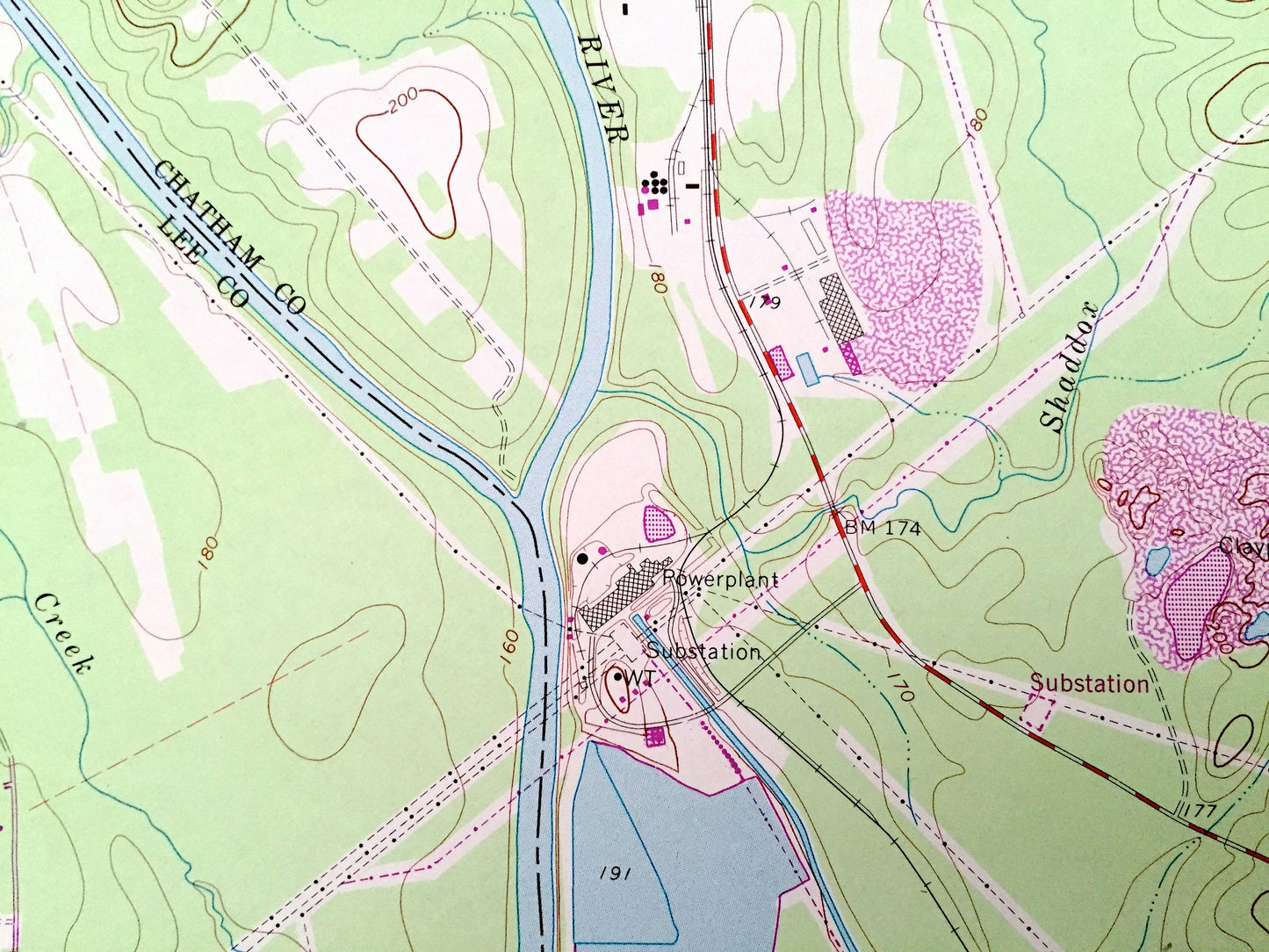
See what North Carolina looked like 50 years ago. Lots of intricate details and geological contours. Map even has little squares for every house that existed at the time. The USGS cartographers were very thorough back then!
Perfect for the historian, map-lover, the curious or just as a conversation starter. Wonderful and rare. Vintage maps such as this make great gifts.
Edition of 1970, printed 1982
Dimensions: 22" width x 27" height
----
Features
Cities & Towns: Moncure, Blacknel, Haywood, Brickhaven, Corinth.
Points of Interest: Chatham County, Lee County, Cape Fear River, Haw River, Shaddox Creek, McKay Island, Wombles Creek, Lick Creek, Progress Energy Cape Fear Plant, Mermaid Point, Raleigh Executive Jetport location, and many more roads, rivers, houses and churches.
Condition: Very Good condition, commensurate with age. This map is in incredible shape for being about 40 years old.
----
We will happily adjust shipping price for multiple purchases. Maps are rolled up and shipped in sturdy mailing tubes, never folded.
Couldn't load pickup availability
Share