My Store
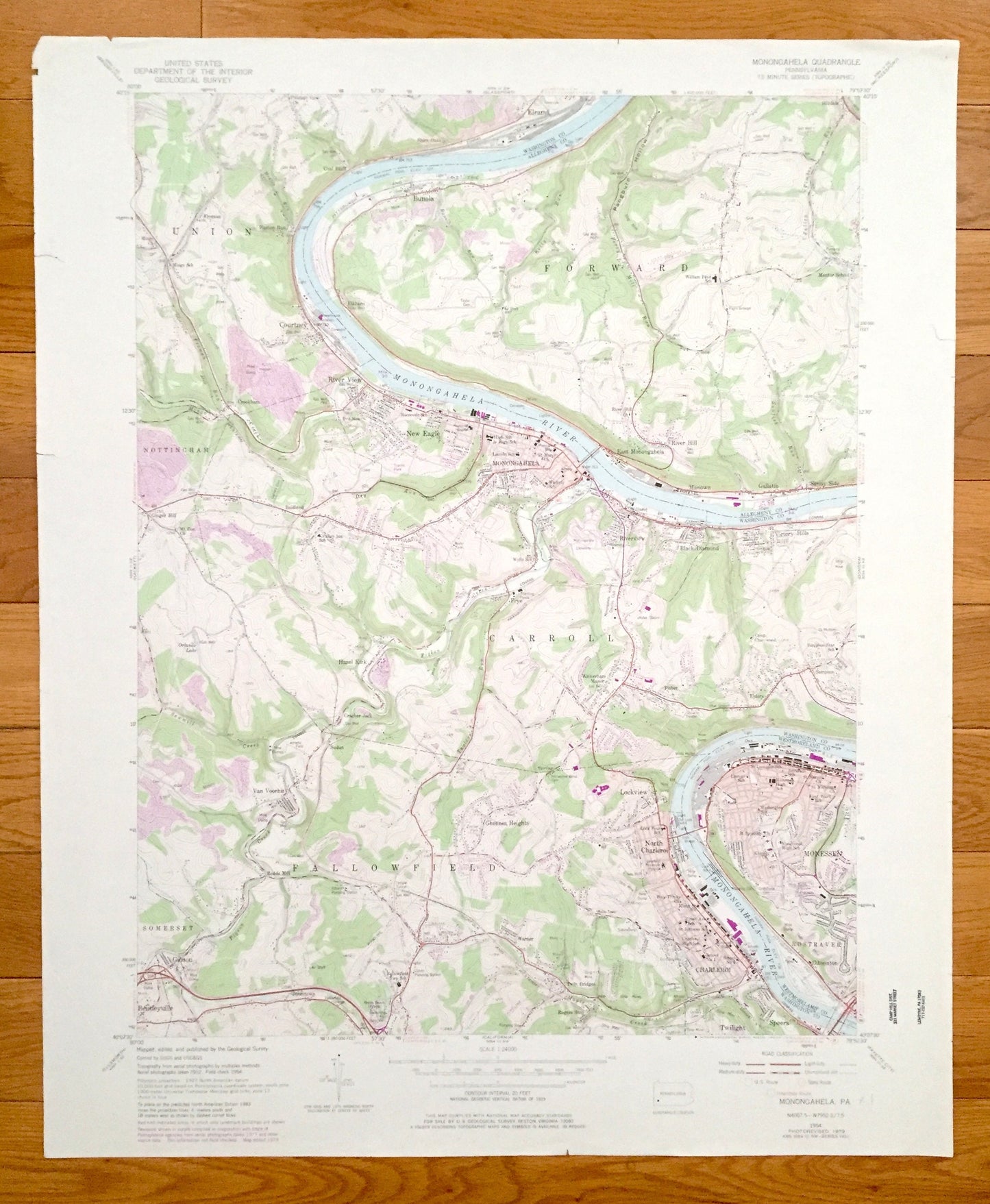
Antique Monongahela, Pennsylvania 1954 US Geological Survey Topographic Map – Washington, Allegheny County, Charleroi, Bunola, Elrama, PA
Antique Monongahela, Pennsylvania 1954 US Geological Survey Topographic Map – Washington, Allegheny County, Charleroi, Bunola, Elrama, PA
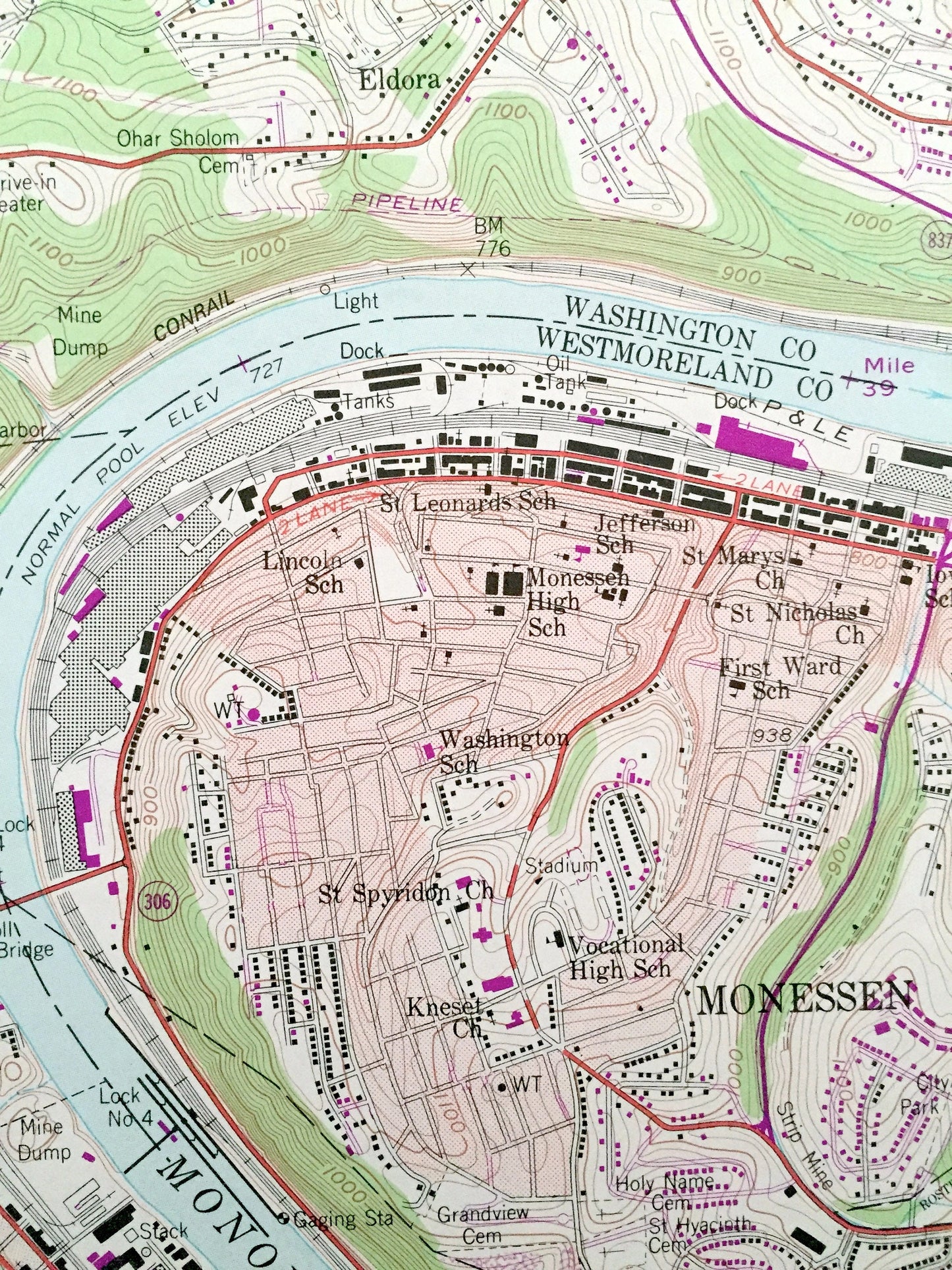
Beautiful, antique map of Monongahela, Pennsylvania and surrounding Washington, Allegheny, and Westmoreland County area. This is an authentic 1954 edition, 1979 print from the U.S. Geological Survey and NOT a computer reproduction.
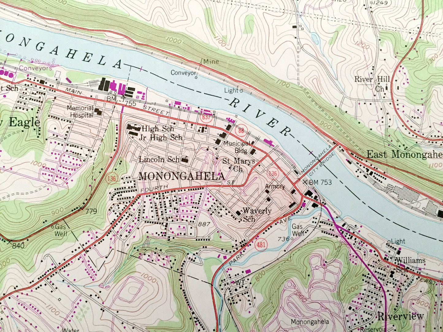
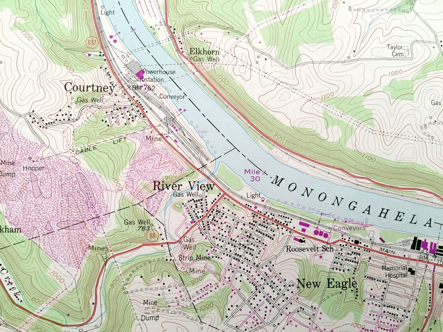
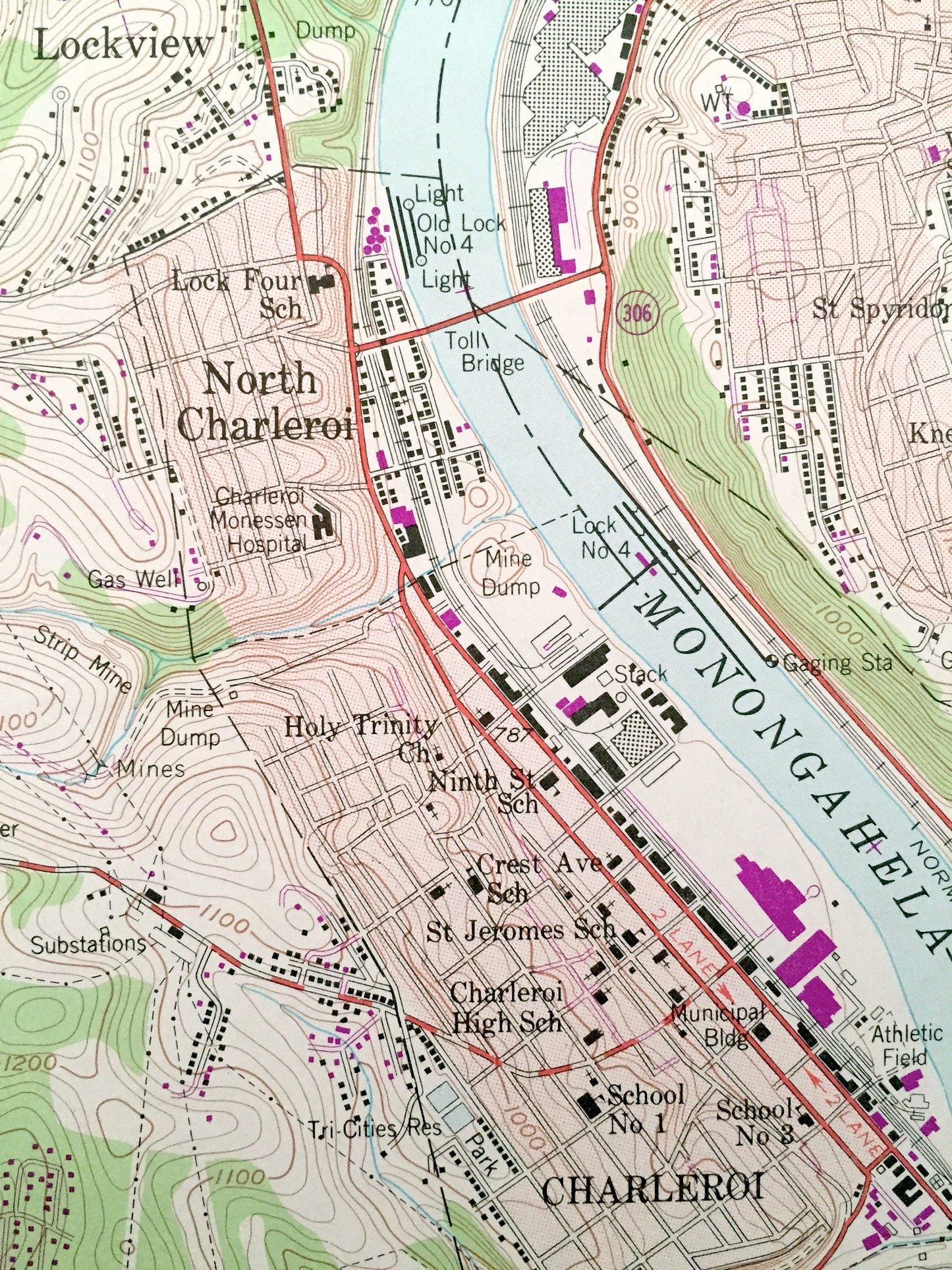
See what Pennsylvania looked like over 60 years ago. Lots of intricate details and geological contours. Map even has little squares for every house that existed at the time. The USGS cartographers were very thorough back then!
Perfect for the historian, map-lover, the curious or just as a conversation starter. Wonderful and rare. Vintage maps such as these make great gifts.
Edition of 1954, printed 1979
Dimensions: 22" width x 27" height
----
Features
Cities & Towns: Monongahela, New Eagle, Courtney, Baidland, River View, Crookham, Huston Run, Coal Bluff, Shire Oaks, Elrama, Bunola, Elkhorn, East Monongahela, River Hill, Manown, Gallatin, Sunny SIde, Hilldale, Ginger Hill, Hazel Kirk, Van Voorhis, Gibson, Bentleyville, Jonestown, Sudan, Cracker Jack, Frye, WIckerham Manor, Ghennes Heights, Warner, Twin Bridges, Twilight, Speers, Charleroi, North Charleroi, Lockview, Eldora, Fisher, Riverview, Black Diamond, Sampson, Victory Hills, Monessen, Gibsonton, Somerset, Fallowfield, Carroll, Rostraver, Nottingham, Union, Forward.
Points of Interest: Monongahela River, Conrail, Norfolk and Western Railway, Abandoned Railroad, Pittsburgh and Lake Erie Railroad, Pangburn Hollow, Mentor School, Orlando Lake, Pigeon Creek, Redds Beach, Radio Tower, Drive-in Theater, Camp Charwood, and many more hills, streams, ponds, houses, schools, churches and roads.
Condition: Very Good condition, commensurate with age. This map is in incredible shape for being almost 40 years old. This map was most likely used in the field. Has light-edge wear and tears and pencil markings, but this will read as vintage character when framed.
----
We will happily adjust shipping price for multiple purchases. Maps are rolled up and shipped in sturdy mailing tubes, never folded.
Couldn't load pickup availability
Share