My Store
Antique Monroe County, New York 1911 New Century Atlas Map – Rochester, Irondequot, Honeoye Falls, Henrietta, Webster Pittsford Brockport NY
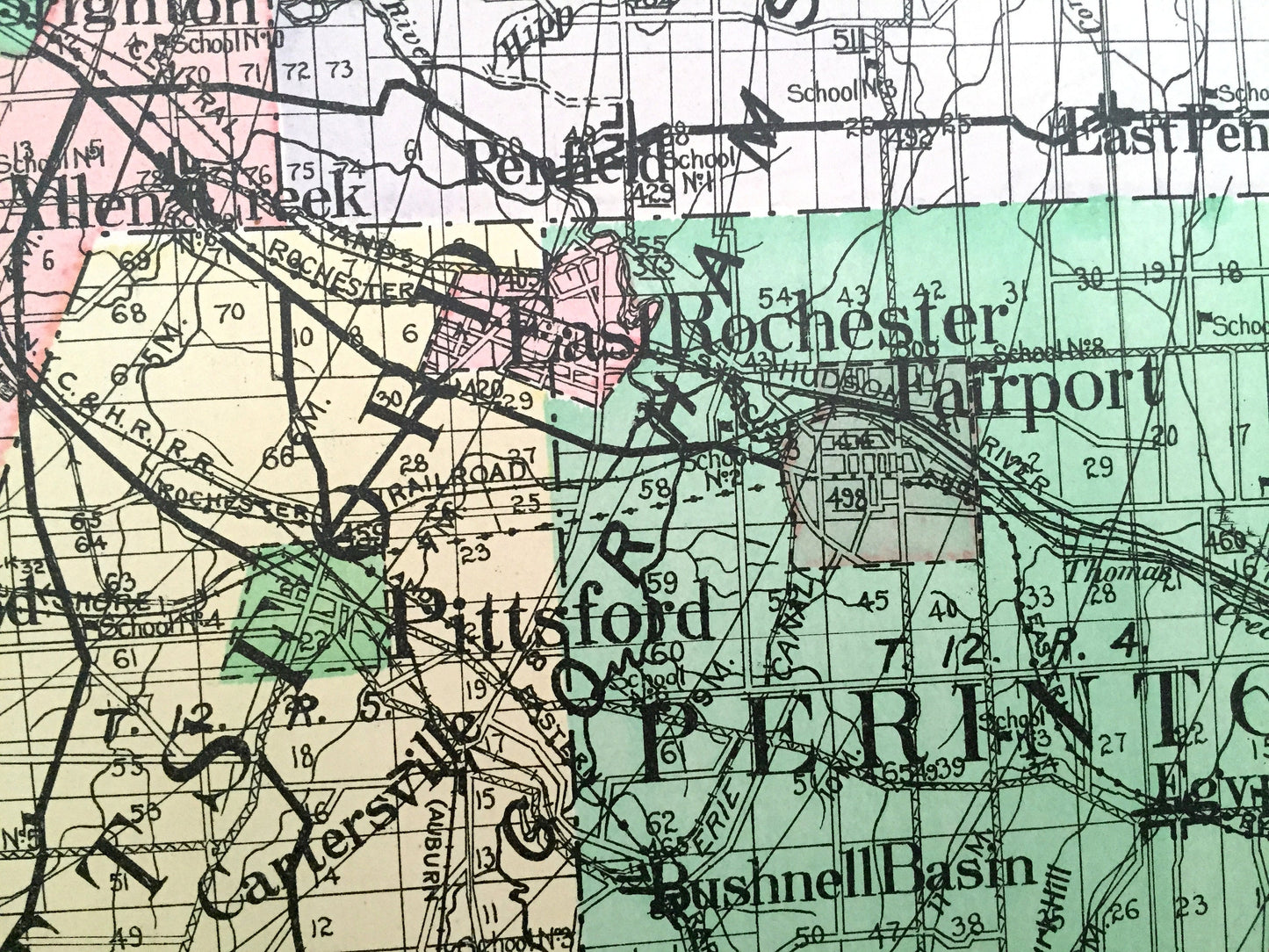
Antique Monroe County, New York 1911 New Century Atlas Map – Rochester, Irondequot, Honeoye Falls, Henrietta, Webster Pittsford Brockport NY
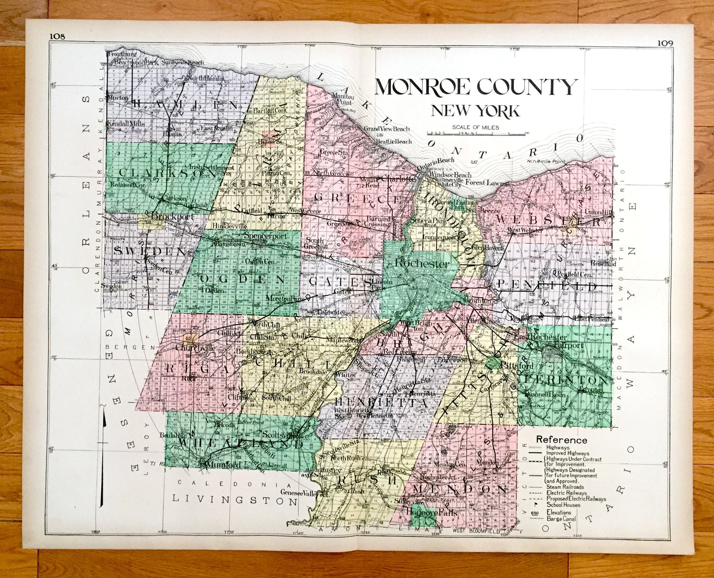
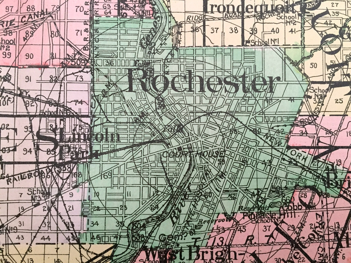
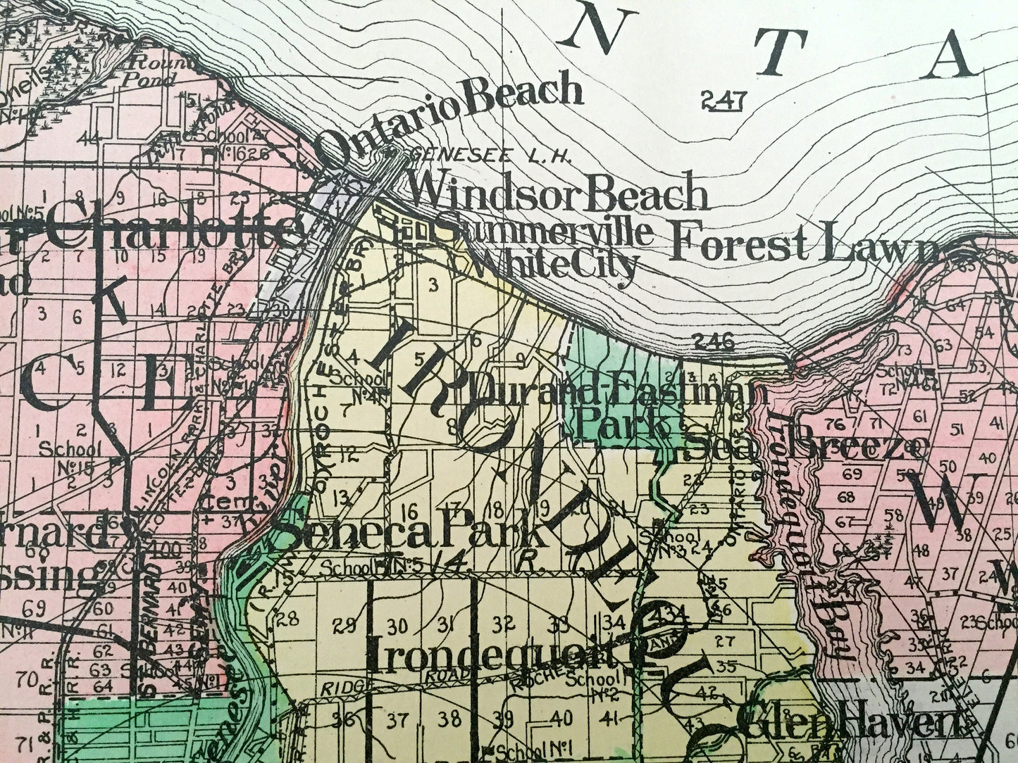
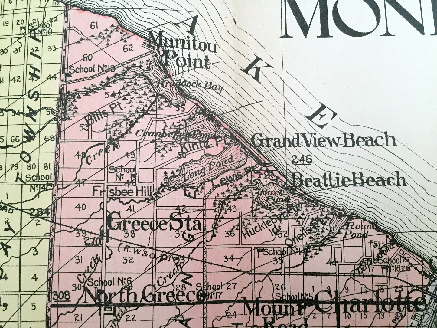
Beautiful, antique map of Monroe County, New York, including Rochester, Irondequot, Honeoye Falls, Henrietta, Webster, Pittsford & Brockport. This is an authentic map taken from the rare New Century Atlas published in 1911 and NOT a computer reproduction.
See what Monroe County looked like more than a century ago. Lots of charming, intricate details and contours, including land allotments, names of farms and manufacturing plants and geographical points of interest. It is a very large print and will be a showpiece wherever it is presented. Hand colored. Verso is blank.
Perfect for the historian, map-lover, the curious or just as a conversation starter. Wonderful and rare. Vintage maps such as these make great gifts.
Edition of 1911, printed 1911
Dimensions: 30" width x 23 1/2" height
----
Features
Cities & Towns: Hamlin, Clarkson, Parma, Greece, Irondequot, Webster, Sweden, Brockport, Ogden, Gates, Rochester, Brighton, Penfield, Riga, Chili, Henrietta, Pittsford, Perinton, Whwatland, Rush, Mendon, Troutburg, Beachwood Park, Morton, Kendall Mills, Uilton, Manitou Point, Grand View Beach, Charlotte, Beattie Beach, Ontario Beach, Windsor Beach, Summerville, White City, Seneca Park, Glen Haven, Durand-Eastman Park, Forest Lawn, Breeze, Union Hill, Irish Settlement, Brockport, Hinkleyville, Spencerport, Coldwater, Lincoln Park, South Park, Red Creek, Allen Creek, Roseland, Chuchville, Buckbee Corners, Clifton, Brookdale, Maplewood, Whites, Ridgeland, Edgewood, East Rochester, Fairport, Bushnell Basin, Egypt, Beulah, Belcoda, Mumford, Scottsville, Industry, Sivleyville, Honeoye Falls, more.
Points of Interest: Lake Ontario, Genesee River, Irondequot Bay, Irondquot River, Braddock Bay, Long Pond, Back Pond, Braddock Bay Township, New York Central & Hudson Railroad, and many more ponds, lakes, creeks, rivers, roads, highways, railroads, farms, school houses and elevations.
----
Condition: Very Good condition, commensurate with age. This map is in incredible shape for being over 100 years old. A fold, as issued, and slight edge-toning, all of which will read as vintage character when framed. (Images of New Century Atlas cover and frontispiece for information only and not included.)
----
We will happily adjust shipping price for multiple purchases. Maps are rolled up and shipped in sturdy mailing tubes, never folded.
Couldn't load pickup availability
Share