My Store
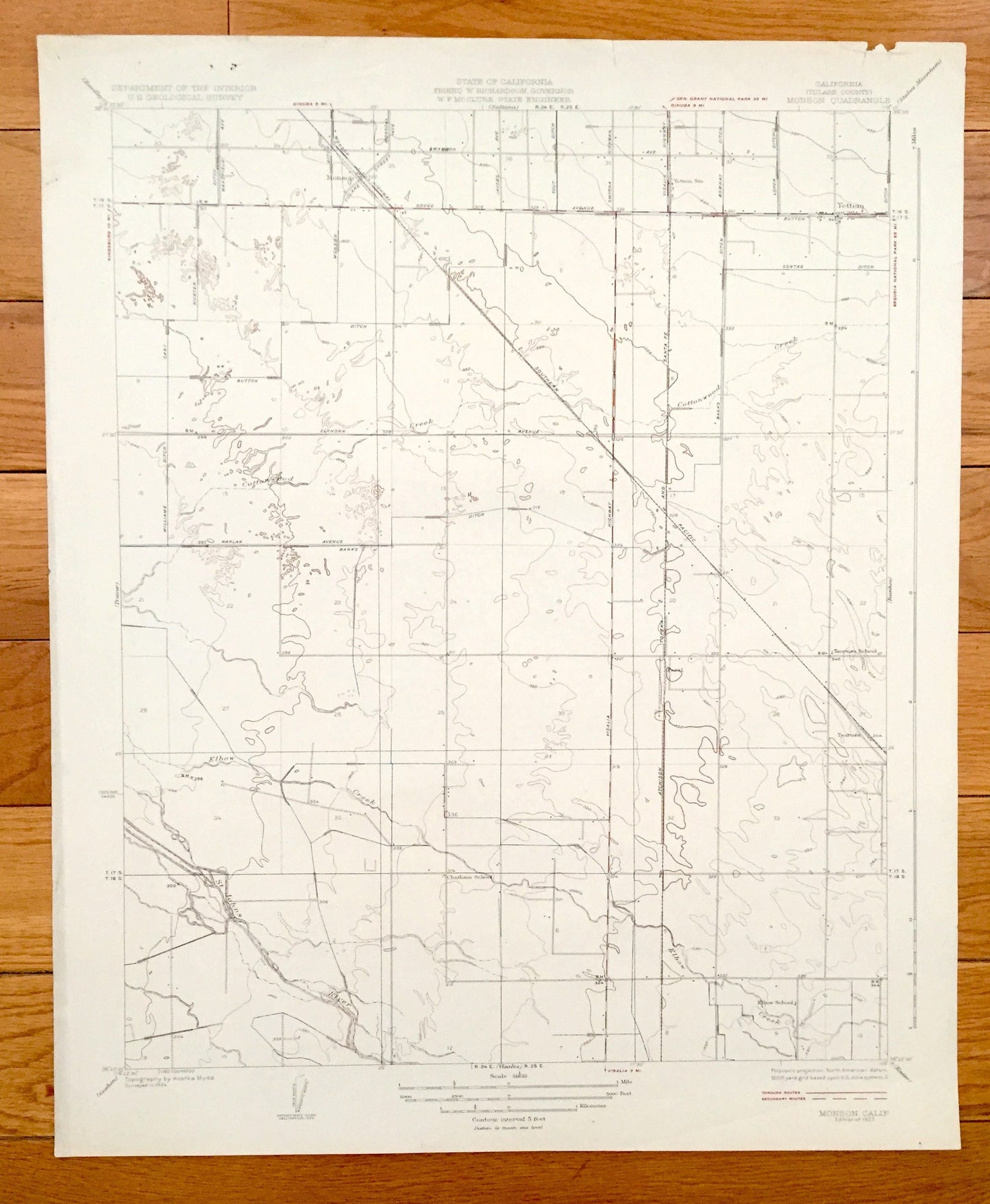
Antique Monson, California 1927 US Geological Survey Topographic Map – Tulare County, Yettem, Penal, Taurusa, Visalia, St Johns River, CA
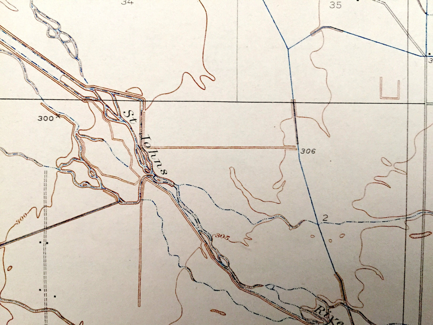
Antique Monson, California 1927 US Geological Survey Topographic Map – Tulare County, Yettem, Penal, Taurusa, Visalia, St Johns River, CA
Beautiful, antique map of Monson, California and surrounding Tulare County area. This is an authentic 1927 print from the U.S. Geological Survey and NOT a computer reproduction.
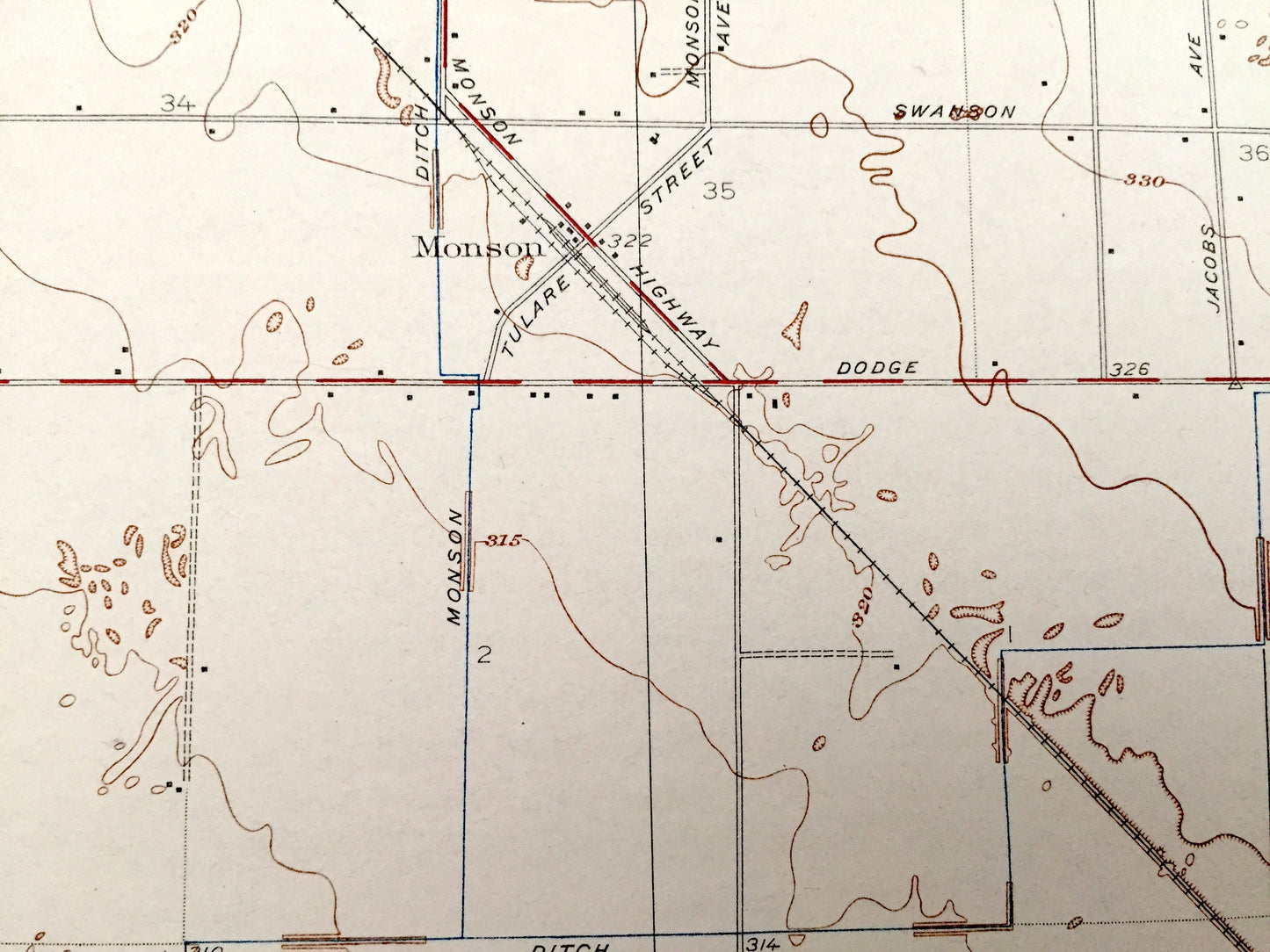
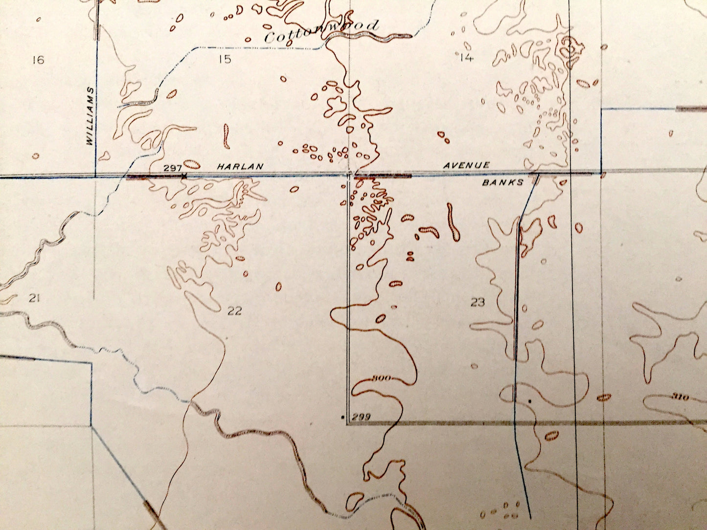
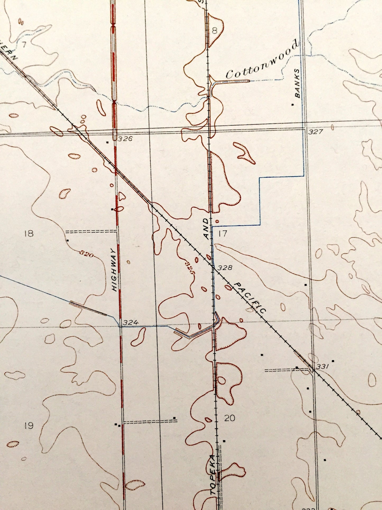
See what California looked like almost a century ago. Lots of intricate details and geological contours. Map even has little squares for every house that existed at the time. The USGS cartographers were very thorough back then! On the back is a description of topographic symbols and map guide.
Perfect for the historian, map-lover, the curious or just as a conversation starter. Wonderful and rare. Maps such as these make great gifts.
Edition of 1927, printed 1927
Dimensions: 17" width x 21" height
----
Features
Cities & Towns: Monson, Yettem, Penal, Taurusa.
Points of Interest: Tulare County, St. Johns River, Elbow Creek, Visalia Highway, Cottonwood Creek, Southern Pacific Railroad, Atchison Topeka & Santa Fe Railroad, and many more, creeks, ditches, houses, farms, ranches and roads.
Condition: Very Good Vintage condition, commensurate with age. This map is in great shape for being more than 90 years old.
----
We will happily adjust shipping price for multiple purchases. Maps are rolled up and shipped in sturdy mailing tubes, never folded.
Couldn't load pickup availability
Share