My Store
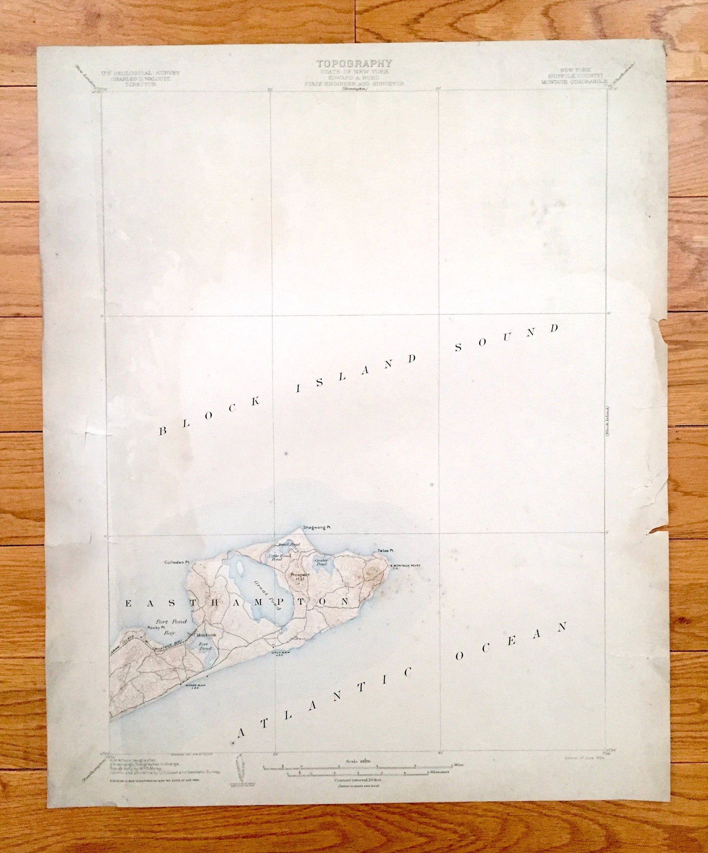
Antique Montauk, Long Island, New York 1904 US Geological Survey Topographic Map – Easthampton, Hamptons, Suffolk County, Hither Woods, NY
Antique Montauk, Long Island, New York 1904 US Geological Survey Topographic Map – Easthampton, Hamptons, Suffolk County, Hither Woods, NY
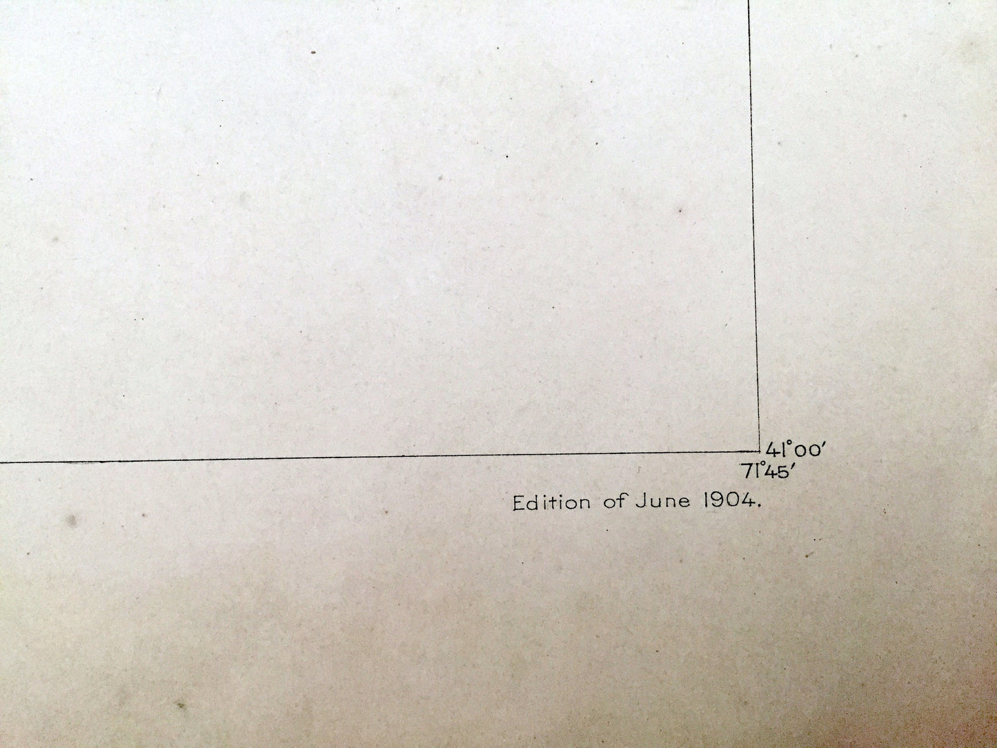
Beautiful, antique map of Montauk, New York and surrounding Suffolk County on Long Island. This is an authentic 1904 edition, 1904 print from the U.S. Geological Survey and NOT a computer reproduction.
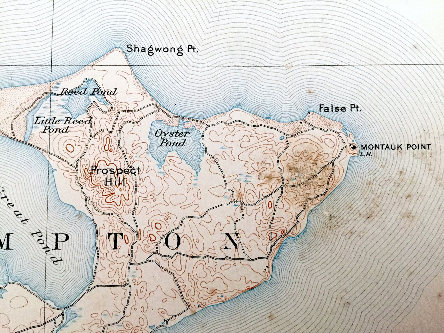
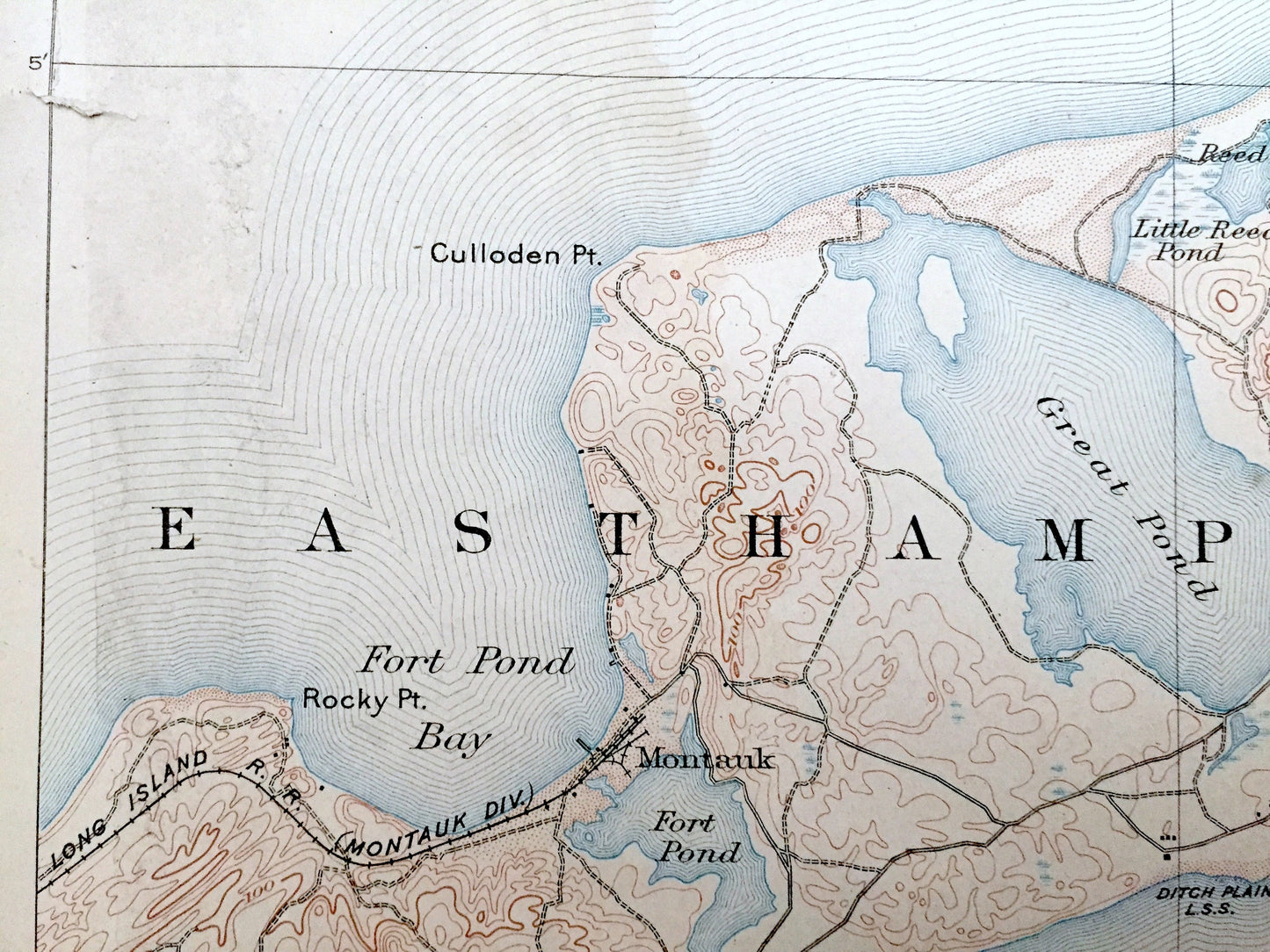
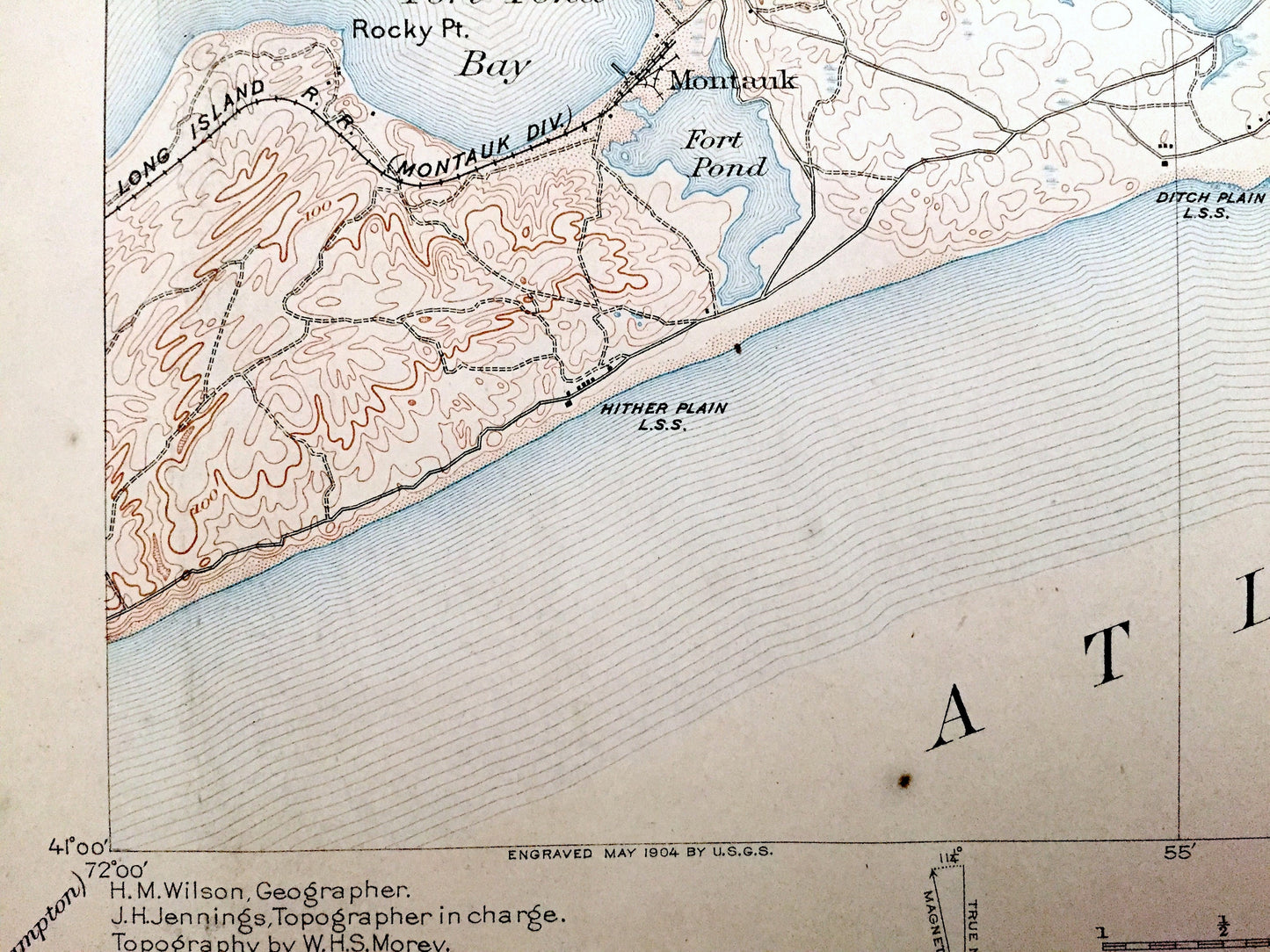
See what Long Island looked like almost 120 years ago. Lots of intricate details and geological contours. Map even has little squares for every house that existed at the time. The USGS cartographers were very thorough back then! On the back is a description of topographic symbols and map guide.
Perfect for the historian, map-lover, the curious or just as a conversation starter. Wonderful and rare. Vintage maps such as this make great gifts.
Edition of 1904, printed 1904
Dimensions: 16 1/2" width x 20 1/2" height
----
Features
Cities & Towns: Montauk, Easthampton.
Points of Interest: Long Island, Suffolk County, Block Island Sound, Atlantic Ocean, Montauk Point, False Point, Shagwong Point, Great Pond, Fort Pond Bay, Fort Pond, Culloden Point, Rocky Point, Prospect Hill, Oyster Pond, Reed Pond, Little Reed Pond, and many more, brooks, ponds, islands, coves, hills, houses, train tracks and roads.
Condition: Good or "Very Vintage" condition, commensurate with age. This map is in great shape for being over 115 years old. Has some edge-wear, toning and tears at edges, but this will add to vintage character when framed.
----
We will happily adjust shipping price for multiple purchases. Maps are rolled up and shipped in sturdy mailing tubes, never folded.
Couldn't load pickup availability
Share