My Store
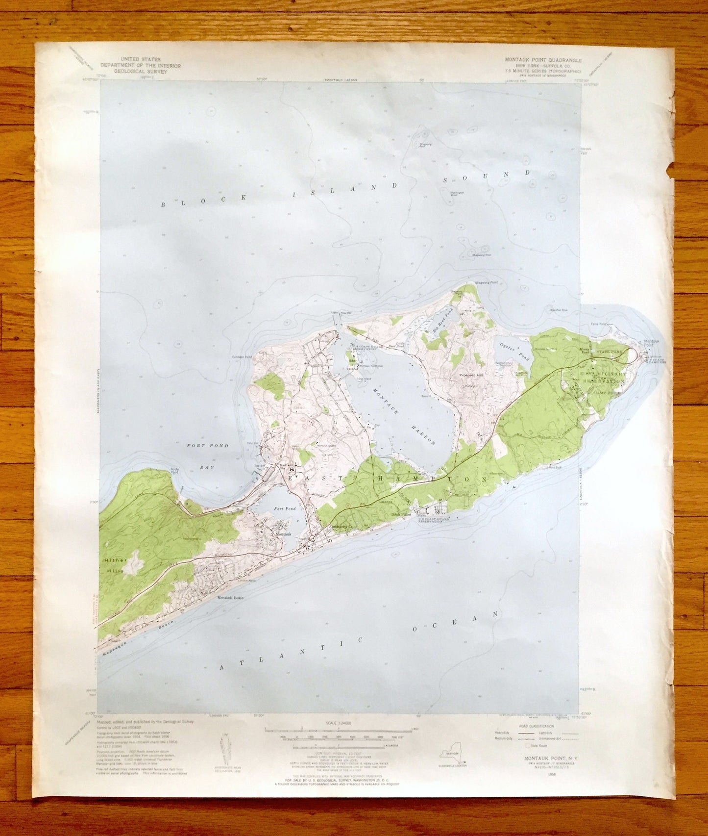
Antique Montauk Point, New York 1956 US Geological Survey Topographic Map – Suffolk County, East Hampton, Napeague, Montauk, NY
Antique Montauk Point, New York 1956 US Geological Survey Topographic Map – Suffolk County, East Hampton, Napeague, Montauk, NY
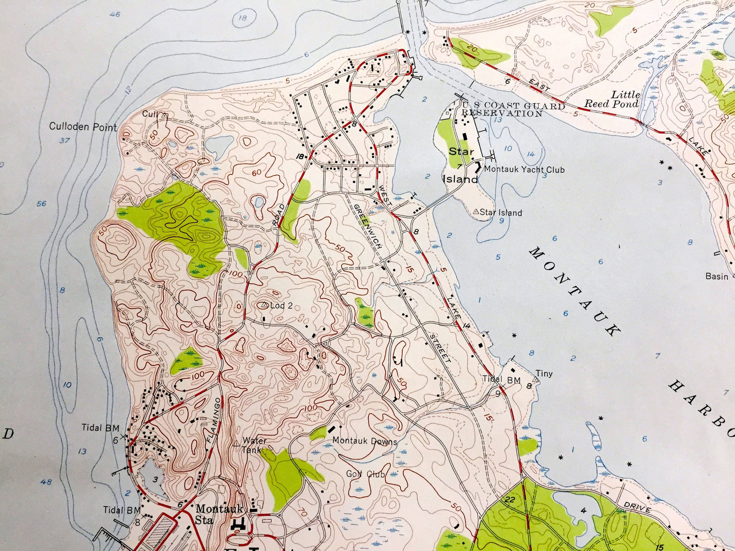
Beautiful, antique map of Montauk Point, New York and surrounding Suffolk County areas. This is an authentic 1956 edition, 1957 print from the U.S. Geological Survey and NOT a computer reproduction.
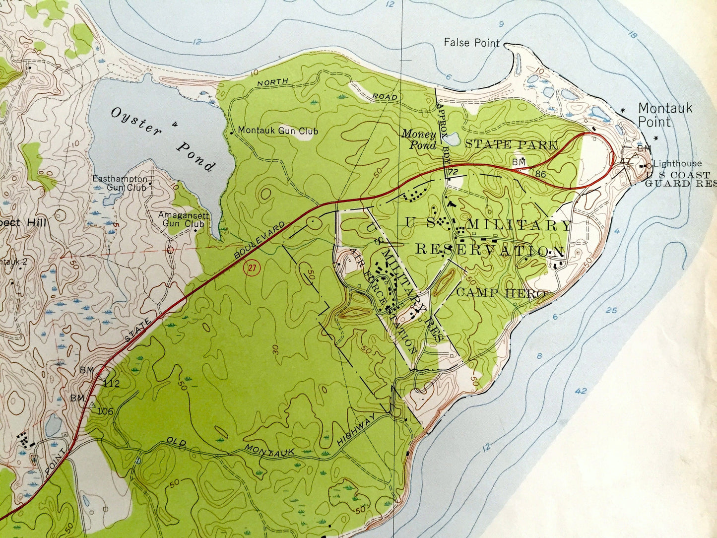
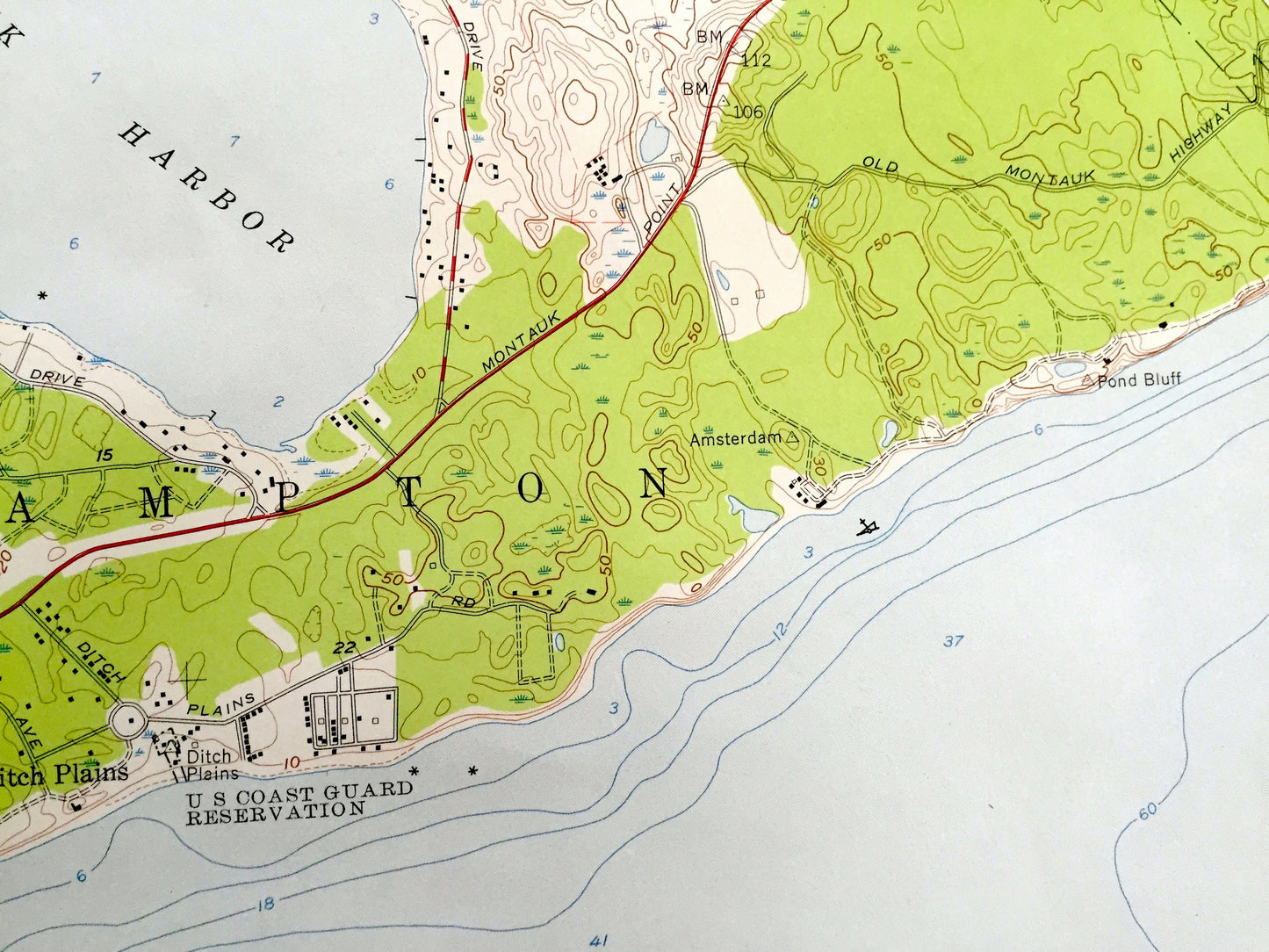
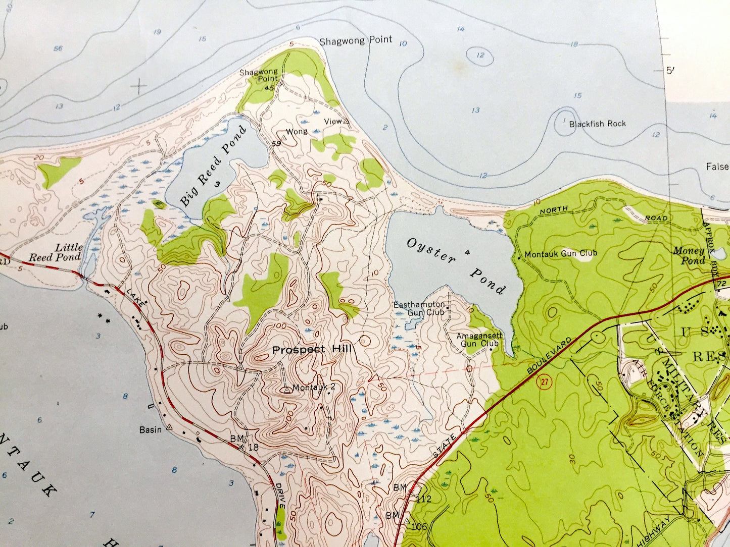
See what New York looked like over 65 years ago. Lots of intricate details and geological contours. Map even has little squares for every house that existed at the time. The USGS cartographers were very thorough back then!
Perfect for the historian, map-lover, the curious or just as a conversation starter. Wonderful and rare. Vintage maps such as these make great gifts.
Edition of 1956, printed 1957
Dimensions: 23" width x 27" height
----
Features
Cities & Towns: Long Island, Montauk Beach, Ditch Plains.
Points of Interest: Suffolk County, Block Island Sound, Montauk Downs Golf Club, Lake Montauk, Fort Pond, Fort Pond Bay, Napeague Beach, Hither Hills, Hither Plains, Star Island, Montauk Yacht Club, Big Reed Pond, Oyster Pond, Heatherwood, Prospect Hill, US Coast Guard Station, Air Force Base, Rocky Point, Culloden Point, Shagwong Point, False Point, and many more hills, streams, ponds, houses, schools, railroads, churches, roads, beaches, islands, and creeks.
Condition: Good or "Very Vintage" condition, commensurate with age. This map is in great shape for being over 65 years old. Has some real edge-wear and toning, all of which will read as character when framed.
----
We will happily adjust shipping price for multiple purchases. Maps are rolled up and shipped in sturdy mailing tubes, never folded.
Couldn't load pickup availability
Share