My Store
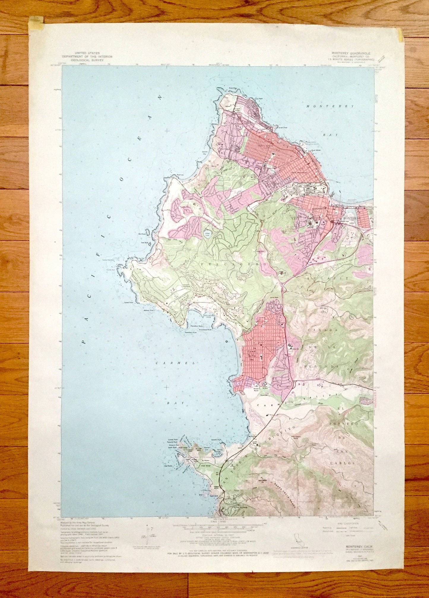
Antique Monterey, California 1947 US Geological Survey Topographic Map – Carmel By The Sea, Bay, Pacific Grove, Pinos, Pebble Beach Golf, CA
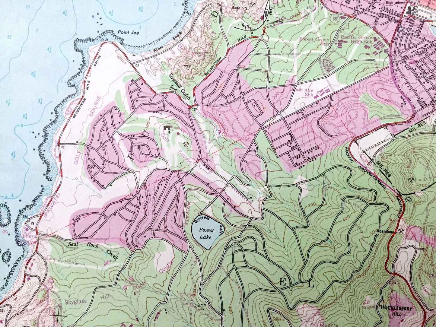
Antique Monterey, California 1947 US Geological Survey Topographic Map – Carmel By The Sea, Bay, Pacific Grove, Pinos, Pebble Beach Golf, CA
Beautiful, antique map of Monterey, California and surrounding area. This is an authentic 1947 edition, 1969 print from the U.S. Geological Survey and is NOT a computer reproduction.
See what California looked like over 70 years ago. Lots of intricate details and geological contours. Lots of intricate details and geological contours. The USGS cartographers were very thorough back then!
Perfect for the historian, map-lover, the curious or just as a conversation starter. Wonderful and rare. Vintage maps such as these make great gifts.
Edition of 1947, printed 1969
Dimensions: 22" width x 32" height
----
Features
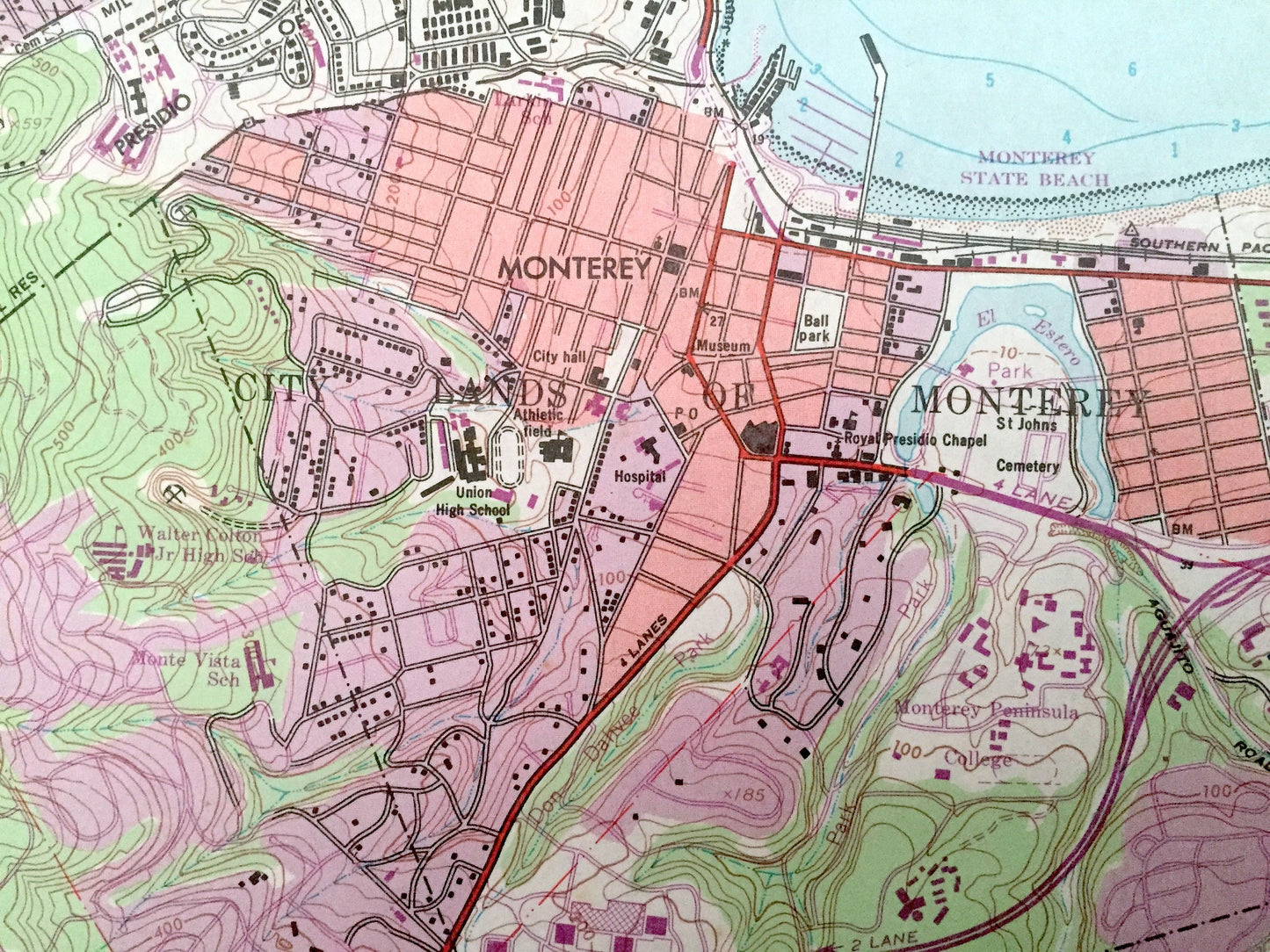
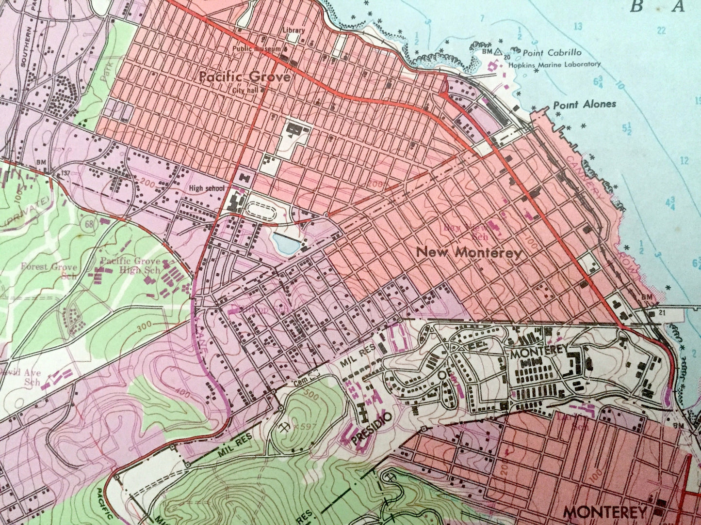
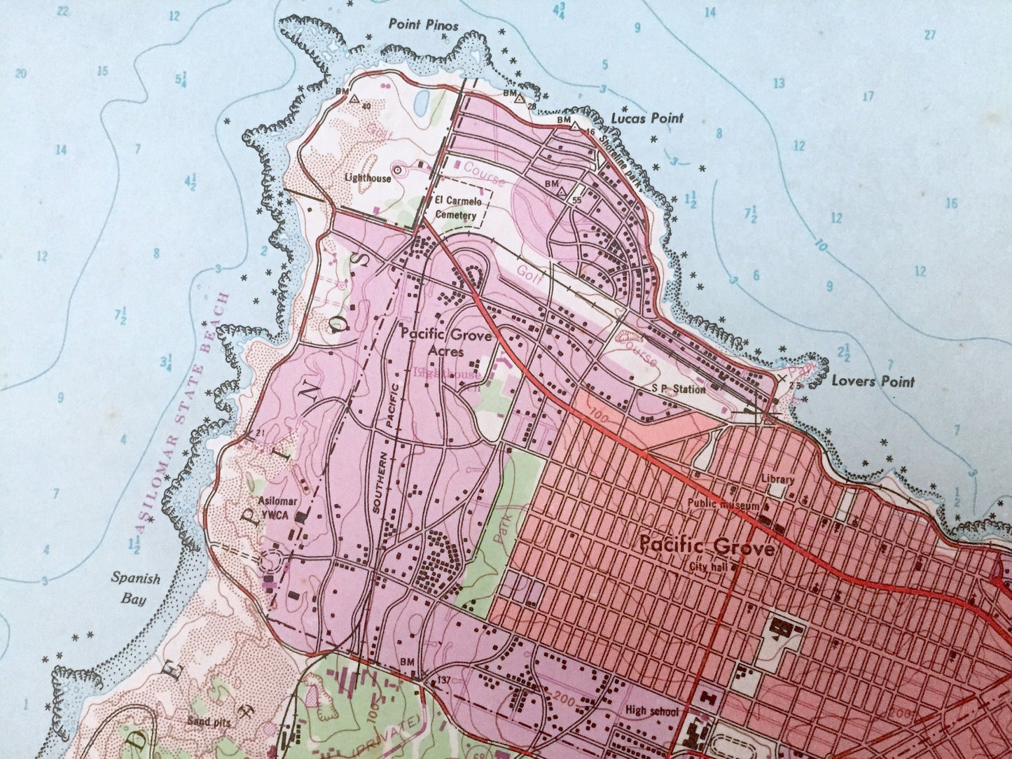
Cities & Towns: Monterey, Carmel By The Sea, Pacific Grove, New Monterey.
Points of Interest: Pacific Ocean, Monterey Bay, Carmel Bay, Santa Lucia Range, El Potrero de San Carlos, San Jose y Sur Chiquito, Carmel Valley, Canada de la Segunda, Pescadero, Aguajit, Forest Lake, and lots more hills, mountains, lakes, islands, bays, highways, railroads.
Condition: Good Vintage condition, commensurate with age. This map is in great shape for being over 50 years old. Has light wear and a small tab at left corner, but this will all add to vintage character when framed.
----
We will happily adjust shipping price for multiple purchases. Maps are rolled up and shipped in sturdy mailing tubes, never folded.
Couldn't load pickup availability
Share