My Store
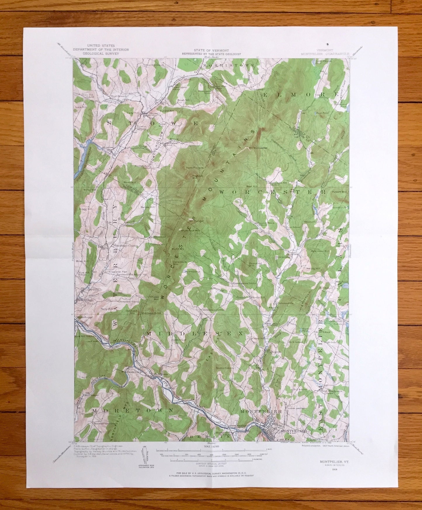
Antique Montpelier, Vermont 1919 US Geological Survey Topographic Map – Middlesex, Waterbury, Worcester, Stowe, Moretown, Calais, Elmore, VT
Antique Montpelier, Vermont 1919 US Geological Survey Topographic Map – Middlesex, Waterbury, Worcester, Stowe, Moretown, Calais, Elmore, VT
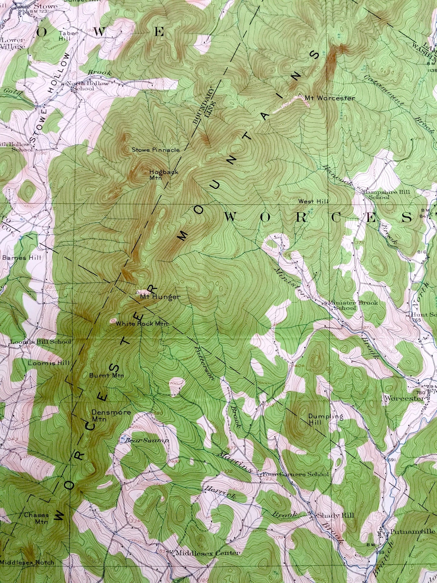
Beautiful, antique map of Montpelier, Vermont and surrounding Washington & Lamoille County area. This is an authentic 1919 edition, 1963 print from the U.S. Geological Survey and is NOT a computer reproduction.
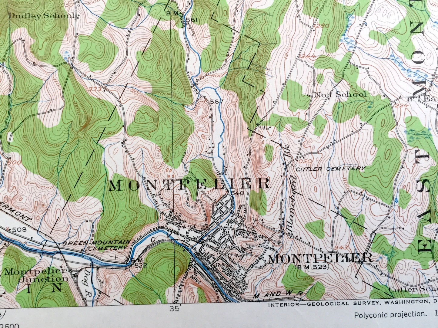
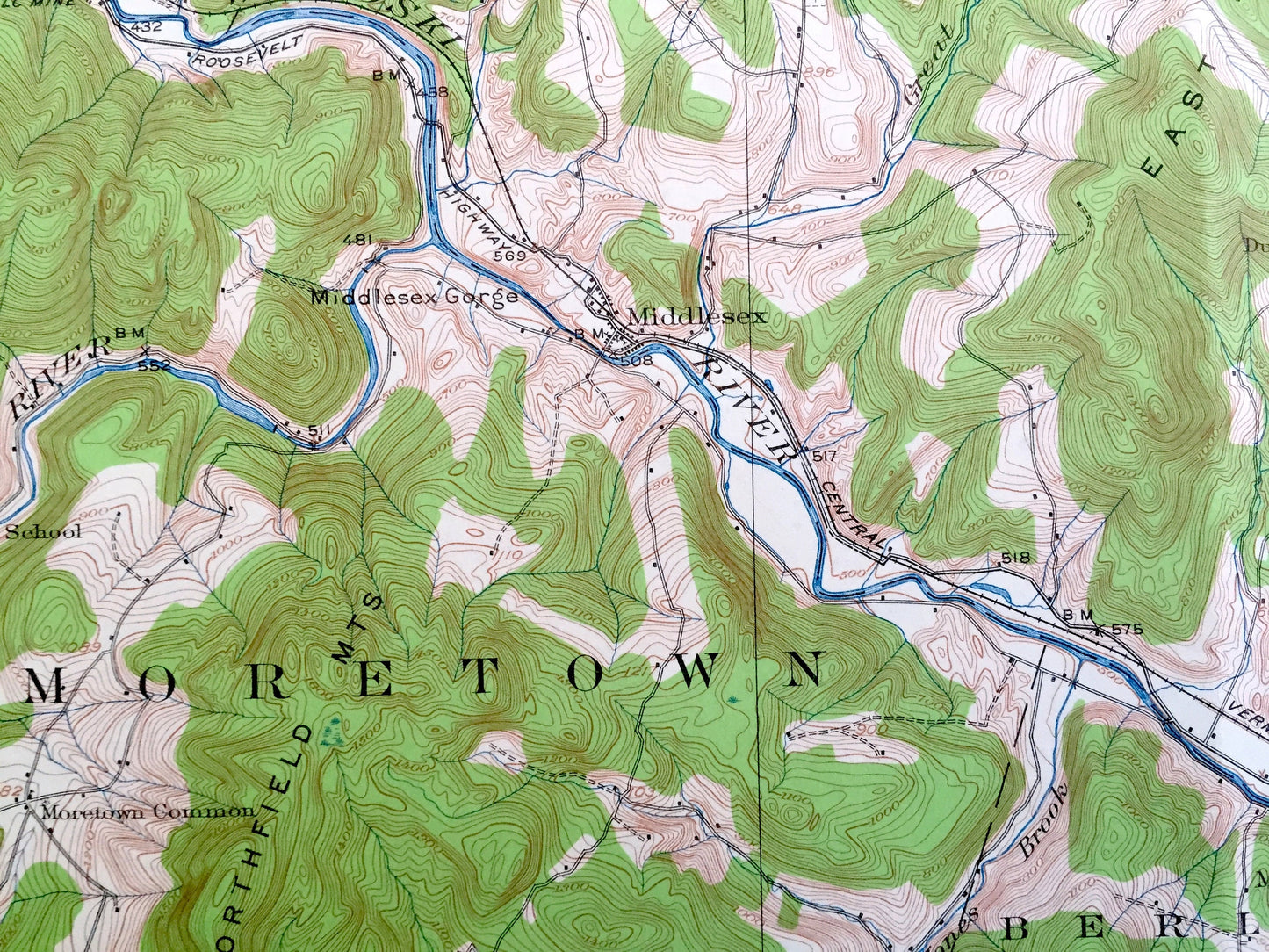
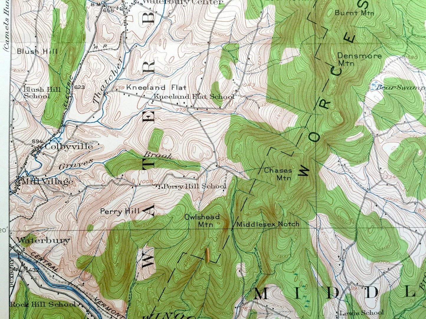
See what Vermont looked like over 100 years ago. Lots of intricate details and geological contours. Map even has little squares for every house that existed at the time. The USGS cartographers were very thorough back then!
Perfect for the historian, map-lover, the curious or just as a conversation starter. Wonderful and rare. Vintage maps such as these make great gifts.
Edition of 1919, printed 1963
Dimensions: 17" width x 21" height
----
Features
Cities & Towns: Stowe, Morristown, Elmore, Waterbury, Worcester, Calais, Moretown, Middlesex, Berlin, Montpelier, East Montpelier, West Branch, Lower Village, Moscow, Waterbury Center, Colbyville, Mill Village, Shady Rill, Putnamville, Moretown Common, Montpelier Junction, Wrightsville, Adamant.
Points of Interest: Lamoille County, Washington County, Winooski River, Worcester Mountains, Waterbury River, Stowe Hollow, Stowe Pinnacle, Hogback Mountain, Mt. Worcester, Densmore Mountain, Dumpling Hill, Middlesex Notch, Gregg Hill, Willey Hill, Luce Hill, Long Meadow Hill, Central Vermont Railroad and many more streams, hills, mountains, houses, churches, school, roads and railroads.
Condition: Good Vintage condition, commensurate with age. This map is in great shape for being 60 years old. Has light wear and folds as-issued, but these will flatten easily and all will read as vintage character when framed.
----
We will happily adjust shipping price for multiple purchases. Maps are rolled up and shipped in sturdy mailing tubes, never folded.
Couldn't load pickup availability
Share