My Store
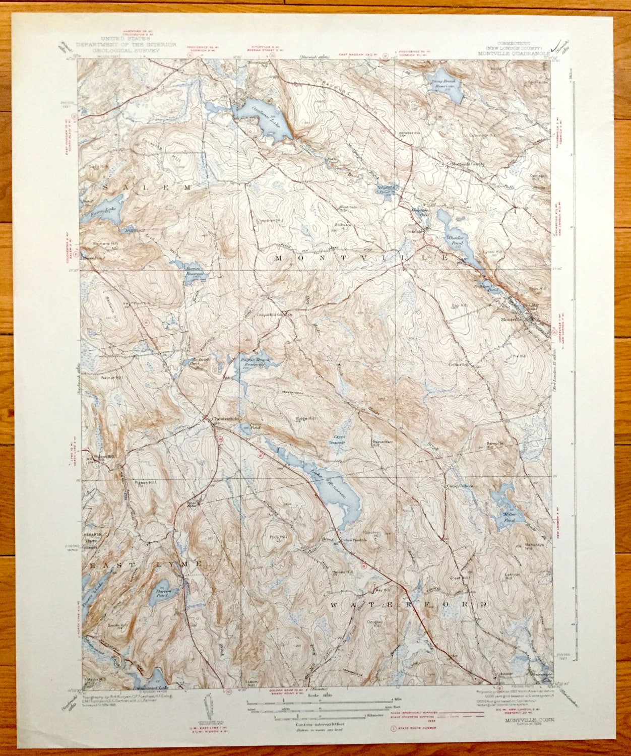
Antique Montville, Connecticut 1939 US Geological Survey Topographic Map – Salem, Waterford, East Lyme, Berlin, New London County, CT
Antique Montville, Connecticut 1939 US Geological Survey Topographic Map – Salem, Waterford, East Lyme, Berlin, New London County, CT
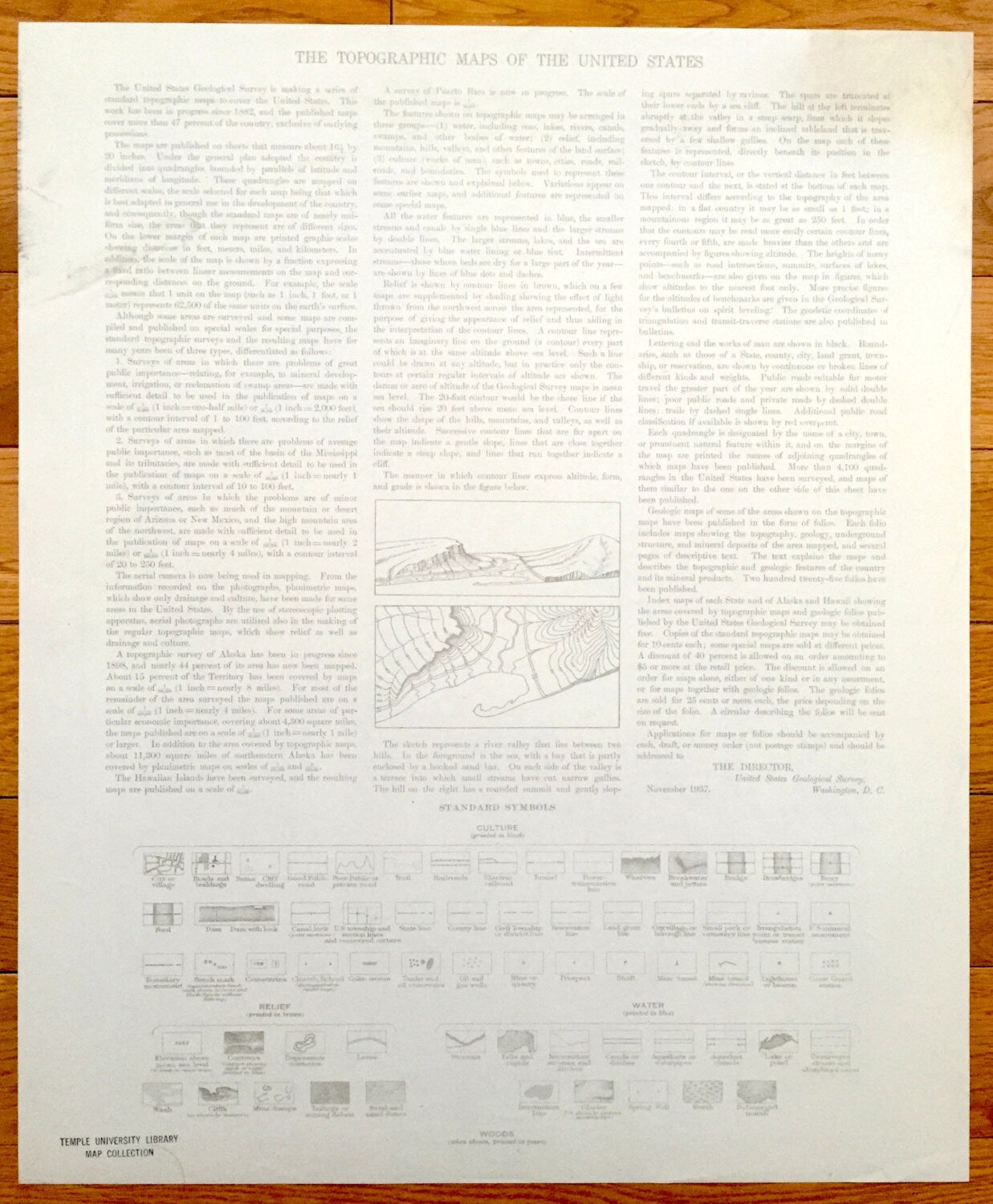
Beautiful, antique map of Montville, Connecticut and surrounding New London County area. This is an authentic 1939 print from the U.S. Geological Survey and NOT a computer reproduction.
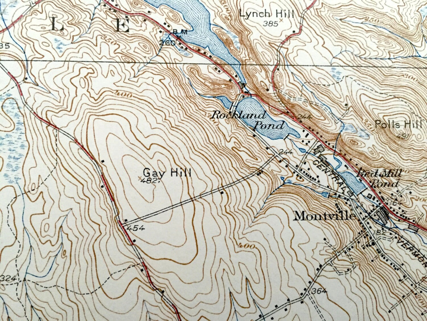
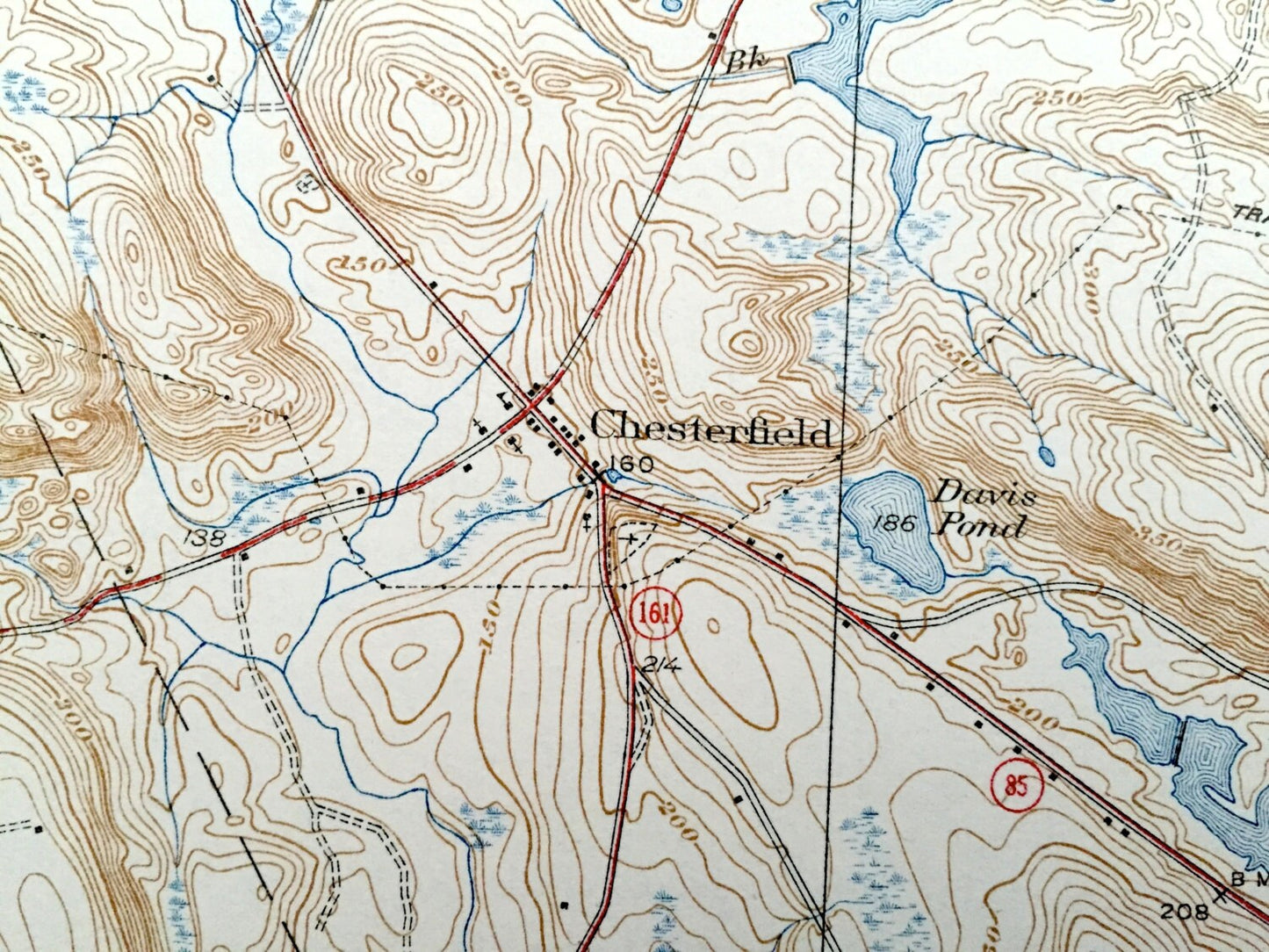
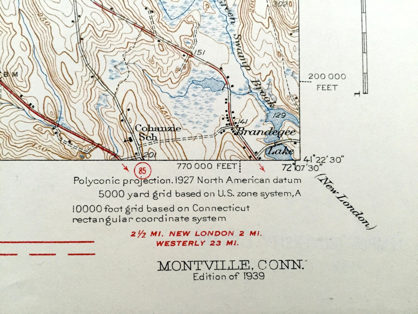
See what Montville, Waterford, and East Lyme looked like over 80 years ago. Lots of intricate details and geological contours. Map even has little squares for every house that existed at the time. The cartographers were very thorough back then! On the back is a description of topographic symbols and map guide.
Perfect for the historian, map-lover, the curious or just as a conversation starter. Wonderful and rare. Maps such as these make great gifts.
Edition of 1939, printed 1939
Dimensions: 17" width x 21" height
----
Features
Cities & Towns: Berlin, Salem, Oakdale, Montville, Montville Center, Waterford, East Lyme, Chesterfield.
Points of Interest: Oxoboxo Lake, Lake Konomoo, Miller Pond, Comstock Hill, West Side School, Fair Oaks School, Wheeler Pond, Camp Waterford, Lakes Pond Church, Cohanzie School, Nehantic State Forest, Salem Airport and lots more hills, mountains, creeks, towns, schools, and roads.
Condition: Very Good Vintage condition, commensurate with age. This map is in great shape for being over 80 years old. Has some and toning, but this will add to character when framed.
----
We will happily adjust shipping price for multiple purchases.
Couldn't load pickup availability
Share