My Store
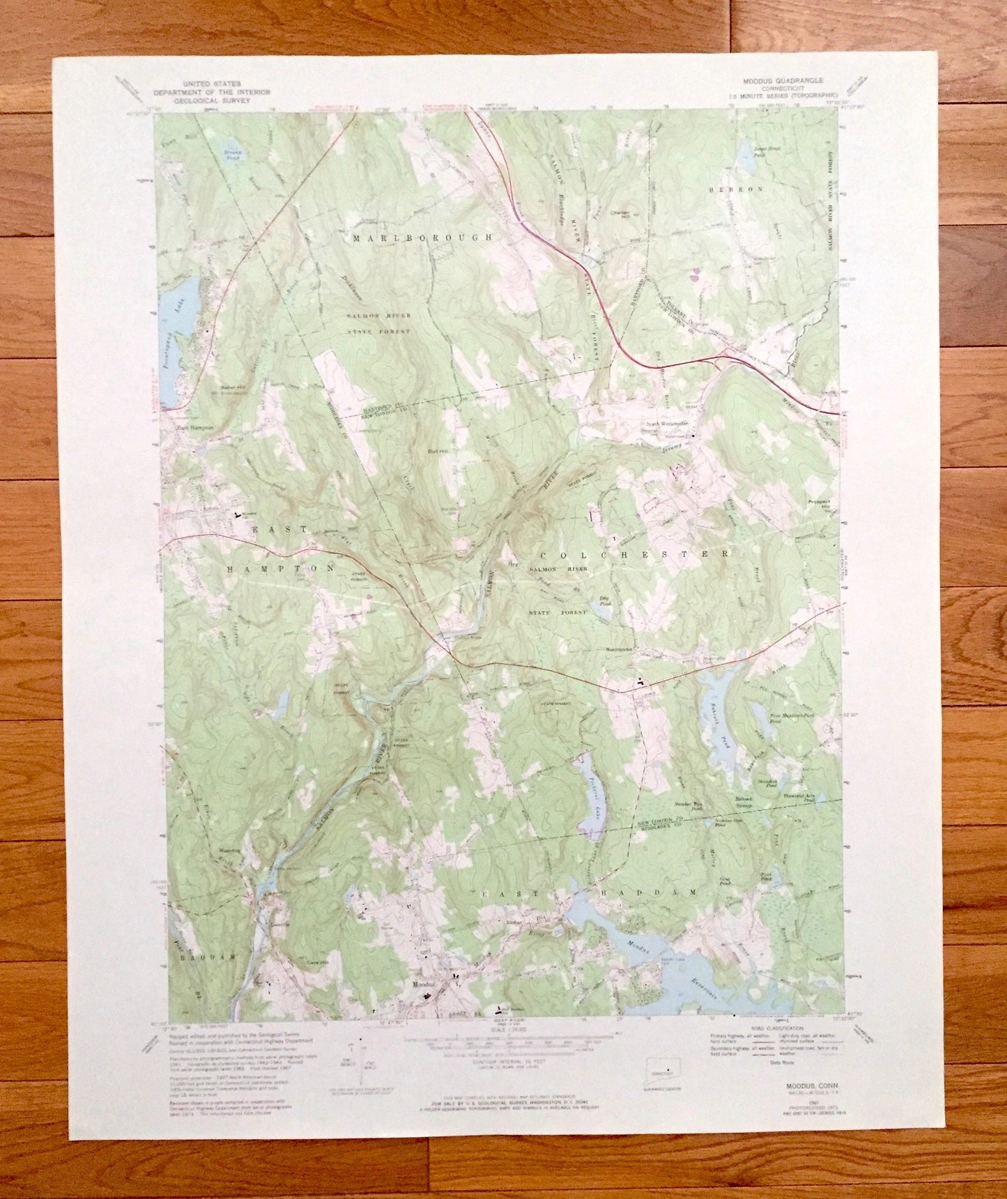
Antique Moodus, Connecticut 1967 US Geological Survey Topographic Map – Hartford, New London, Middlesex County, Marlborough, Colchester, CT
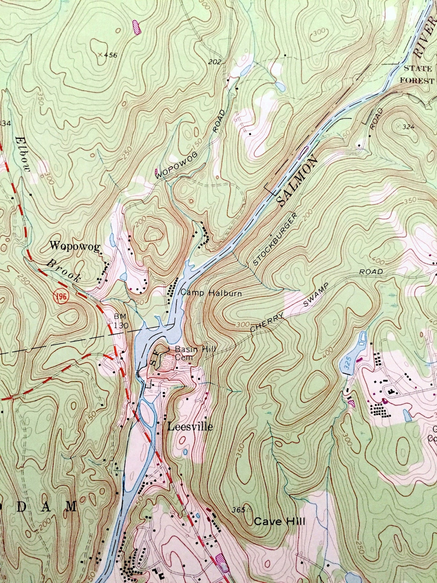
Antique Moodus, Connecticut 1967 US Geological Survey Topographic Map – Hartford, New London, Middlesex County, Marlborough, Colchester, CT
Beautiful, antique map of Moodus, Connecticut and surrounding Hartford County, New London County, Tolland County, and Middlesex County areas. This is an authentic 1967 edition, 1973 print from the U.S. Geological Survey and NOT a computer reproduction.
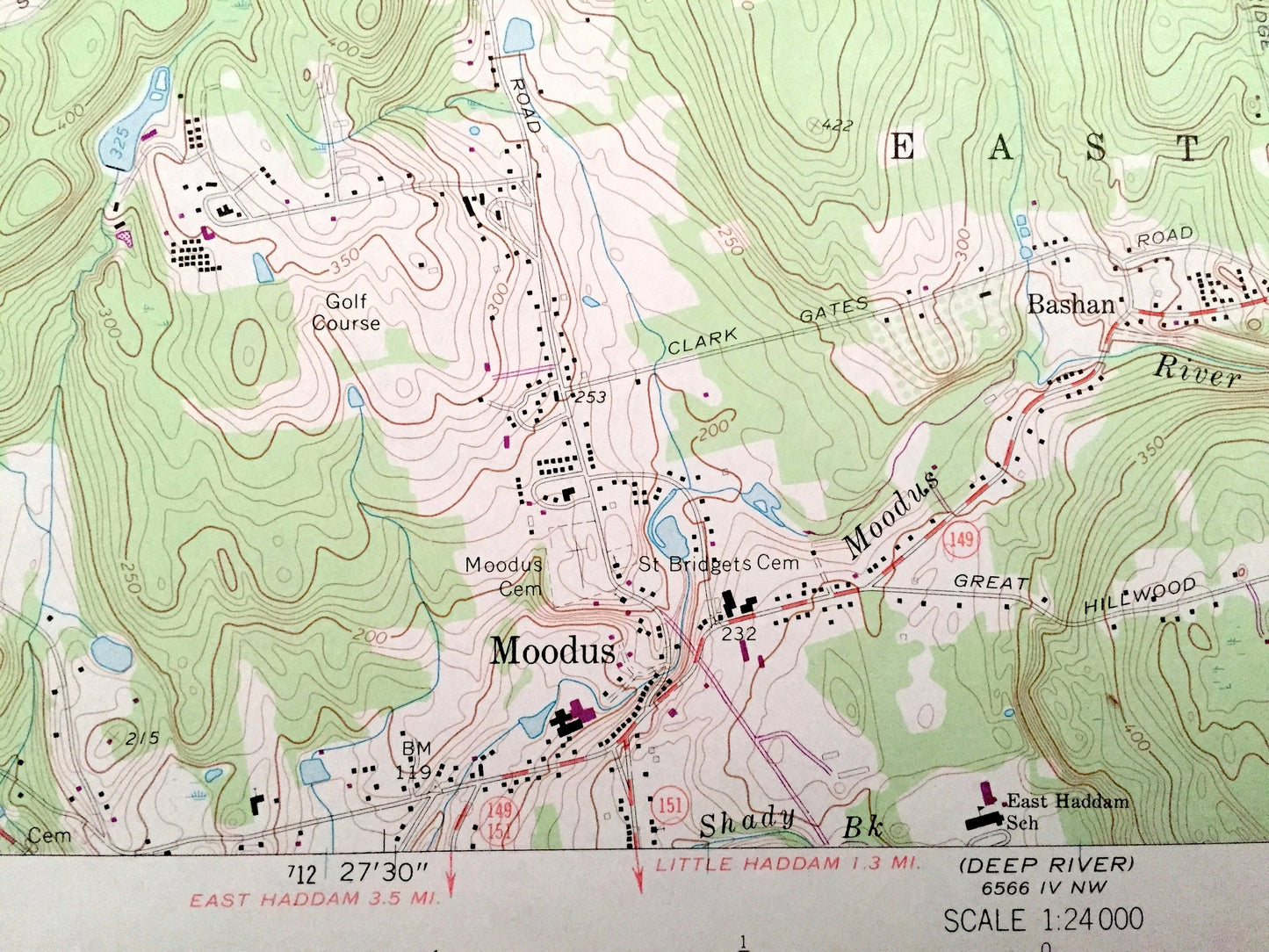
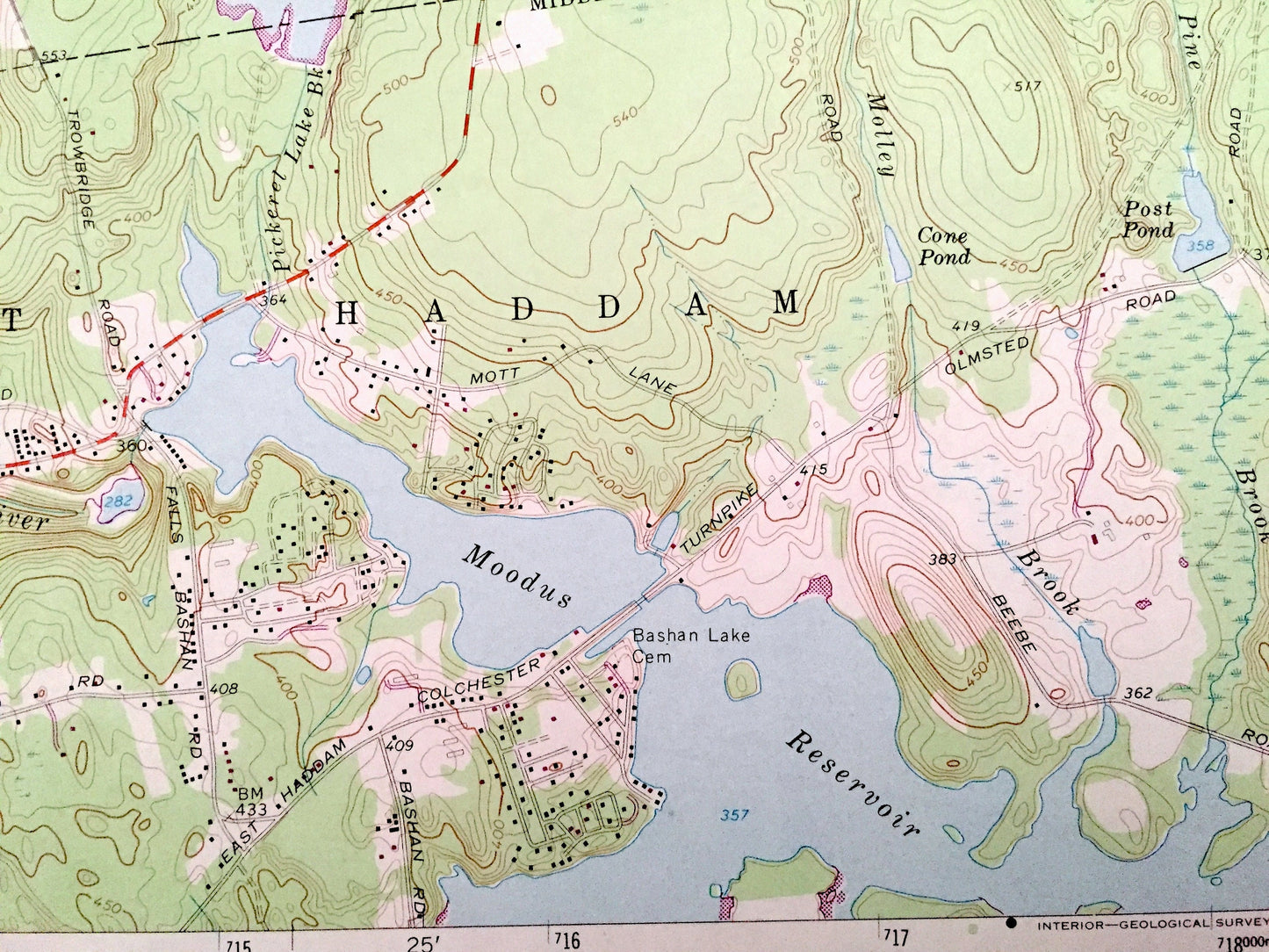
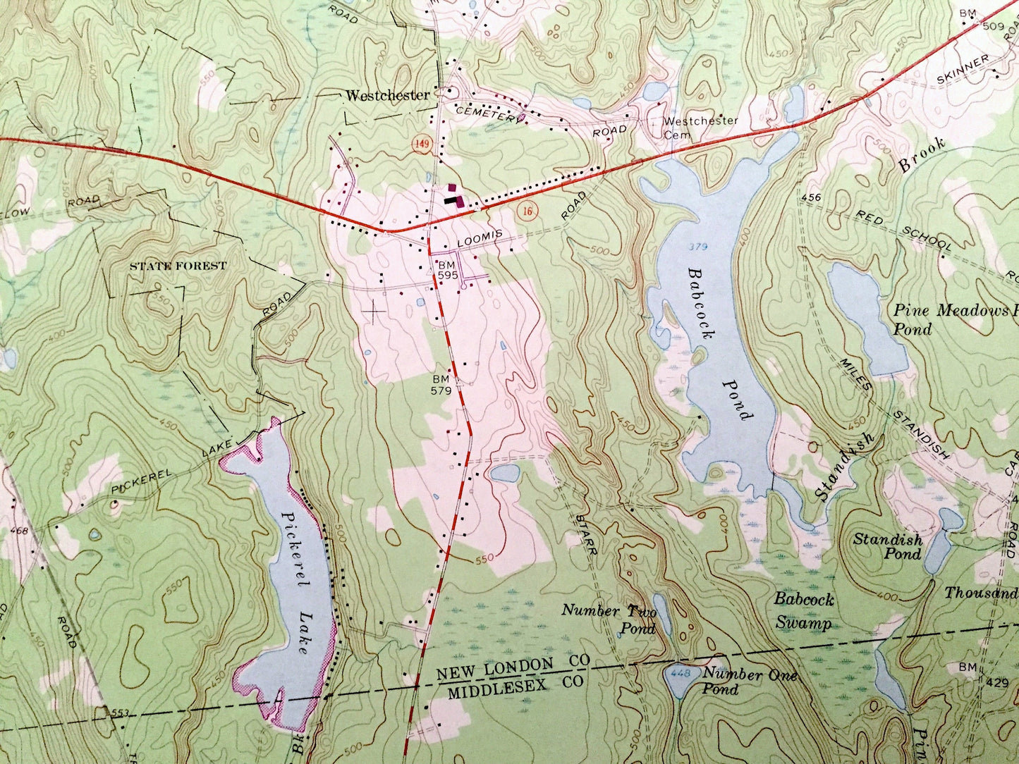
See what Connecticut looked like over 50 years ago. Lots of intricate details and geological contours. Map even has little squares for every house that existed at the time. The cartographers were very thorough back then!
Perfect for the historian, map-lover, the curious or just as a conversation starter. Wonderful and rare. Vintage maps such as these make great gifts.
Edition of 1967, printed 1973
Dimensions: 22" width x 27" height
----
Features
Cities & Towns: Hebron, North Westchester, Westchester, East Hampton, Wopowog, Haddam, Leesville, East Haddam, Bashan.
Points of Interest: Salmon River State Forest, Baker Hill, Chalker Hill, Bull Hill, Cave Hill, Pocotopaug Lake, Babcock Pond, Pickerel Lake, Moodus Reservoir, Strong Pond, Jones Street Pond, Day Pond, Salmon River, Jeremy River, Blackledge River, Pine Brook, Fawn Hill Brook, and many more hills, streams, ponds, houses, schools, railroads, churches and roads.
Condition: Very Good Vintage condition, commensurate with age. This map is in great shape for being over 45 years old. Has subtle edge-wear but will read as character when framed.
----
We will happily adjust shipping price for multiple purchases. Maps are rolled up and shipped in sturdy mailing tubes, never folded.
Couldn't load pickup availability
Share