My Store
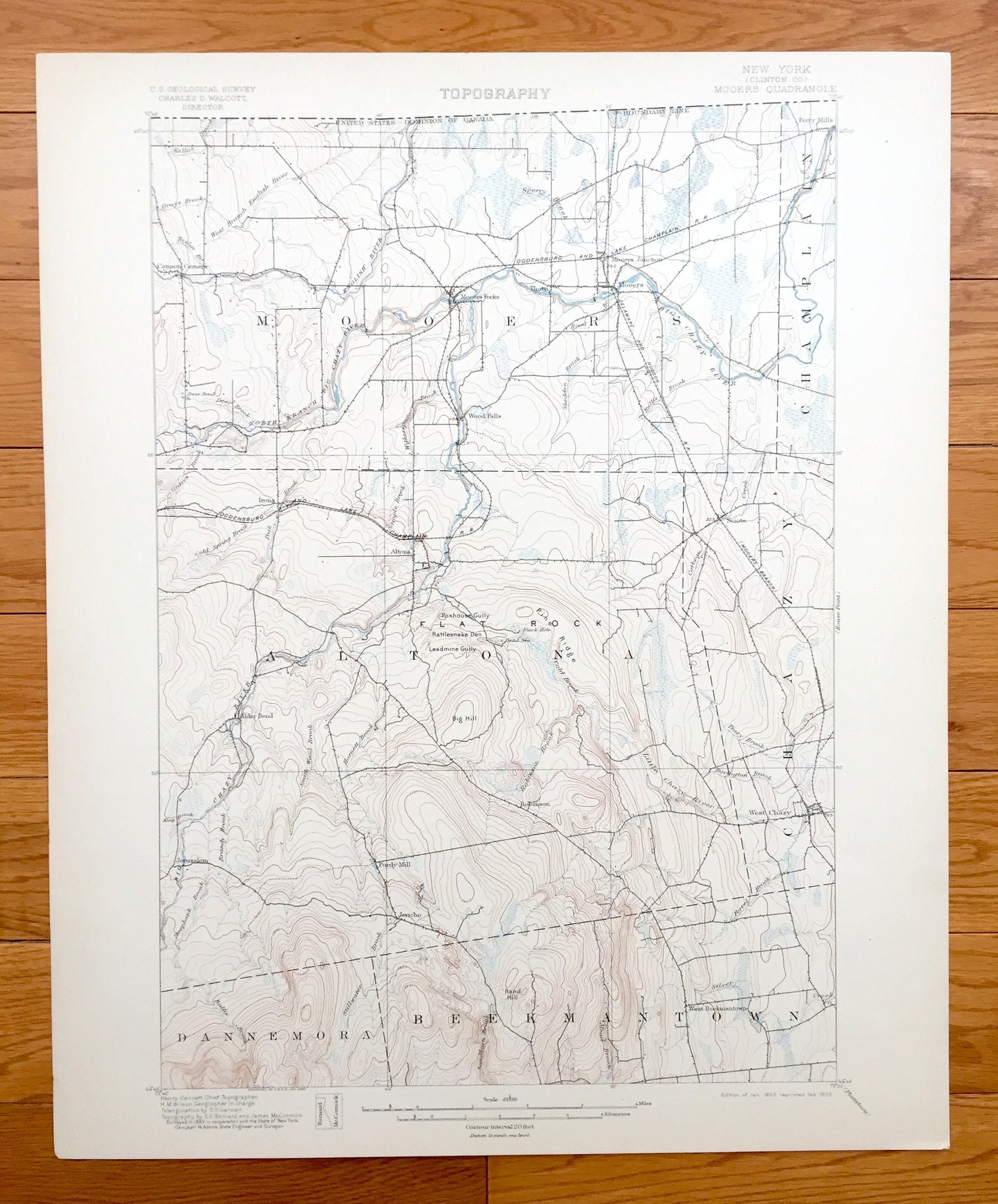
Antique Mooers, New York 1899 US Geological Survey Topographic Map – Adirondacks, Chazy, Champlain, Altona, Beekmantown, Clinton County, NY
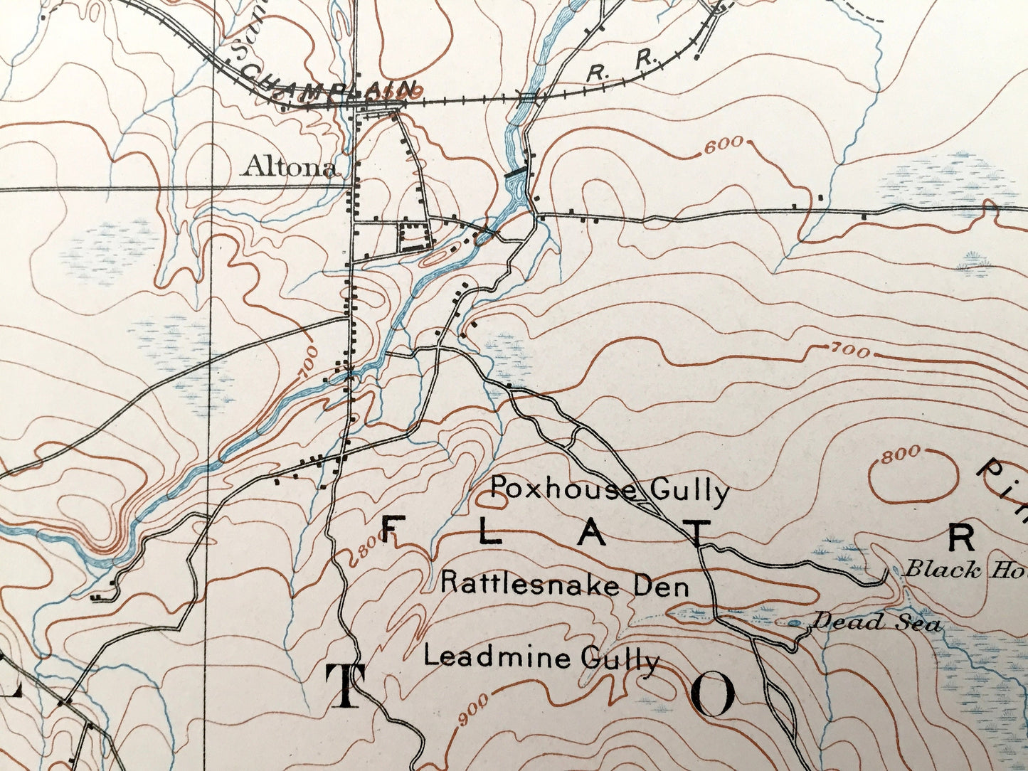
Antique Mooers, New York 1899 US Geological Survey Topographic Map – Adirondacks, Chazy, Champlain, Altona, Beekmantown, Clinton County, NY
Beautiful, antique map of Mooers, New York and surrounding Clinton County area. This is an authentic 1899 edition, 1903 print from the U.S. Geological Survey and NOT a computer reproduction.
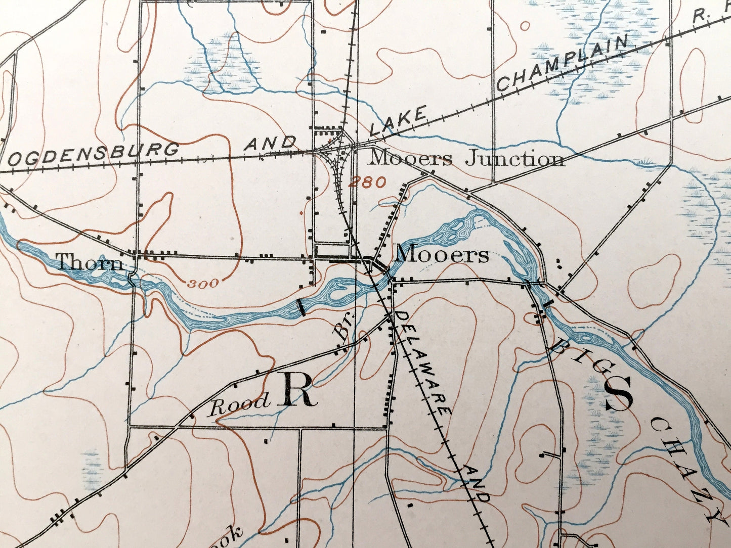
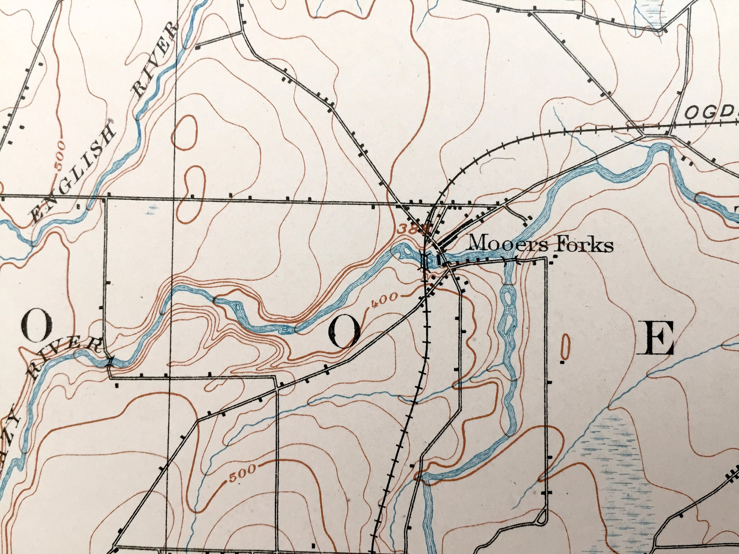
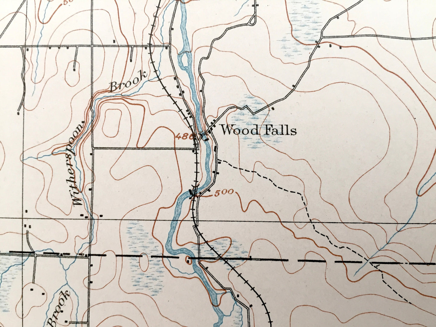
See what New York looked like more than 120 years ago. Lots of intricate details and geological contours. Map even has little squares for every house that existed at the time. The USGS cartographers were very thorough back then! On the back is a description of topographic symbols and map guide.
Perfect for the historian, map-lover, the curious or just as a conversation starter. Wonderful and rare. Vintage maps such as this make great gifts.
Edition of 1899, printed 1903
Dimensions: 16 1/2" width x 20" height
----
Features
Cities & Towns: Mooers, Champlain, Altona, Chazy, Dannemora, Beekmantown, Irona, Mooers Forks, Woods Falls, Perry Mills, Twin Bridges, Sciota, Purdy Mill, West Chazy, West Beekmantown, Jericho.
Points of Interest: Clinton County, Adirondacks, United States-Canada Border, Great Chazy River, English River, Miner Lake, Flat Rock, Witherspoon Brook, Lake Alice New York State Game Management Area, and many more lakes, ponds, islands, coves, hills, mountains, houses, train tracks, roads.
Condition: Very Good Vintage condition, commensurate with age. This map is in great shape for being 120 years old. An exceedingly well-preserved print.
----
We will happily adjust shipping price for multiple purchases. Maps are rolled up and shipped in sturdy mailing tubes, never folded.
Couldn't load pickup availability
Share