My Store
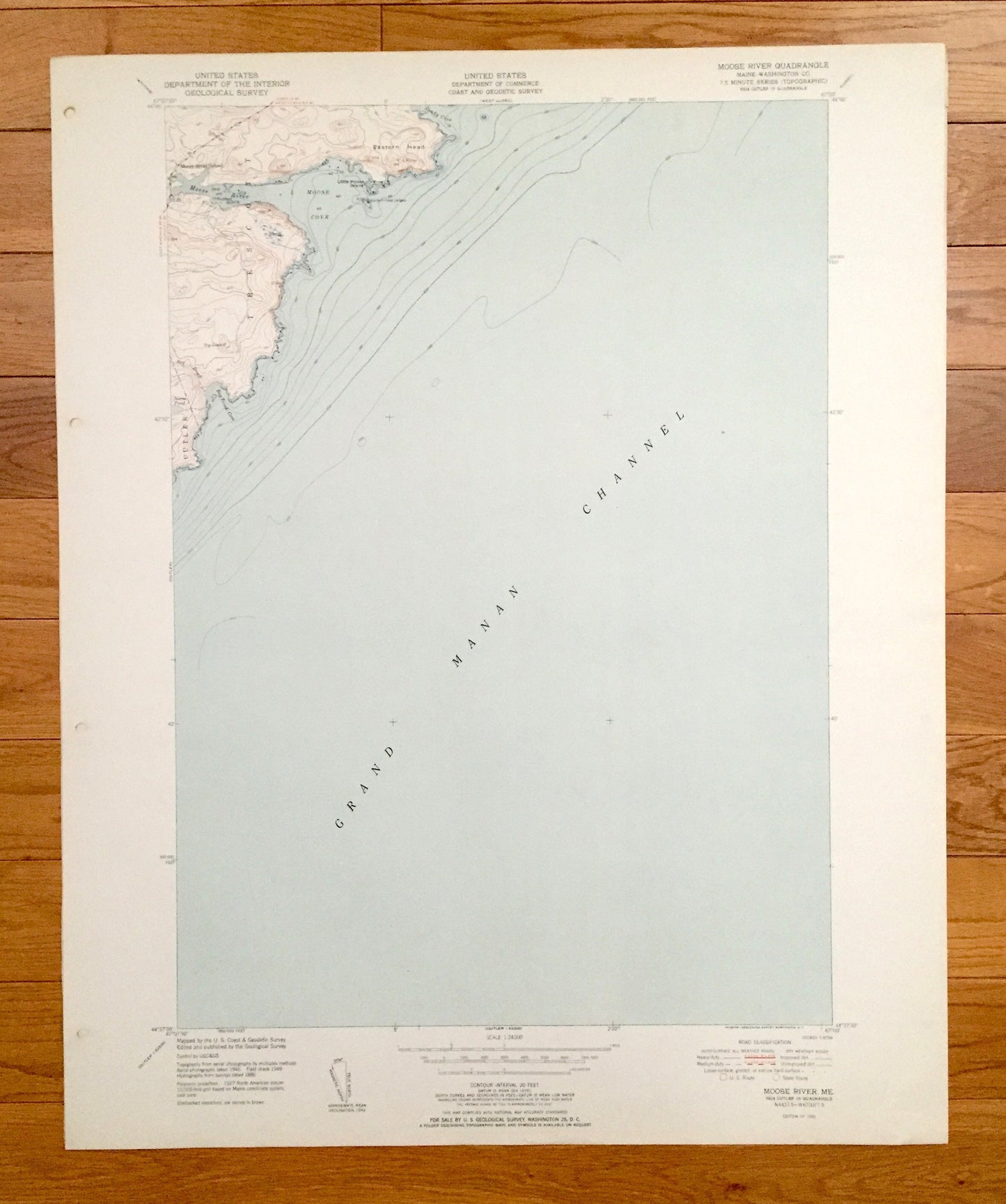
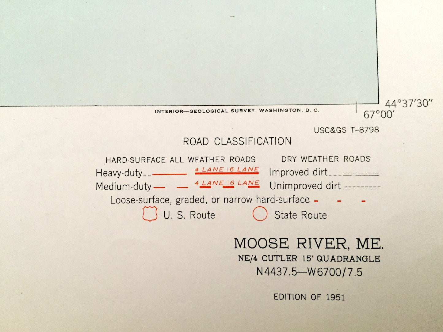
Antique Moose River, Maine 1951 US Geological Survey Topographic Map – Somerset County, Trescott, Cutler, Grand Manan Channel, ME
Antique Moose River, Maine 1951 US Geological Survey Topographic Map – Somerset County, Trescott, Cutler, Grand Manan Channel, ME
Beautiful, antique map of Moose River, Maine and surrounding Somerset County area. This is an authentic 1951 edition, 1951 print from the U.S. Geological Survey and NOT a computer reproduction.
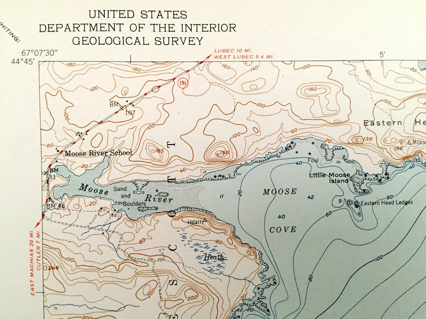
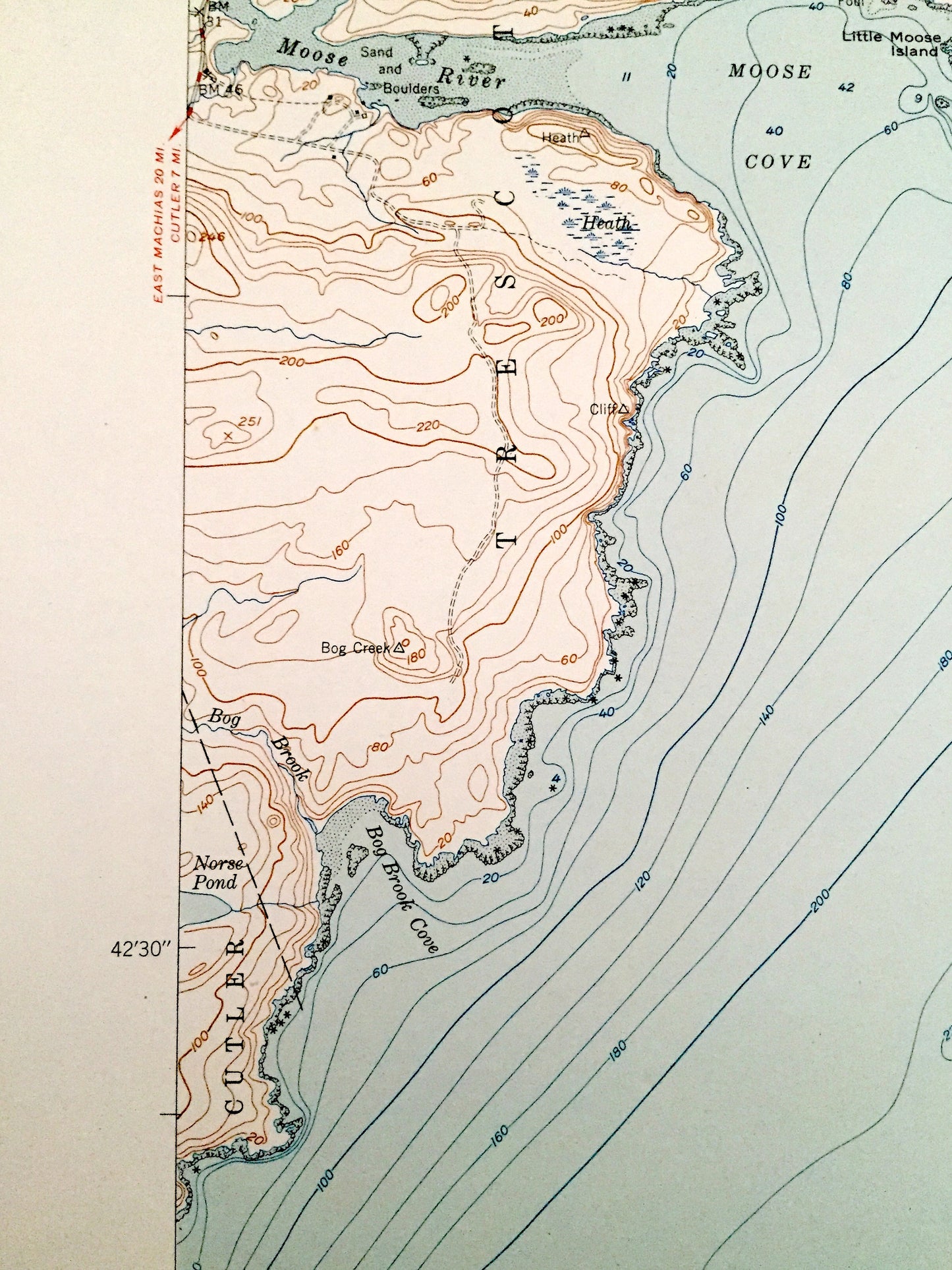
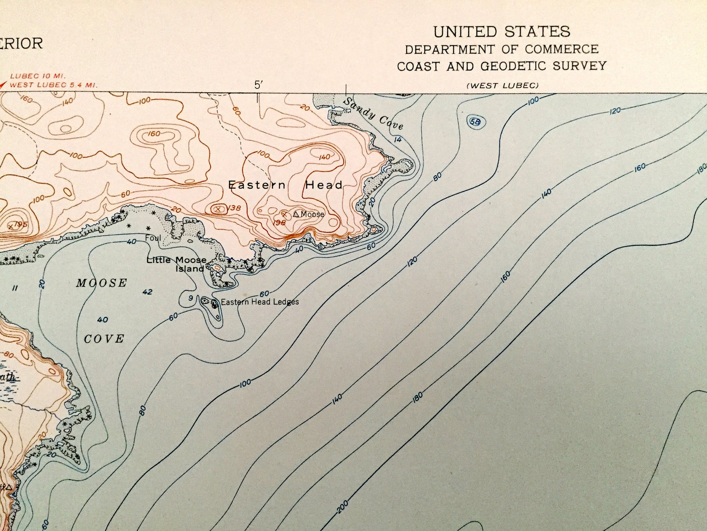
See what Maine looked like over 70 years ago. Lots of intricate details and geological contours. Map even has little squares for every house that existed at the time. The USGS cartographers were very thorough back then!
Perfect for the historian, map-lover, the curious or just as a conversation starter. Wonderful and rare. Vintage maps such as these make great gifts.
Edition of 1951, printed 1951
Dimensions: 22" width x 27" height
----
Features
Cities & Towns: Trescott, Cutler, Moose River School.
Points of Interest: Eastern Head, Moose Cove, Moose River, Sandy Cove, Little Moose Island, Bog Brook Cove, Grand Manan Channel, and many more hills, streams, ponds, houses, schools, railroads, churches and roads.
Condition: Very Good Vintage condition, commensurate with age. This map is in great shape for being over 70 years old. Has subtle edge-wear with few fold creases and a four-hole-punch on the left hand margin, all of which will read as character when framed.
----
We will happily adjust shipping price for multiple purchases. Maps are rolled up and shipped in sturdy mailing tubes, never folded.
Couldn't load pickup availability
Share