My Store
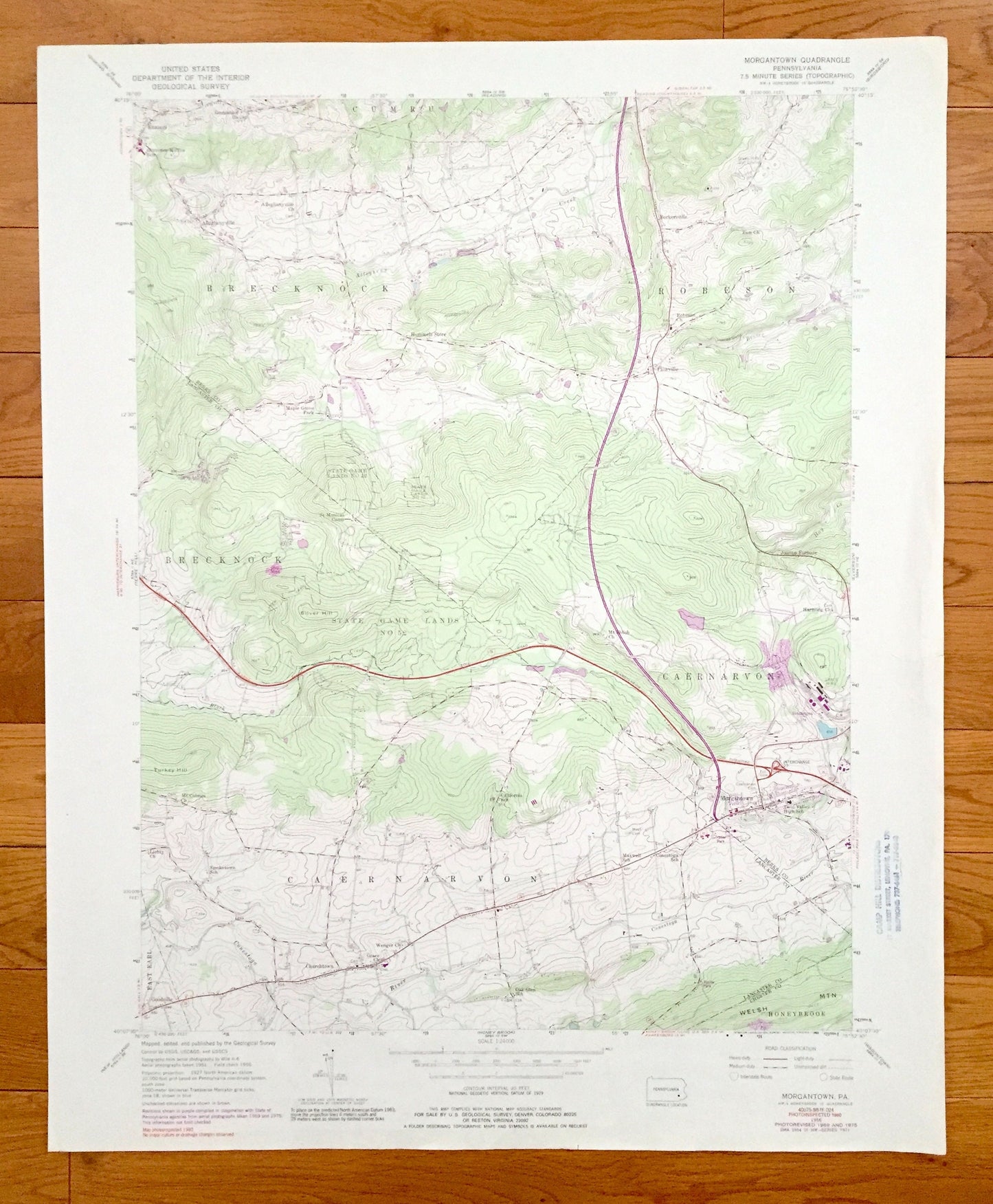
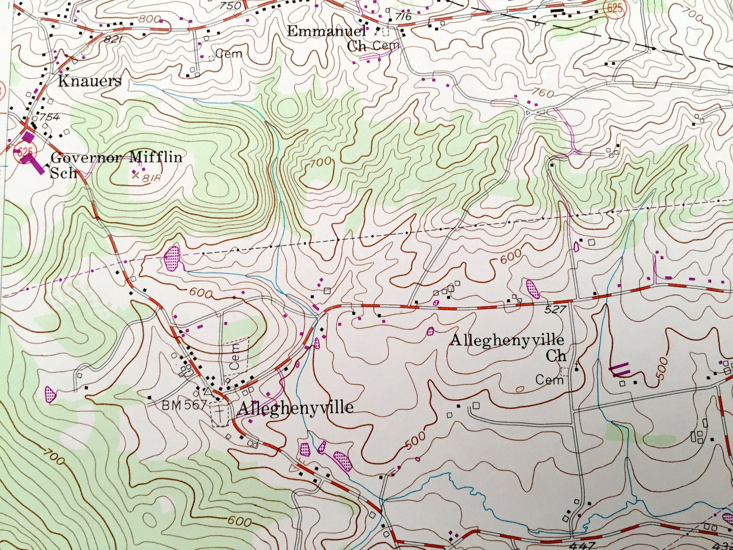
Antique Morgantown, Pennsylvania 1956 US Geological Survey Topographic Map – Knauers, Alleghenyville, Beckersville, Churchtown, Berks Co
Antique Morgantown, Pennsylvania 1956 US Geological Survey Topographic Map – Knauers, Alleghenyville, Beckersville, Churchtown, Berks Co
Beautiful, antique map of Morgantown, Pennsylvania. This is an authentic 1956 edition, 1989 print from the U.S. Geological Survey and NOT a computer reproduction.
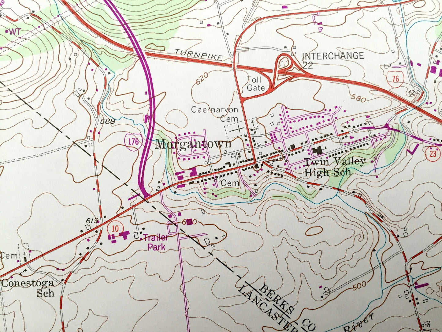
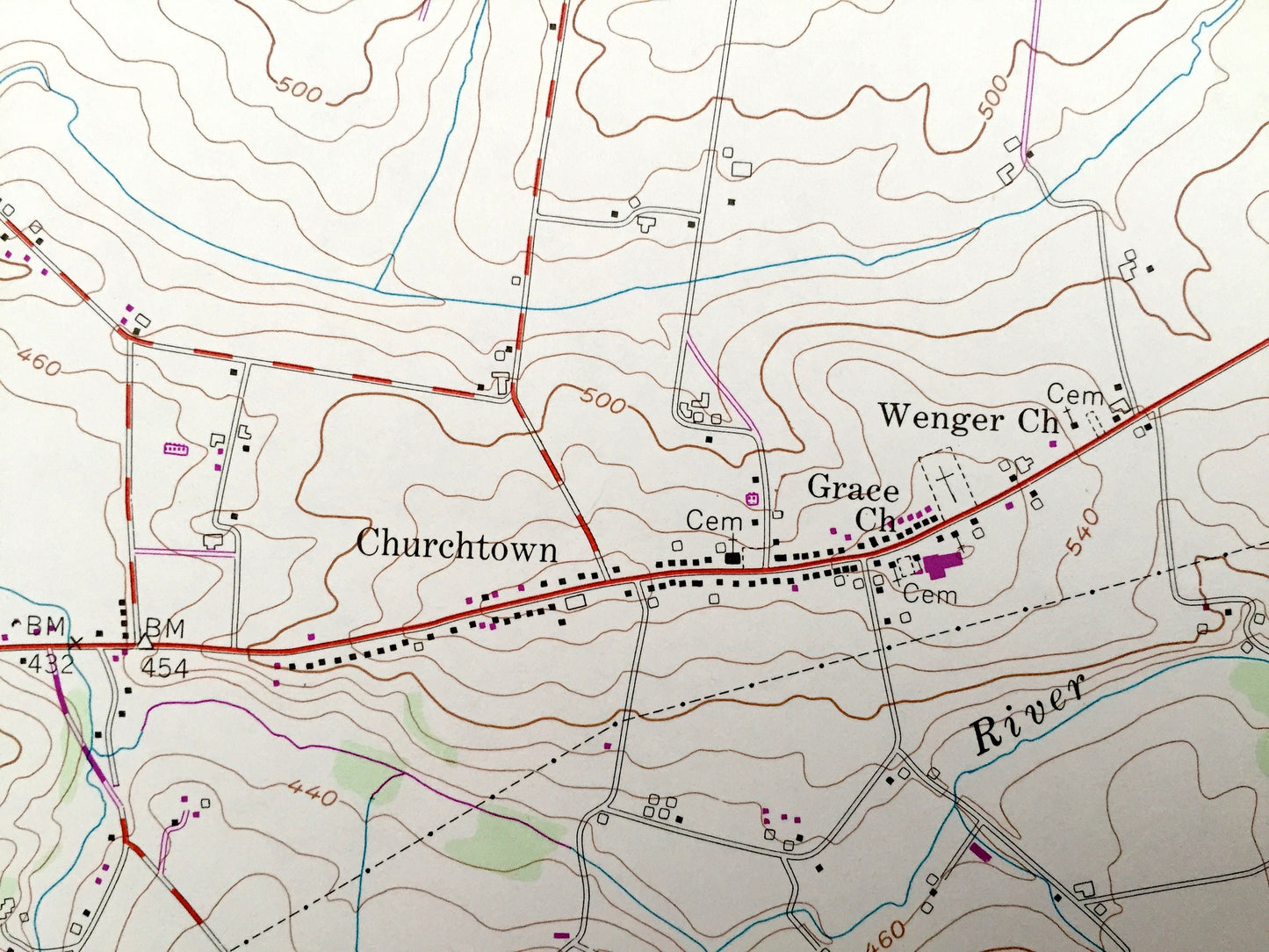
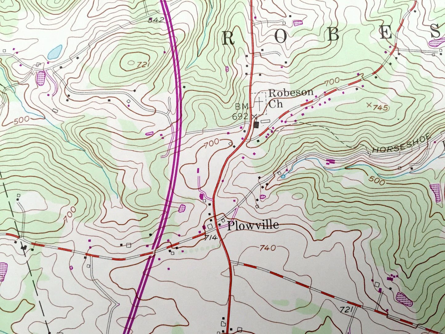
See what Berks and Lancaster Counties of Pennsylvania looked like over 60 years ago. Lots of intricate details and geological contours. Map even has little squares for every house that existed at the time. The USGS cartographers were very thorough back then!
Perfect for the historian, map-lover, the curious or just as a conversation starter. Wonderful and rare. Vintage maps such as these make great gifts.
Edition of 1956, printed 1989
Dimensions: 22" width x 27" height
----
Features
Cities & Towns: Knauers, Alleghenyville, Beckersville, Hummels Store, Maple Grove Park, Joanna Furnace, St Monica's Camp, Morgantown, Churchtown, Goodville, Honeybrook, East Earl, Caernarvon, Breakneck, Robeson, Cumru.
Points of Interest: State Game Lands No. 52, Berks County, Lancaster County, Mt Shiloh Church, Welsh Mountain, Governor Mifflin School, Silver Hill, Conestoga River, and lots more hills, streams, ponds, schools, churches, houses, and roads.
Condition: Very Good condition, commensurate with age. This map is in incredible shape for being over 60 years old. Has some edge-wear, which will read as character when framed.
----
We will happily adjust shipping price for multiple purchases. Maps are rolled up and shipped in sturdy mailing tubes, never folded.
Couldn't load pickup availability
Share