My Store
Antique Morris, Minnesota 1917 US Geological Survey Topographic Map – Darren, Hodges, Framnas, Rendsville, Pope County, Stevens County, MN
Antique Morris, Minnesota 1917 US Geological Survey Topographic Map – Darren, Hodges, Framnas, Rendsville, Pope County, Stevens County, MN
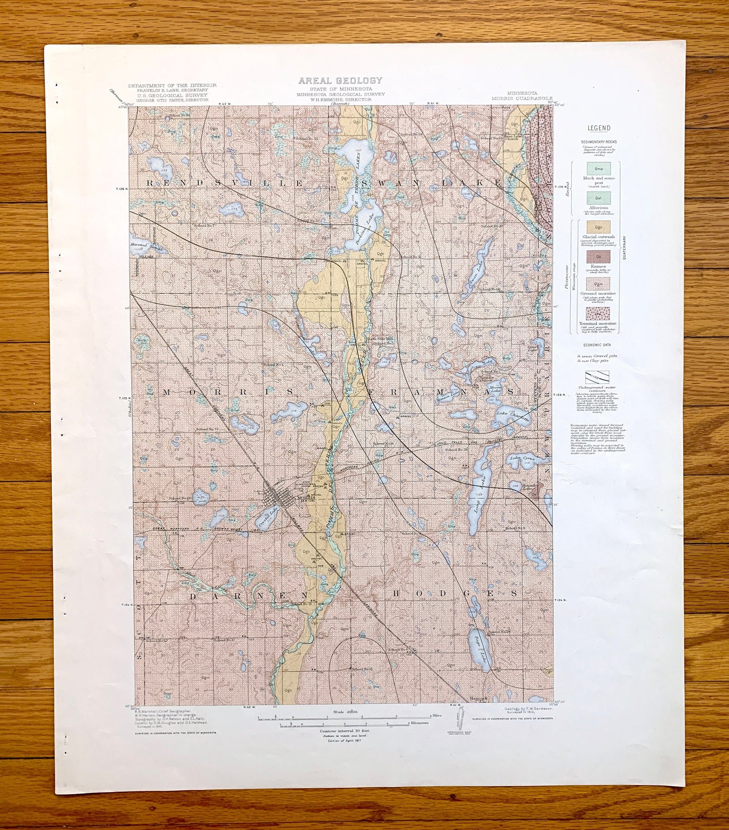
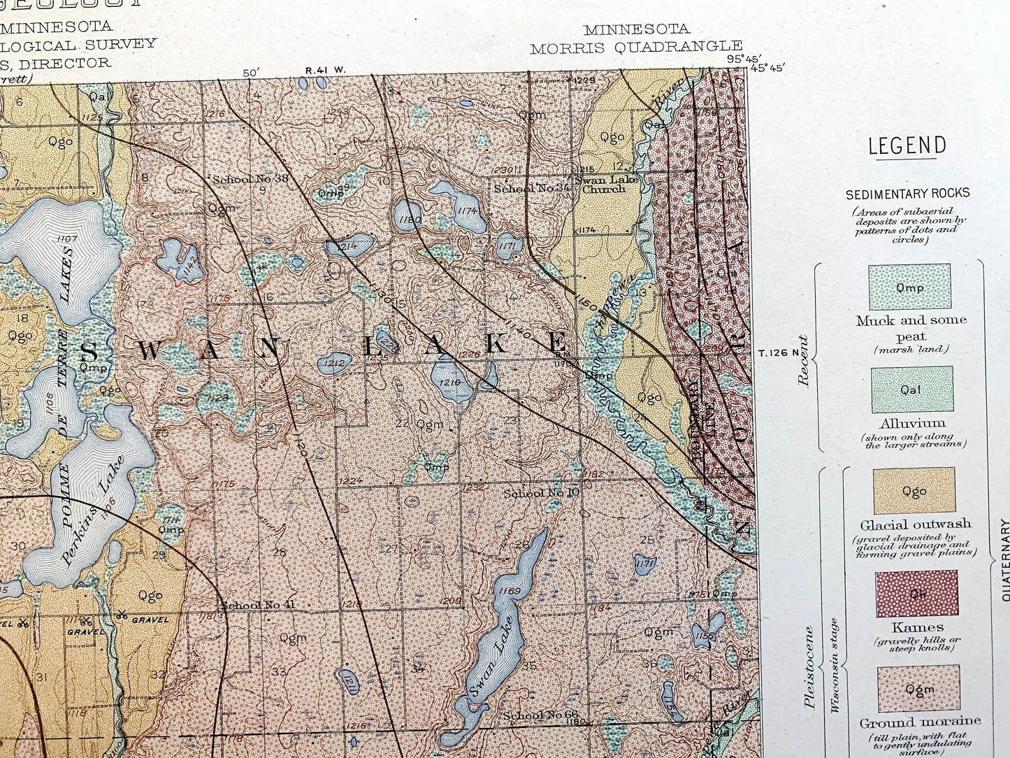
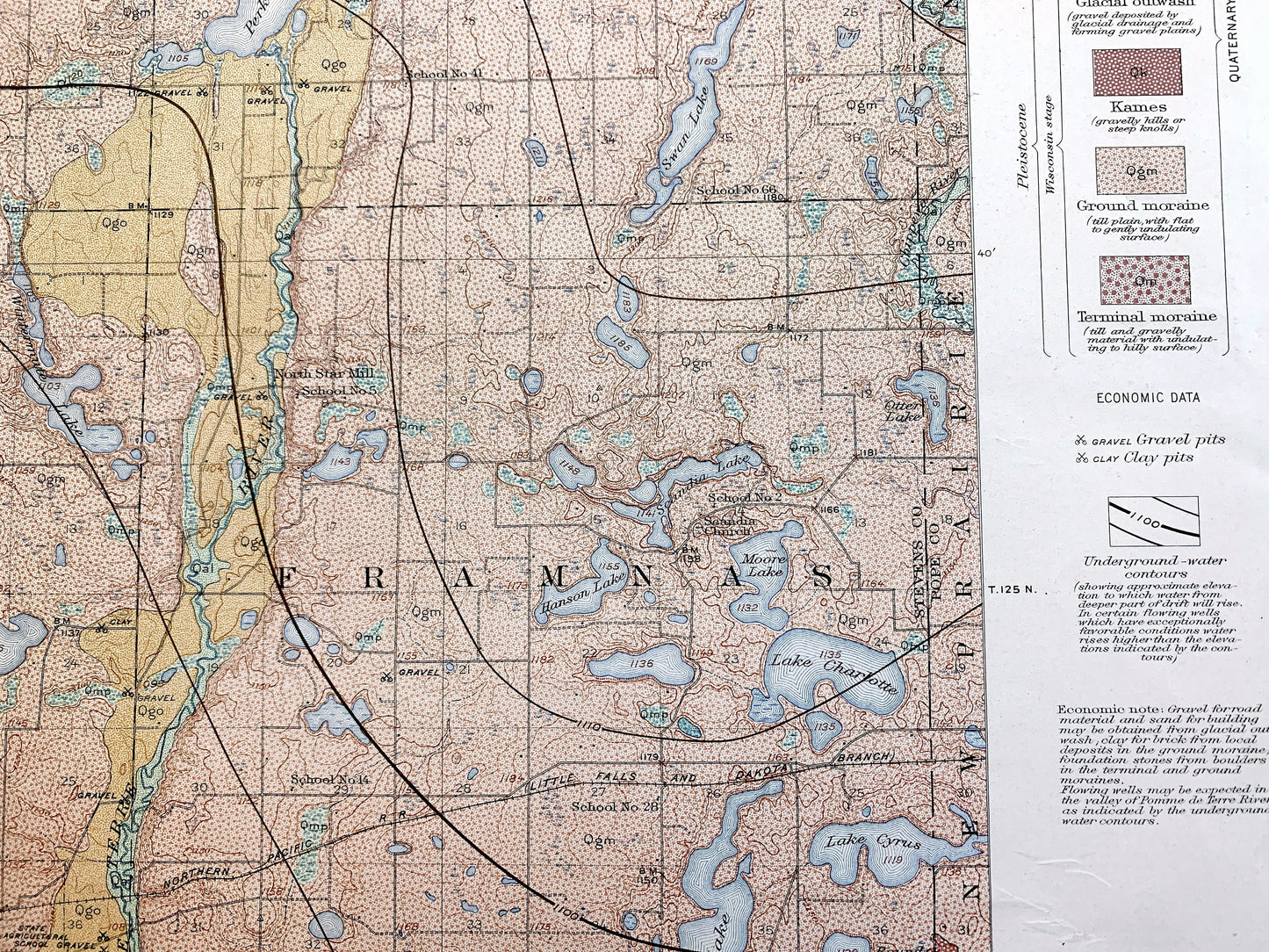
Beautiful, antique Areal Geology map of Morris, Minnesota and surrounding Pope County and Stevens County areas. This is an authentic 1917 edition, 1917 print from the U.S. Geological Survey and NOT a computer reproduction. It is from a Geologic Atlas folio.
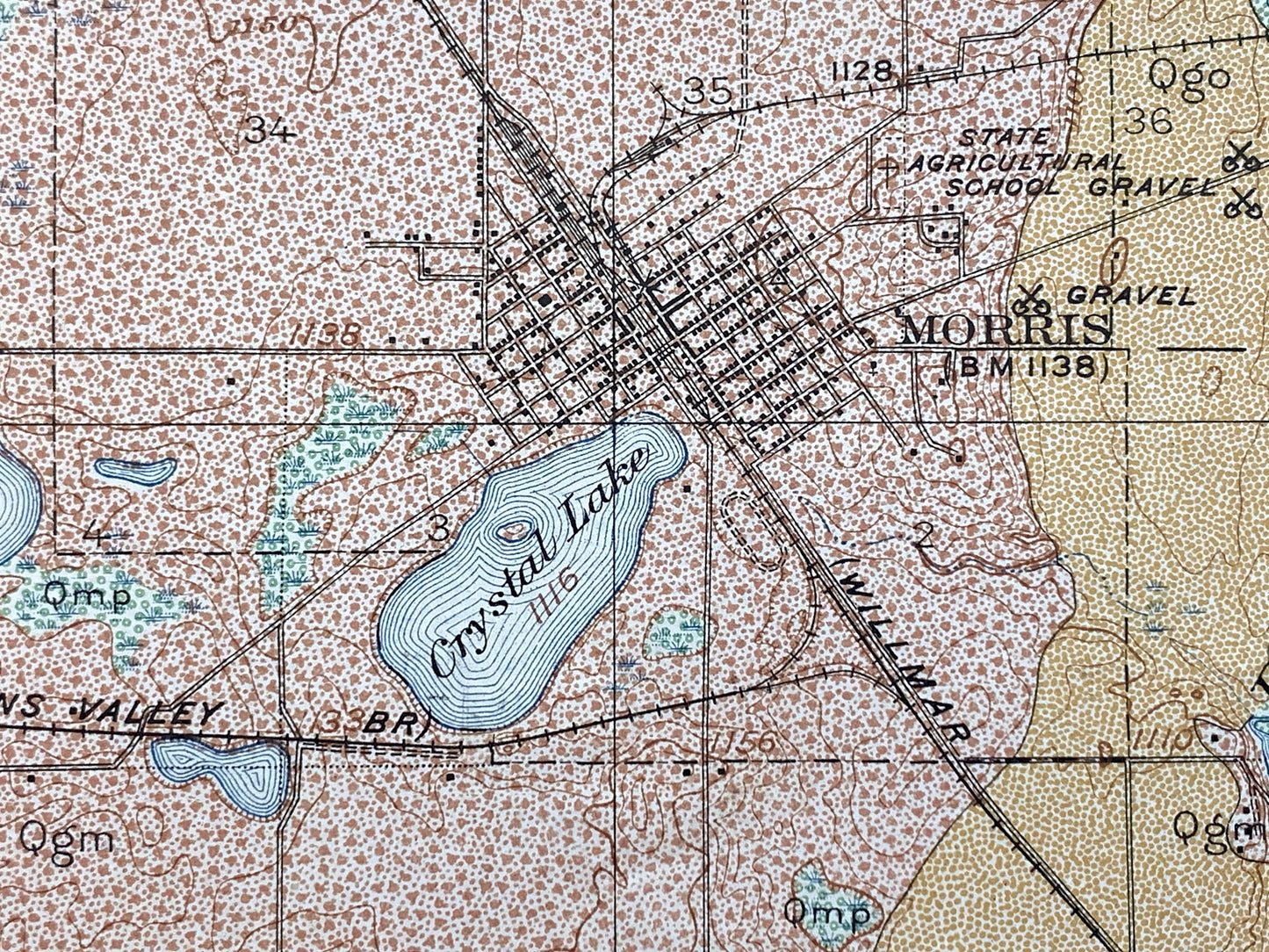
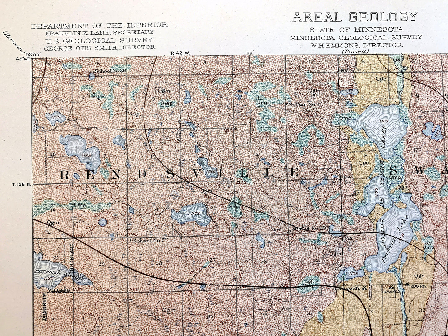
See what Minnesota looked like over 100 years ago. Lots of intricate details and geological contours. Map even has little squares for every house that existed at the time. The USGS cartographers were very thorough back then! This is one of the rare maps where the topographic symbols and map guide are on the front.
Perfect for the historian, map-lover, the curious or just as a conversation starter. Wonderful and rare. Maps such as these make great gifts.
Edition of 1917, printed 1917
Dimensions: 18 1/2" width x 22" height
----
Features
Cities & Towns: Morris, Darren, Hodges, Framnas, Rendsville, Swan Lake, New Prairie, Hancock, Scott.
Points of Interest: Big Stone County, Stevens County, Pomme de Terre River, Crystal Lake, Page Lake, Long Lake, Perkins Lake, Pomme de Terre Lakes, Swan Lake, Lake Cyrus, Lake Charlotte, Hanson Lake, Scandia Lake, Wintermute Lake, old railroad lines, and many more hills, streams, ponds, houses, schools, railroads, churches and roads.
Condition: Very Good Vintage condition, commensurate with age. This map is in great shape for being over 100 years old. Has light wear and staple holes in the margin, but this will add to the real vintage character when framed.
----
We will happily adjust shipping price for multiple purchases. Map will be shipped folded to preserve integrity.
Couldn't load pickup availability
Share