My Store
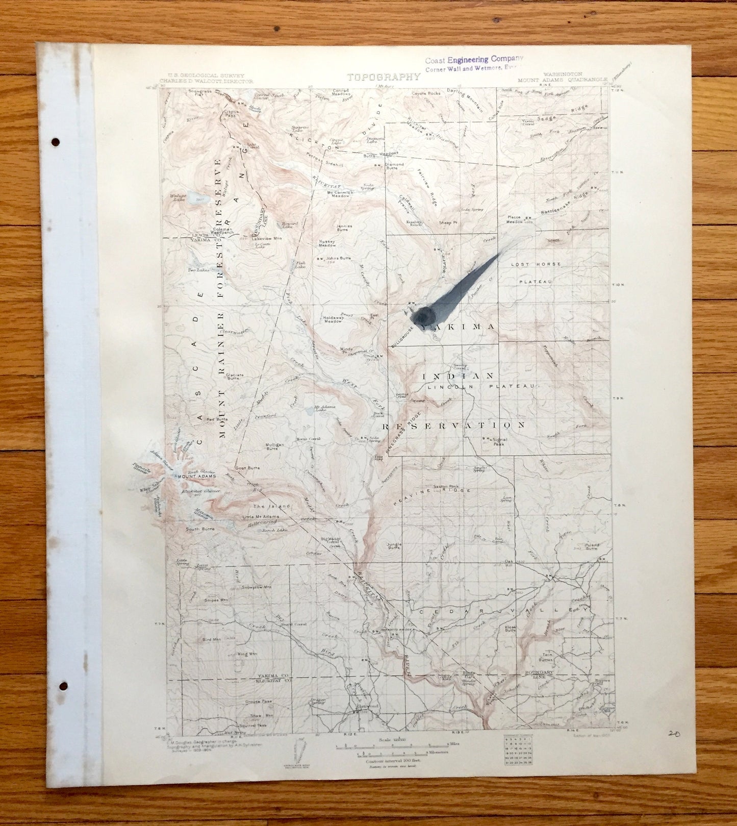
Antique Mount Adams, Washington 1907 US Geological Survey Topographic Map – Yakima, Klickitat County, Mt Rainier National Park, Lewis, WA
Antique Mount Adams, Washington 1907 US Geological Survey Topographic Map – Yakima, Klickitat County, Mt Rainier National Park, Lewis, WA
Beautiful, antique map of Mount Adams, Washington and surrounding Yakima, Lewis & Klickitat County area. This is an authentic 1907 print from the U.S. Geological Survey and NOT a computer reproduction.
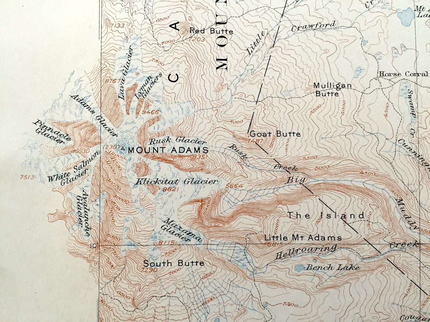
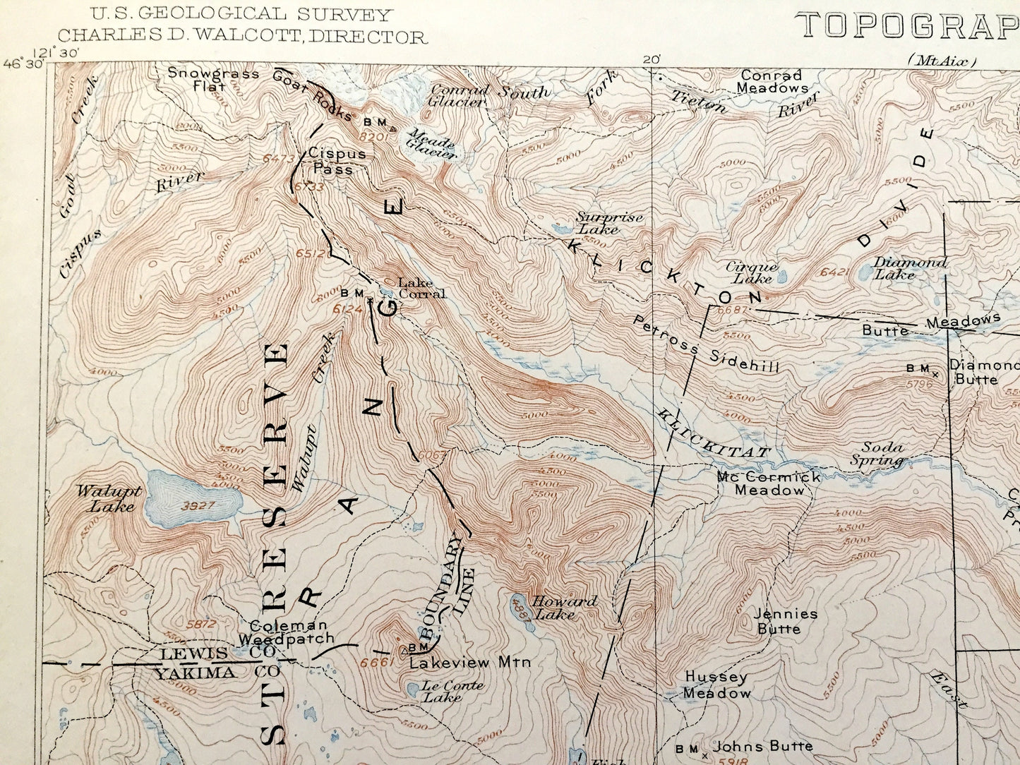
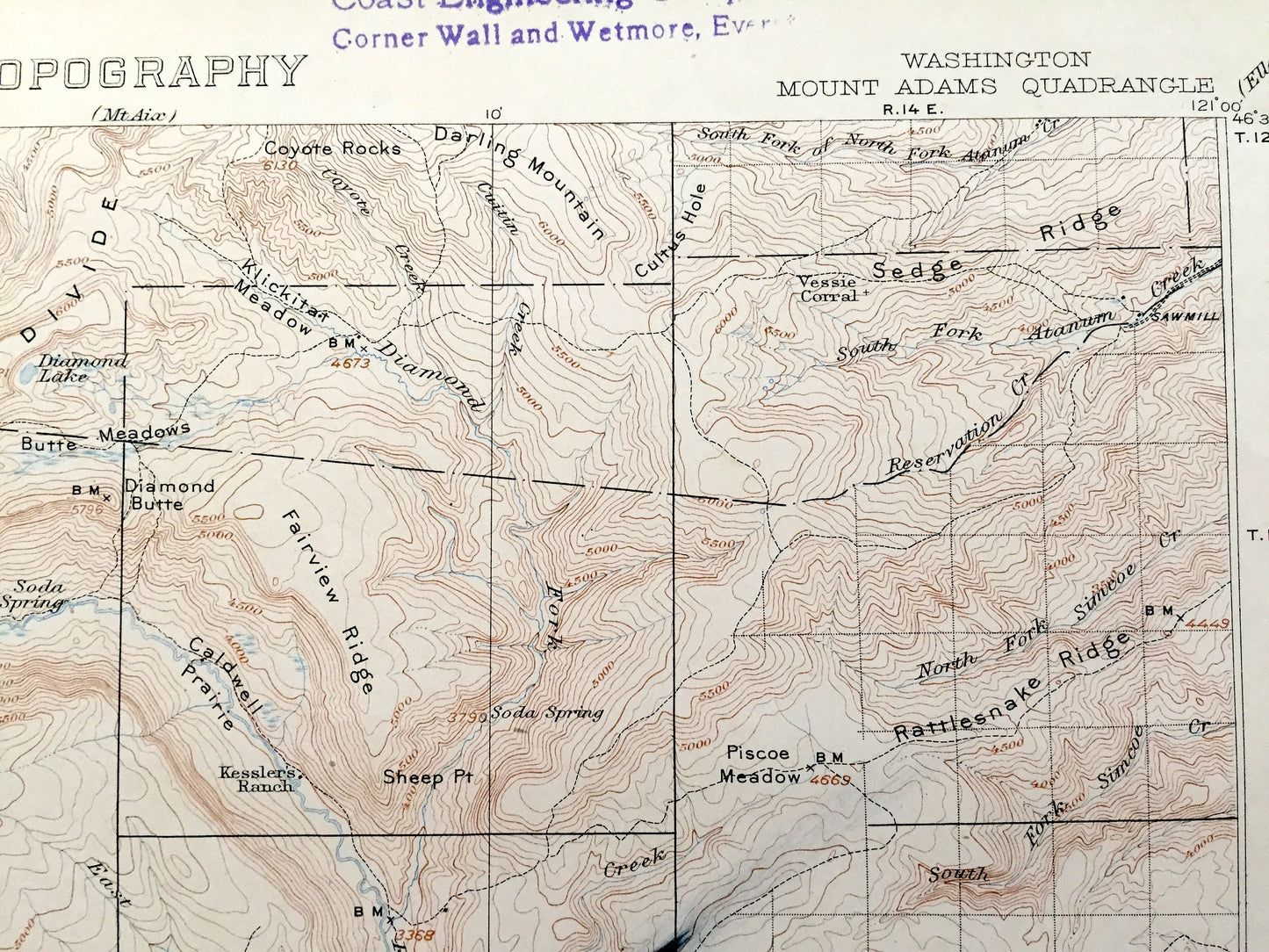
See what Washington looked like over 115 years ago. Lots of intricate details and geological contours. Map even has little squares for every house that existed at the time. The USGS cartographers were very thorough back then! On the back is a description of topographic symbols and map guide.
Perfect for the historian, map-lover, the curious or just as a conversation starter. Wonderful and rare. Vintage maps such as these make great gifts.
Edition of 1907, printed 1907
Dimensions: 16 1/2" width x 20" height (The atlas binding on the left margin is another inch.)
----
Features
Cities & Towns: Glenwood.
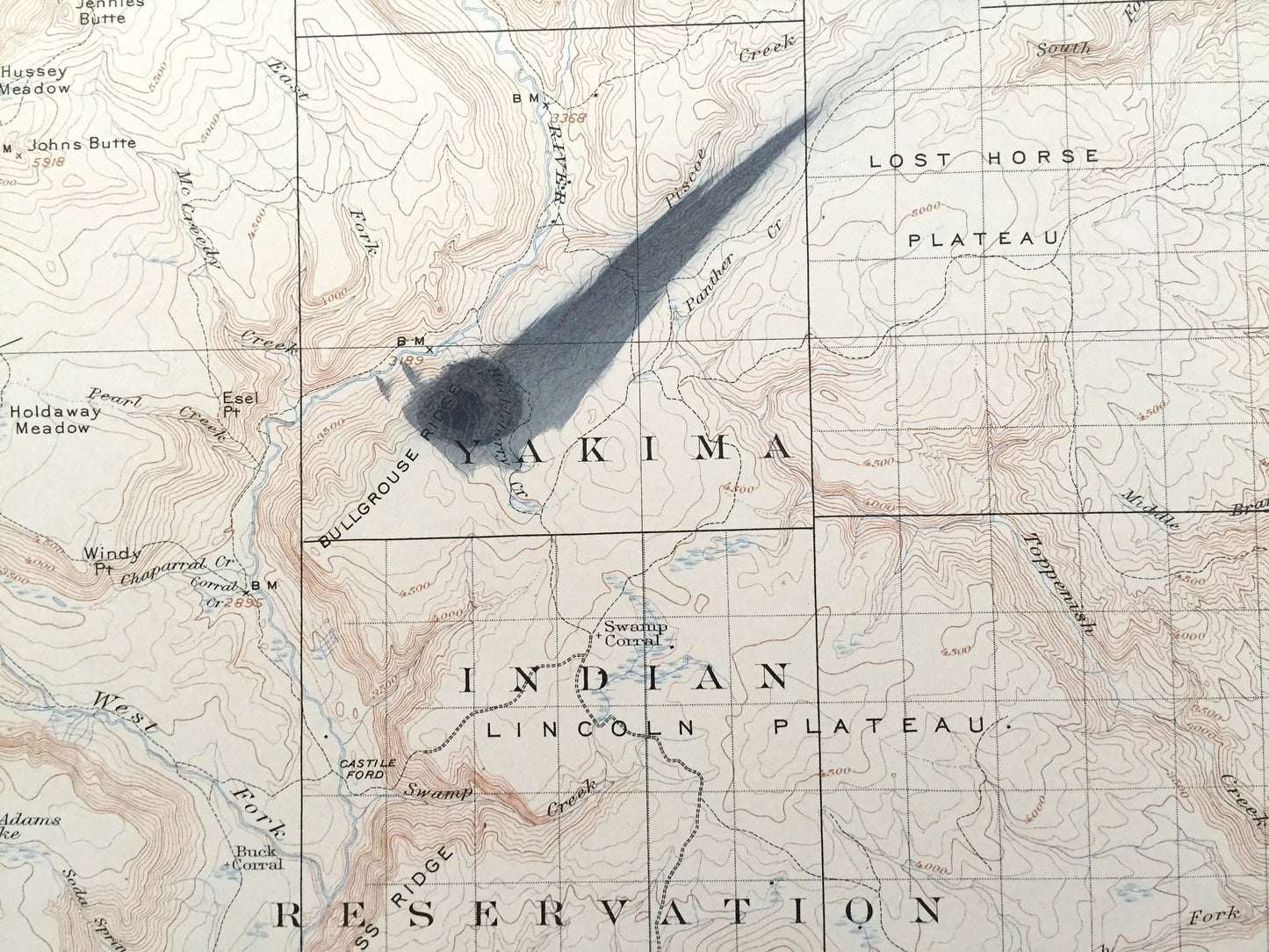
Points of Interest: Yakima County, Lewis County, Klickitat County, Mount Adams, Cascade Range, Mount Rainier National Park, Yakima Indian Reservation, Kickton Divide, Lost Horse Plateau, Peavine Ridge, The Island, Cedar Valley, Lincoln Plateau, Klickitat River, Pinegrass Ridge, Goat Butte, Signal Peak, Klickitat Glacier, South Butte, Pinnacle Glacier, Adams Glacier, Avalanche Glacier, Hellroaring Creek, Jungle Butte, Bullgrouse Ridge, Fish Lake Stream, Lakeview Mountain, Walupt Lake, Bird Creek, Parrotts Bridge, Grouse Pass, Shaw Mountain, Squirrel Pass, Bird Creek, Soda Ford, Toppenish Creek, Caldwell Prairie, Coleman Weedpatch, Mulligan Butte, King Mountain, and lots more hills, mountains, creeks, towns, roads and train tracks.
Condition: Good Vintage condition, commensurate with age. This map is in great shape for being over 115 years old. Has light wear, toning, foxing, edge-wear, stamp in upper margin, and pencil in lower right margin, as well as a prominent ink stain in the middle of the map, but these are what make the map unique, and will read as vintage character when framed. Canvas binding at left margin has been left on map, for discretion of buyer to keep or remove.
----
We will happily adjust shipping price for multiple purchases. Maps are rolled up and shipped in sturdy mailing tubes, never folded.
Couldn't load pickup availability
Share