My Store
Antique Mount Alto, West Virginia 1958 US Geological Survey Topographic Map – Arbuckle, Leon, Rollins, Harvey Chapel, Union, Baden, WV OH
Antique Mount Alto, West Virginia 1958 US Geological Survey Topographic Map – Arbuckle, Leon, Rollins, Harvey Chapel, Union, Baden, WV OH
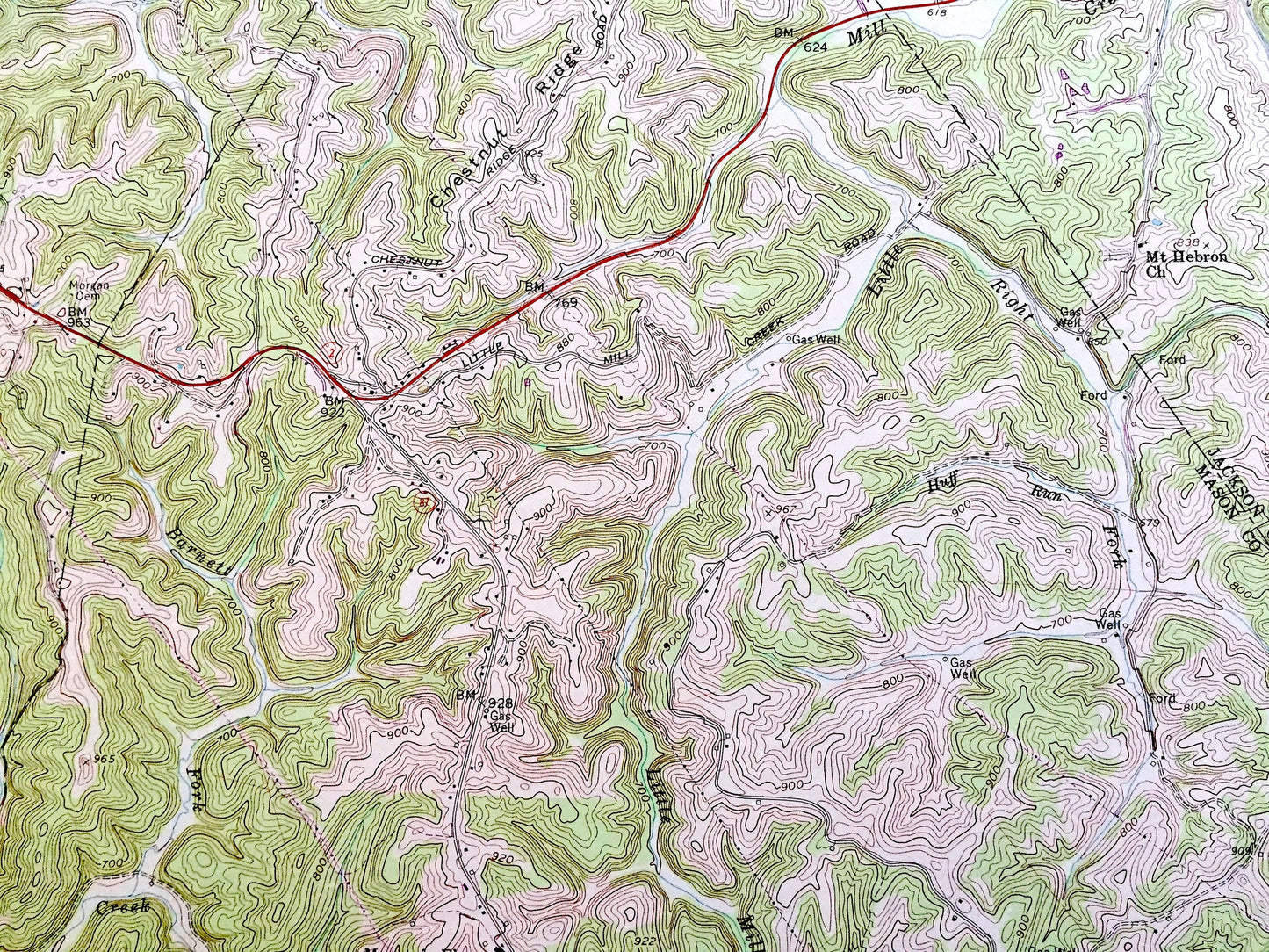
Beautiful, antique map of Mount Alto, West Virginia and the surrounding Jackson & Mason County areas. This is an authentic 1958 edition, 1984 print from the U.S. Geological Survey and NOT a computer reproduction.
See what Meigs County of Ohio and Jackson County of West Virginia looked like over 60 years ago. Lots of intricate details and geological contours. Map even has little squares for every house that existed at the time. The USGS cartographers were very thorough back then!
Perfect for the historian, map-lover, the curious or just as a conversation starter. Wonderful and rare. Vintage maps such as these make great gifts.
Edition of 1958, printed 1984
Dimensions: 22" width x 27" height
----
Features
Cities & Towns: Arbuckle, Leon, Rollins, Harvey Chapel, Union, Baden, Davies Grove, Mount Alto, Cooper.
Points of Interest: Ohio River, Kanawha River, Thirteenmile Creek, Poplar Fork, Tenmile Creek, Thomas Ridge, Oldtown Creek, Chestnut Ridge, Ohio River, Meigs County, Jackson County, Mason County, Little Creek, Little Mill, and lots more hills, streams, ponds, churches, houses, and roads.
Condition: Good or "Very Vintage" condition, commensurate with age. This map is in great shape for being about 40 years old. Has some real edge-wear, toning and staining, as well as some warble, but this will flatten easily and all of which will read as character when framed.
----
We will happily adjust shipping price for multiple purchases. Maps are rolled up and shipped in sturdy mailing tubes, never folded.
Couldn't load pickup availability
Share