My Store
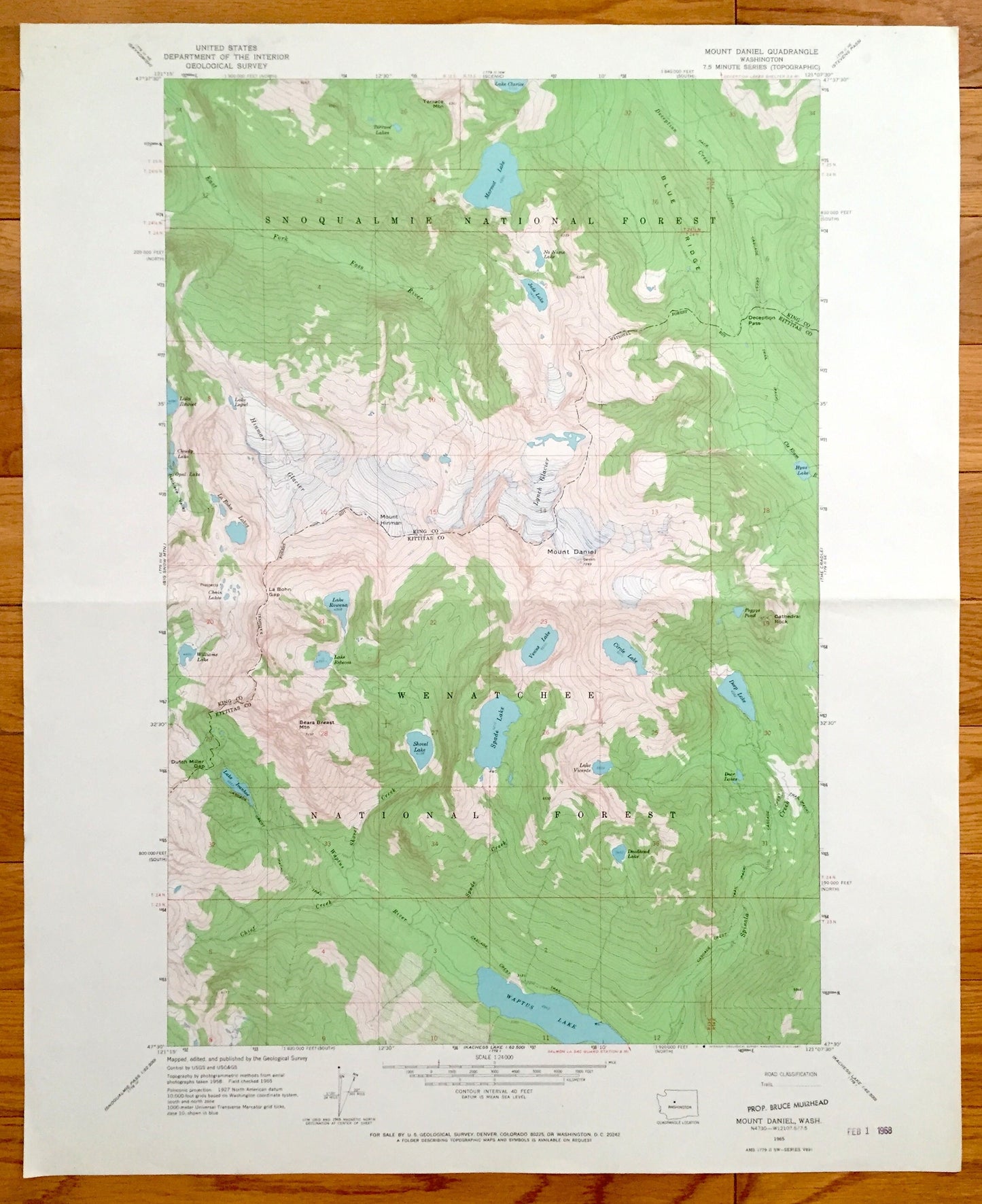
Antique Mount Daniel, Washington 1965 US Geological Survey Topographic Map – King, Kittatas County, Wenatchee, Snoqualmie National Forest WA
Antique Mount Daniel, Washington 1965 US Geological Survey Topographic Map – King, Kittatas County, Wenatchee, Snoqualmie National Forest WA
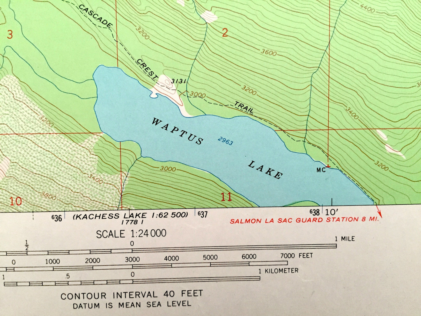
Beautiful, antique map of Mount Daniel, Washington and surrounding King County and Kittatas County areas including Wenatchee National Forest. This is an authentic 1965 print from the U.S. Geological Survey and NOT a computer reproduction.
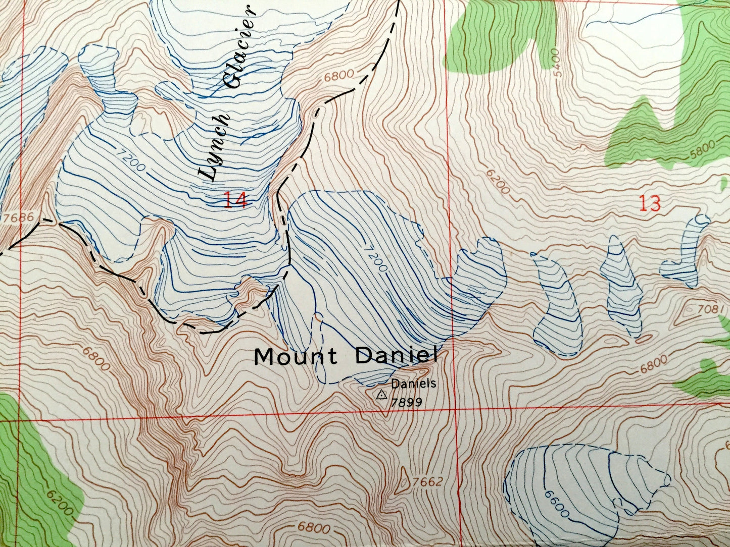
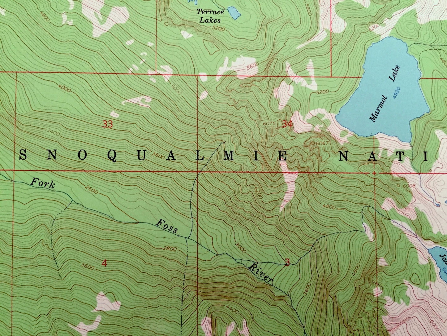
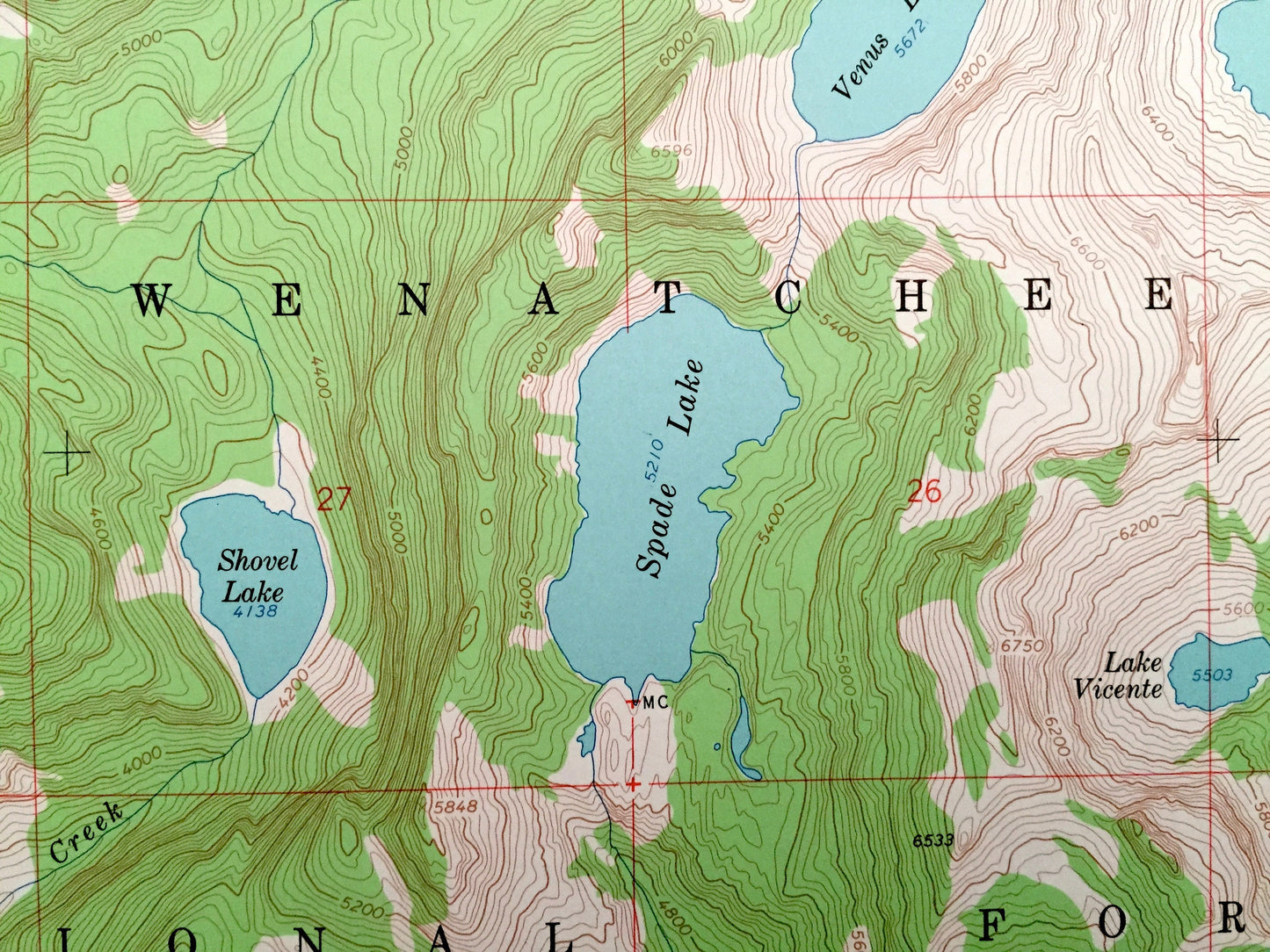
See what Washington State looked like more than 50 years ago. Lots of intricate details and geological contours. Map even has little squares for every house that existed at the time. The USGS cartographers were very thorough back then!
Perfect for the historian, map-lover, the curious or just as a conversation starter. Wonderful and rare. Vintage maps such as these make great gifts.
Edition of 1965 printed 1965
Dimensions: 22" width x 27" height
----
Features
Points of Interest: King County, Kittitas County, Snoqualmie National Forest, Wenatchee National Forest, Mount Daniel, Mount Hinman, Terrace Mountain, Bears Breast Mountain, Cathedral Rock, La Bohn Gap, Ducth Miller Gap, Blue Ridge, Hinman Glacier, Lynch Glacier, Deception Pass, Foss River, Spinola Creek, Waptus River, Waptus Lake, Marmot Lake, Spade Lake, Venus Lake, Shovel Lake, La Bohn Lakes, Deep Lake, Jade Lake, Lake Clarice, Deadhead Lake, and lots more hills, rivers, creeks, ponds, and trails.
Condition: Very Good condition, commensurate with age. This map is in incredible shape for being over 50 years old. Some edge-wear and a fold as issued, all of which will read as vintage character when framed.
----
We will happily adjust shipping price for multiple purchases. Maps are rolled up and shipped in sturdy mailing tubes, never folded.
Couldn't load pickup availability
Share