My Store
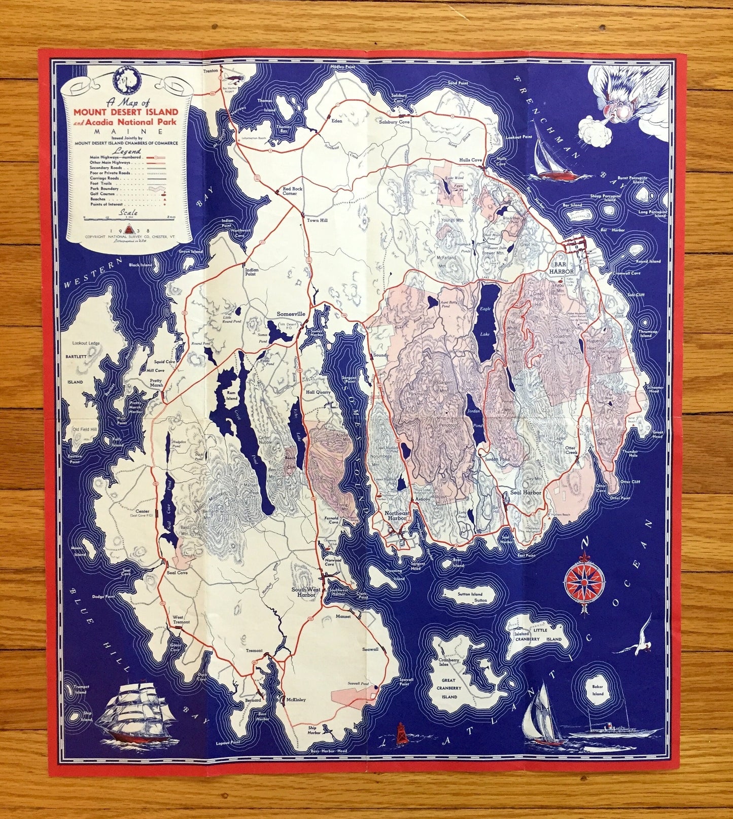
Antique Mount Desert Island, Maine 1938 US Geological Survey Topographic Map – Acadia National Park, Hancock County, Bar Harbor, Tremont, ME
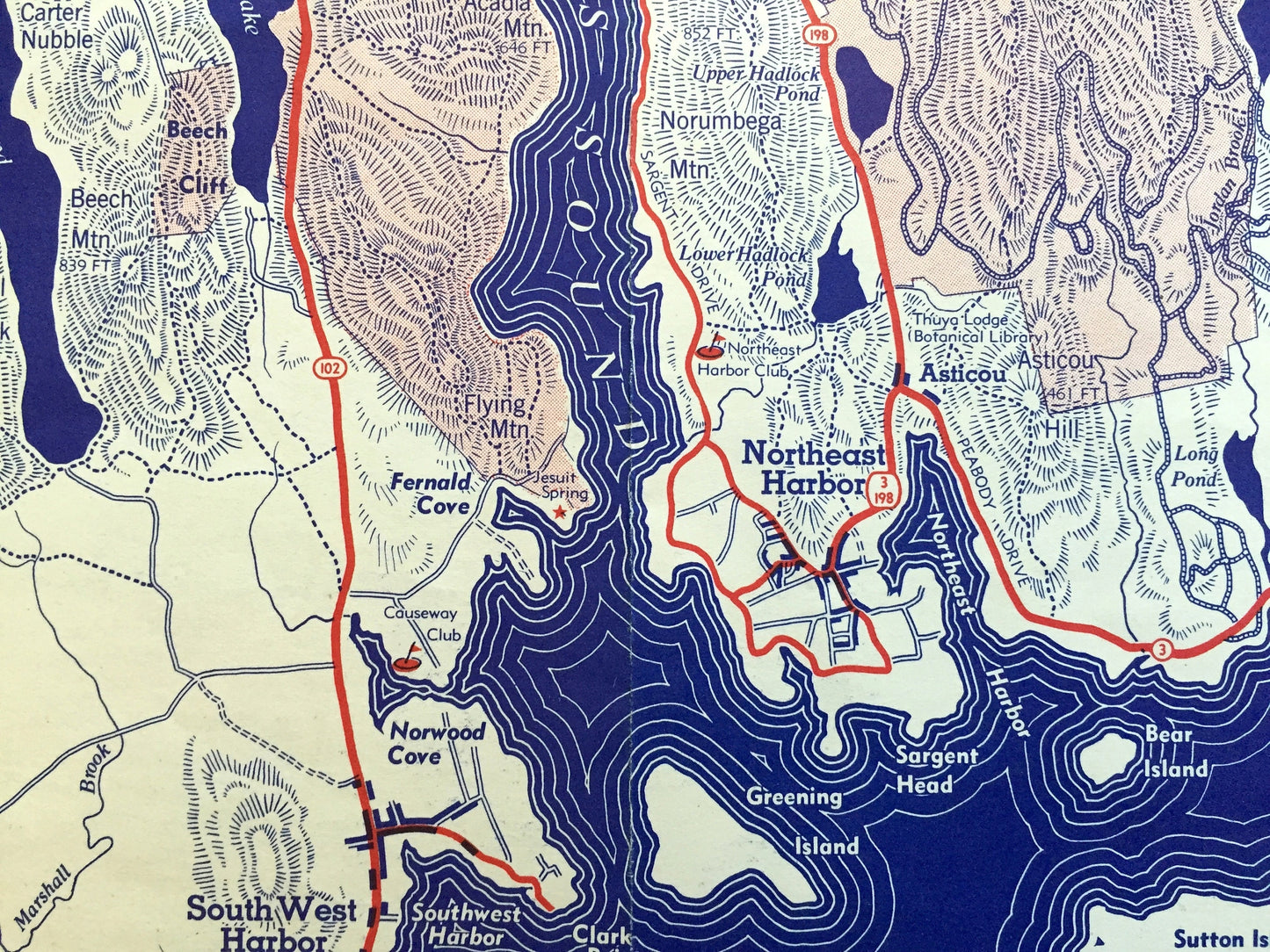
Antique Mount Desert Island, Maine 1938 US Geological Survey Topographic Map – Acadia National Park, Hancock County, Bar Harbor, Tremont, ME
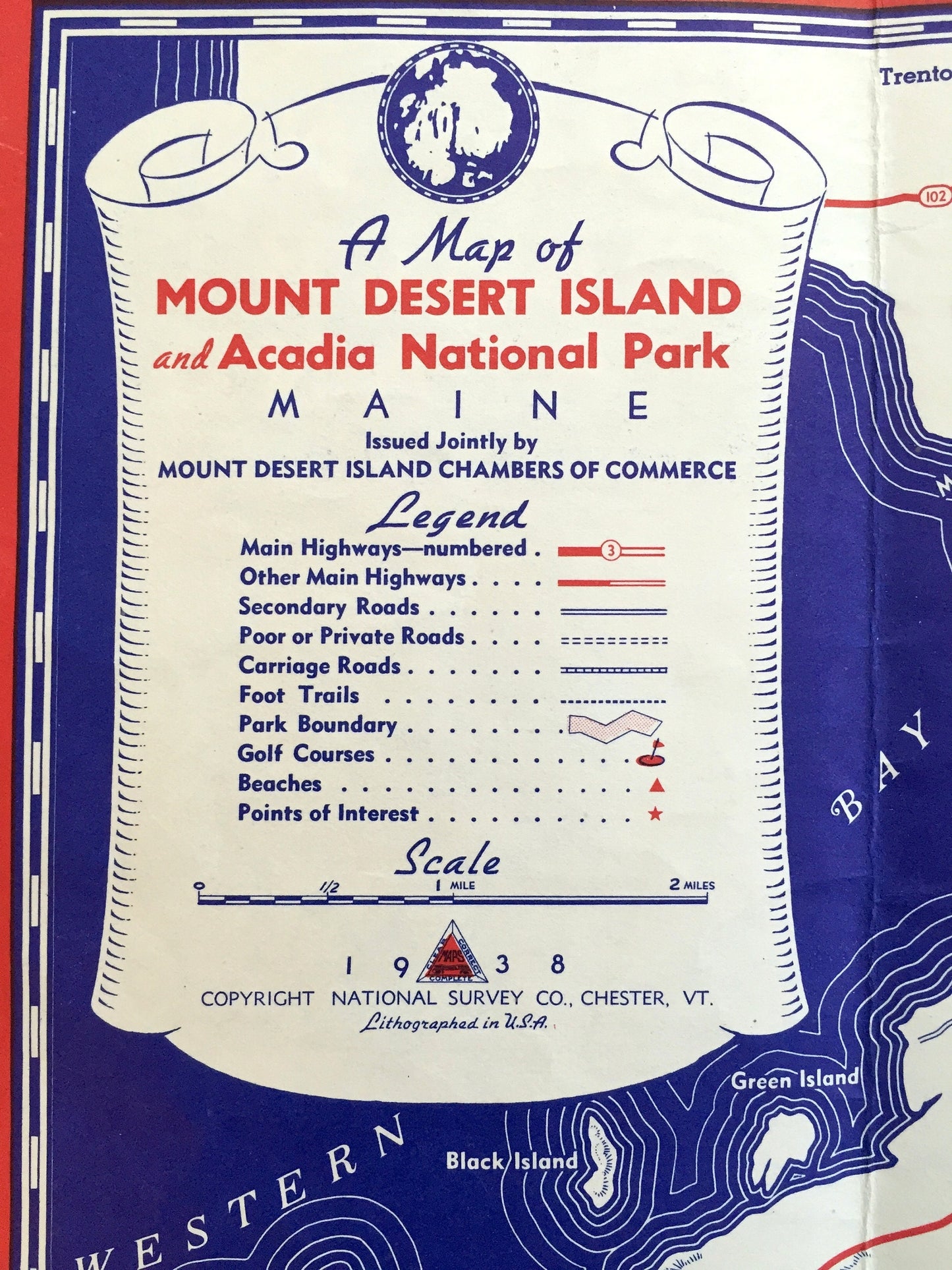
Beautiful, antique map of Mount Desert and Acadia National Park, Maine. This is an authentic 1938 print from the Mount Desert Island Chambers of Commerce, printed by National Survey Co., and is NOT a computer reproduction.
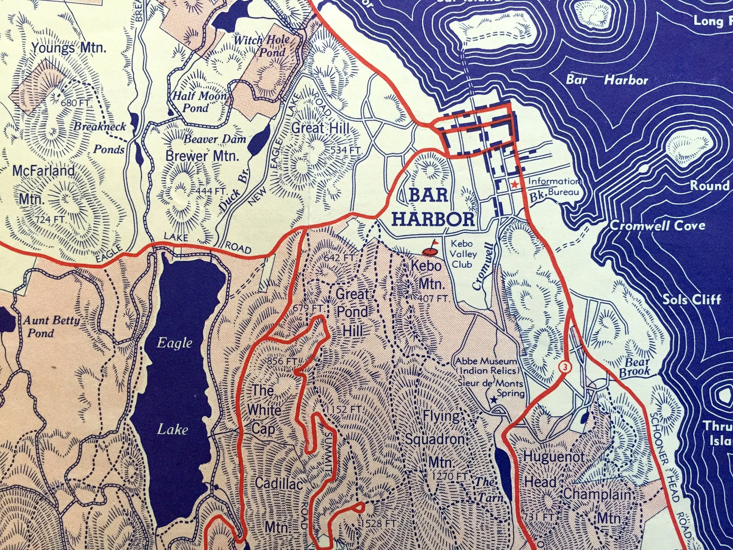
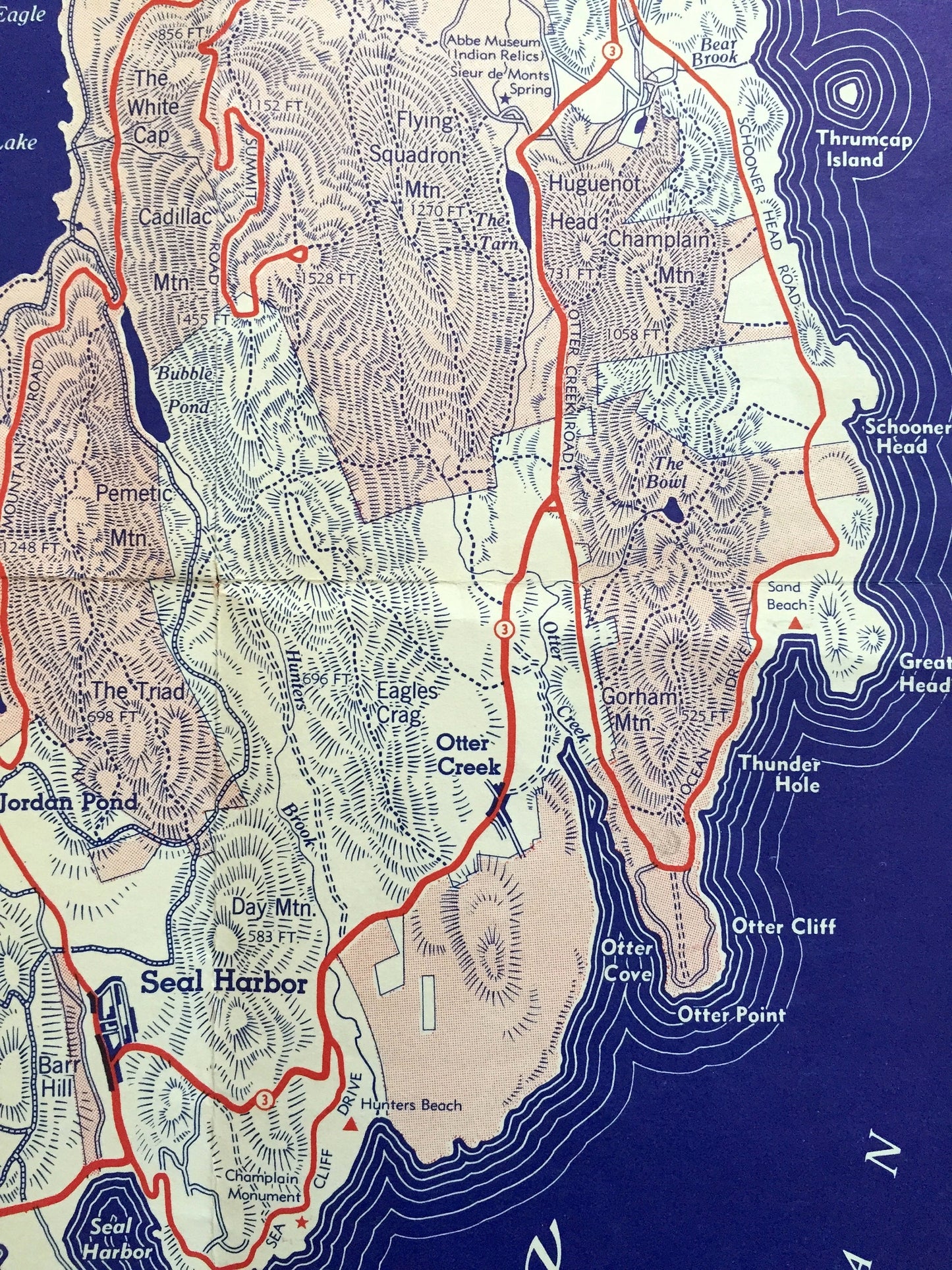
See what Mt Desert Island looked like over 80 years ago. Lots of intricate details and geological contours, as well as illustrations and drawings of major roads and towns. Reverse side has a history of the island, approaches and tourist destinations.
Perfect for the historian, map-lover, the curious or just as a conversation starter. Wonderful and rare. Vintage maps such as these make great gifts.
Edition of 1938, printed 1938
Dimensions: 16" width x 18" height
----
Features
Cities & Towns: Bar Harbor, Mount Desert, Tremont, Southwest Harbor, Cranberry Isles, Winter Harbor, Gouldsboro, Trenton, Indian Point, Eden, Town Hill, Salisbury Cove, Hulls Cove, Somesville, Sound, Otter Creek, Seal Harbor, Asticon, Northeast Harbor, Center, West Tremont, Bernard, McKinley, Manset, Isleford, Kellytown.
Points of Interest: Hancock County, Union River Bay, Union River, Patten Bay, Morgan Bay, Western Bay, Blue Hill Bay, Mount Desert Narrows, Eastern Bay, Skilling River, Jordan River, Raccoon Cove, Bartless Narrows, Long Pond, Echo Lake, Somes Sound, Seal Cove Pond, Southwest Harbor, Western Harbor, Newbury Neck, Long Island, Bartlett Island, McFarland Mountain, Youngs Mountain, Whales Back, Egg Lake, Eagle Lake, McFarland Mountain, The Triad, The Bubbles, Sieur De Monts National Monument, Western Mountain, Beech Hill, Browns Mountain, Tinkers Island, The Heath, Thomas Bay, Oak Hill, Dog Mountain, Clark Ridge, Beech Mountain, Great Cranberry Island, Sutton Island, and many more mountains, peaks, ranges, canyons, buttes, crests, rivers, creeks, lakes, ponds, springs, trails, campgrounds, caves, valleys, hills, towns, roads and train tracks.
Condition: Good Vintage condition, commensurate with age. This map is in great shape for being over 80 years old. Has some light wear and folds as-issued, but these will flatten easily and all will add to vintage character when framed.
----
We will happily adjust shipping price for multiple purchases. Maps are rolled up and shipped fully-insured in sturdy mailing tubes, never folded.
Couldn't load pickup availability
Share