My Store
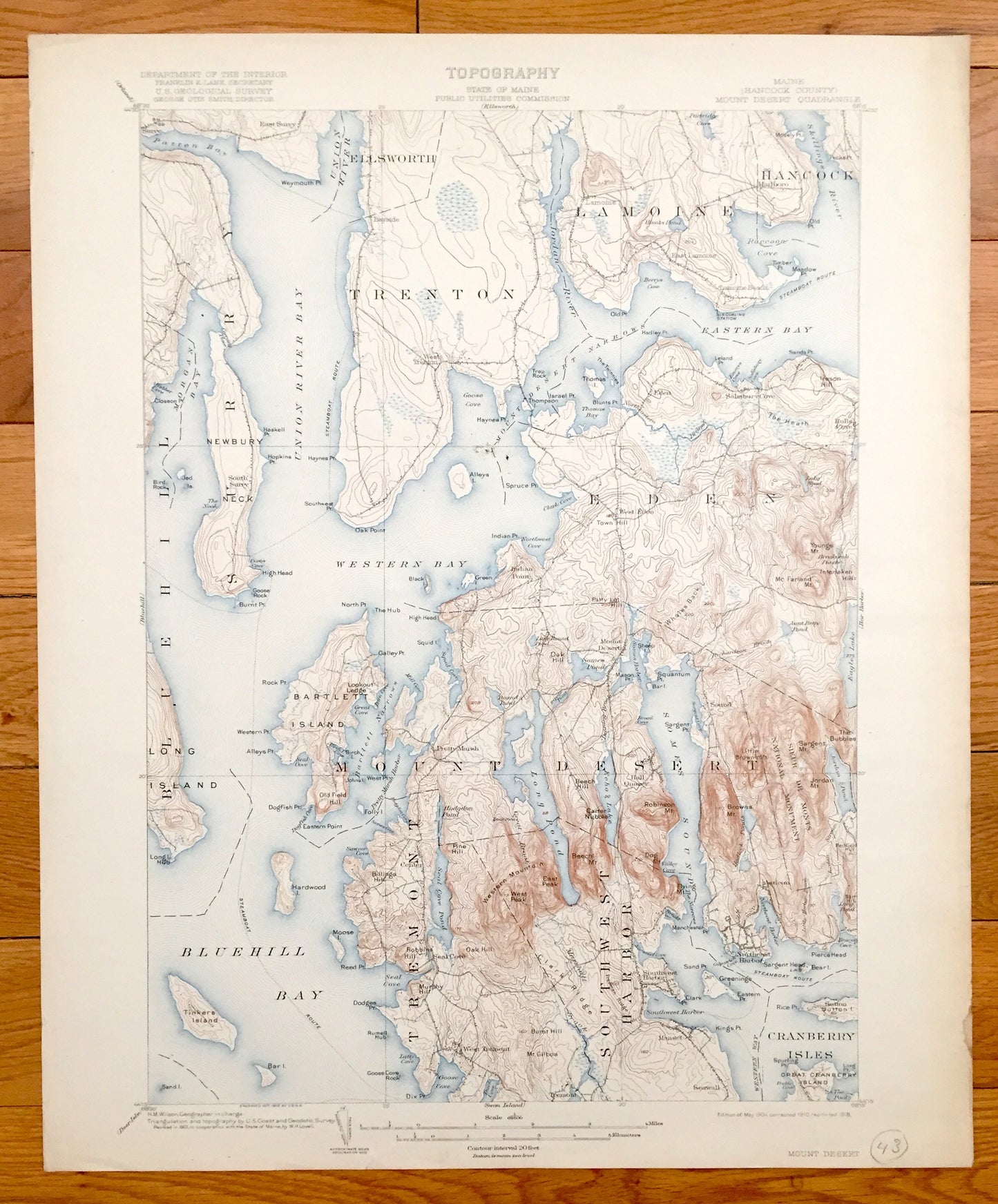
Antique Mount Desert, Maine 1904 US Geological Survey Topographic Map – Tremont, Eden, Blue Hill, Acadia Park, Southwest, Bar Harbor, ME Mt
Antique Mount Desert, Maine 1904 US Geological Survey Topographic Map – Tremont, Eden, Blue Hill, Acadia Park, Southwest, Bar Harbor, ME Mt
Beautiful, antique map of Mount Desert, Maine and surrounding Hancock County area on the Maine Coast. This is an authentic 1904 edition, 1918 print from the U.S. Geological Survey and NOT a computer reproduction.
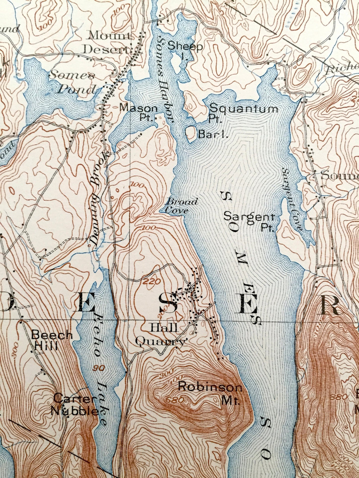
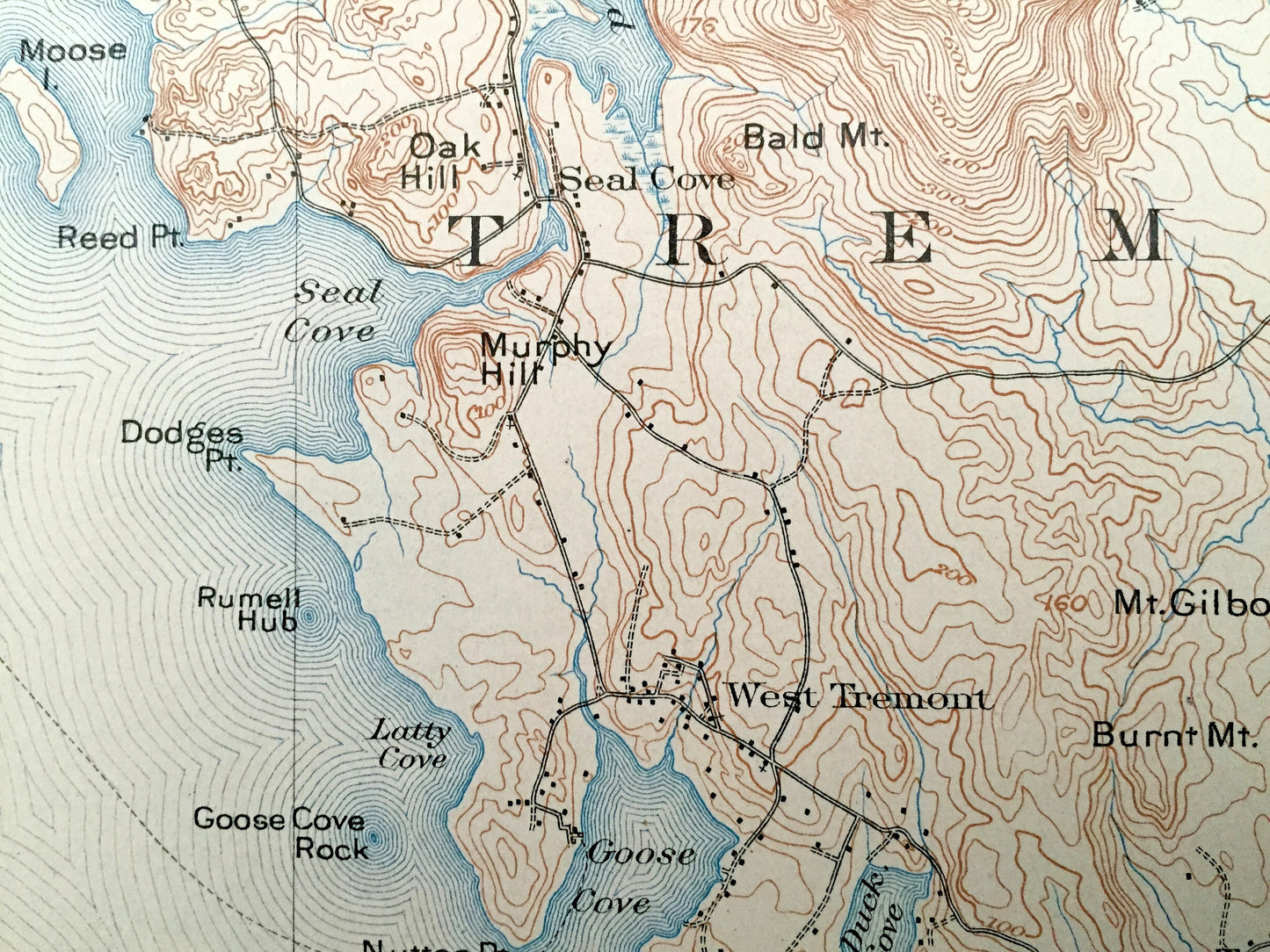
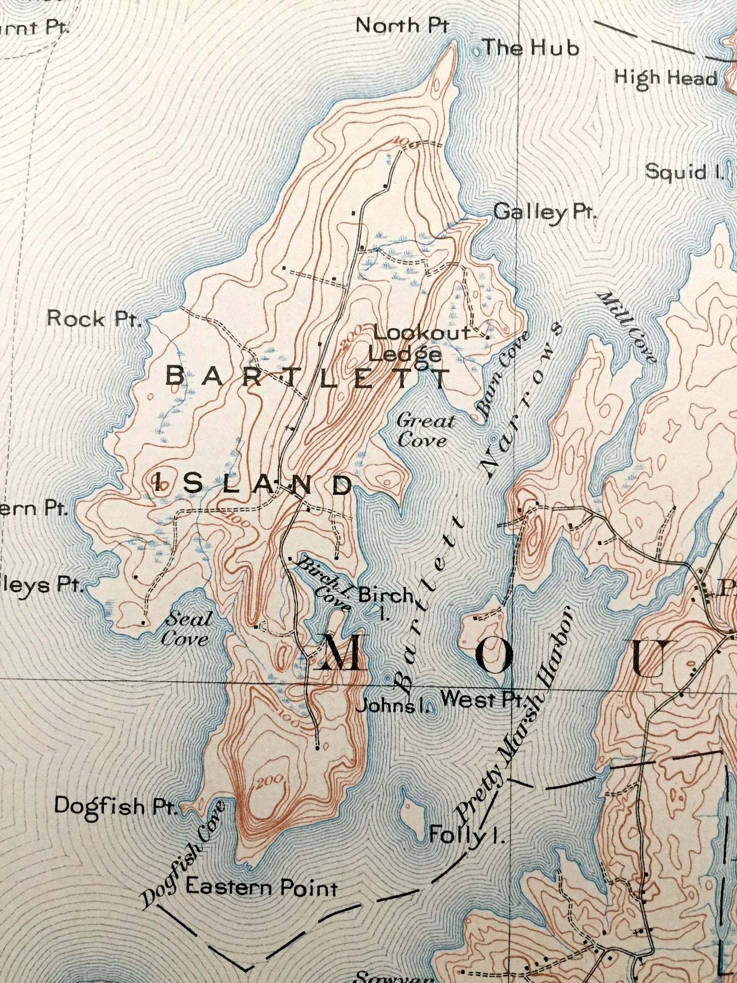
See what the Maine Coast looked like over a century ago. Lots of intricate details and geological contours. Map even has little squares for every house that existed at the time. The USGS cartographers were very thorough back then! On the back is a description of topographic symbols and map guide.
Perfect for the historian, map-lover, the curious or just as a conversation starter. Wonderful and rare. Vintage maps such as these make great gifts.
Edition of 1904, printed 1918
Dimensions: 16 1/2" width x 20" height
----
Features
Cities & Towns: Blue Hill, Surry, Ellsworth, Trenton, Lamoine, Hancock, Eden, Mount Desert, Tremont, Southwest Harbor, Cranberry Isles, Bayside, Lamoine Beach, Salisbury Cove, Hulls Cove, Marlboro, Indian Point, Pretty Marsh, Sound, Center, Seal Cove, Hall Quarry, Asticon, Southwest Harbor, Northeast Harbor, Manset, Seawall, Sutton.
Points of Interest: Hancock County, Union River Bay, Union River, Patten Bay, Morgan Bay, Western Bay, Blue Hill Bay, Mount Desert Narrows, Eastern Bay, Skilling River, Jordan River, Raccoon Cove, Bartless narrows, Long Pond, Echo Lake, Somes Sound, Seal Cove Pond, Southwest Harbor, Western Harbor, Newbury Neck, Long Island, Bartlett Island, McFarland Mountain, Youngs Mountain, Whales Back, Egg Lake, The Bubbles, Sieur De Monts National Monument, Western Mountain, Beech Hill, Browns Montain, Tinkers Island, The Heath, Thomas Bay, Oak Hill, Dog Mountain, Clark Ridge, Beech Mountain, Great Cranberry Island, Sutton Island and lots more hills, mountains, streams, ponds, marshes, houses, islands, coves and roads.
Condition: Very Good condition, commensurate with age. This map is in incredible shape for being over 100 years old. Has light edge-wear but this will add to vintage character when framed.
----
We will happily adjust shipping price for multiple purchases. Maps are rolled up and shipped in sturdy mailing tubes, never folded.
Couldn't load pickup availability
Share