My Store
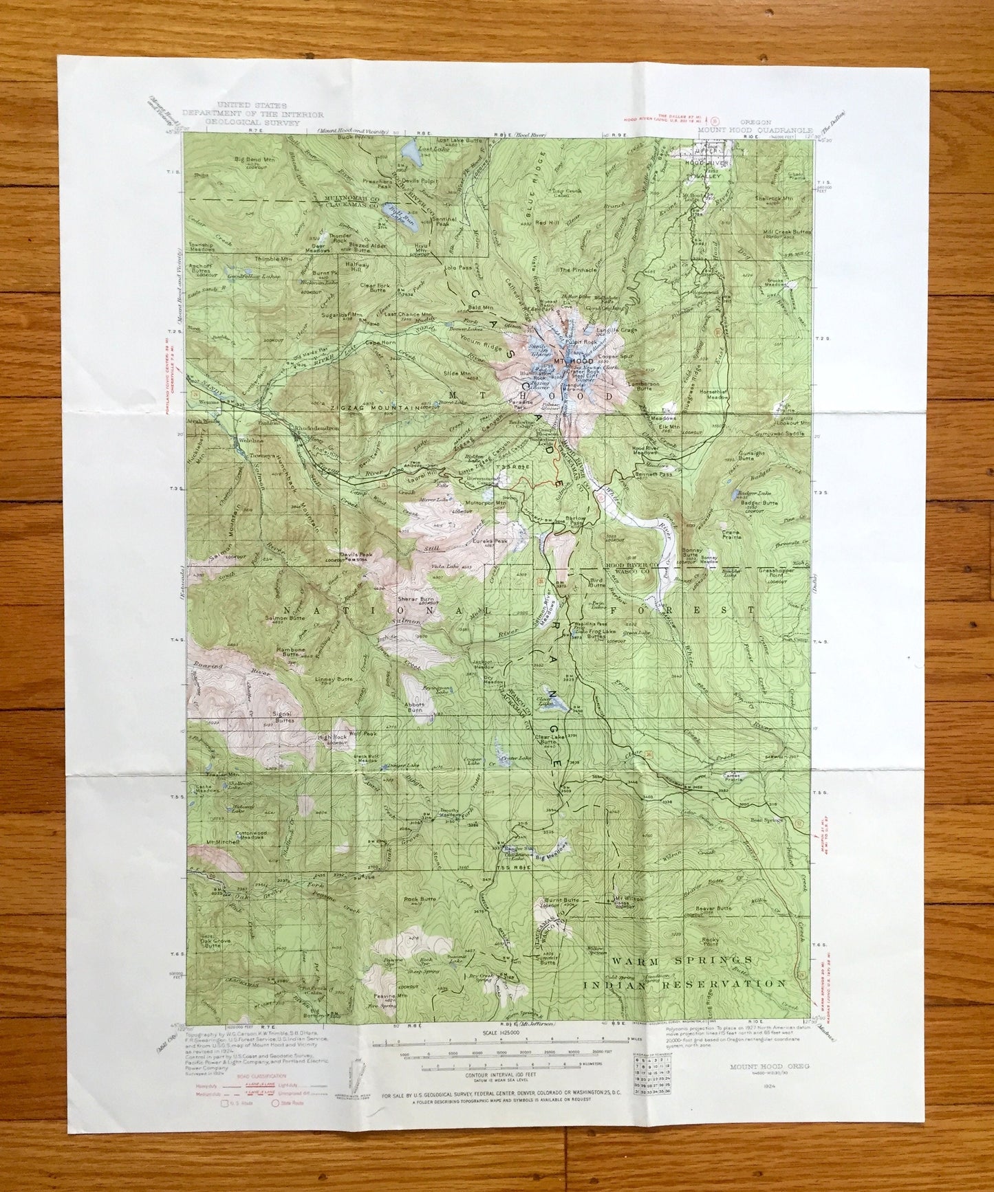
Antique Mount Hood, Oregon 1924 US Geological Survey Topographic Map – Multnomah, Clackamas, Wasco, Zigzag River, Cascade Range, OR, Mt
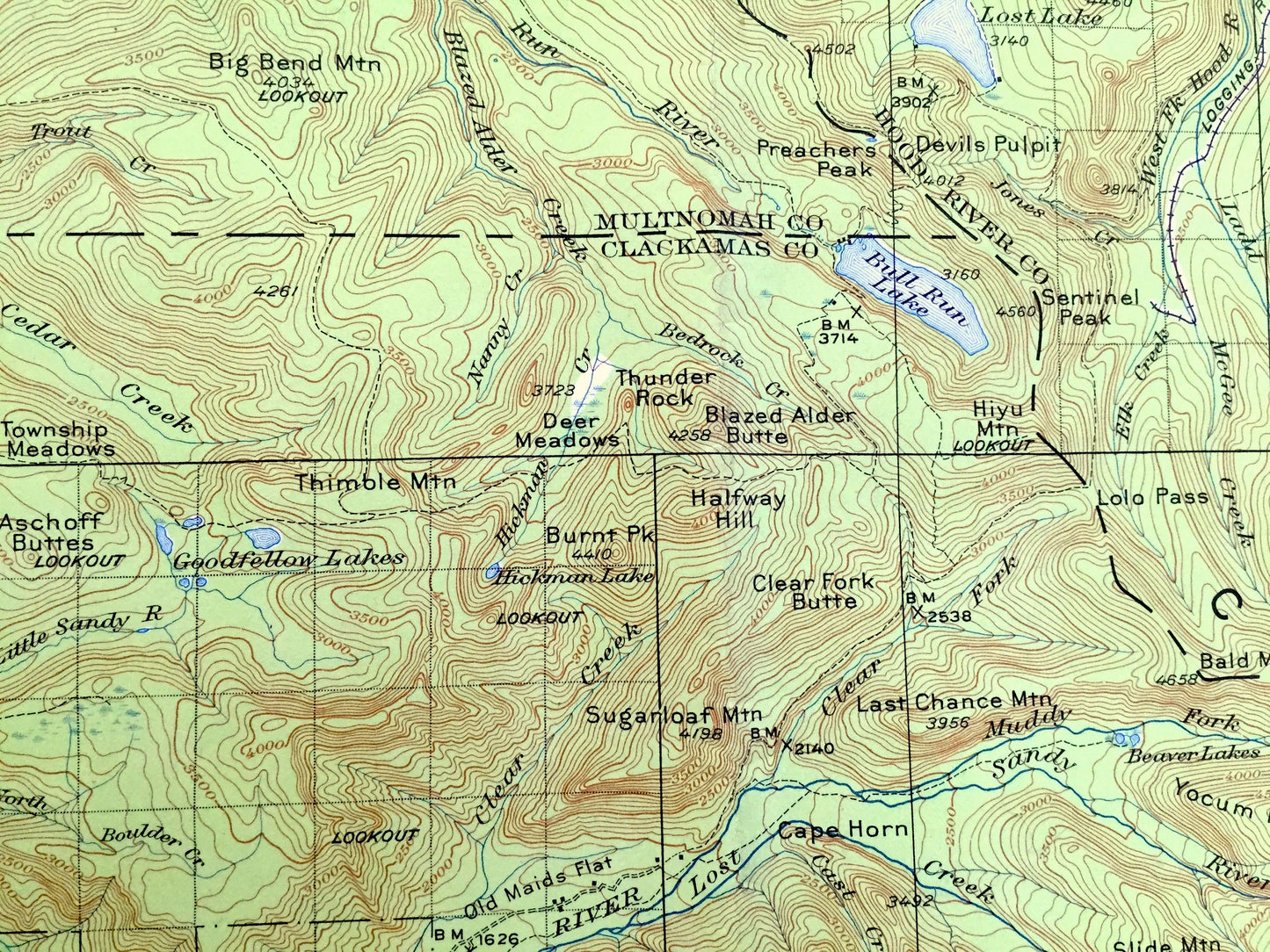
Antique Mount Hood, Oregon 1924 US Geological Survey Topographic Map – Multnomah, Clackamas, Wasco, Zigzag River, Cascade Range, OR, Mt
Beautiful, antique map of Mount Hood, Oregon and surrounding Multnomah, Hood River, Wasco & Clackamas County area. This is an authentic 1924 edition, 1955 print from the U.S. Geological Survey and NOT a computer reproduction.
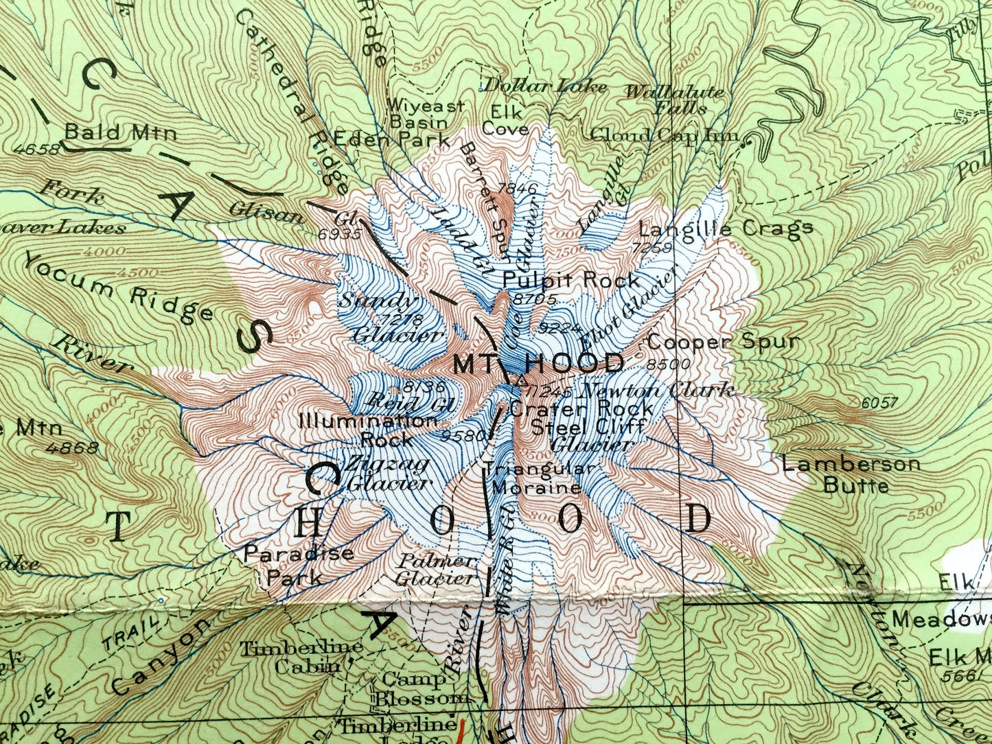
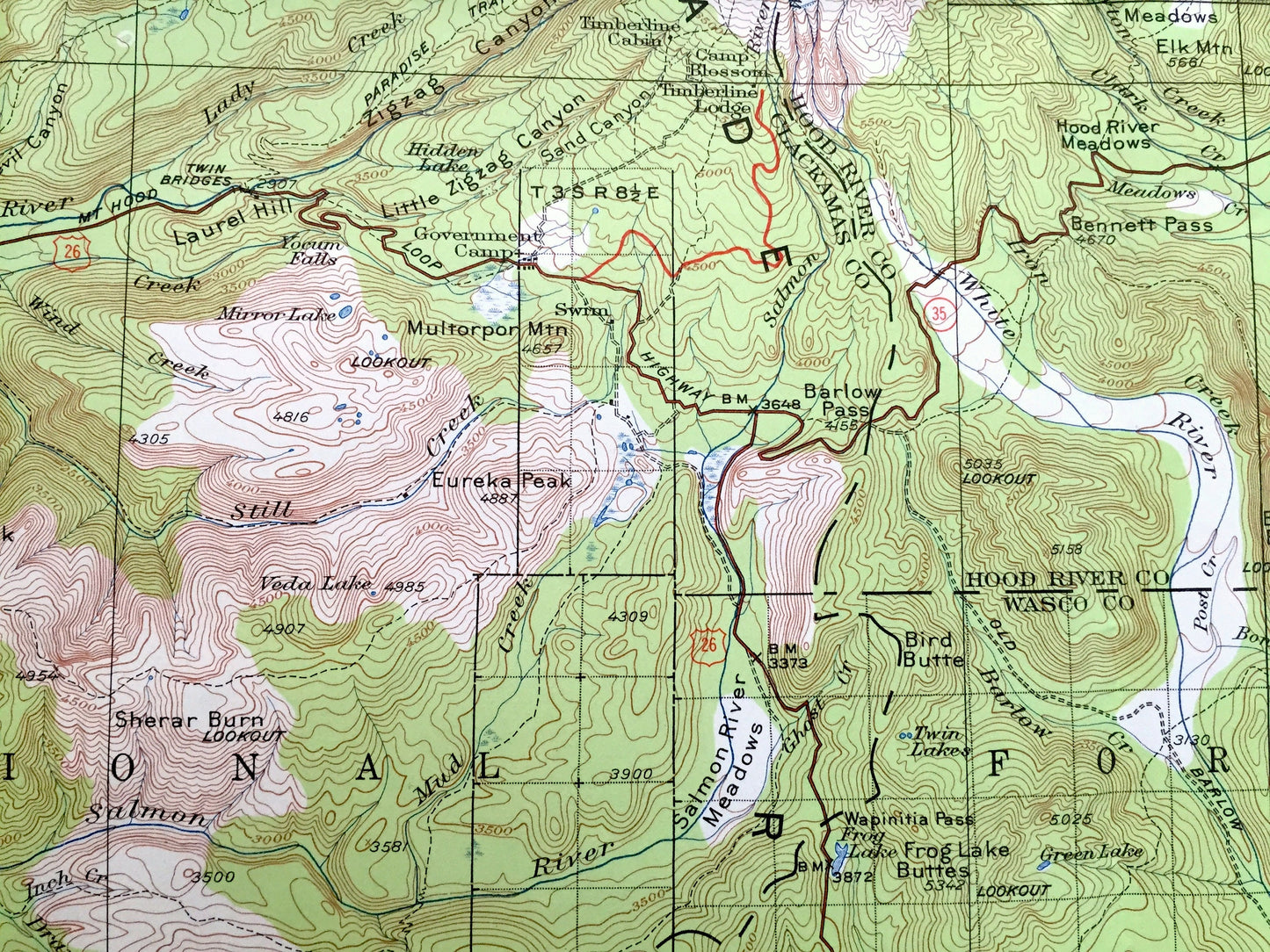
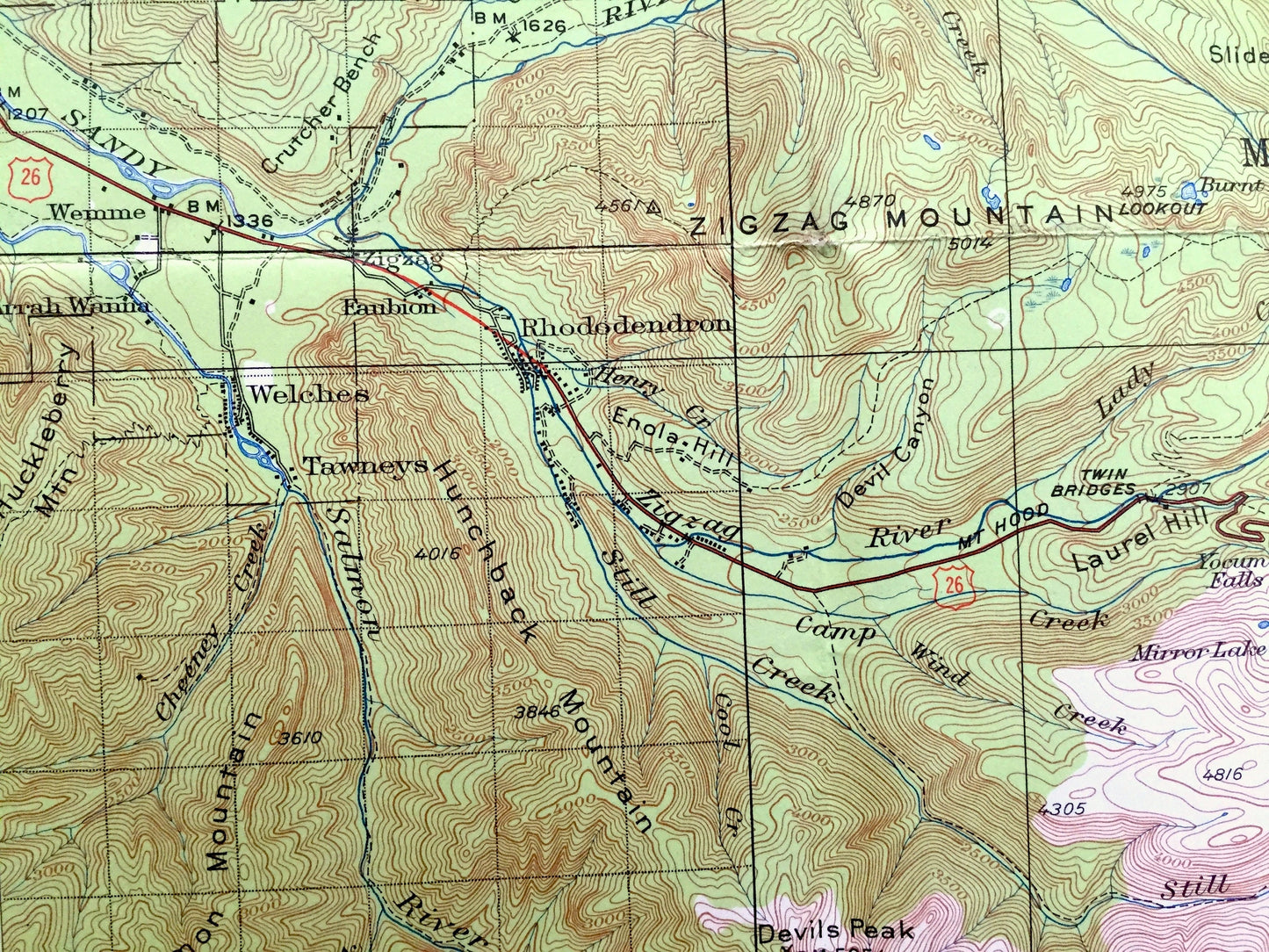
See what Oregon looked like 100 years ago. Lots of intricate details and geological contours. Map even has little squares for every house that existed at the time. The USGS cartographers were very thorough back then!
Perfect for the historian, map-lover, the curious or just as a conversation starter. Wonderful and rare. Vintage maps such as this make great gifts.
Edition of 1924, printed 1955
Dimensions: 17" width x 21" height
----
Features
Cities & Towns: Wemme, Rhododendron, Government Camp, Mt Hood Lodge.
Points of Interest: Multnomah County, Hood River County, Clackamas County, Wasco County, Mount Hood, Mt Hood National Forest, Bull Run Division, Warm Springs Indian Reservation, Sandy River, ZigZag Mountain, Cascade Range, Blue Ridge, Upper Hood River Valley, Hood River, Salmon River Meadows, The Pinnacle, Lamberson Butte, Devils Peak, White River, Lost Lake, Bull Run Lake, Zigzag River, and many more towns, houses, train tracks, mountains, streams and rivers.
Condition: Good Vintage condition, commensurate with age. This map is in great shape for being about 75 years old. Has some edge-wear and old fold lines as-issued, but these will flatten easily and all will read as vintage character when framed.
----
We will happily adjust shipping price for multiple purchases. Maps are rolled up and shipped in sturdy mailing tubes, never folded.
Couldn't load pickup availability
Share