My Store
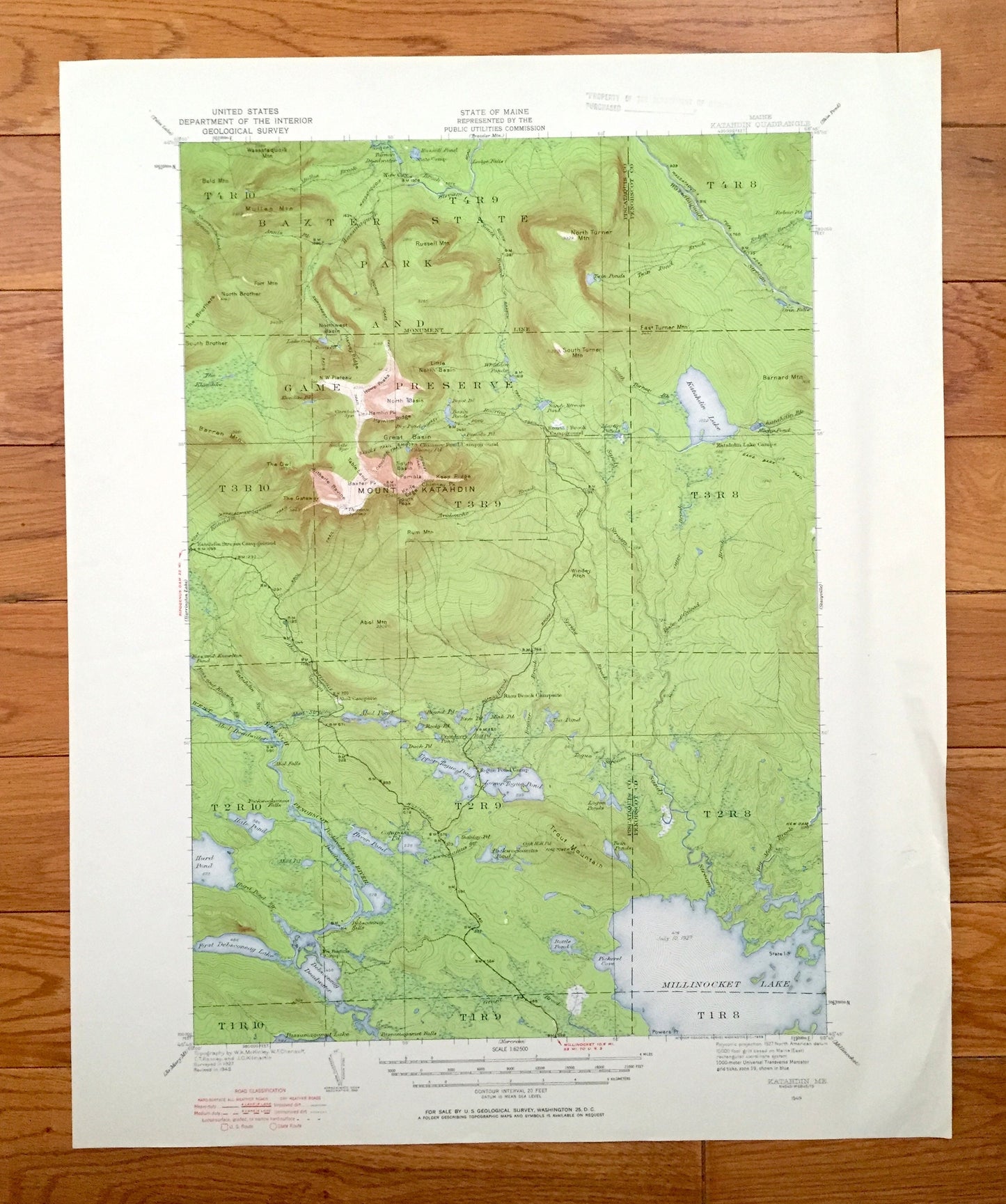
Antique Mount Katahdin, Maine 1949 US Geological Survey Topographic Map – Baxter State Park, Millinocket Lake, Piscataquis, Penobscot, Mt ME
Antique Mount Katahdin, Maine 1949 US Geological Survey Topographic Map – Baxter State Park, Millinocket Lake, Piscataquis, Penobscot, Mt ME
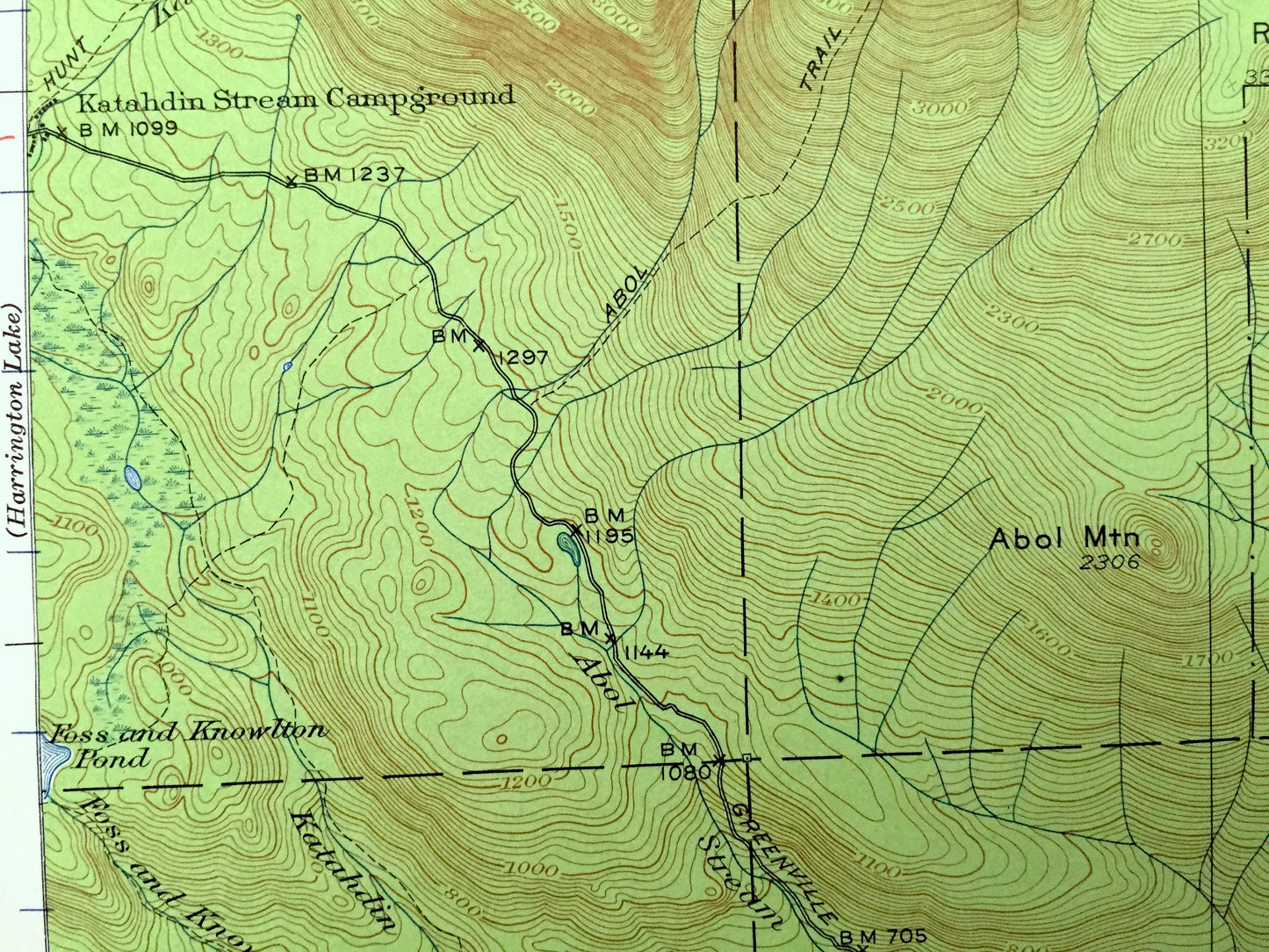
Beautiful, antique map of Mount Katahdin, Maine and surrounding Piscataquis & Penobscot County area. This is an authentic 1949 edition, 1958 print from the U.S. Geological Survey and NOT a computer reproduction.
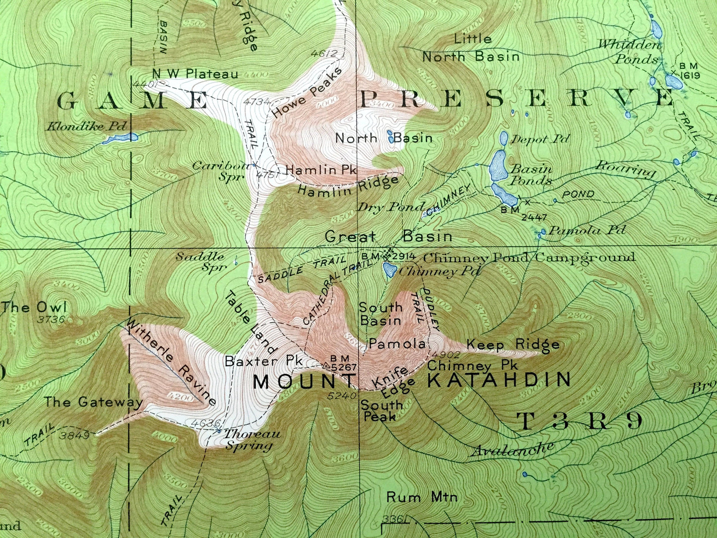
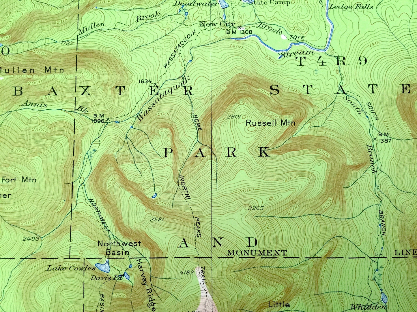
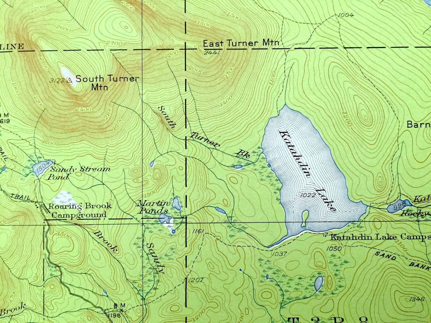
See what Mt. Katahdin, the northern terminus of the Appalachian Trail, Millinocket Lake and Baxter State Park and Game Preserve (Baxter State Park) looked like over 70 years ago when parts of Maine were still unincorporated or unnamed. Lots of intricate details and geological contours. Map even has little squares for every house that existed at the time. The USGS cartographers were very thorough back then!
Perfect for the historian, map-lover, the curious or just as a conversation starter. Wonderful and rare. Vintage maps such as these make great gifts.
Edition of 1949, printed 1958
Dimensions: 17" width x 21" height
----
Features
Points of Interest: Mount Katahdin, Baxter State Park, Katahdin Lake, Millinocket Lake, Balm of Gilead, Togue Ponds, Penobscot River, Appalachian Trail, North Turner Mountain, Northwest Basin, The Gateway, Baxter Mountain, The Brothers, Wassataguoik Stream, Debsconeag Lake, Trout Mountain and many more camps, streams, ponds and mountains.
Condition: Very Good Vintage condition, commensurate with age. This map is in great shape for being over 60 years old. Has light wear and faint ex-libris stamp in upper margin, but this will all add to vintage character when framed.
----
We will happily adjust shipping price for multiple purchases. Maps are rolled up and shipped in sturdy mailing tubes, never folded.
Couldn't load pickup availability
Share