My Store
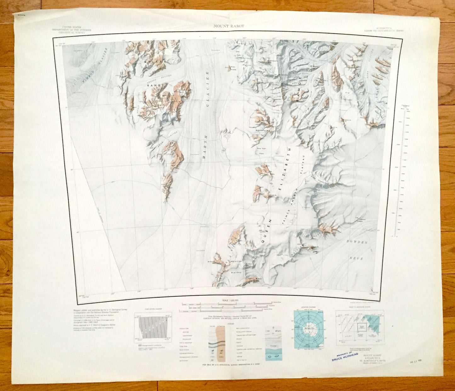
Antique Mount Rabot, Antarctica 1964 US Geological Survey Topographic Map – Marsh Glacier, Queen Elizabeth Range, Nimrod Glacier, Bowden
Antique Mount Rabot, Antarctica 1964 US Geological Survey Topographic Map – Marsh Glacier, Queen Elizabeth Range, Nimrod Glacier, Bowden
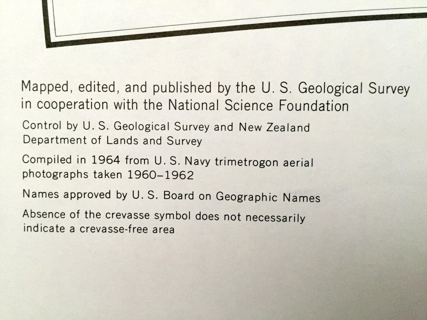
Beautiful, antique map of Mount Rabot and the Queen Elizabeth Range of Antarctica. This is an authentic 1964 print from the U.S. Geological Survey Reconnaissance Series and not a computer reprint.
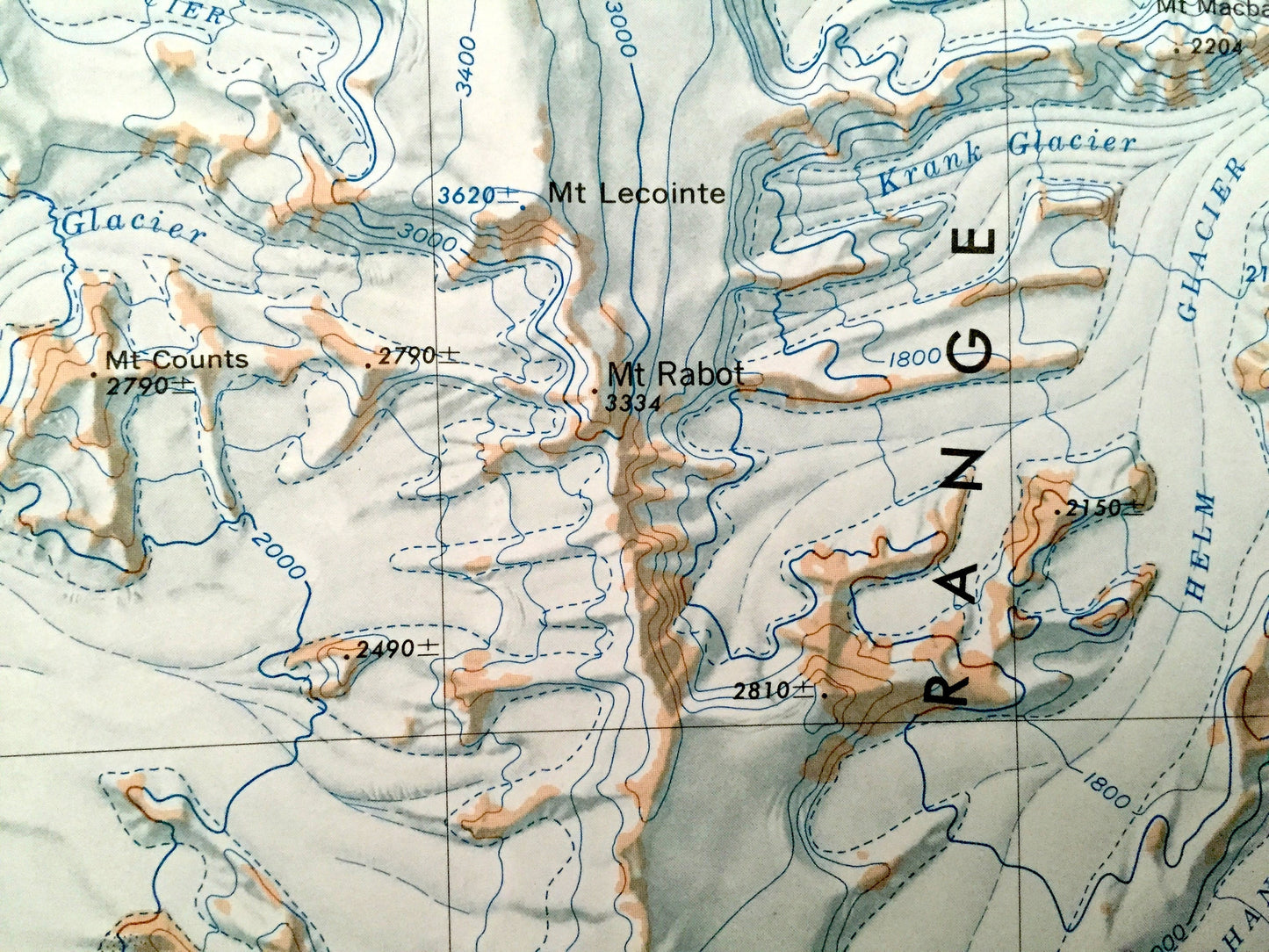
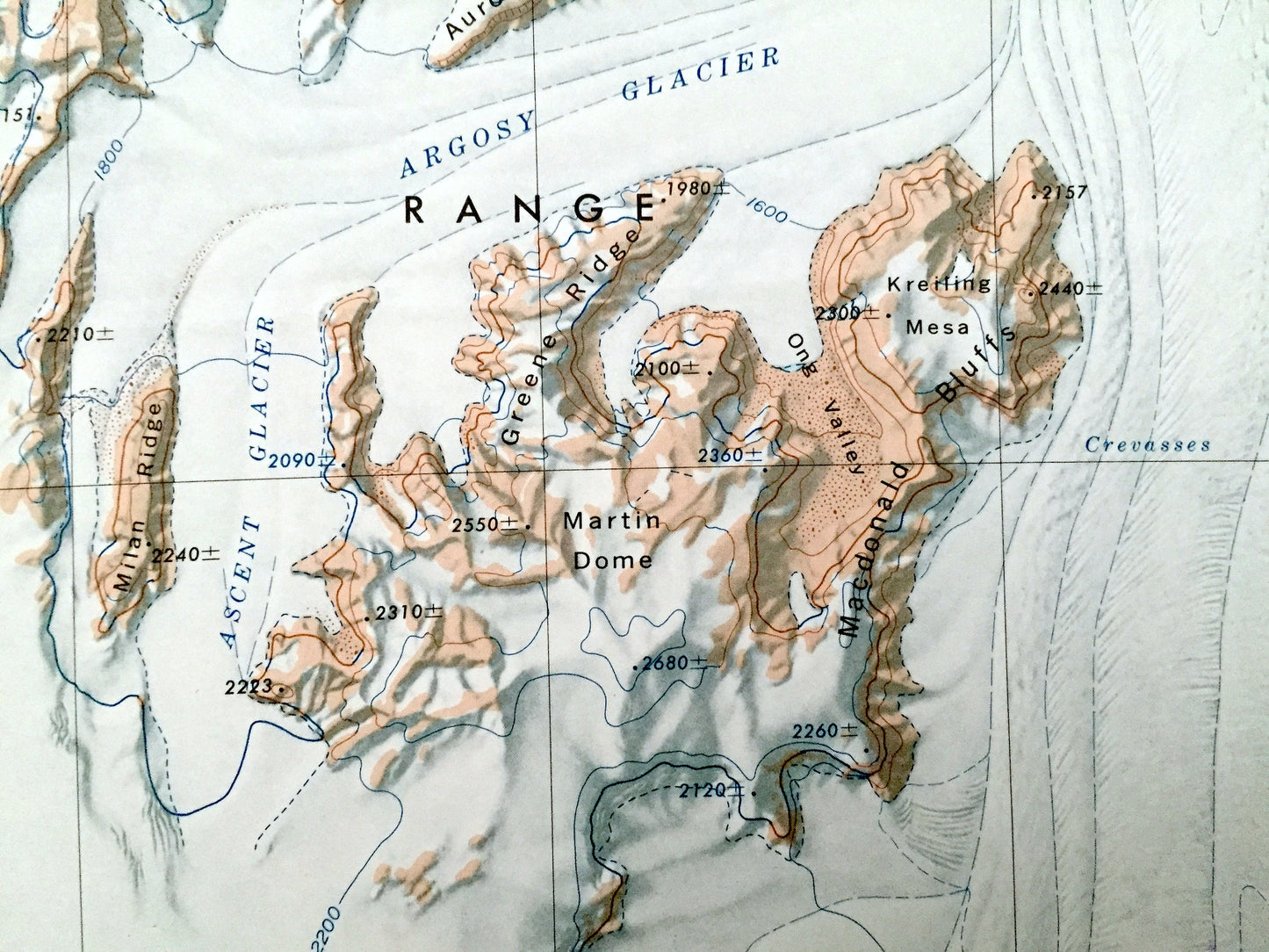
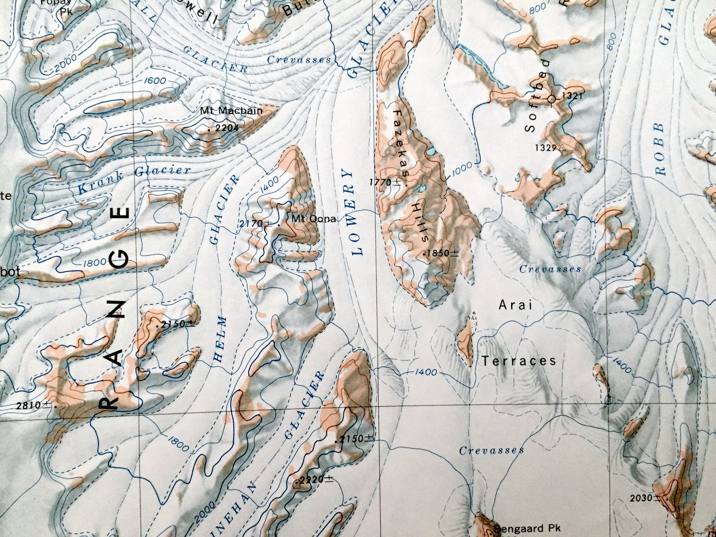
See what Antarctica looked like over 50 years ago. Lots of intricate details and geological contours. The USGS cartographers were very thorough back then!
Perfect for the historian, map-lover, the curious or just as a conversation starter. Wonderful and rare. Vintage maps such as these make great gifts.
Edition of 1964, printed 1964
Dimensions: 30" width x 26" height
----
Features
Points of Interest: Nimrod Glacier, Marsh Glacier, Queen Elizabeth Range, Prince Andrew Plateau, Miller Range, Argosy Glacier, Argo Glacier, Moore Mountains, Lowery Glacier, Robb Glacier, New Year Pass, Peletier Plateau, Painted Cliffs, Disch Promontory, Arai Terraces, Mt. Bonaparte, Mt. Lecointe, Sandford Cliffs, Martin Dome, Mt. Rabot, Bartrum Plateau and many more mountains, glaciers, inlets, promontories, crevasses, névés and bays.
Condition: Good condition, commensurate with age. This map is in incredible shape for being almost 60 years old. Has some edge-wear, all of which will read as vintage character when framed.
----
We will happily adjust shipping price for multiple purchases. Maps are rolled up and shipped in sturdy mailing tubes, never folded.
Couldn't load pickup availability
Share