My Store
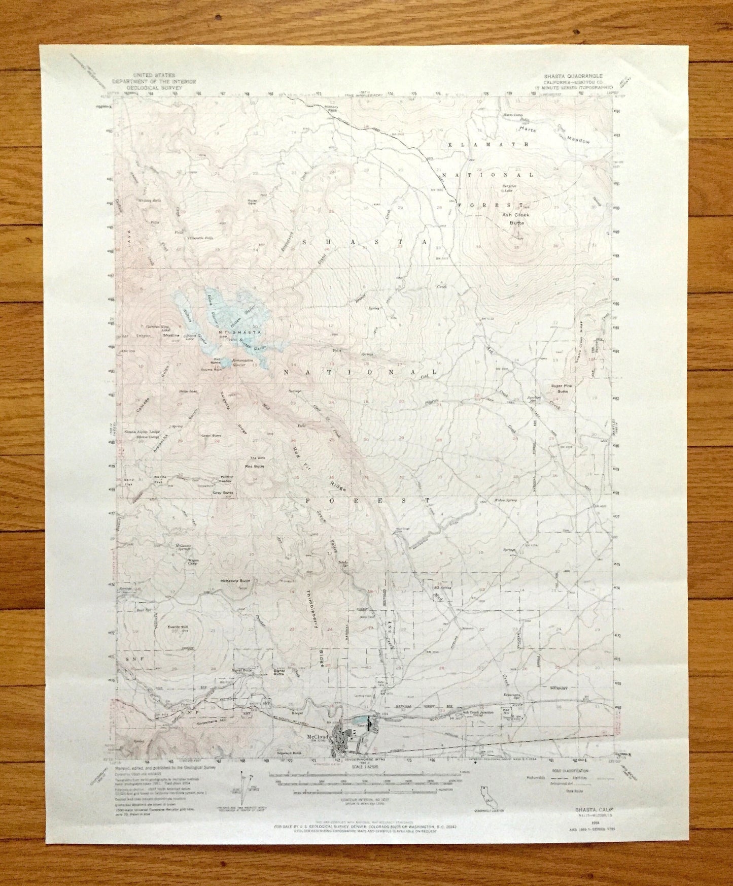
Antique Mount Shasta, California 1954 US Geological Survey Topographic Map – Siskiyou County, Klamath National Forest, McCloud, Ski Park, CA
Antique Mount Shasta, California 1954 US Geological Survey Topographic Map – Siskiyou County, Klamath National Forest, McCloud, Ski Park, CA
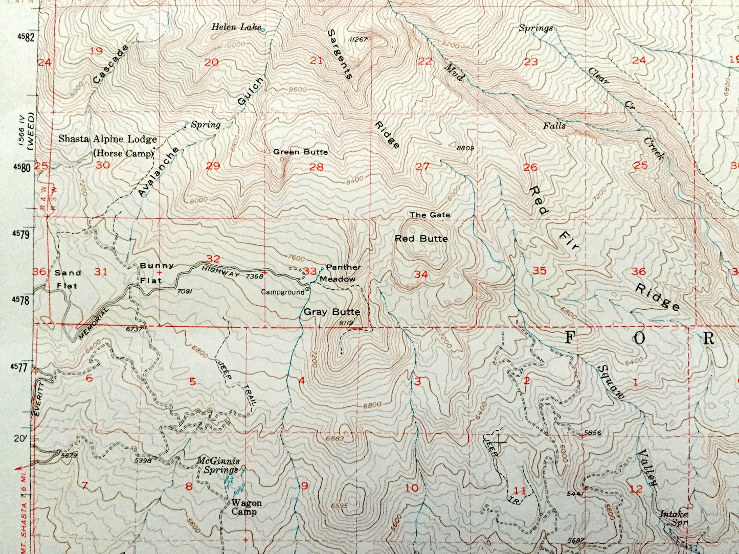
Beautiful, antique map of Mt Shasta, California and surrounding Siskiyou, Trinity & Shasta County area. This is an authentic 1954 edition, 1968 print from the U.S. Geological Survey and NOT a computer reproduction.
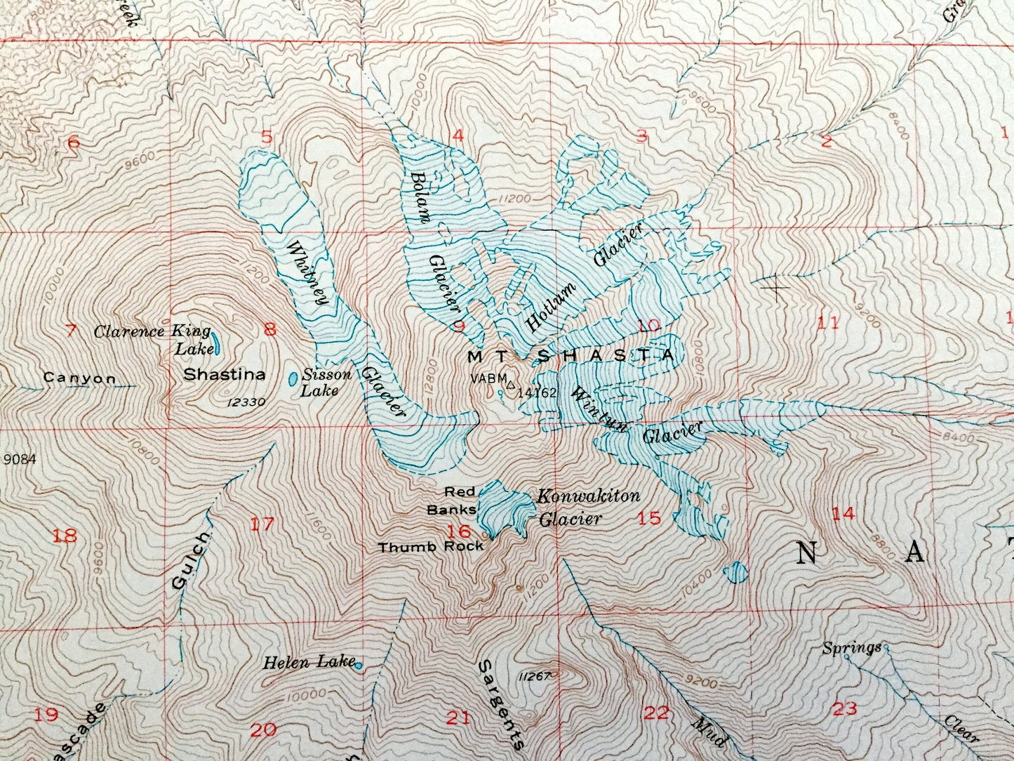
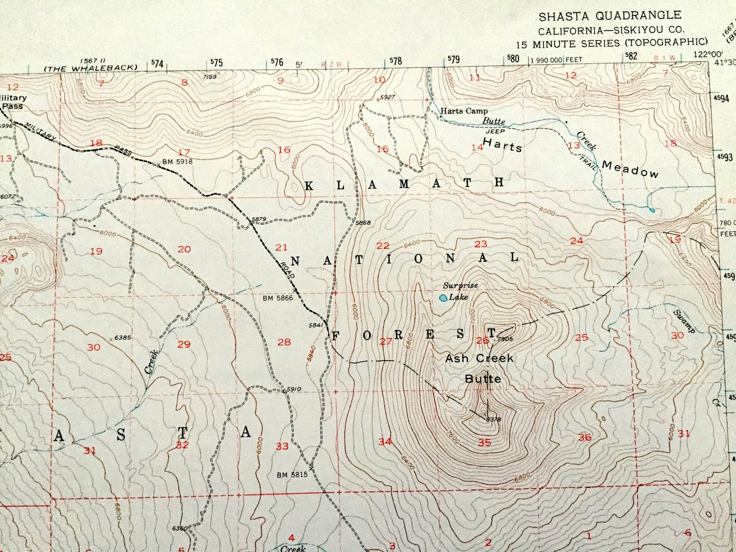
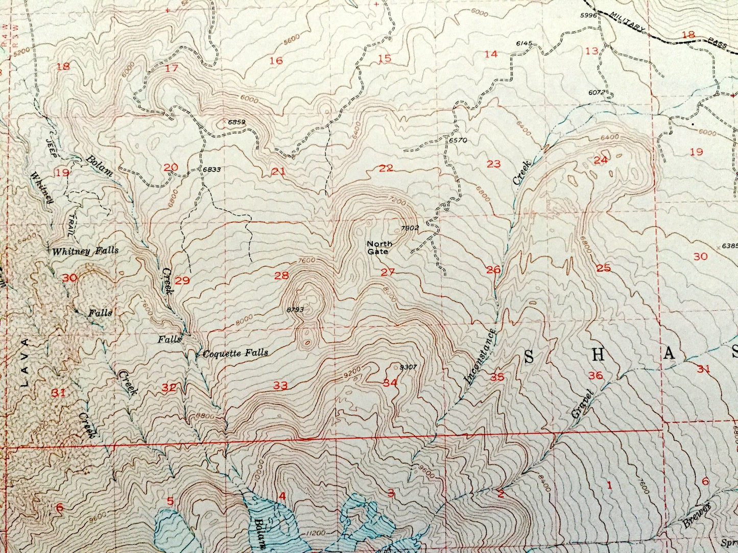
See what California looked like 70 years ago. Lots of intricate details and geological contours. Map even has little squares for every city block that existed at the time. The USGS cartographers were very thorough back then!
Perfect for the historian, map-lover, the curious or just as a conversation starter. Wonderful and rare. Vintage maps such as these make great gifts.
Edition of 1954, printed 1968
Dimensions: 17" width x 21" height
----
Features
Cities & Towns: McCloud, Pierce, Signal Butte, Ash Creek Junction.
Points of Interest: Siskiyou County, Shasta National Forest, Klamath National Forest, Thimbleberry Ridge, Ash Creek Butte, Sugar Pine Butte, Harts Meadow, Red Banks, Whitney Glacier, Red Fir Ridge, McCloud River, and many more hills, mountains, buttes, canyons, towns, houses and roads.
Condition: Good Vintage condition, commensurate with age. This map is in great shape for being over 50 years old. Has light edge-wear and slight creasing, but these will flatten easily and all will add to vintage character when framed.
----
We will happily adjust shipping price for multiple purchases. Maps are rolled up and shipped in sturdy mailing tubes, never folded.
Couldn't load pickup availability
Share