My Store
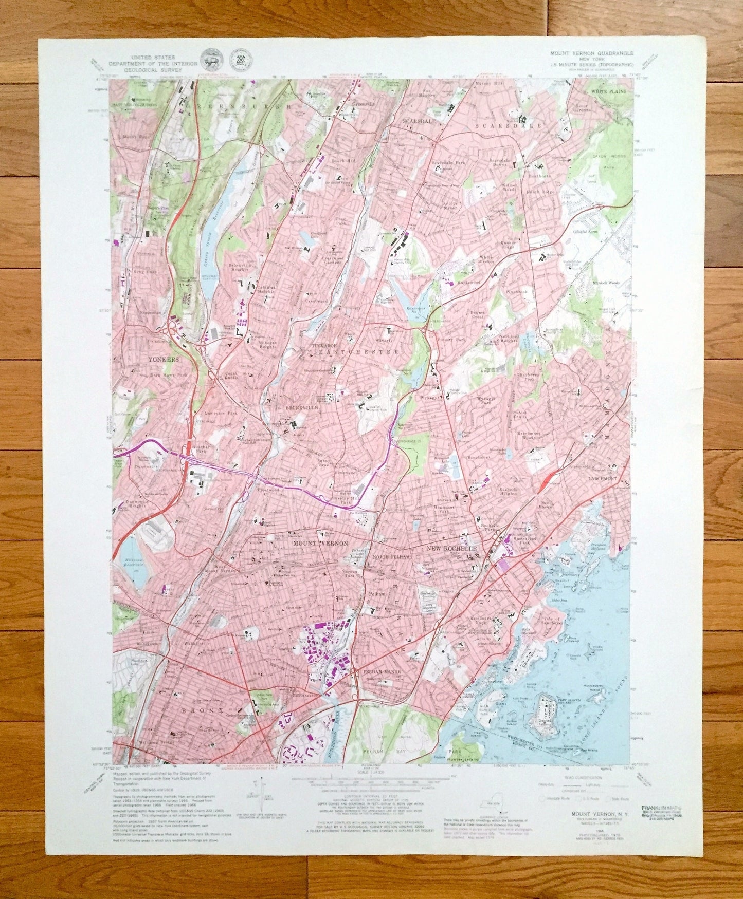
Antique Mount Vernon, New York 1966 US Geological Survey Topographic Map – Bronx, Westchester County, Yonkers, White Plains, Larchmont Mt NY
Antique Mount Vernon, New York 1966 US Geological Survey Topographic Map – Bronx, Westchester County, Yonkers, White Plains, Larchmont Mt NY
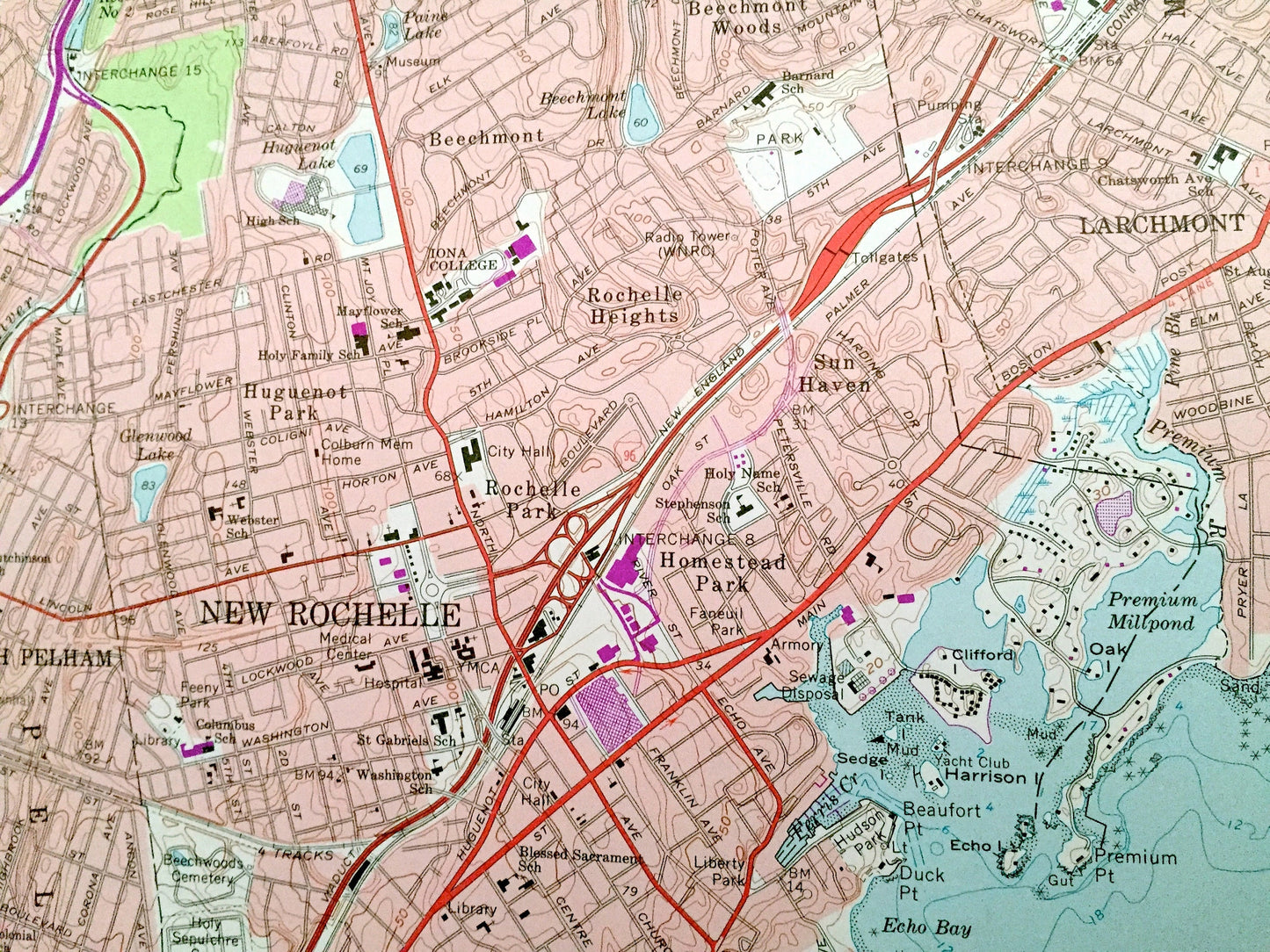
Beautiful, antique map of Mount Vernon, New York and surrounding Westchester County and Bronx County areas. This is an authentic 1966 edition, 1979 print from the U.S. Geological Survey and NOT a computer reprint.
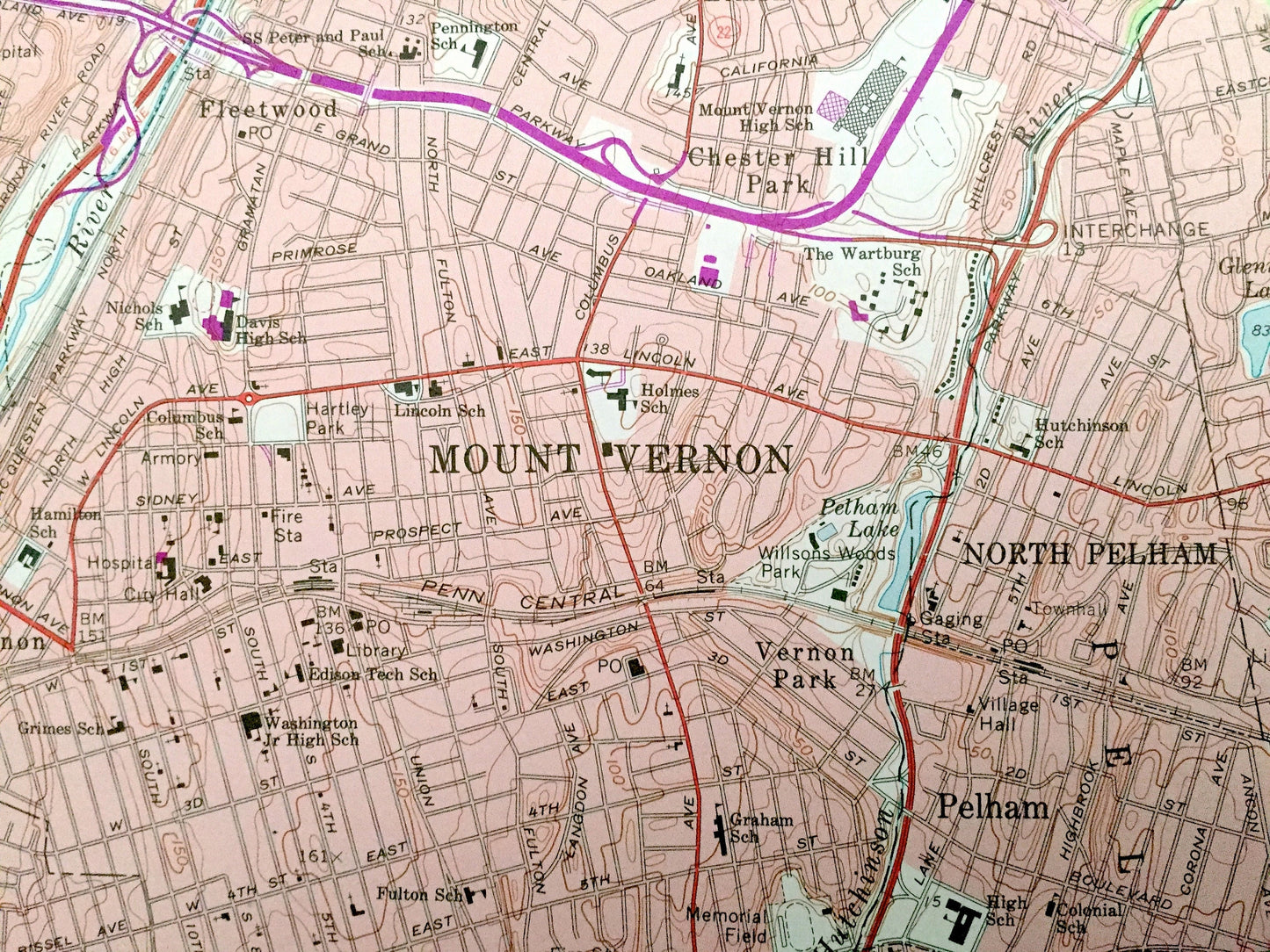
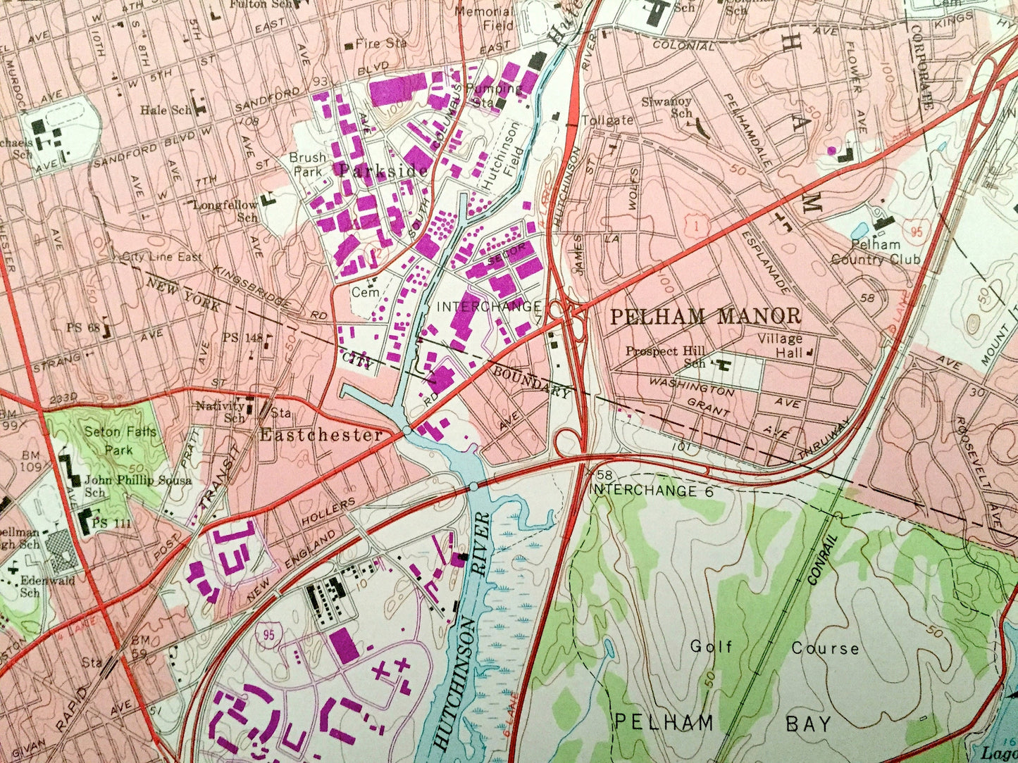
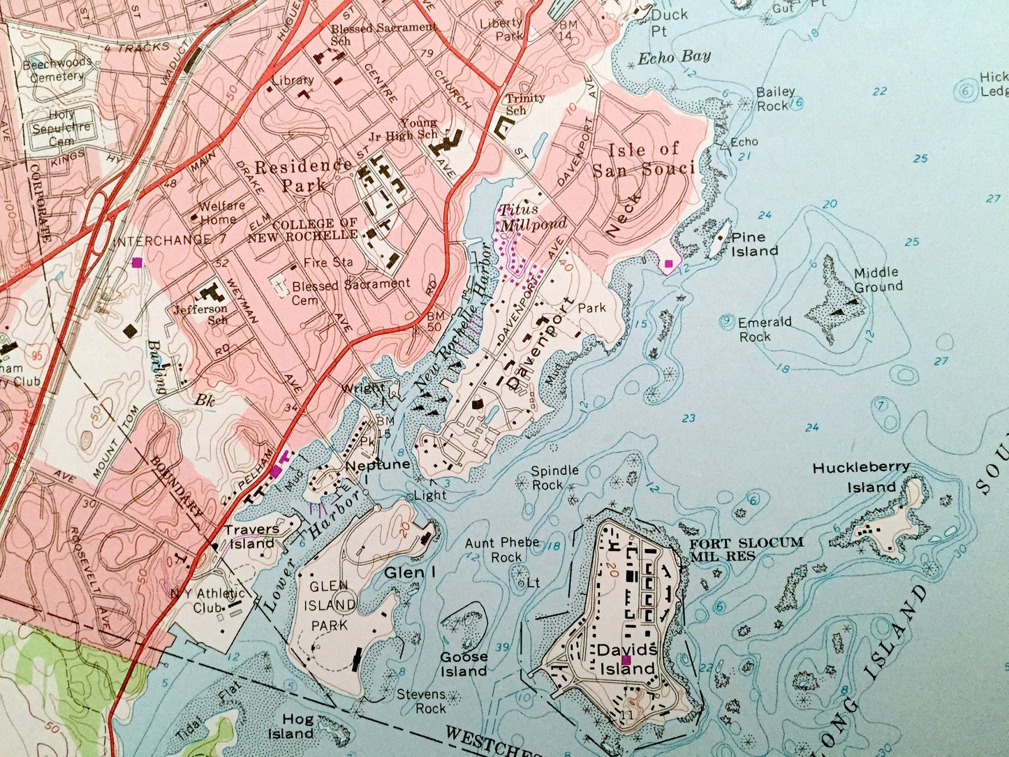
See what New York looked like over 55 years ago. Lots of intricate details and geological contours. Map even has little squares for every house that existed. The USGS cartographers were very thorough back then!
Perfect for the historian, map-lover, the curious or just as a conversation starter. Wonderful and rare. Vintage maps such as these make great gifts.
Edition of 1966, printed 1979
Dimensions: 22" width x 27" height
----
Features
Cities & Towns: Mount Vernon, Bronx, Williams Bridge, Eastchester, Woodlawn, Wakefield, Parkside, Pelham Manor, Isle of San Souci, Residence Park, Pelham, West Mount Vernon, Vernon Park, New Rochelle, Homestead Park, Sun Haven, Rochelle Heights, Rochelle Park, Huguenot Park, Chester Hill Park, Fleetwood, Dunwoodie Heights, Dunwoodie, Gunther Park, Sunny Brae, Elmsmere, Beechmont, Larchmont, Mamaroneck, Beechmont Woods, Forest Knolls, Wykagyl Park, Wykagyl, Bronxville, Lawrence Park, Yonkers, Bryn Mawr Park, Cedar Knolls, Mohegan Heights, Tuckahoe, Waverly, Victory Park, Bayberry Park, Pinebrook Heights, Bonnie Crest, Crestwood, Colonial Heights, Nepperhan, Grey Oaks, Bronxville Heights, Crestwood Gardens, Maplewood, White Birches, Pinebrook, Murdock Woods, Quaker Ridge, Colonial Acres, Arthur Manor, Cecil Park, Nepera Park, Beech Hill, Scarsdale Park, Scarsdale Downs, Wilmot Woods, Heath Ridge, Heathcote, Secor Gardens, White Plains, Scarsdale, Greenville, Greenburgh, Hastings-on-Hudson.
Points of Interest: Long Island Sound, Pelham Bay Park, Glen Island Park, Davids Island, Premium Millpond, Hutchinson River, College of New Rochelle, Willson's Woods Park, Penn Central Railroad, Hillview Reservoir, Yonkers Raceway, Bronx River, Sarah Lawrence College, Sheldrake Lake, Grassy Sprain Reservoir, Saxon Woods Park, Butler Field, Beechmont Lake, Huguenot Lake, and many more hills, streams, ponds, houses, schools, railroads, churches and roads.
Condition: Very Good Vintage condition, commensurate with age. This map is in great shape for being over 40 years old. Has light edge-wear and slight discoloration but will read as character when framed.
----
We will happily adjust shipping price for multiple purchases. Maps are rolled up and shipped in sturdy mailing tubes, never folded.
Couldn't load pickup availability
Share