My Store
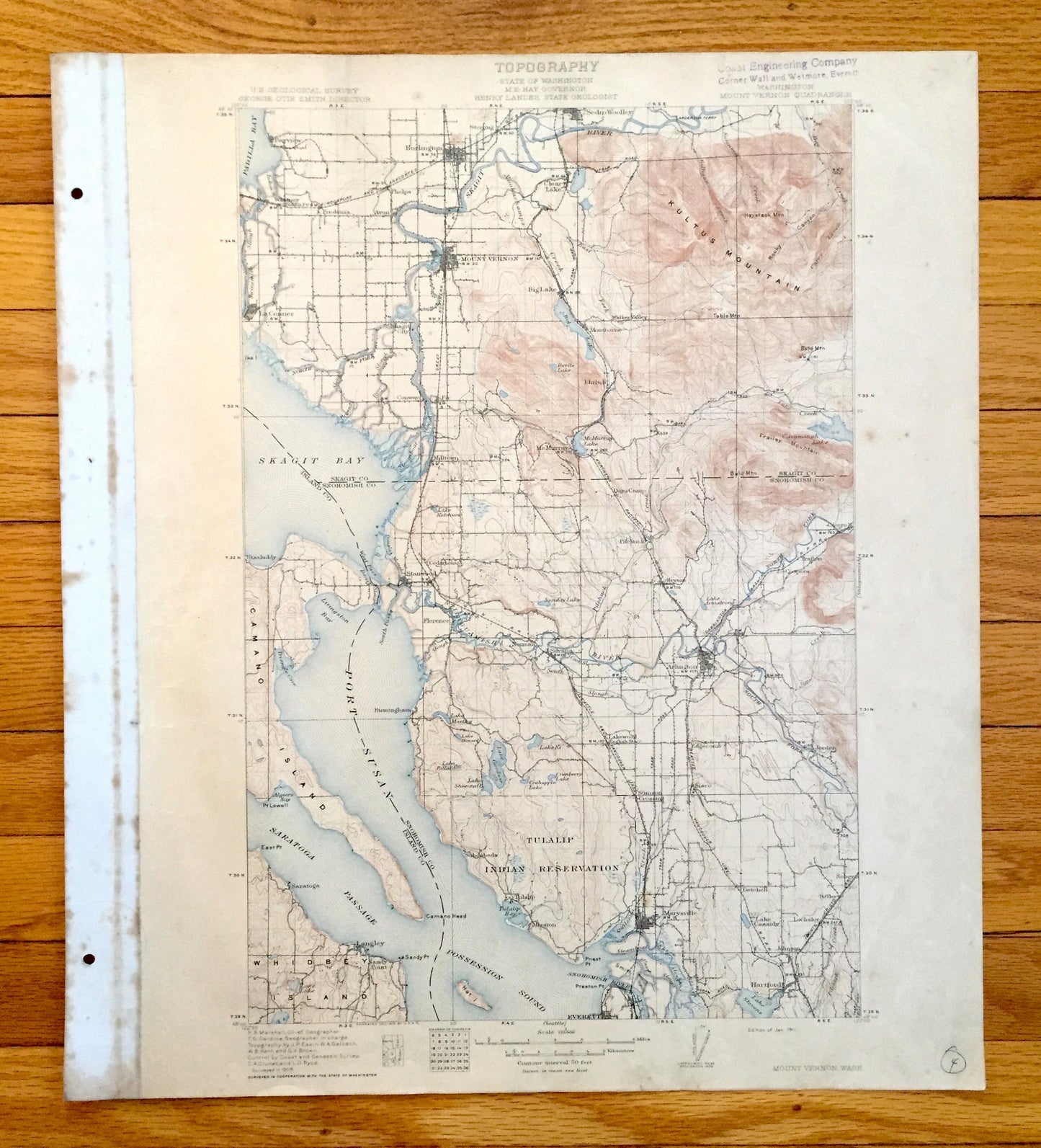
Antique Mount Vernon, Washington 1911 US Geological Survey Topographic Map – Snohomish, Island, Skagit County, Stanwood, Tulalip, Everett WA
Antique Mount Vernon, Washington 1911 US Geological Survey Topographic Map – Snohomish, Island, Skagit County, Stanwood, Tulalip, Everett WA
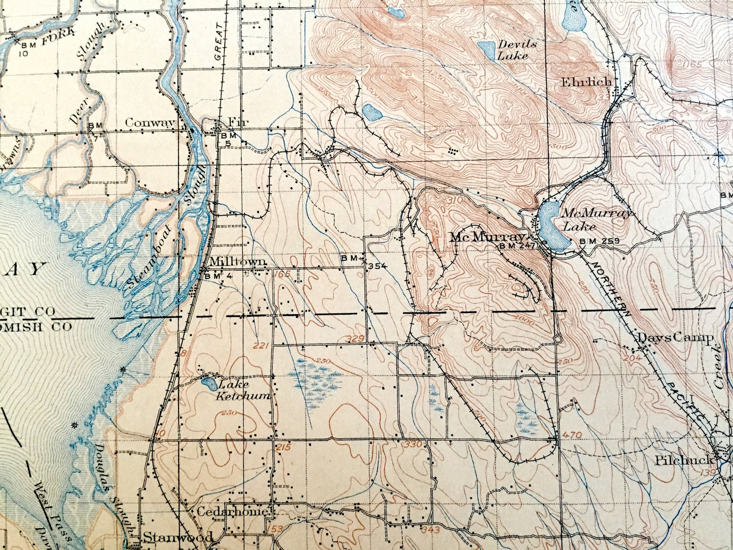
Beautiful, antique map of Mount Vernon, Washington and surrounding Island County, Skagit County & Snohomish County area. This is an authentic 1911 print from the U.S. Geological Survey and NOT a computer reproduction.
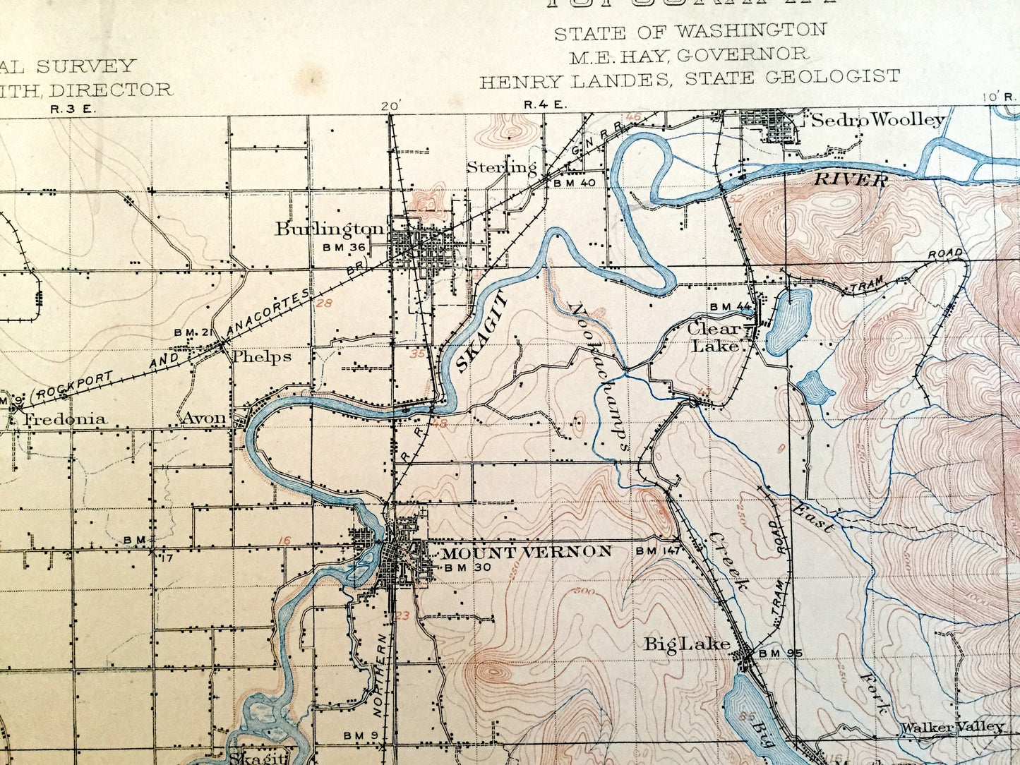
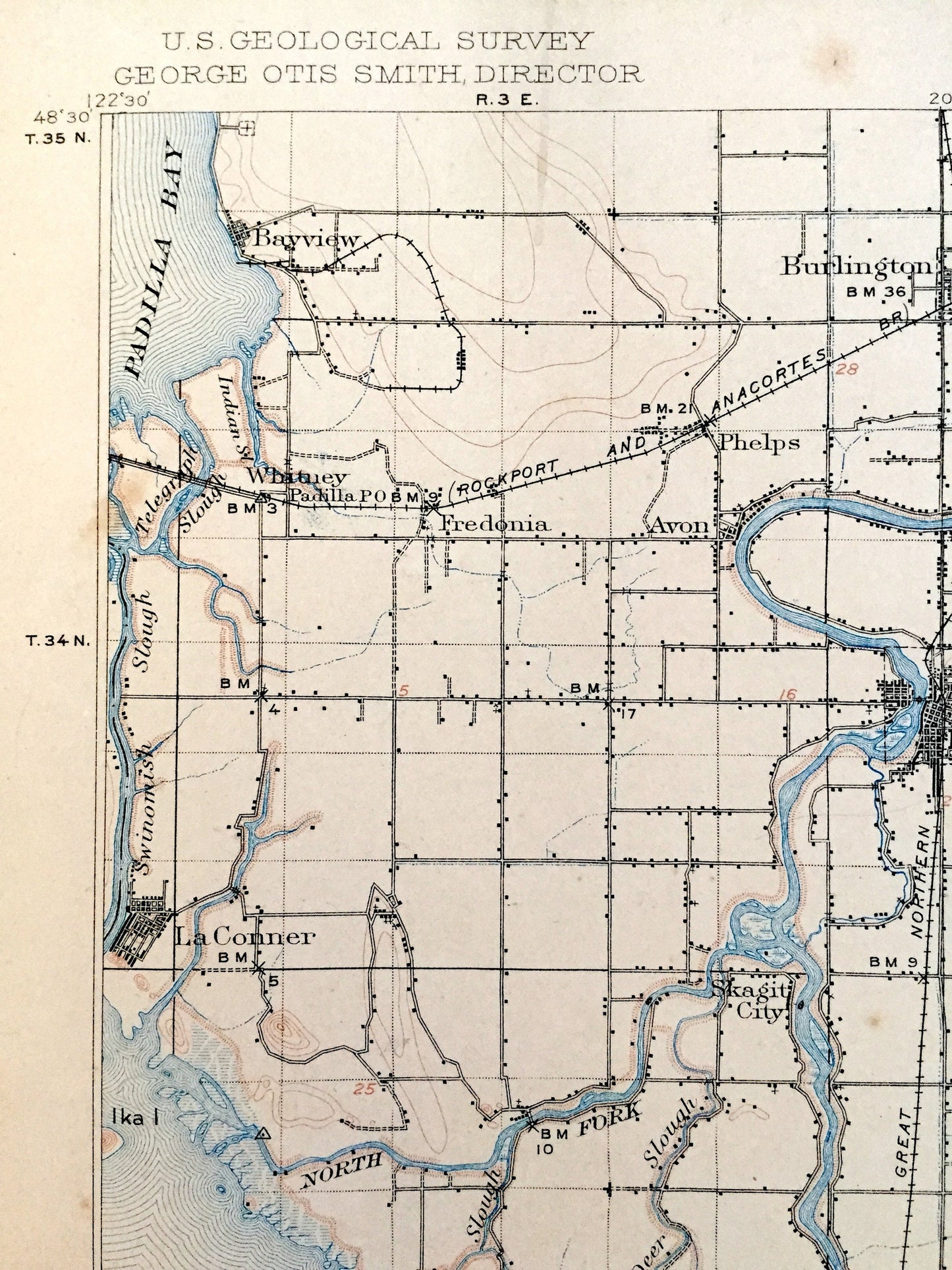
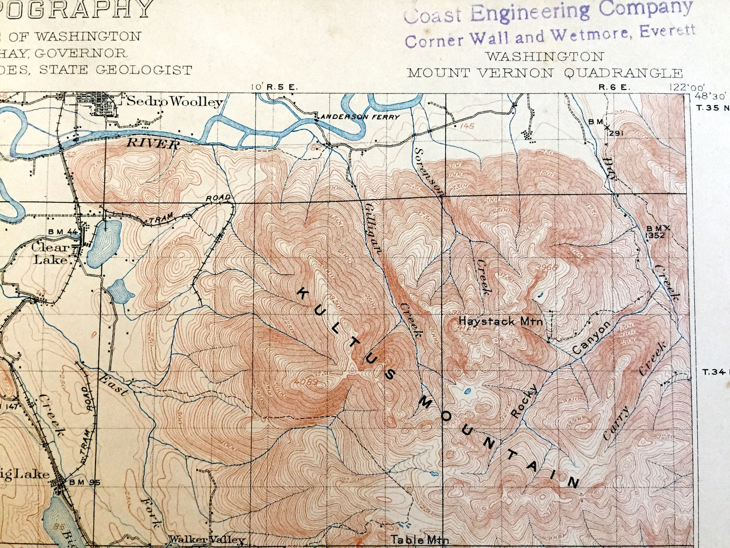
See what Washington looked like over 110 years ago. Lots of intricate details and geological contours. Map even has little squares for every house that existed at the time. The USGS cartographers were very thorough back then!
Perfect for the historian, map-lover, the curious or just as a conversation starter. Wonderful and rare. Vintage maps such as this make great gifts.
Edition of 1911, printed 1911
Dimensions: 16 1/2" width x 20" height (The atlas binding on the left margin is another inch.)
----
Features
Cities & Towns: Mount Vernon, Bayview, Burlington, La Conner, Whitney, Avon, Fredonia, Sterling, Sedro Woolley, Clear Lake, Conway, Milltown, McMurray, Ehrlich, Montborne, Fir, Conway, Stanwood, Utsaladdy, Florence, Cedarhome, Norman, Silvanna, Pilchuck, Bryant, Trafton, Cicero, Coopers, Arlington, Jordan, Birmingham, Lakewood, English Station, Saratoga, Langley, Sandy Point, Subeebeda, Tulalip, Mission, Marysville, Getchell, Sobey, Diffley, Everett, Lake Cassidy, Johnson, Hartford, Lochsloy.
Points of Interest: Island County, Skagit County, Snohomish County, Tulalip Indian Reservation, Skagit Bay, Port Susan, Saratoga Passage, Possession Sound, Padilla Bay, Skagit River, Stillaguamish River, Snohomish River, Camano Island, Whidbey Island, Hat Island, Kultus Mountain, Frailey Mountain, Lake Goodyear, Lake Stevens, Big Lake, Cavanaugh Lake, and many more towns, bays, rivers, islands, train tracks, roads, hills, streams and rivers.
Condition: Good Vintage condition, commensurate with age. This map is in great shape for being over 110 years old. Has some wear, toning, foxing, edge-wear, as well as pencil in lower right margin, but these will read as vintage character when framed. Canvas binding at left margin has been left on map, for discretion of buyer to keep or remove.
----
We will happily adjust shipping price for multiple purchases. Maps are rolled up and shipped in sturdy mailing tubes, never folded.
Couldn't load pickup availability
Share