My Store
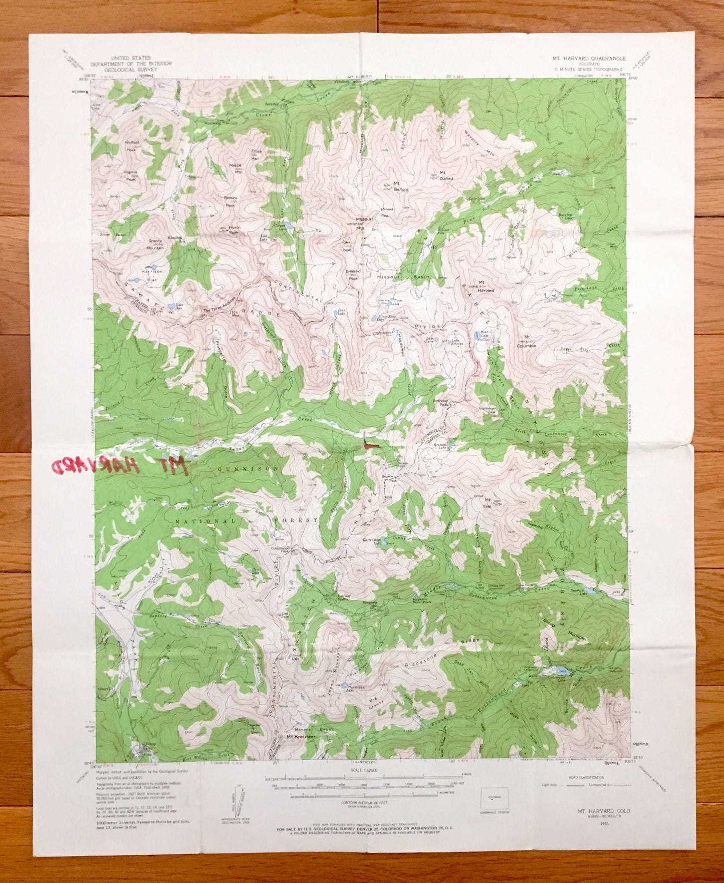
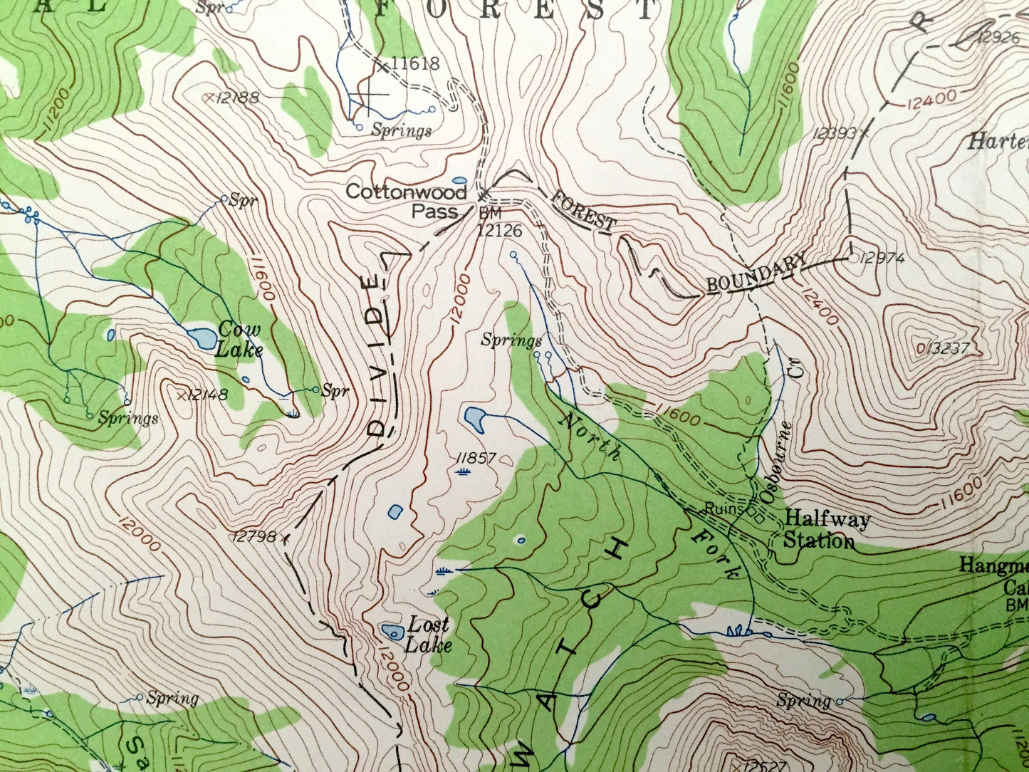
Antique Mt Harvard, Colorado 1955 US Geological Survey Topographic Map – Chaffee, Gunnison County, San Isabel National Forest Tincup Yale CO
Antique Mt Harvard, Colorado 1955 US Geological Survey Topographic Map – Chaffee, Gunnison County, San Isabel National Forest Tincup Yale CO
Beautiful, antique map of Mt Harvard, Colorado and surrounding Gunnison National Forest and San Isabel National Forest area. This is an authentic 1955 edition, 1960 print from the U.S. Geological Survey and NOT a computer reprint.
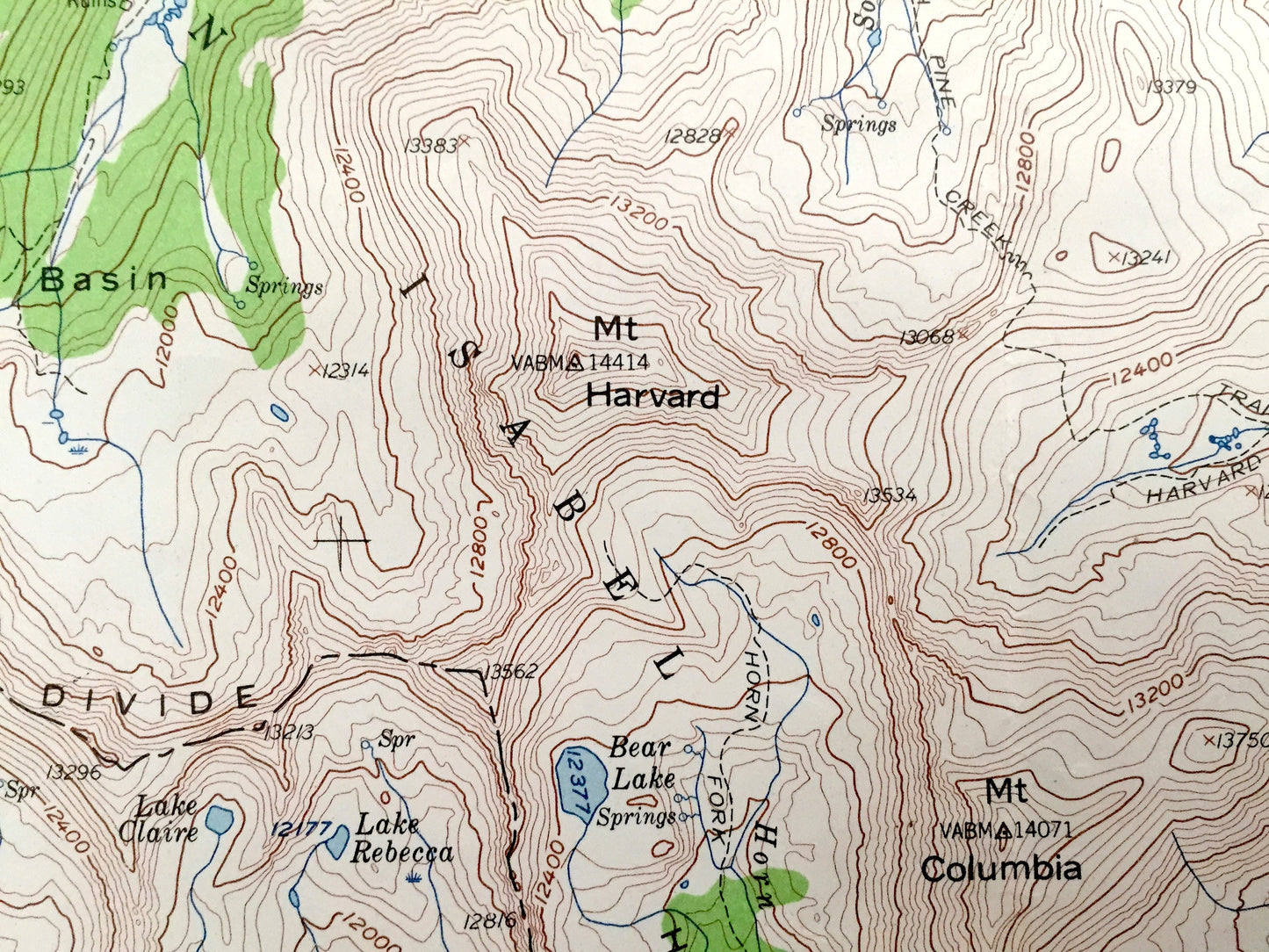
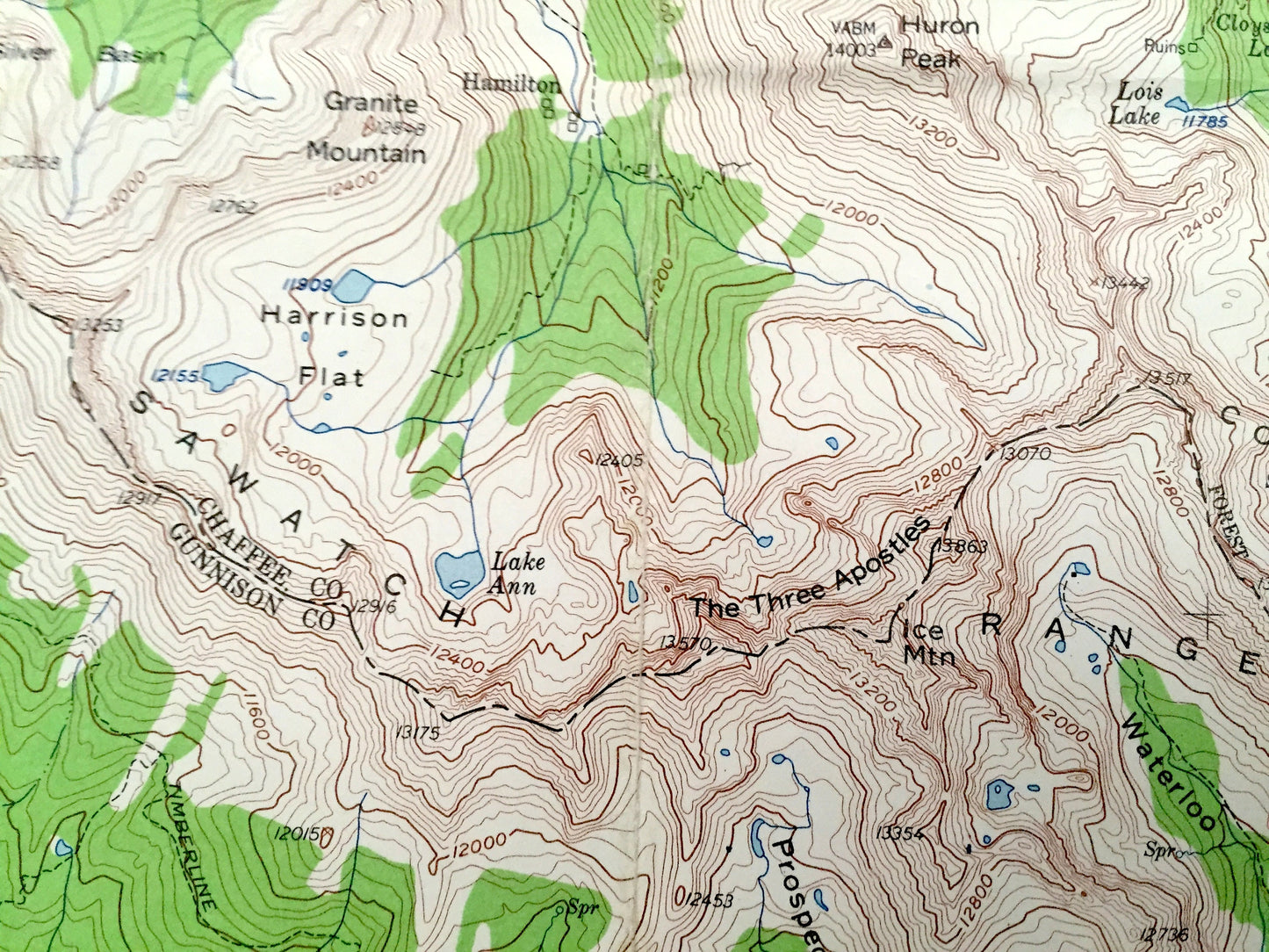
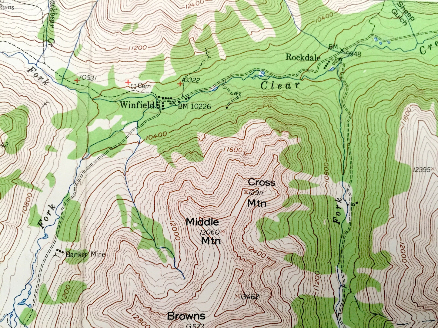
See what Colorado looked like over 65 years ago. Lots of intricate details and geological contours. Map even has little squares for every house that existed. The USGS cartographers were very thorough back then!
Perfect for the historian, map-lover, the curious or just as a conversation starter. Wonderful and rare. Vintage maps such as these make great gifts.
Edition of 1955, printed 1960
Dimensions: 17" width x 21" height
----
Features
Points of Interest: Chaffee County, Gunnison County, Gunnison National Park, San Isabel National Park, Sawatch Range, Continental Divide, Mt Harvard, Mt Columbia, Missouri Mountain, Missouri Basin, Mt Kreutzer, Tincup, Cottonwood Lake, Cottonwood Creek, Mt Yale, Waterloo Gulch and many more peaks, lakes, creeks, houses, schools, roads, camps and train tracks.
Condition: Good Vintage condition, commensurate with age. This map is in great shape for being 60 years old. Has some wear, marker on the reverse side and light fold lines, as issued, but these will flatten easily with framing and all will add to vintage character when framed.
----
We will happily adjust shipping price for multiple purchases. Maps are rolled up and shipped in sturdy mailing tubes, never folded.
Couldn't load pickup availability
Share