My Store
Antique Mt Jefferson, Oregon 1927 US Geological Survey Topographic Map – Marion, Clackamas, Linn County, Mount Hood National Forest, OR, Mt
Antique Mt Jefferson, Oregon 1927 US Geological Survey Topographic Map – Marion, Clackamas, Linn County, Mount Hood National Forest, OR, Mt
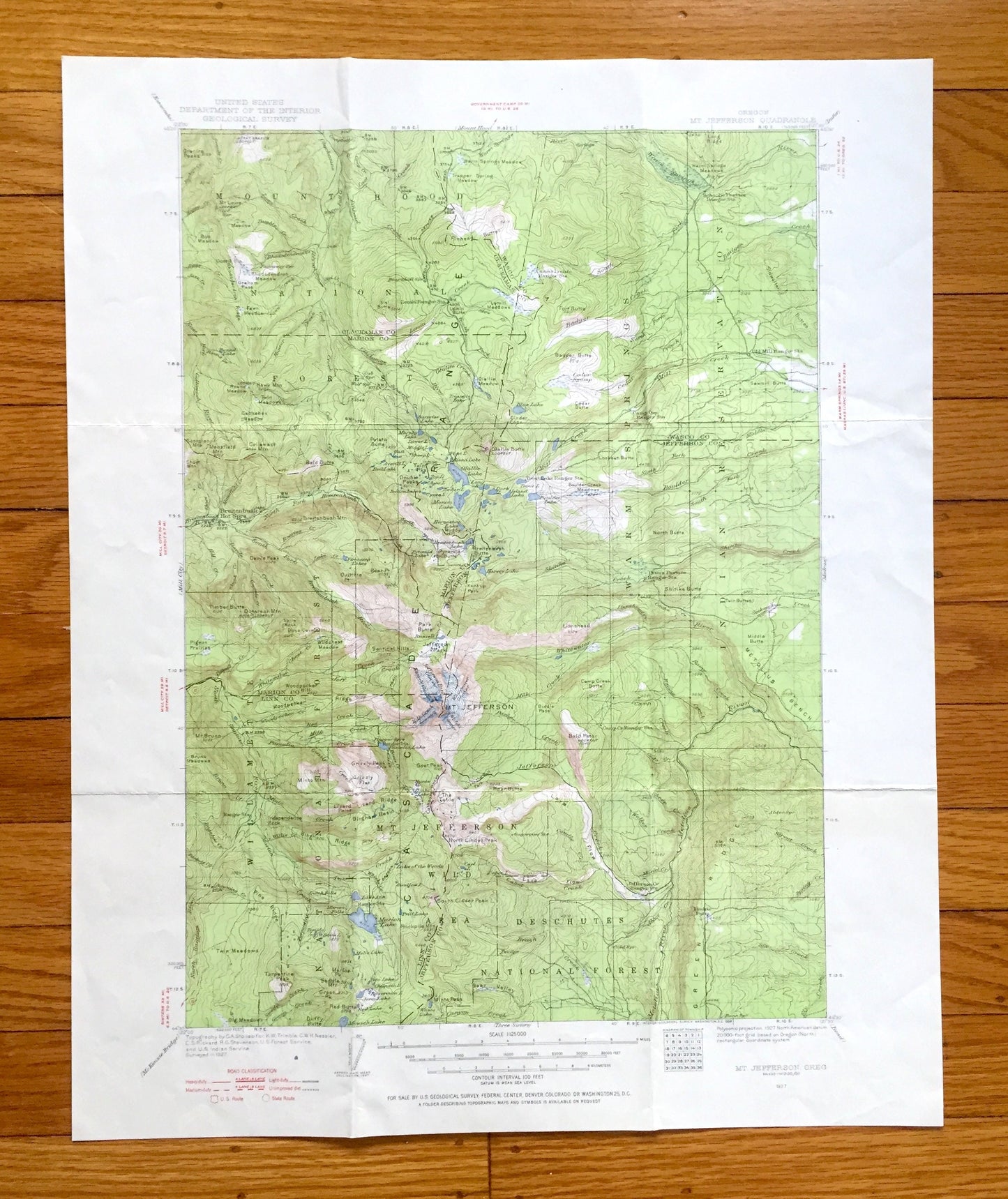
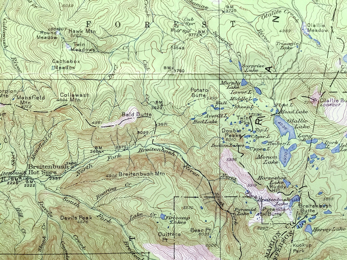
Beautiful, antique map of Mt Jefferson, Oregon and surrounding Marion, Linn, Jefferson, Wasco & Clackamas County area, including Mount Hood National Forest and Warm Springs Indian Reservation. This is an authentic 1927 edition, 1956 print from the U.S. Geological Survey and NOT a computer reproduction.
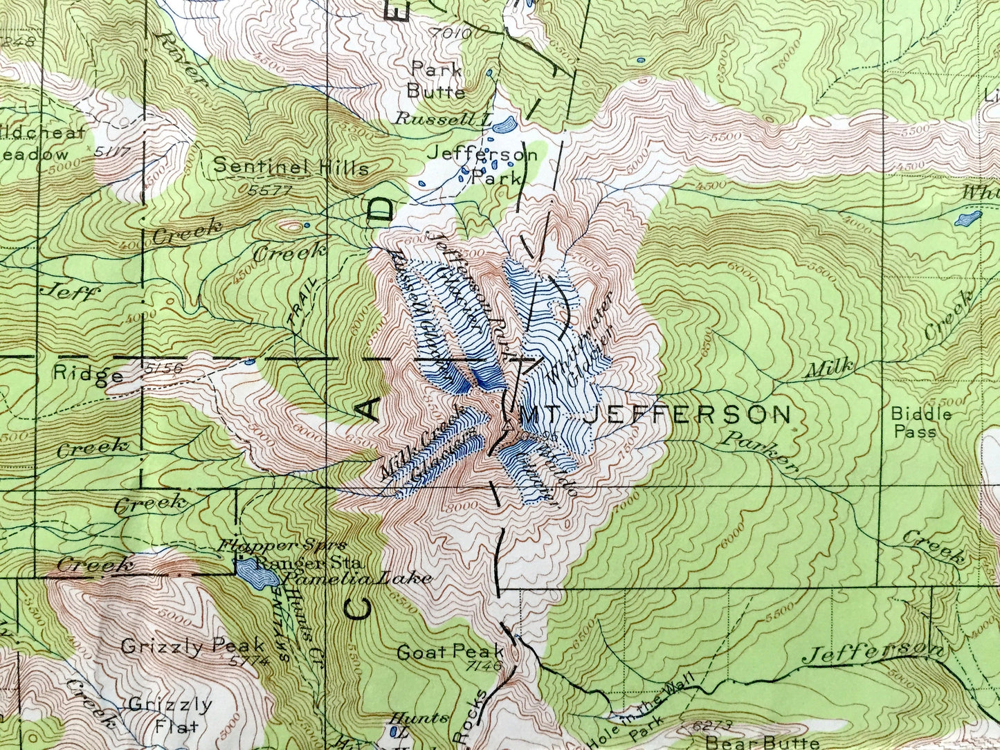
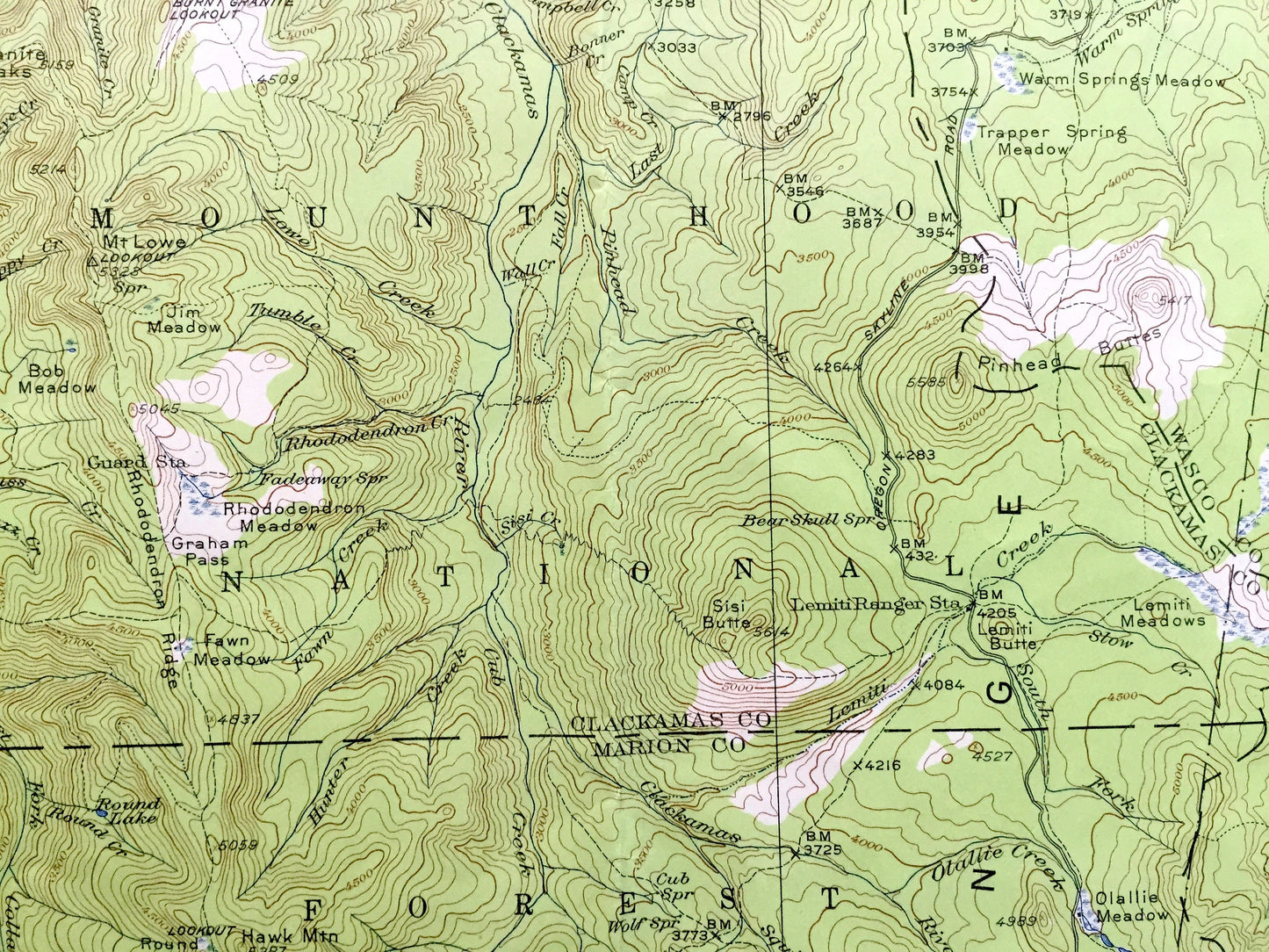
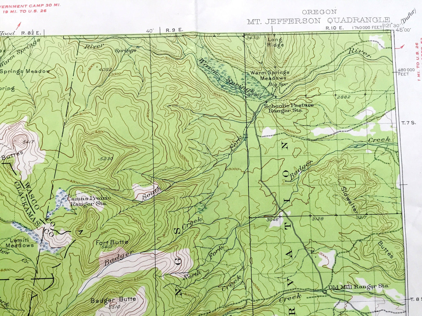
See what Oregon looked like about 100 years ago. Lots of intricate details and geological contours. Map even has little squares for every house that existed at the time. The USGS cartographers were very thorough back then!
Perfect for the historian, map-lover, the curious or just as a conversation starter. Wonderful and rare. Vintage maps such as this make great gifts.
Edition of 1927, printed 1956
Dimensions: 17" width x 21" height
----
Features
Points of Interest: Clackamas County, Marion County, Jefferson County, Linn County, Wasco County, Cascade Range, Mt Hood National Forest, Willamette National Forest, Mt Jefferson Wild Area, Deschutes National Forest, Warm Springs Indian Reservation, Mt Jefferson, Mt Bruno, The Table, Grizzly Peak, Grizzly Flat, Devils Peak, Double Peaks, Pyramid Butte, Metolius Bench, Green Ridge, Jefferson Creek, Rhododendron Meadow, Hawk Mountain, Jim Meadow, Granite Peaks, Bob Meadow, Otallie Creek, Surprise Lake, Warm Springs Meadows, Sidwalter Buttes, Bald Butte, Mansfield Mountain, Breitenbush Hot Springs, Quitters Point, Wildcheat Meadow, Pigeon Prairies, Woodpecker Hill, Jefferson Park, Monon Lake, Shitike Butte, Goat Peak, Minto Mountain, Marion Lake, South Cinder Peak, Green Ridge and many more towns, houses, train tracks, mountains, creeks, buttes, peaks, meadows, lakes and rivers.
Condition: Good Vintage condition, commensurate with age. This map is in great shape for being about 75 years old. Has some edge-wear and old fold lines as-issued, but these will flatten easily and all will read as vintage character when framed.
----
We will happily adjust shipping price for multiple purchases. Maps are rolled up and shipped in sturdy mailing tubes, never folded.
Couldn't load pickup availability
Share