My Store
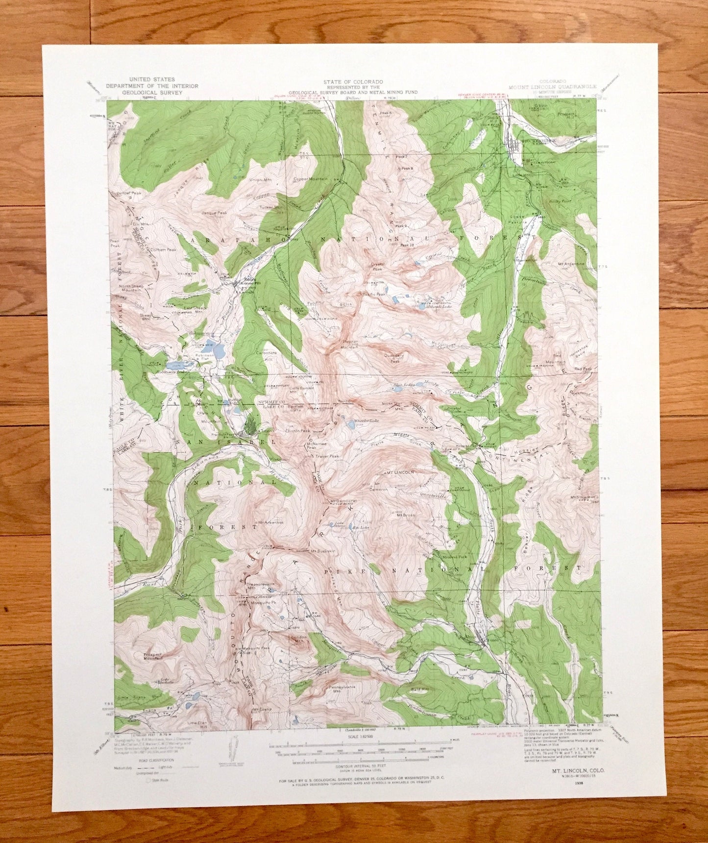
Antique Mt Lincoln, Colorado 1938 US Geological Survey Topographic Map – Breckenridge, Copper Mountain, Climax, Kokomo, Alma, Summit Lake CO
Antique Mt Lincoln, Colorado 1938 US Geological Survey Topographic Map – Breckenridge, Copper Mountain, Climax, Kokomo, Alma, Summit Lake CO
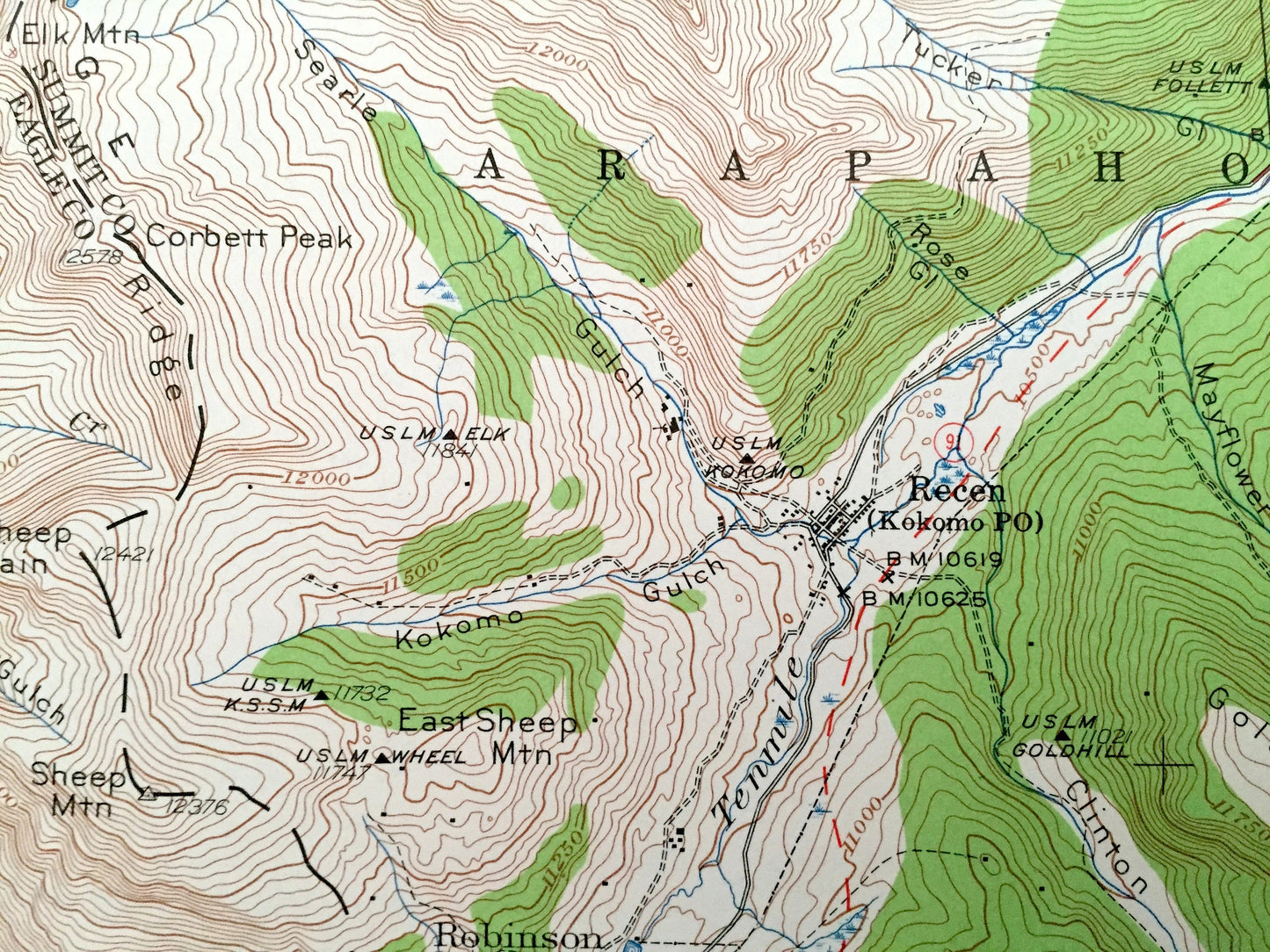
Beautiful, antique map of Mt Lincoln, Colorado, Arapaho, San Isabel & Pike National Forest and surrounding Summit & Lake County area, including Breckenridge, Climax and Alma. This is an authentic 1938 edition, 1962 print from the U.S. Geological Survey and NOT a computer reprint.
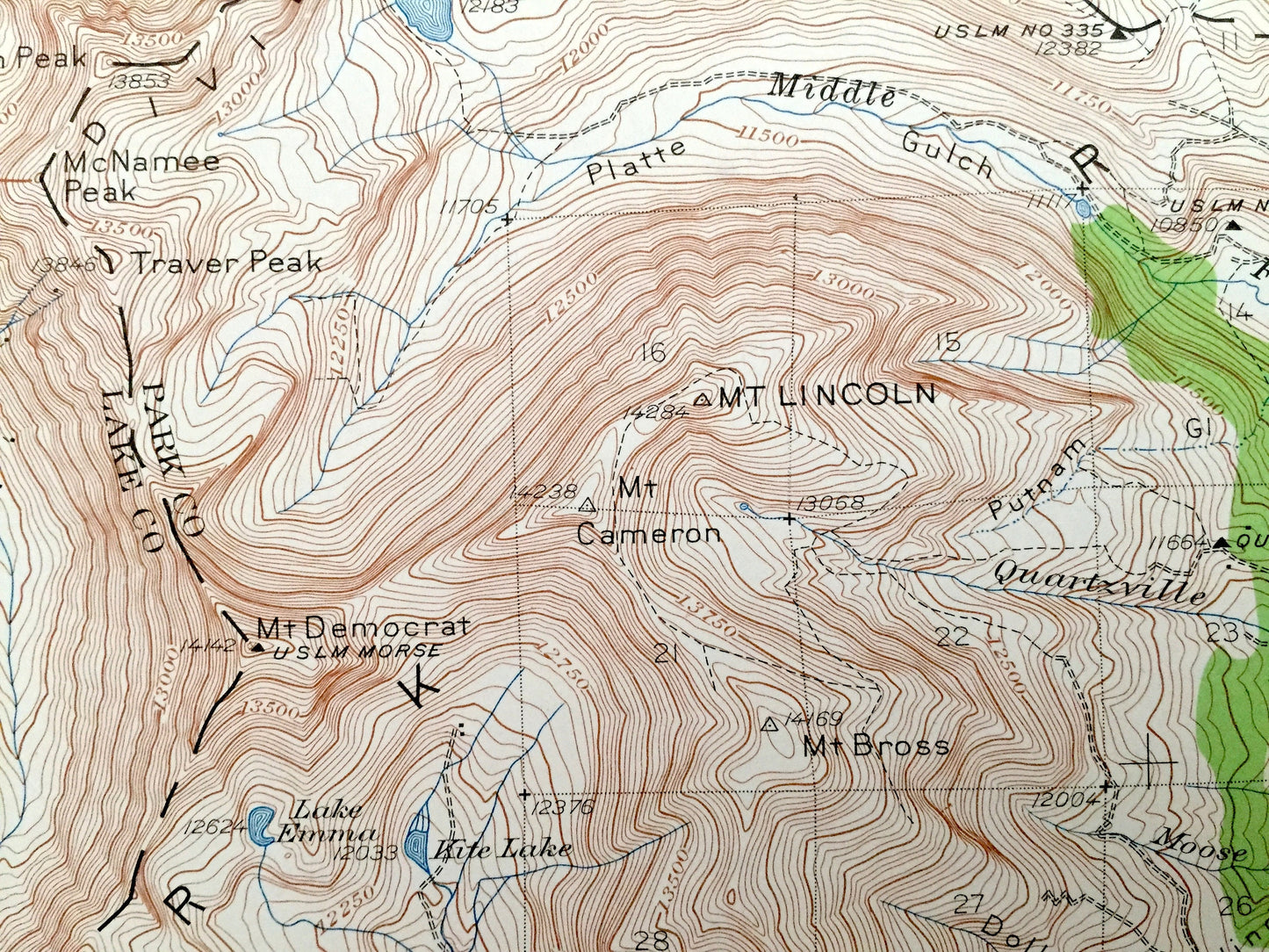
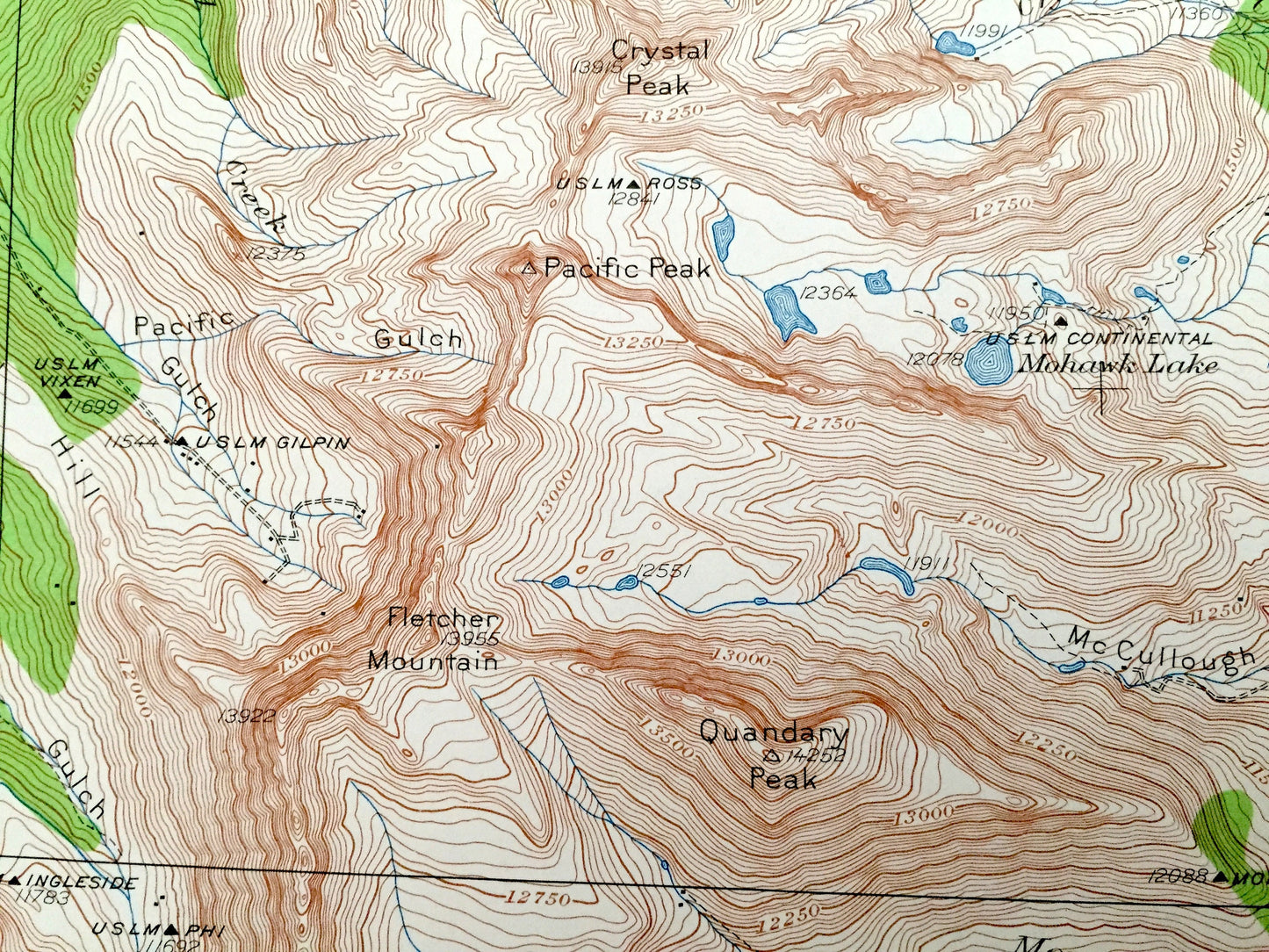
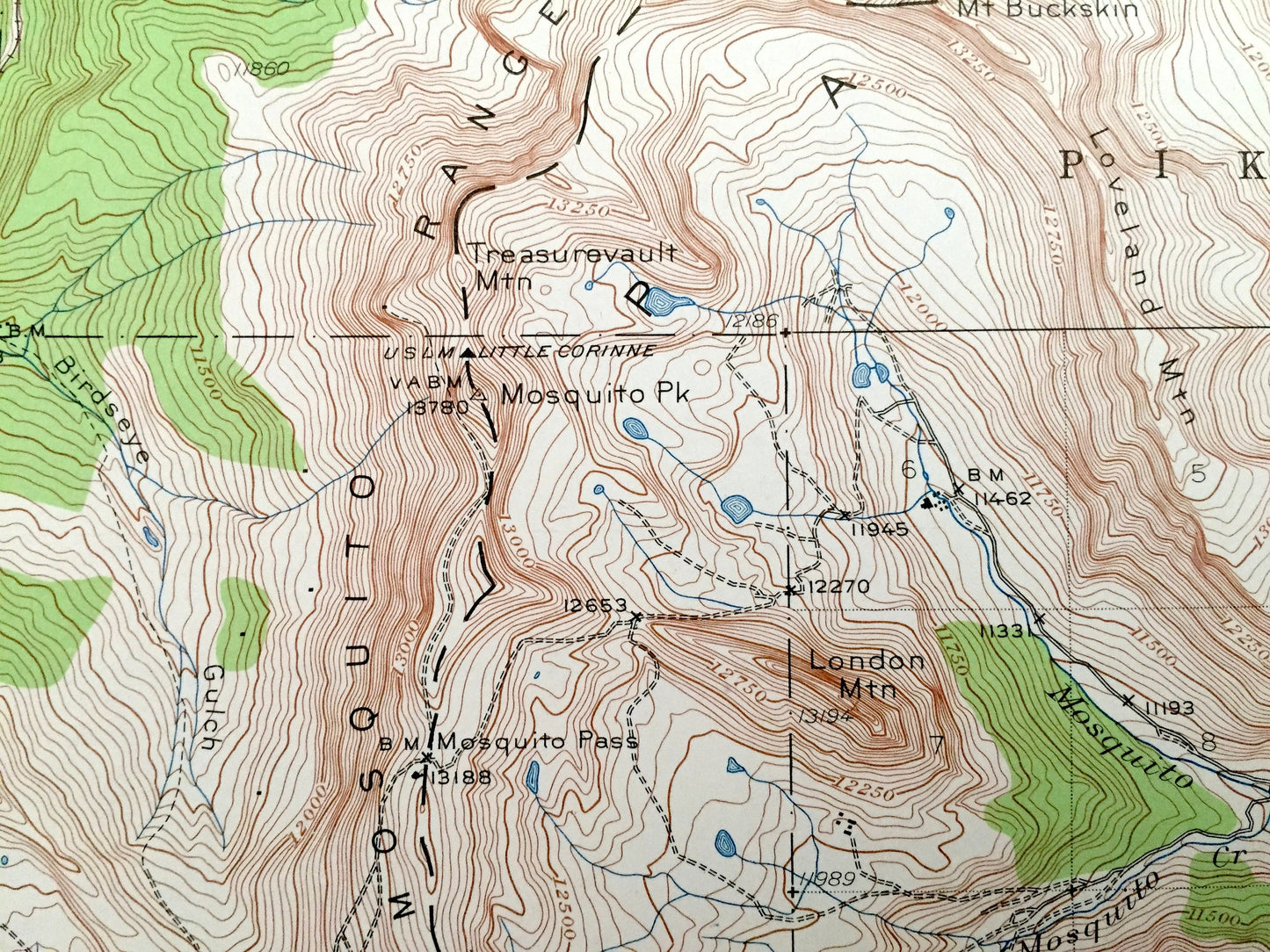
See what Colorado looked like 80 years ago. Lots of intricate details and geological contours. Map even has little squares for every house that existed. The USGS cartographers were very thorough back then!
Perfect for the historian, map-lover, the curious or just as a conversation starter. Wonderful and rare. Vintage maps such as these make great gifts.
Edition of 1938, printed 1962
Dimensions: 17" width x 21" height
----
Features
Cities & Towns: Kokomo, Robinson, Breckenridge, Climax, Wortman, Mineral Park, Alma.
Points of Interest: Lake County, Summit County, White River National Forest, Arapaho National Forest, San Isabel National Forest, Pike National Forest, South Platte River, Tenmile Creek, Robinson Lake, Breckenridge Ski Area, Copper Mountain Ski Area, Mt Lincoln, Mt Democrat, Arkansas River, Tenmile Range, Mt. Argentine, Jacque Peak, Mohawk Lake, Quandary Peak, Blue River, and many more smaller lakes, creeks, mountains, valleys, houses, schools, roads, churches and train tracks.
Condition: Very Good Vintage condition, commensurate with age. This map is in great shape for being almost 60 years old.
----
We will happily adjust shipping price for multiple purchases. Maps are rolled up and shipped in sturdy mailing tubes, never folded.
Couldn't load pickup availability
Share