My Store
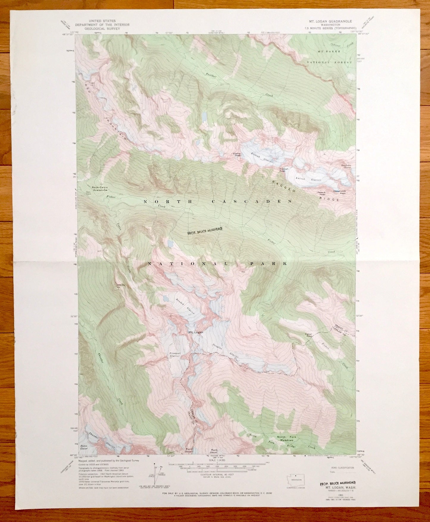
Antique Mt. Logan, Washington 1963 US Geological Survey Topographic Map – North Cascades, Mt Baker, Ragged Ridge, Red Mountain, Glaciers
Antique Mt. Logan, Washington 1963 US Geological Survey Topographic Map – North Cascades, Mt Baker, Ragged Ridge, Red Mountain, Glaciers
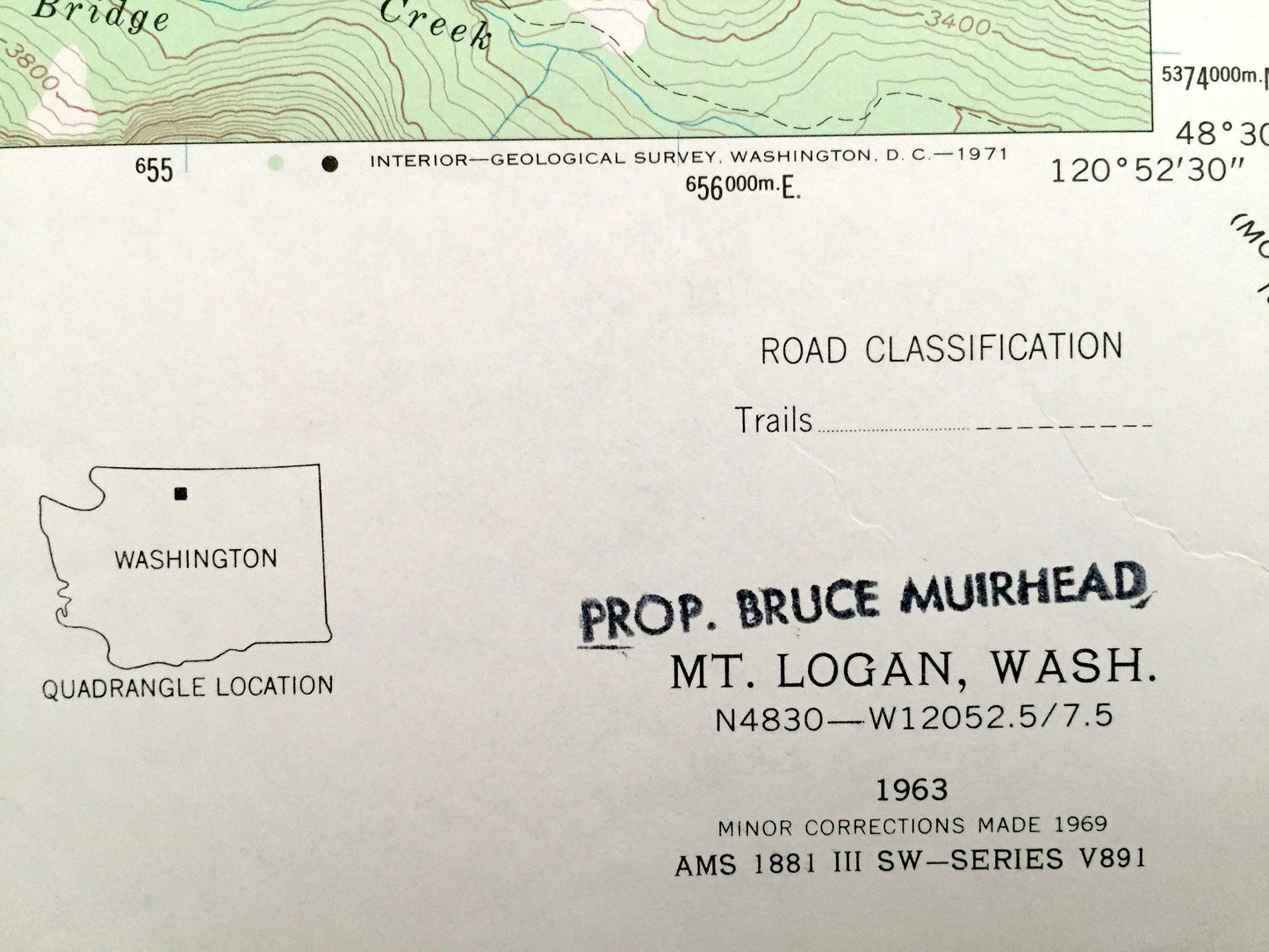
Beautiful, antique map of Mt. Logan, Washington and surrounding Chelan County and Skagit County areas including North Cascades National Park. This is an authentic 1963 edition, 1969 print from the U.S. Geological Survey and NOT a computer reproduction.
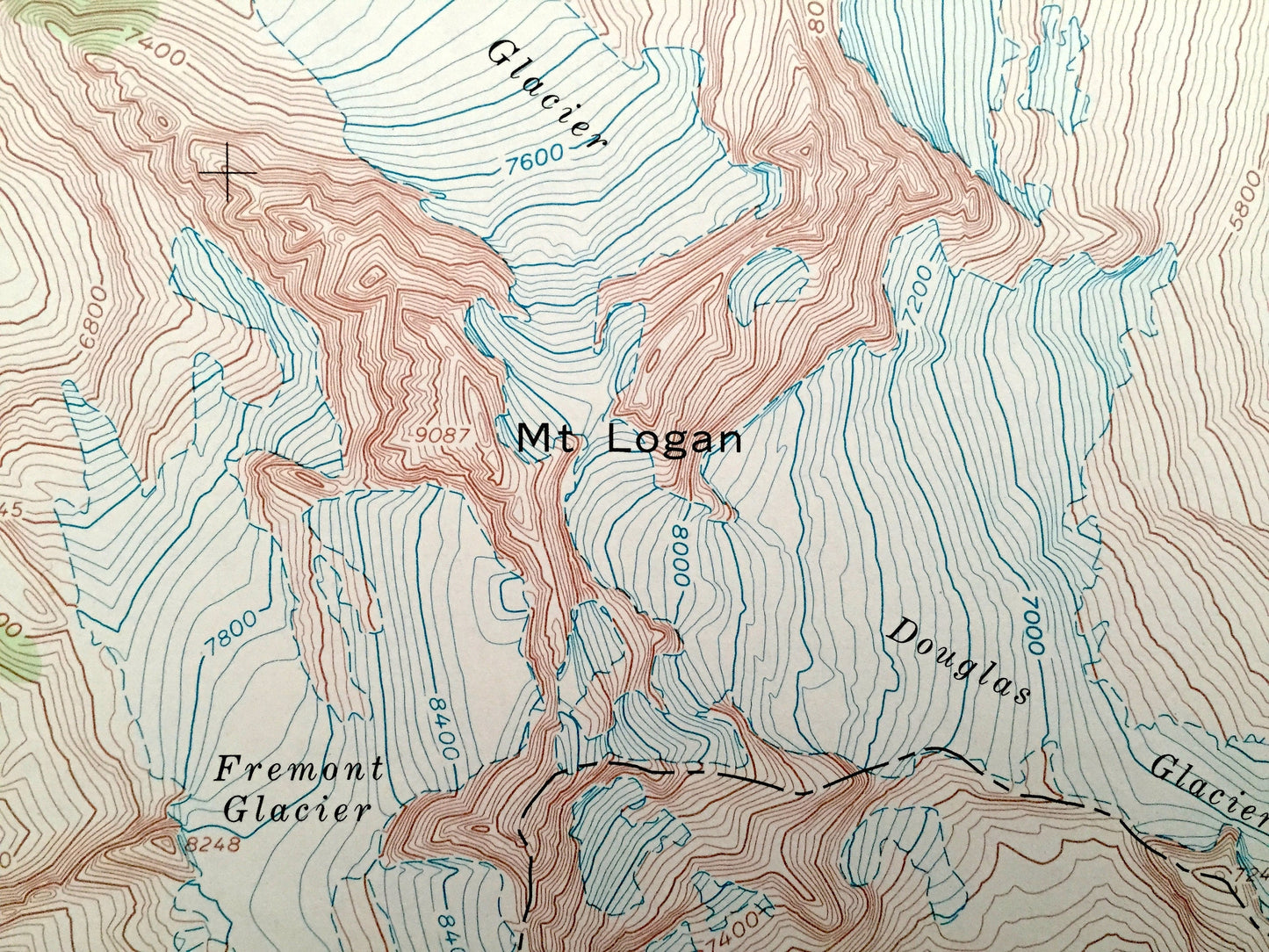
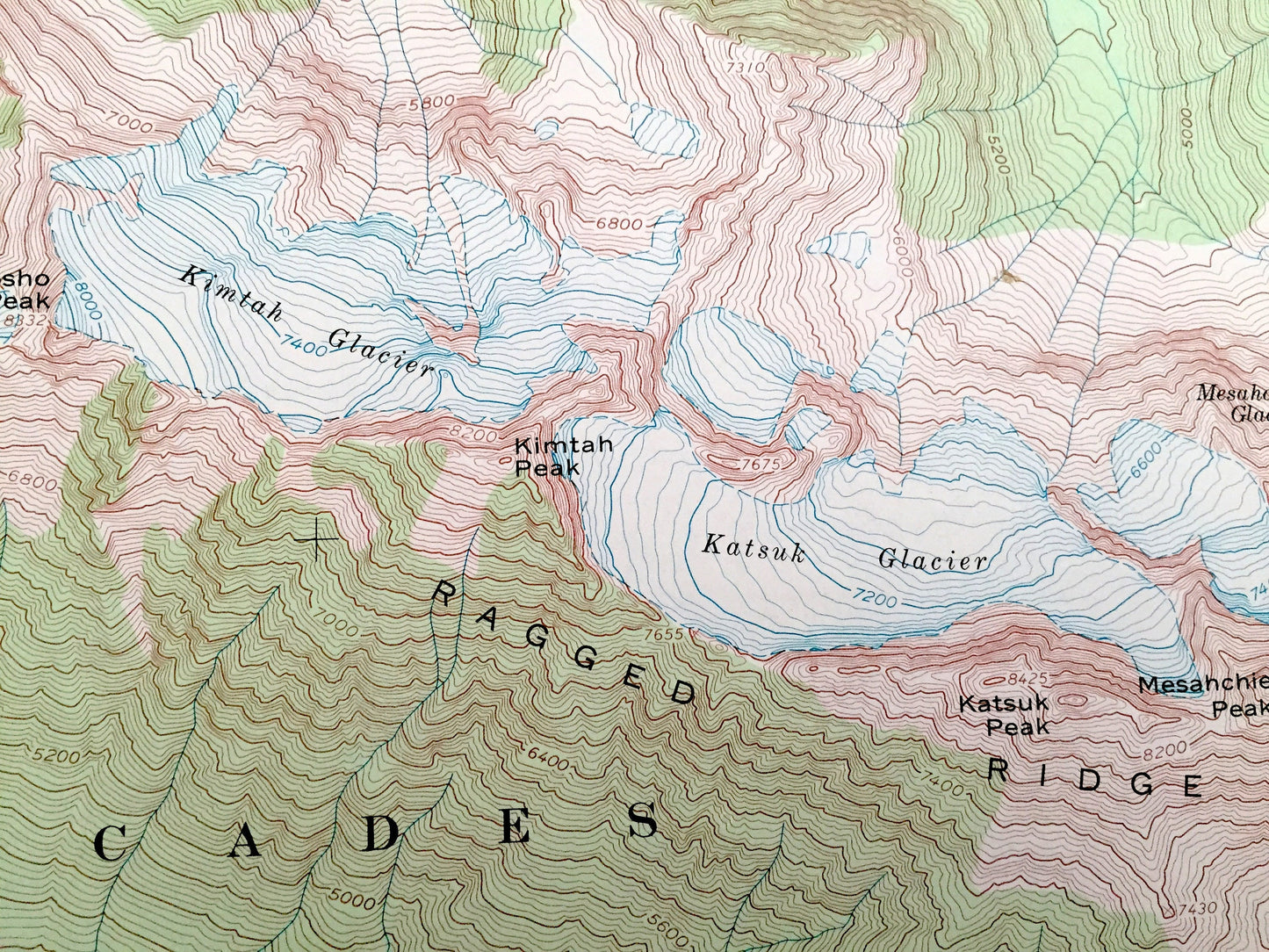
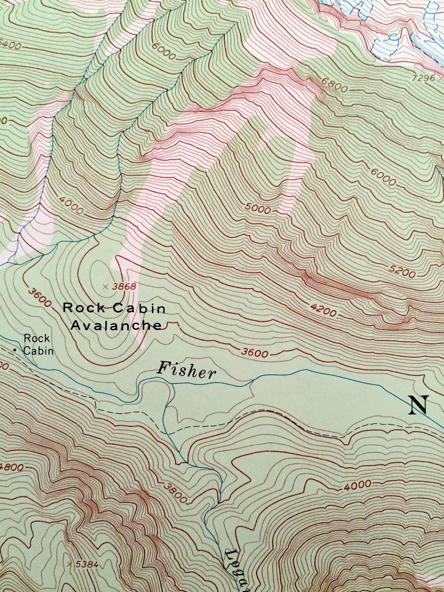
See what Washington State looked like more than 50 years ago. Lots of intricate details and geological contours. Map even has little squares for every house that existed at the time. The USGS cartographers were very thorough back then!
Perfect for the historian, map-lover, the curious or just as a conversation starter. Wonderful and rare. Vintage maps such as these make great gifts.
Edition of 1963, printed 1969
Dimensions: 22" width x 27" height
----
Features
Points of Interest: Chelan County, Skagit County, North Cascades National Park, Mt. Baker National Forest, Bridge Creek, Thunder Creek, Fisher Creek, Logan Creek, Panther Creek, Cabinet Creek, Ragged Ridge, Red Mountain, Mt. Logan, Consho Peak, Katsuk Peak, Kimtah Peak, Mesahnchie Peak, North Fork Meadows, Fisher Pass, Rock Cabin Avalanche, Kimtah Glacier, Katsuk Glacier, Mesahnchie Glacier, Banded Glacier, Fremont Glacier, Douglas Glacier, Thunder Glacier, Boston Glacier, Wyeth Glacier, and lots more hills, rivers, creeks, ponds, and trails.
Condition: Very Good condition, commensurate with age. This map is in incredible shape for being 50 years old. Some edge-wear and a fold as issued, all of which will read as vintage character when framed.
----
We will happily adjust shipping price for multiple purchases. Maps are rolled up and shipped in sturdy mailing tubes, never folded.
Couldn't load pickup availability
Share