My Store
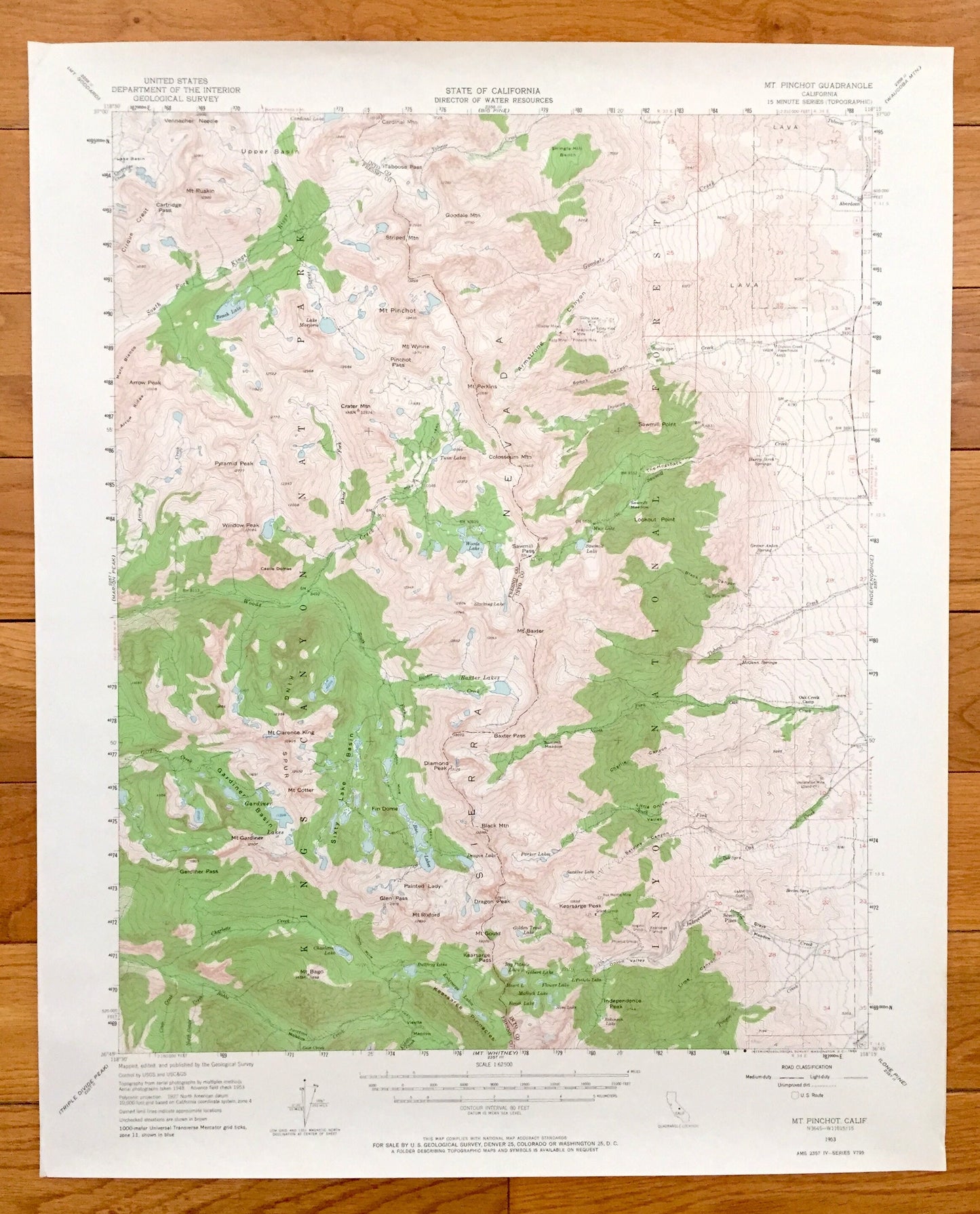
Antique Mt Pinchot, California 1953 US Geological Survey Topographic Map – Sierra Nevadas, Kings, Inyo National Forest, Fresno, County, CA
Antique Mt Pinchot, California 1953 US Geological Survey Topographic Map – Sierra Nevadas, Kings, Inyo National Forest, Fresno, County, CA
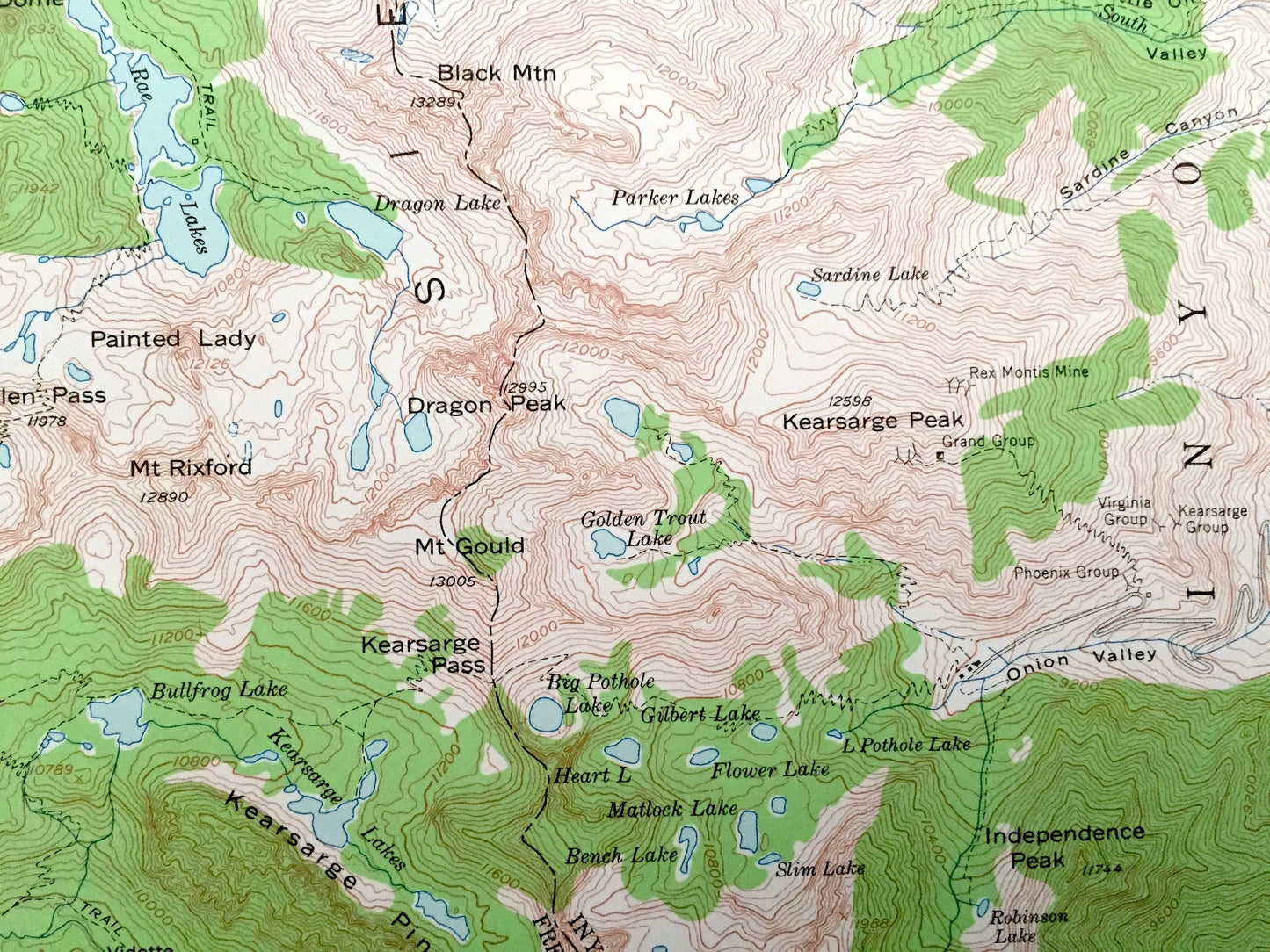
Beautiful, antique map of Mt Pinchot, California and surrounding Fresno County & Inyo County area. This is an authentic 1953 edition, 1964 print from the U.S. Geological Survey and NOT a computer reproduction.
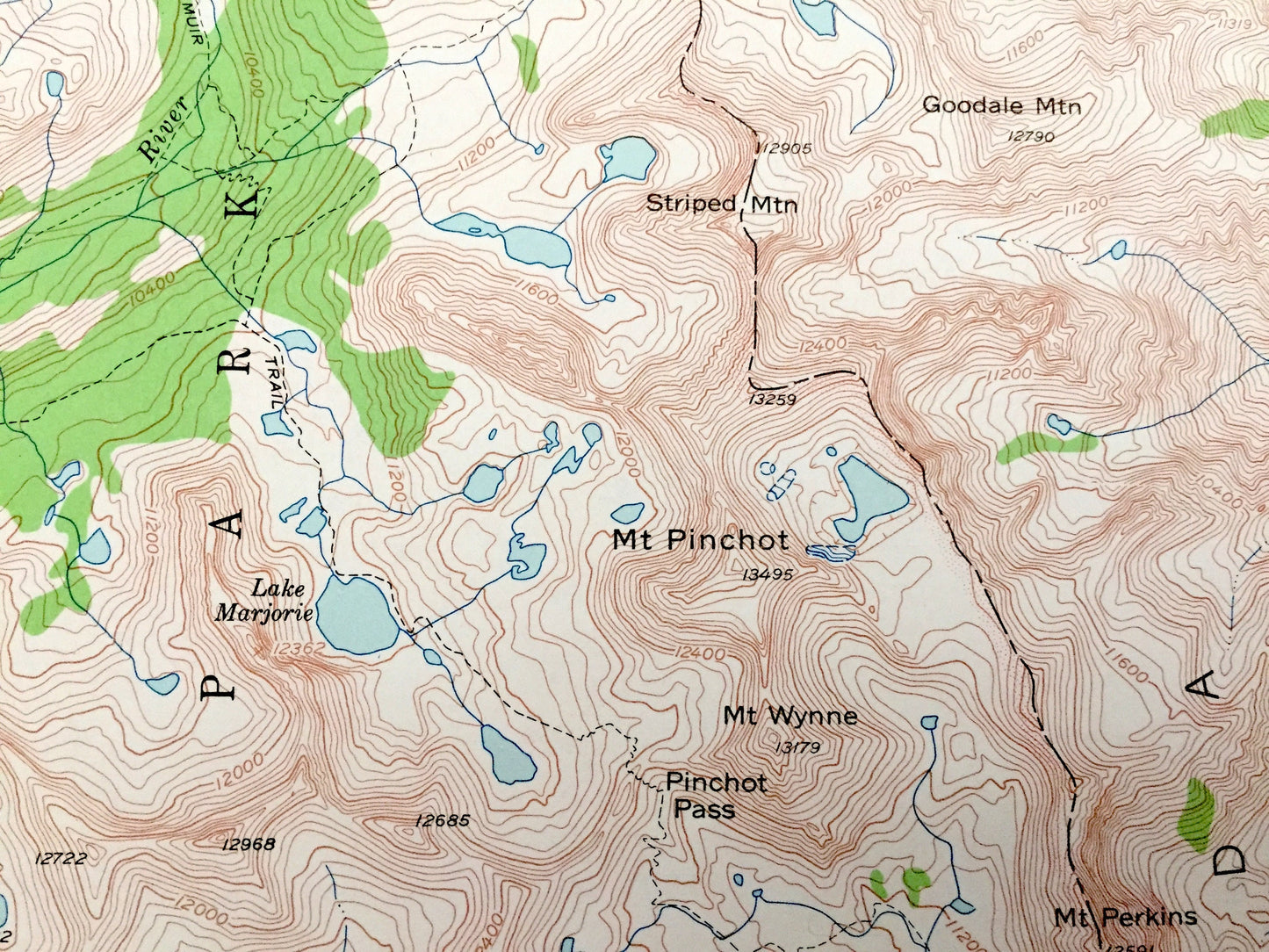
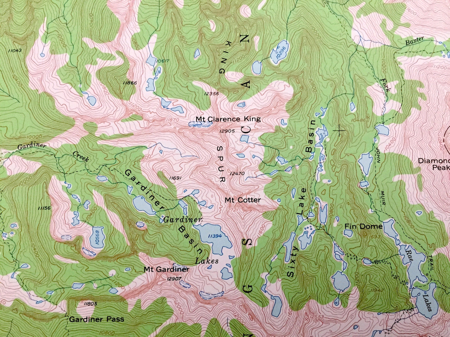
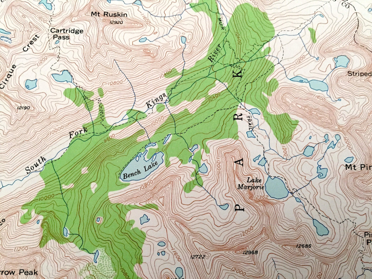
See what California looked like 70 years ago. Lots of intricate details and geological contours. Map even has little squares for every house that existed at the time. The USGS cartographers were very thorough back then!
Perfect for the historian, map-lover, the curious or just as a conversation starter. Wonderful and rare. Vintage maps such as these make great gifts.
Edition of 1953, printed 1964
Dimensions: 17" width x 21" height
----
Features
Points of Interest: Fresno County, Inyo County, Kings Canyon National Park, Sierra Nevada, Inyo National Forest, Mt Pinchot, Sixty Lake Basin, Gardiner Basin, Mt Cotter, King Spur, Rae Lakes, Mt Rixford, The Hogsback, Shingle Mill Bench, Pyramid Peak, Mt Clarence King, Baxter Pass, Seven Pines, Kearsarge Pass, Kearsarge Pinnacles, Glen Pass, Painted Lady, Baxter Lakes , and lots more hills, mountains, canyons, creeks, houses, roads, ranches and camps.
Condition: Very Good Vintage condition, commensurate with age. This map is in great shape for being over 55 years old.
----
We will happily adjust shipping price for multiple purchases. Maps are rolled up and shipped in sturdy mailing tubes, never folded.
Couldn't load pickup availability
Share