My Store
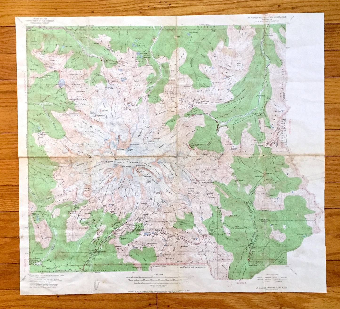
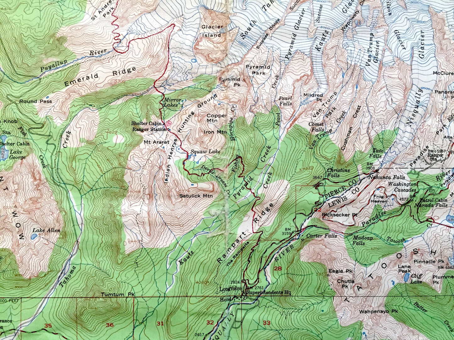
Antique Mt Rainier National Park 1955 US Geological Survey Topographic Map – Pierce County, Cascade Range, Emerald Ridge, Winthrop Mount, WA
Antique Mt Rainier National Park 1955 US Geological Survey Topographic Map – Pierce County, Cascade Range, Emerald Ridge, Winthrop Mount, WA
Beautiful, antique map of Mount Rainier National Park, Washington and surrounding Pierce & Lewis County area. This is an authentic 1955 edition, 1967 print from the U.S. Geological Survey and NOT a computer reproduction.
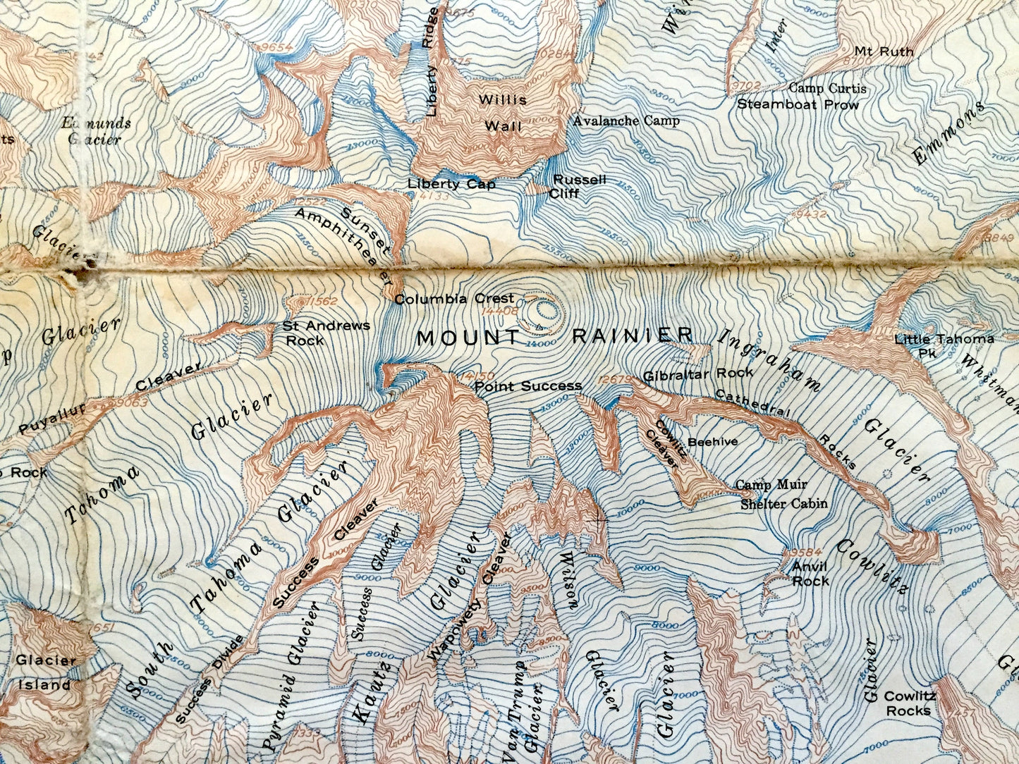
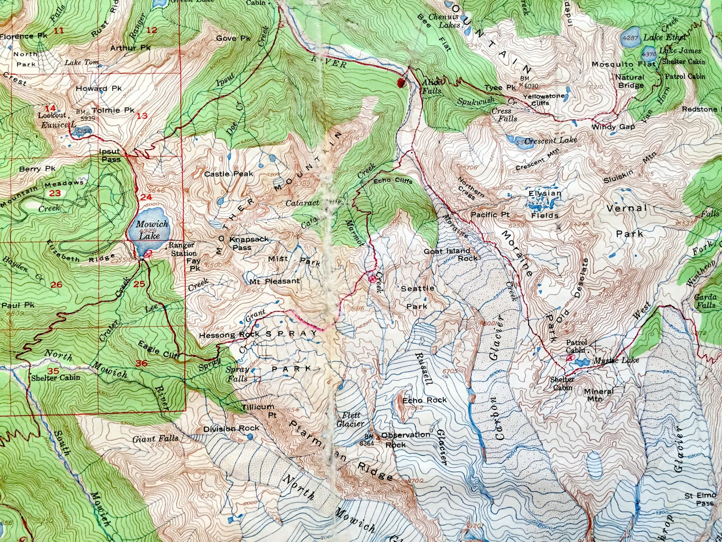
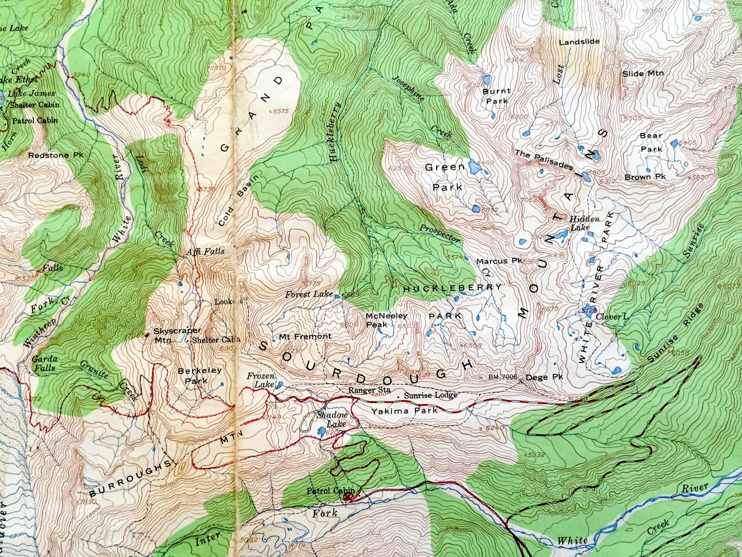
See what Washington looked like over 65 years ago. Lots of intricate details and geological contours. Map even has little squares for every house that existed at the time. The USGS cartographers were very thorough back then! On the back is a detailed description of Mt. Rainier National Park.
Perfect for the historian, map-lover, the curious or just as a conversation starter. Wonderful and rare. Vintage maps such as these make great gifts.
Edition of 1955, printed 1967
Dimensions: approx. 23 1/2" width x 21 1/4" height
----
Features
Cities & Towns: Longmire.
Points of Interest: Mount Rainier, Goat Island Mountain, Grand Park, Emerald Ridge, Winthrop Glacier, Cascade Range, Sunrise Ridge, Ingraham Glacier, Rampart Ridge, Sourdough Mountains, Chenuis Mountain, Cowlitz Divide, Stevens Canyon, Vernal Park, Snoqualmie National Forest, Crystal Mountain, Huckleberry Park, and many more hills, mountains, glaciers, streams, ponds, lakes, houses, ranger stations, trails and roads.
Condition: Good or "Very Vintage" condition, commensurate with age. This map is in great shape for being over 55 years old. Has some real wear, foxing, staining, margin trimming, and small holes at fold lines, as well as folds as issued, but these will flatten easily and all will add to the map's character when framed. Map was most likely used in the field.
----
We will happily adjust shipping price for multiple purchases. Maps are rolled up and shipped in sturdy mailing tubes, never folded.
Couldn't load pickup availability
Share