My Store
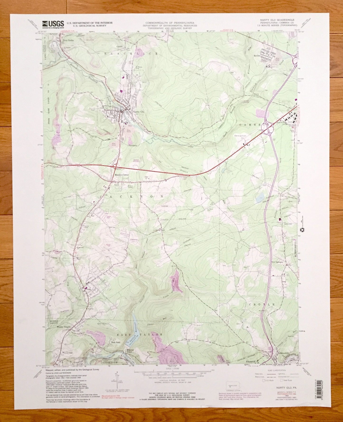
Antique Nanty-Glo, Pennsylvania 1964 US Geological Survey Topographic Map – Cambria County, Mineral Point Revloc Blacklick Jackson Croyle PA
Antique Nanty-Glo, Pennsylvania 1964 US Geological Survey Topographic Map – Cambria County, Mineral Point Revloc Blacklick Jackson Croyle PA
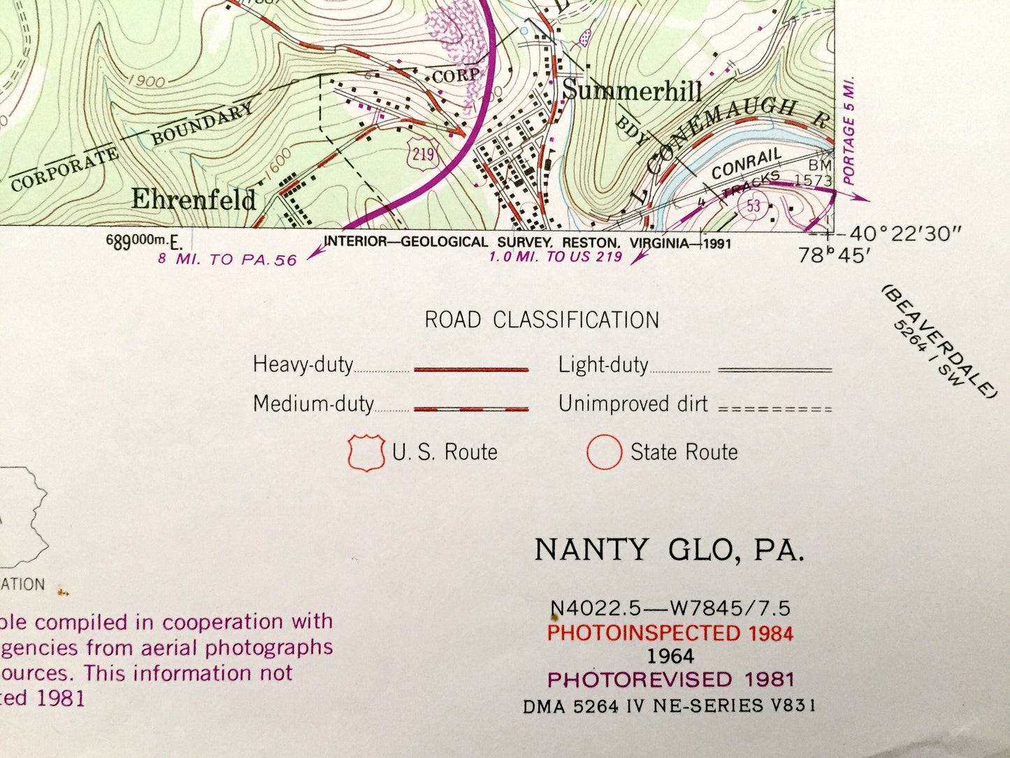
Beautiful, antique map of Nanty-Glo, Pennsylvania and surrounding Cambria County area. This is an authentic 1964 edition, 1984 print from the U.S. Geological Survey and NOT a computer reproduction.
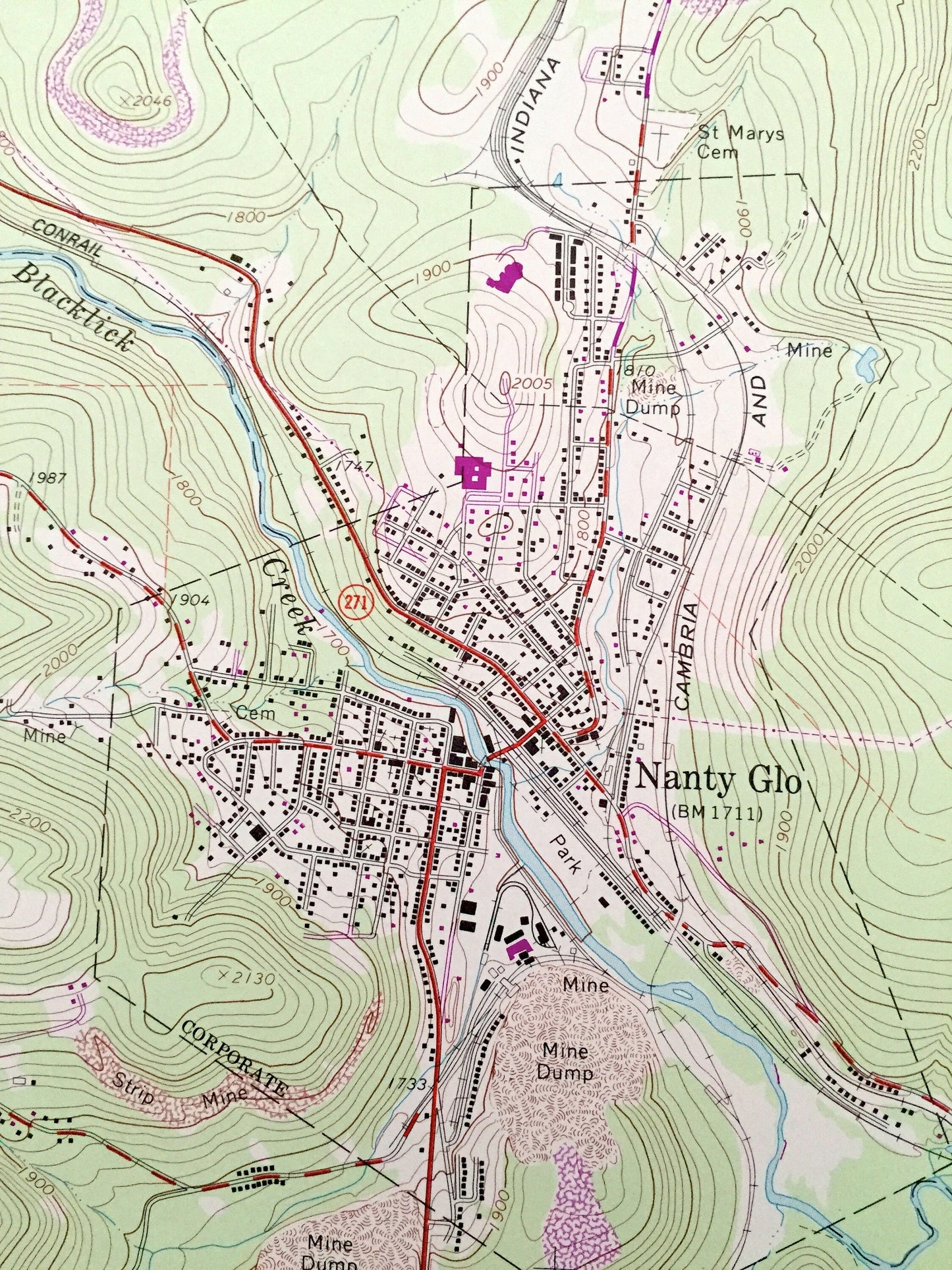
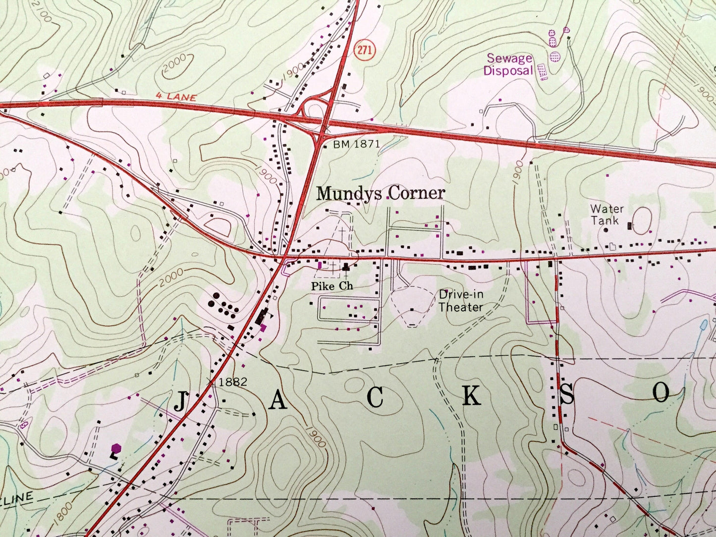
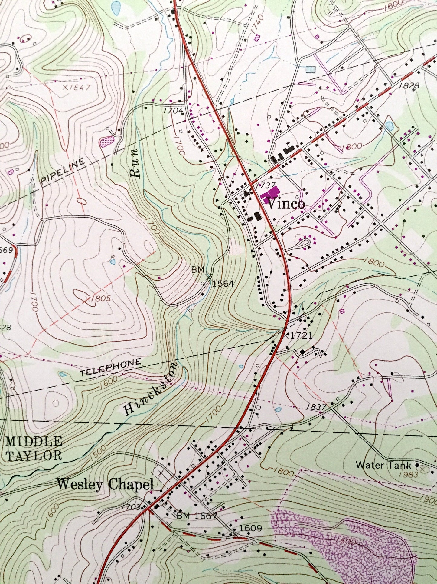
See what Pennsylvania looked like over 50 years ago. Lots of intricate details and geological contours. Map even has little squares for every house that existed at the time. The USGS cartographers were very thorough back then!
Perfect for the historian, map-lover, the curious or just as a conversation starter. Wonderful and rare. Vintage maps such as these make great gifts.
Edition of 1964, printed 1984
Dimensions: 22" width x 27" height
----
Features
Cities & Towns: Nanty-Glo, Cardiff, Twin Rocks, Revloc, Beula, Mundys Corner, Wesley Chapel, Echo, West Point, Mineral Point, Ehrenfeld, Summerhill, New Germany, Blacklick, Cambria, Jackson, Middle Taylor, East Taylor, Croyle, Conemaugh.
Points of Interest: State Game Lands, Little Conemaugh River, Saltlick Reservoir, Conrail, Allegheny Portage Railroad National Historic Site, Ebensburg Airport, Cambria and Indiana Railroad, Blacklick Creek, and many more hills, streams, ponds, houses, schools, churches and roads.
Condition: Very Good condition, commensurate with age. This map is in incredible shape for being over 30 years old. This map was most likely used in the field. Has light-edge wear, but this will read as vintage character when framed.
----
We will happily adjust shipping price for multiple purchases. Maps are rolled up and shipped in sturdy mailing tubes, never folded.
Couldn't load pickup availability
Share