My Store
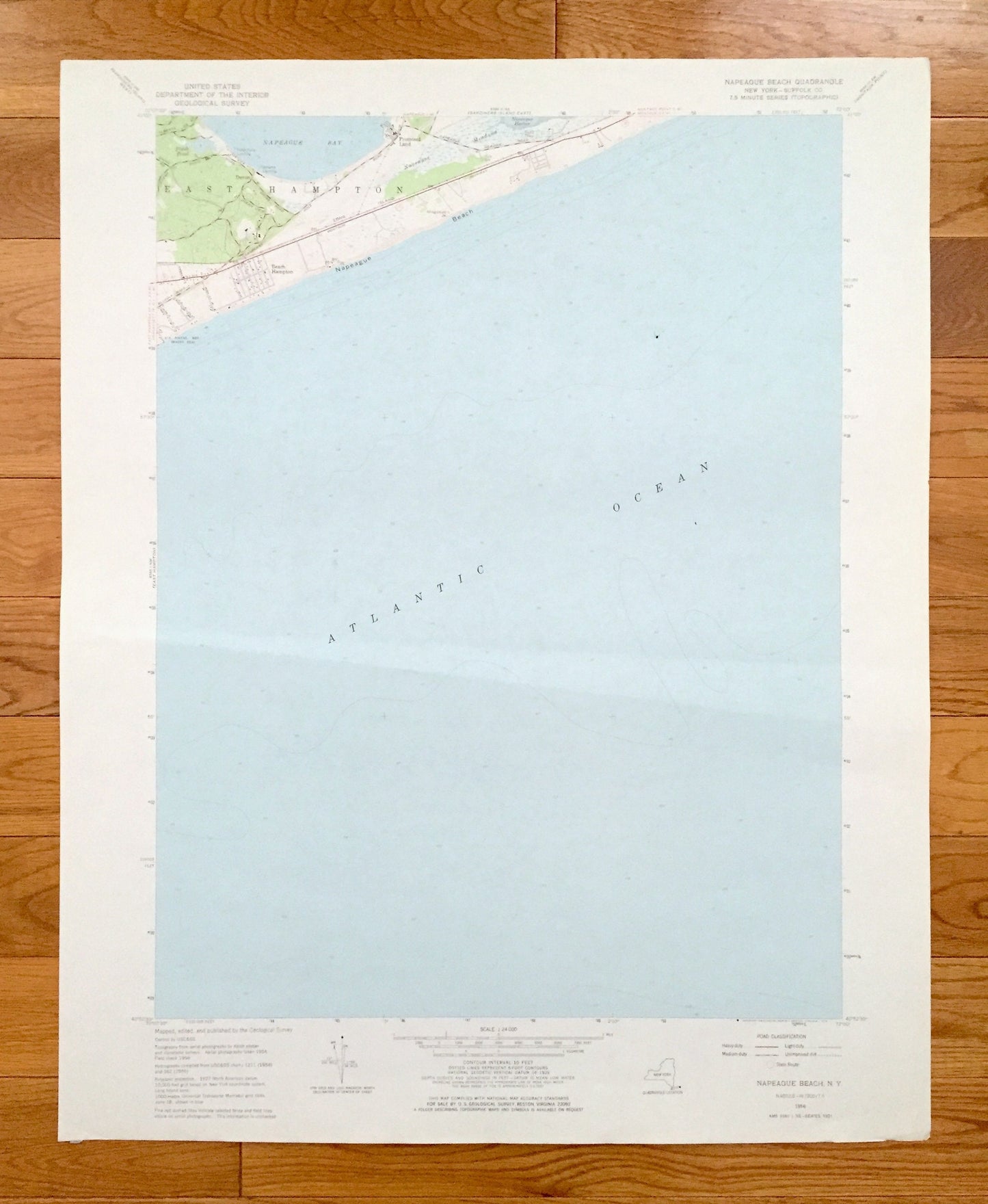
Antique Napeague Beach, New York 1956 US Geological Survey Topographic Map – Suffolk County, East, Promised Land, Hampton, Long Island, NY
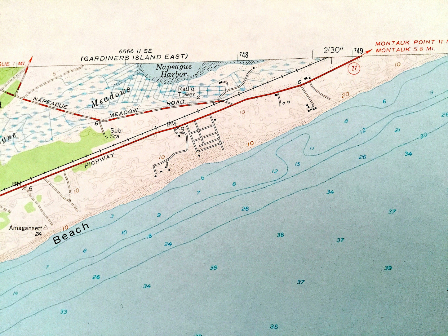
Antique Napeague Beach, New York 1956 US Geological Survey Topographic Map – Suffolk County, East, Promised Land, Hampton, Long Island, NY
Beautiful, antique map of Napeague, New York and surrounding Suffolk County areas. This is an authentic 1956 edition, 1976 print from the U.S. Geological Survey and NOT a computer reproduction.
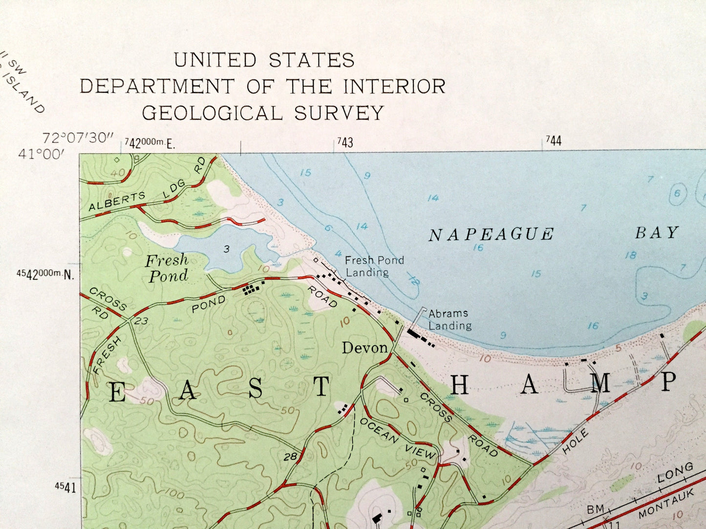
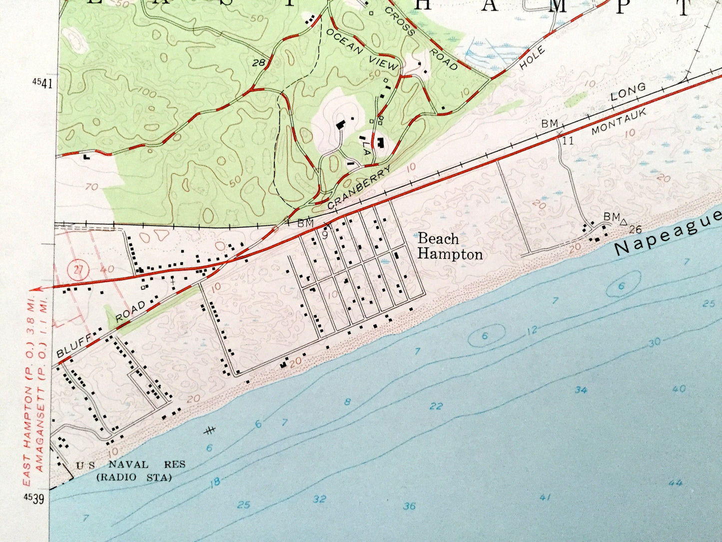
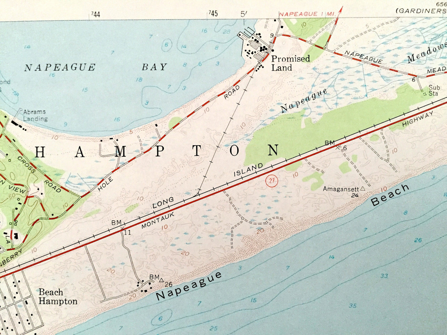
See what New York looked like over 60 years ago. Lots of intricate details and geological contours. Map even has little squares for every house that existed at the time. The USGS cartographers were very thorough back then!
Perfect for the historian, map-lover, the curious or just as a conversation starter. Wonderful and rare. Vintage maps such as this make great gifts.
Edition of 1956, printed 1976
Dimensions: 22" width x 27" height
----
Features
Cities & Towns: East Hampton, Devon, Promised Land, Beach Hampton, Gardiners Island East, Amagansett.
Points of Interest: Atlantic Ocean, U.S. Naval Reservation, Napeague Bay, Napeague Harbor, Fresh Pond, Napeague Meadows, Abrams Landing, Fresh Pond Landing, and many more hills, streams, ponds, houses, schools, railroads, churches, roads, inlets, and beaches.
Condition: Very Good Vintage condition, commensurate with age. This map is in great shape for being over 40 years old. Has light edge-wear and a couple folds in the center, all of which will add character when framed.
----
We will happily adjust shipping price for multiple purchases. Maps are rolled up and shipped in sturdy mailing tubes, never folded.
Couldn't load pickup availability
Share