My Store
Antique Nassau County, New York 1941 Historical Atlas Map – Oyster Bay, Hempstead, Mineola, Freeport, Farmingdale, Long Beach, Rockaway, NY
Antique Nassau County, New York 1941 Historical Atlas Map – Oyster Bay, Hempstead, Mineola, Freeport, Farmingdale, Long Beach, Rockaway, NY
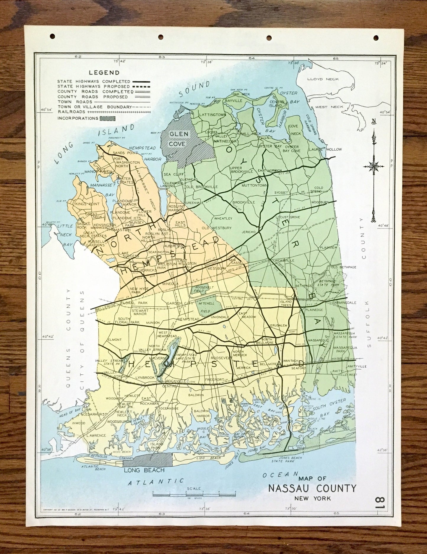
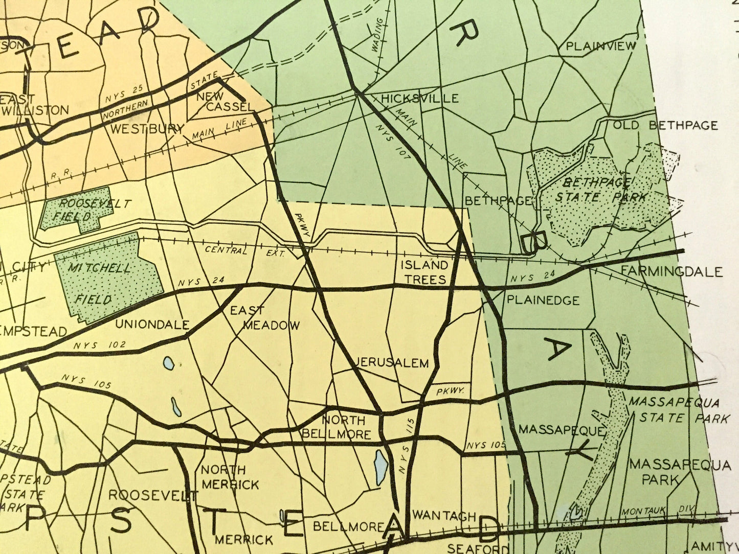
Beautiful, antique map of Nassau County, New York, including Oyster Bay, Hempstead, Mineola, Freeport, Farmingdale, Long Beach & East Rockaway. This is an authentic map taken from the rare "Historical Atlas of New York State" by William P. Munger, published by Frank E. Richards Co. in 1941, and is NOT a computer reproduction.
See what Nassua County looked like more than 80 years ago. Lots of charming details and contours, major cities, towns and roads, as well as geographical points of interest. It is a large, colorful print and will be a showpiece wherever it is presented. Reverse side has an informative history of the county.
Perfect for the historian, map-lover, the curious or just as a conversation starter. Wonderful and rare. Vintage maps such as these make great gifts.
Edition of 1941, printed 1941
Dimensions: 16 1/2" width x 22" height
----
Features
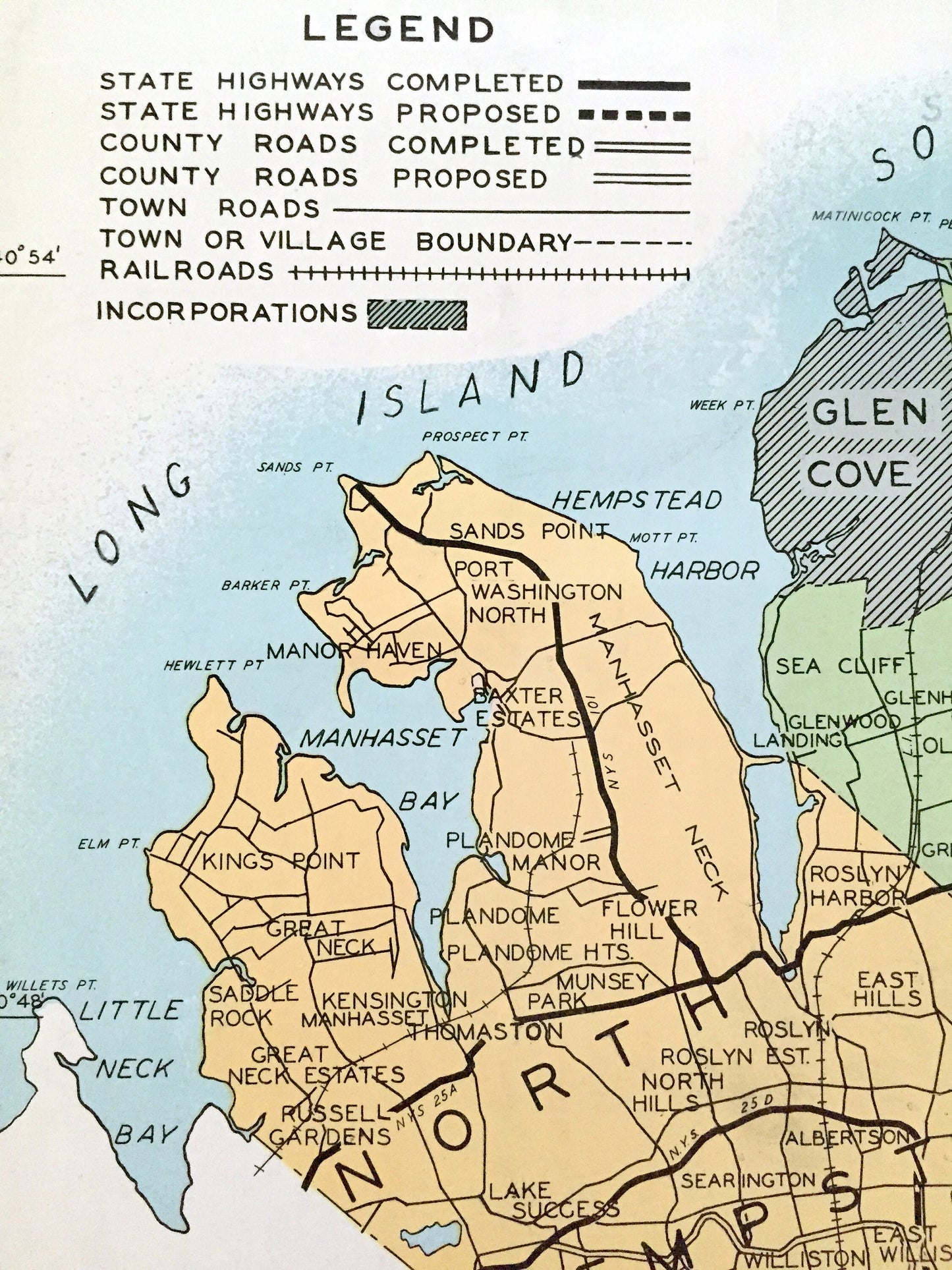
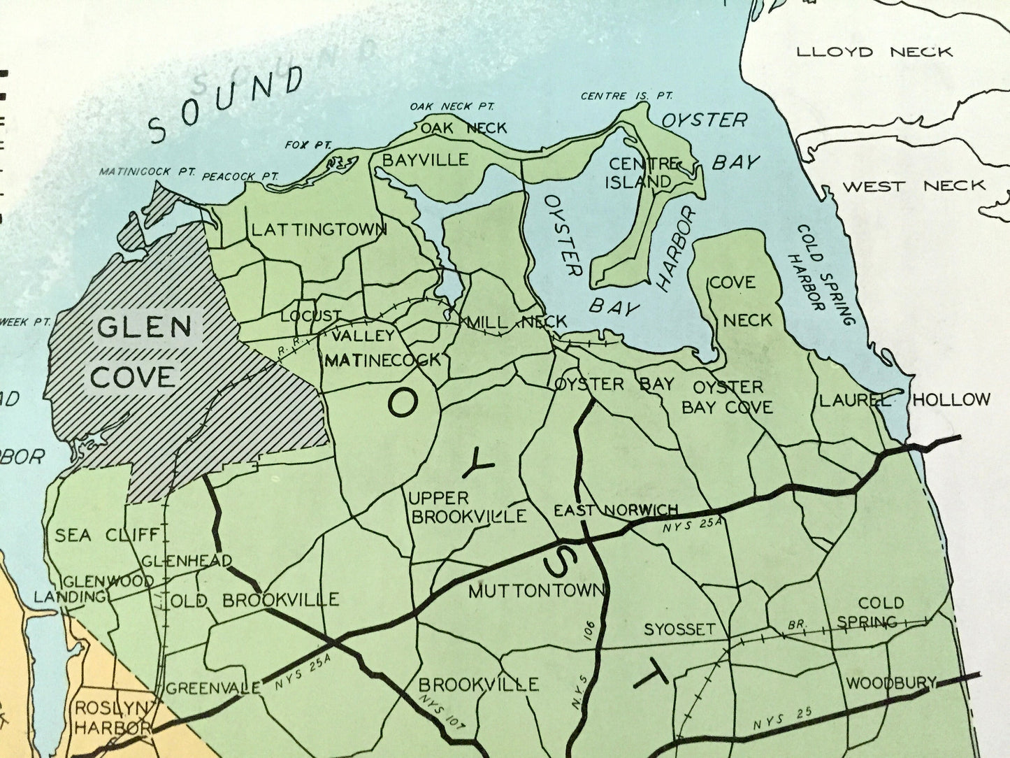
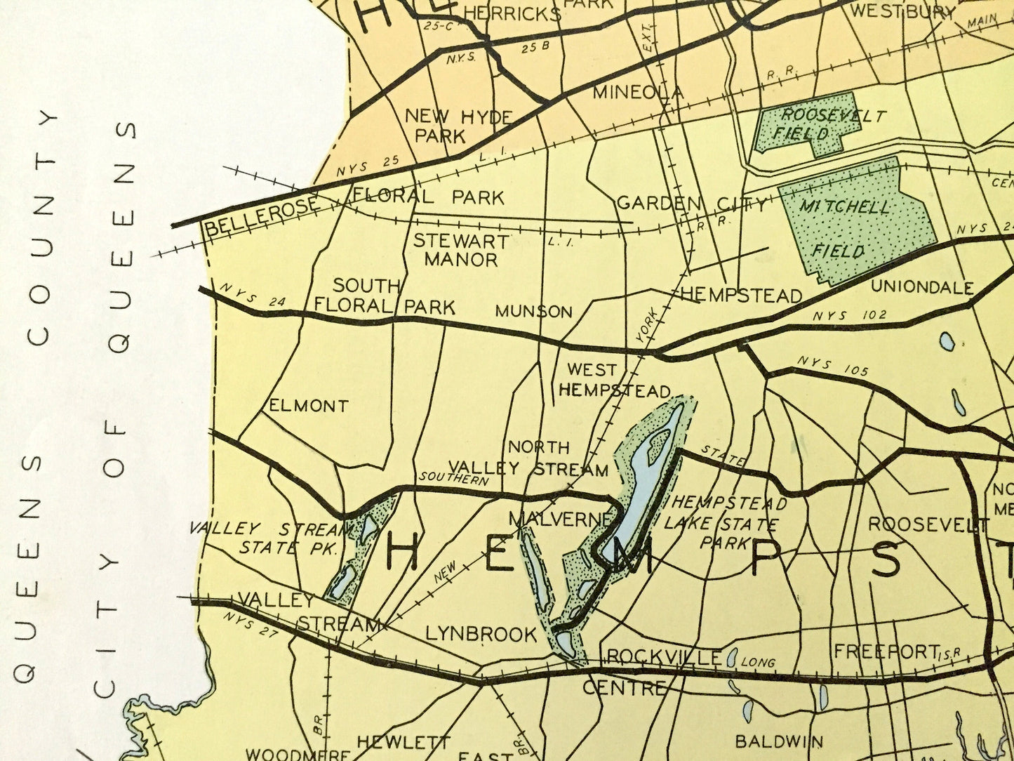
Cities & Towns: North, Hempstead, Oyster Bay, Hempstead, Port Washington, Great Neck, Thomaston, Manhasset Hill, Manhasset, Flower Hill, North Rosyln, Rosyln, Old Westbury, Searingston, Plattsdale, Garden City Park, Mineola, Westbury, Glen Cove Landing, Sea Cliff, Glenwood Landing, Dosoris, Lattingtown, Bayvill, Pine Island Park, Centre Island, Brookville, Wheatley, East Norwich, Cold Spring, Woodbury, Locust Grove, Jericho, Plainview, West Central Park, Central Park, Bethpage, Farmingdale, Garden City, New Hyde Park, West Garden City, Elmont, Franklin Square, Munson, Garden City, Fosters Meadows, Valley Stream, Lynbrook, Rockville Center, East Rockaway, Hewlett, Woodmere, Inwood, Lawrence, Far Rockaway, Oceanside, Christian Hook, Freeport, Merrick, Greenfield, Roosevelt, Manor Grove, Bellmore, Wantagh, Massapequa, Seaford, more.
Points of Interest: Long Island, Long Island Sound, Atlantic Ocean, Little Neck Bay, Manhasset Bay, Hempstead Harbor, Oyster Bay Harbor, Cold Spring Harbor, Bay of Rockaway, Far Rockaway Beach, Hicks Beach, Broad Channel, Long Beach, Middle Bay, Jones Inlet, Short Beach, Jones Beach, South Oyster Bay, New York & Long Island Railroad and many more ponds, lakes, creeks, rivers, roads, highways, railroads, farms, school houses and elevations.
----
Condition: Good Vintage condition, commensurate with age. This map is in great shape for being over 80 years old. Has light edge-wear, toning, and holes in margin where the print was removed from atlas, but this will all add to vintage character when framed.
(Images of atlas cover and frontispiece for information only and not included.)
----
We will happily adjust shipping price for multiple purchases. Maps are rolled up and shipped in sturdy mailing tubes, never folded.
Couldn't load pickup availability
Share