My Store
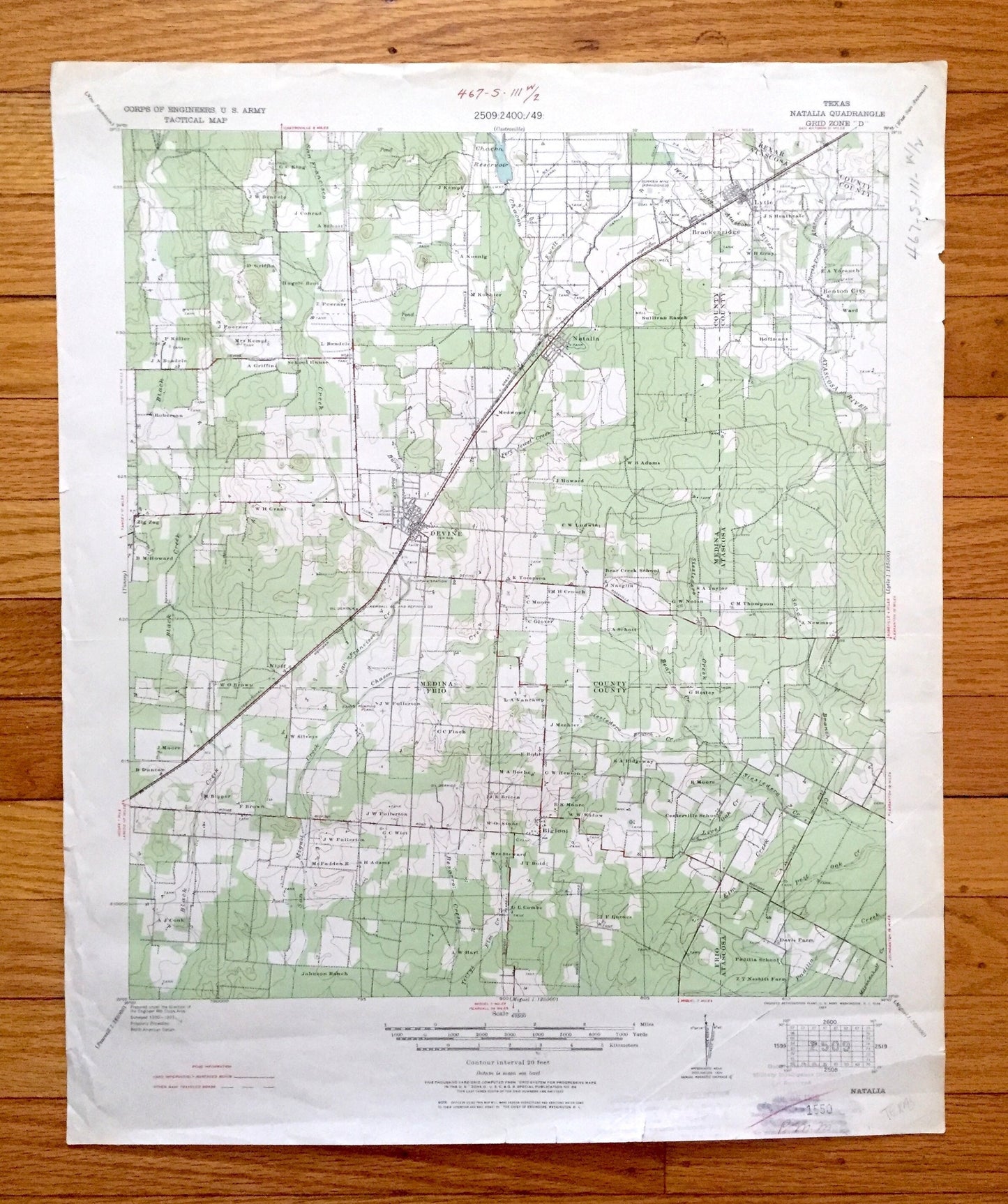
Antique Natalia, Texas 1929 US Geological Survey Topographic Map – Medina, Frio, Bexar, Atascosa County, Lytle, Devine, Bigfoot, Moore, TX
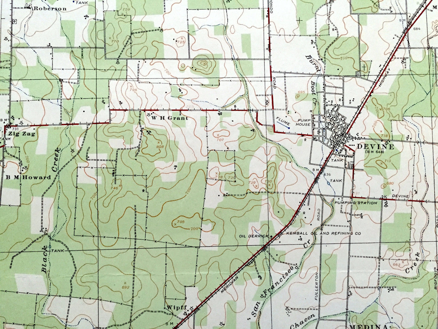
Antique Natalia, Texas 1929 US Geological Survey Topographic Map – Medina, Frio, Bexar, Atascosa County, Lytle, Devine, Bigfoot, Moore, TX
Beautiful, antique map of Natalia, Texas and surrounding Medina, Frio, Atascosa & Bexar County area. This is an authentic 1929 print from the U.S. Army Corps of Engineers and is NOT a computer reproduction.
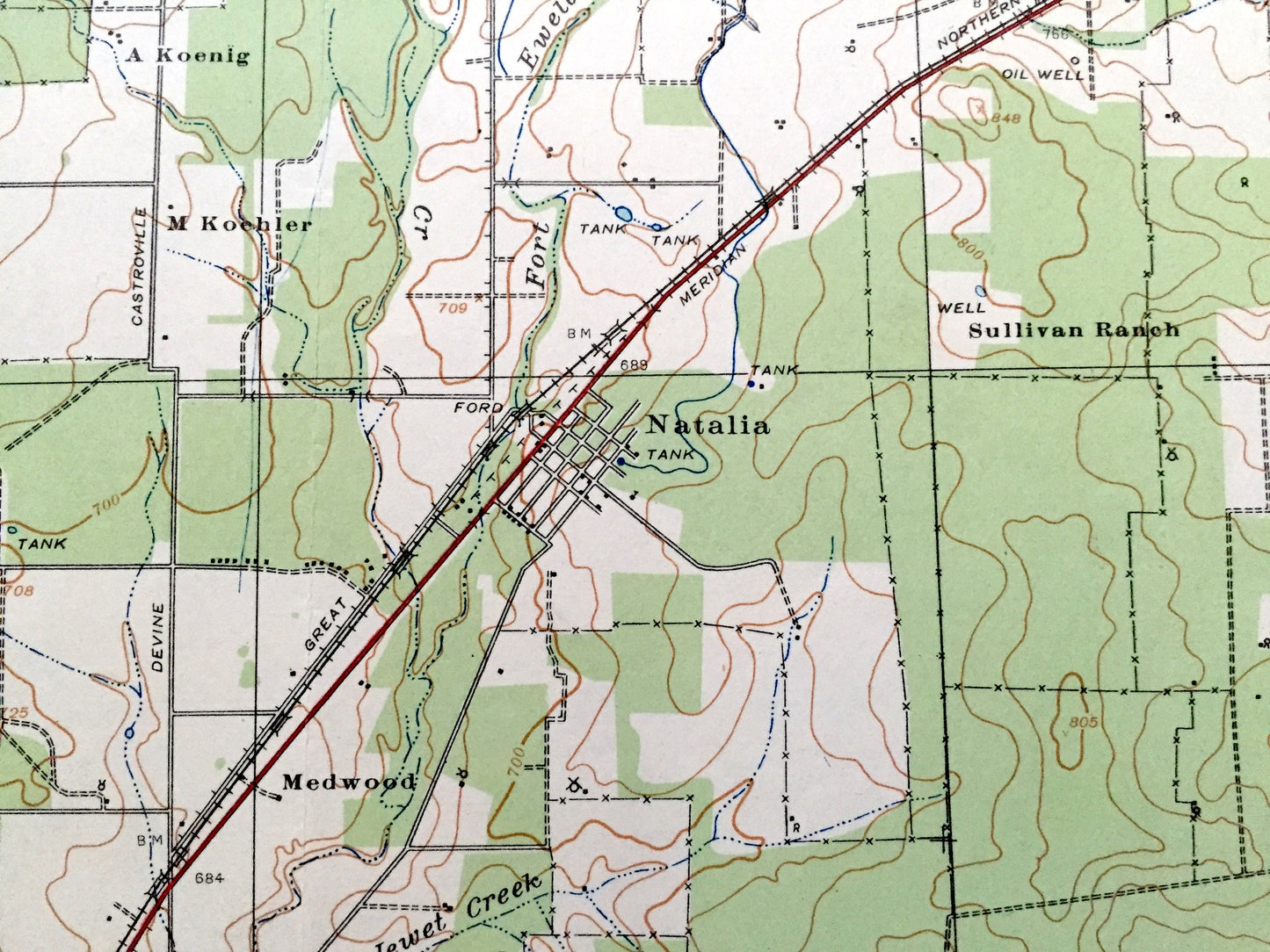
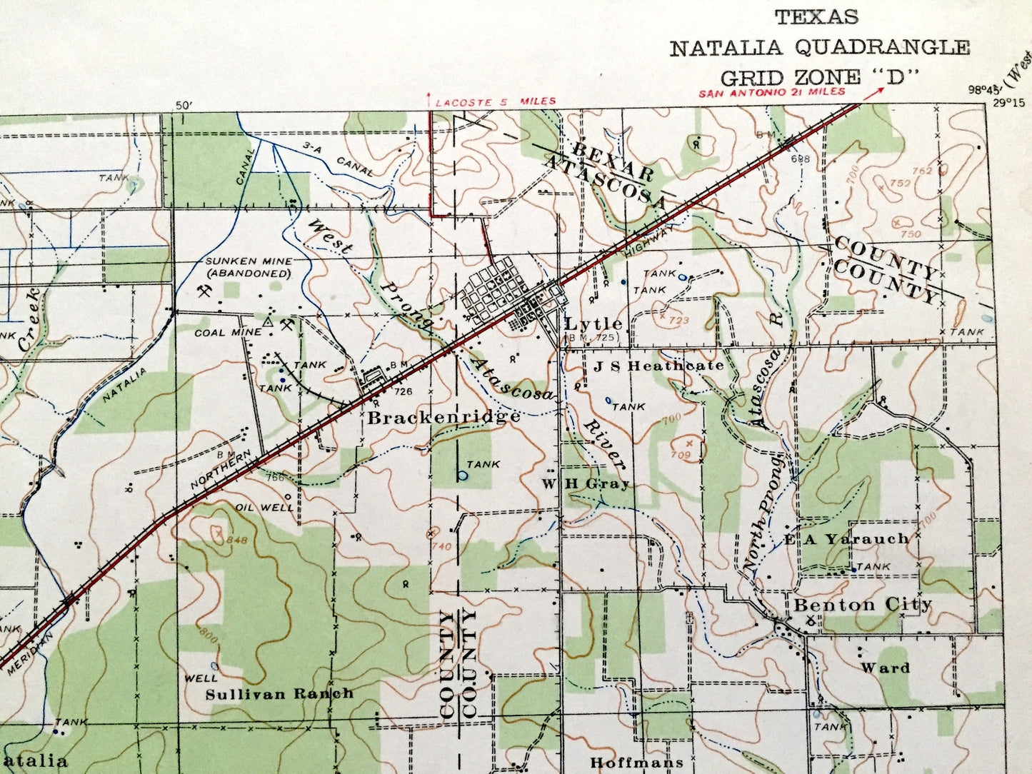
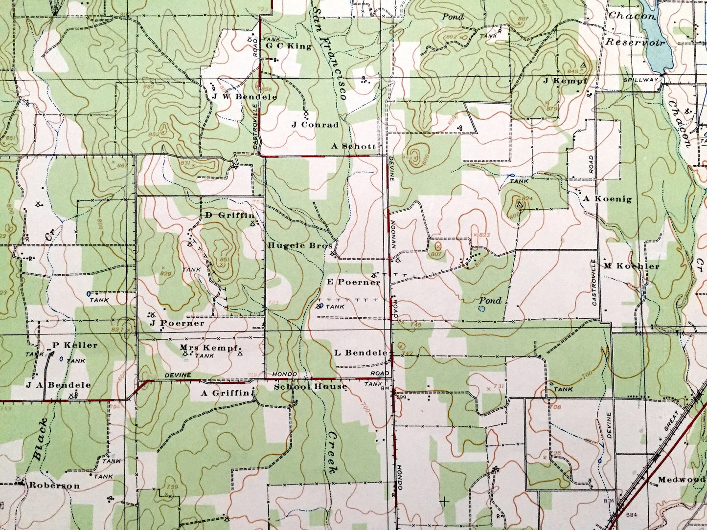
See what Texas looked like over 90 years ago. Lots of intricate details and geological contours. Map even has little squares for every house that existed at the time, as well as the names of many property and ranch owners of the time. The USGS cartographers were very thorough back then!
Perfect for the historian, map-lover, the curious or just as a conversation starter. Wonderful and rare. Vintage maps such as this make great gifts.
Edition of 1929, printed 1929
Dimensions: 17 3/4" width x 21 1/2" height
----
Features
Cities & Towns: Natalia, Lytle, Devine, Bigfoot, Moore, Zig Zag, Brackenridge, Benton City.
Points of Interest: Medina County, Frio County, Atascosa County, Bexar County, Atascosa River, Chacon Reservoir, Siestedero Creek, Sand Creek, San Miguel Creek, Ewell Creek, Black Creek, and many more roads, creeks, churches and houses.
Condition: Good Vintage condition, commensurate with age. This map is in great shape for being over 90 years old. Has some real edge-wear, toning, writing in margin and ex-libris stamps in margin, but this will all add to character when framed.
----
We will happily adjust shipping price for multiple purchases. Maps are rolled up and shipped in sturdy mailing tubes, never folded.
Couldn't load pickup availability
Share