My Store
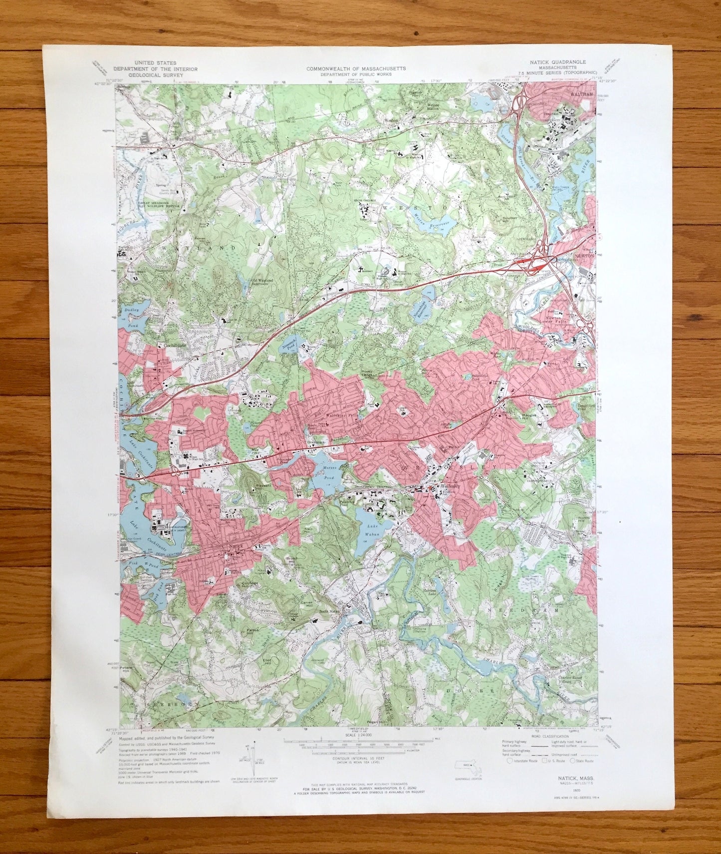
Antique Natick, Massachusetts 1970 US Geological Survey Topographic Map – Wellesley, Wayland, Weston, Waltham Needham Cochituate Sherburn MA
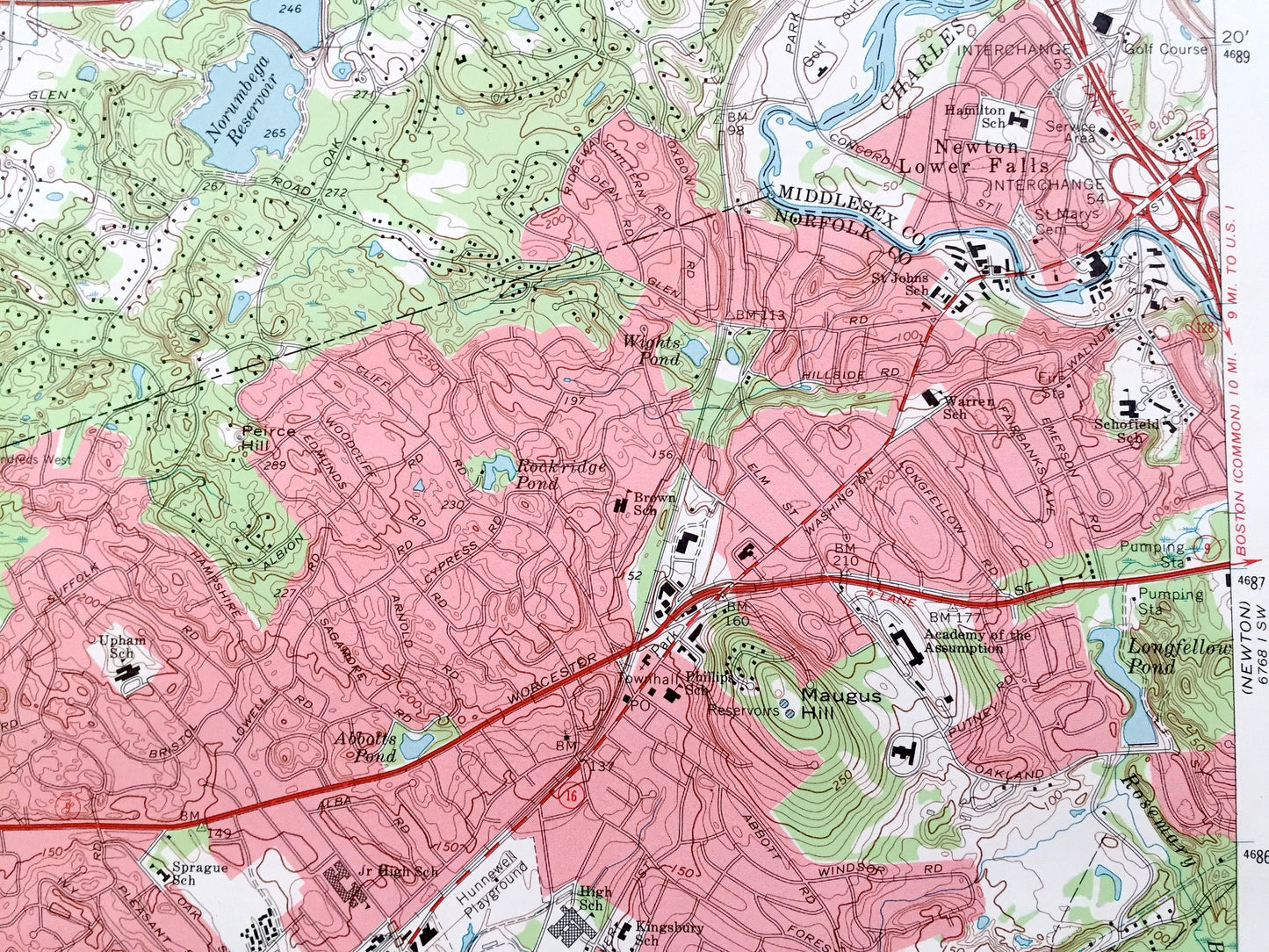
Antique Natick, Massachusetts 1970 US Geological Survey Topographic Map – Wellesley, Wayland, Weston, Waltham Needham Cochituate Sherburn MA
Beautiful, antique map of Natick, Massachusetts and surrounding Merrimack County & Norfolk County area. This is an authentic 1970 edition, 1972 print from the U.S. Geological Survey and NOT a computer reproduction.
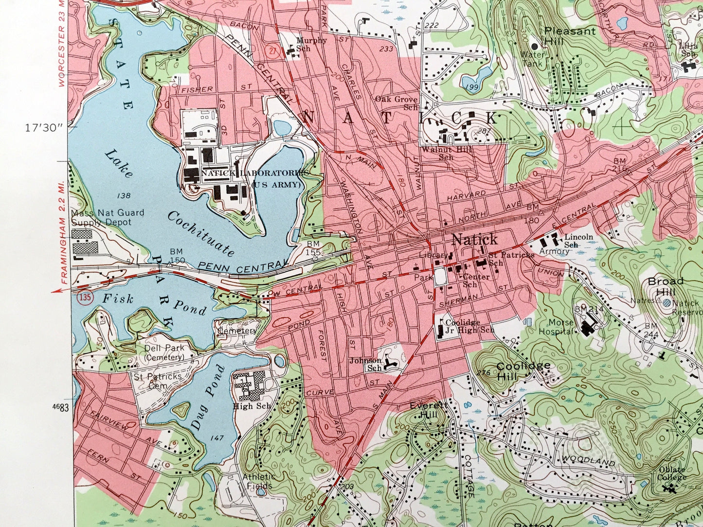
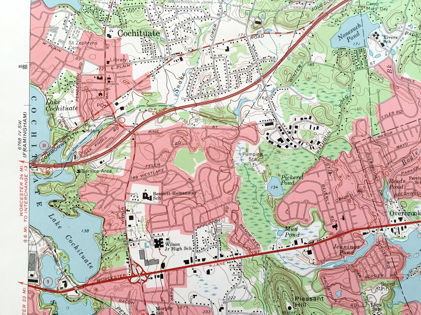
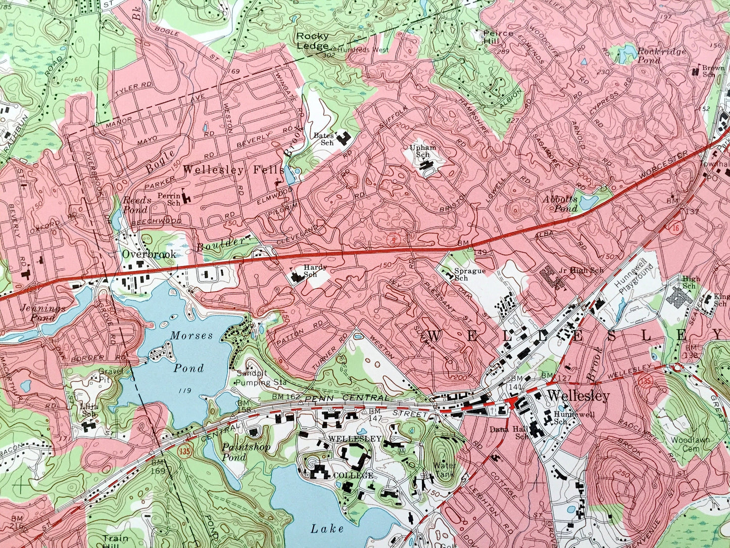
See what Massachusetts looked like over 50 years ago. Lots of intricate details and geological contours. Map even has little squares for every house that existed at the time. The USGS cartographers were very thorough back then!
Perfect for the historian, map-lover, the curious or just as a conversation starter. Wonderful and rare. Vintage maps such as these make great gifts.
Edition of 1970, printed 1972
Dimensions: 22" width x 27" height
----
Features
Cities & Towns: Wayland, Weston, Waltham, Cochituate, Wellesley, Wellesley Fells, East Natick, North Natick, Natick, South Natick, Needham, Sherburn.
Points of Interest: Boston and Main Railroad, Weston Station, Norumbega Park, Riverside Golf Course, Wellesley Country Club, Babson Institute (now Babson College), Sprague School, Hardy School, Walnut Hill School, Charles River, Lake Conchituate, Lake Forest Park, North Natick Pool, Dudley Pond, Lake Waban, Wellesley College, and many more roads, schools, houses, reservoirs, ponds, and hills.
Condition: Very Good Vintage condition, commensurate with age. This map is in great shape for being over 50 years old. Has light wear but this will add to vintage character when framed.
----
We will happily adjust shipping price for multiple purchases. Maps are rolled up and shipped in sturdy mailing tubes, never folded.
Couldn't load pickup availability
Share