My Store
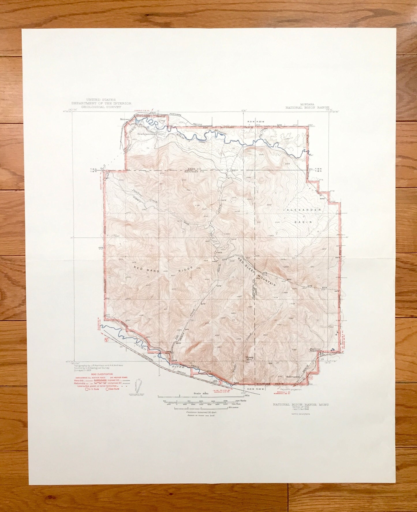
Antique National Bison Range, Montana 1932 US Geological Survey Topographic Map – Lake, Sanders County, Jocko River, Wildlife Refuge, NBR MT
Antique National Bison Range, Montana 1932 US Geological Survey Topographic Map – Lake, Sanders County, Jocko River, Wildlife Refuge, NBR MT
Beautiful, antique map of National Bison Range, Montana of Lake & Sanders County. This is an authentic 1932 edition, 1949 print from the U.S. Geological Survey and NOT a computer reproduction. The USGS printed only a few of these maps of special locations.
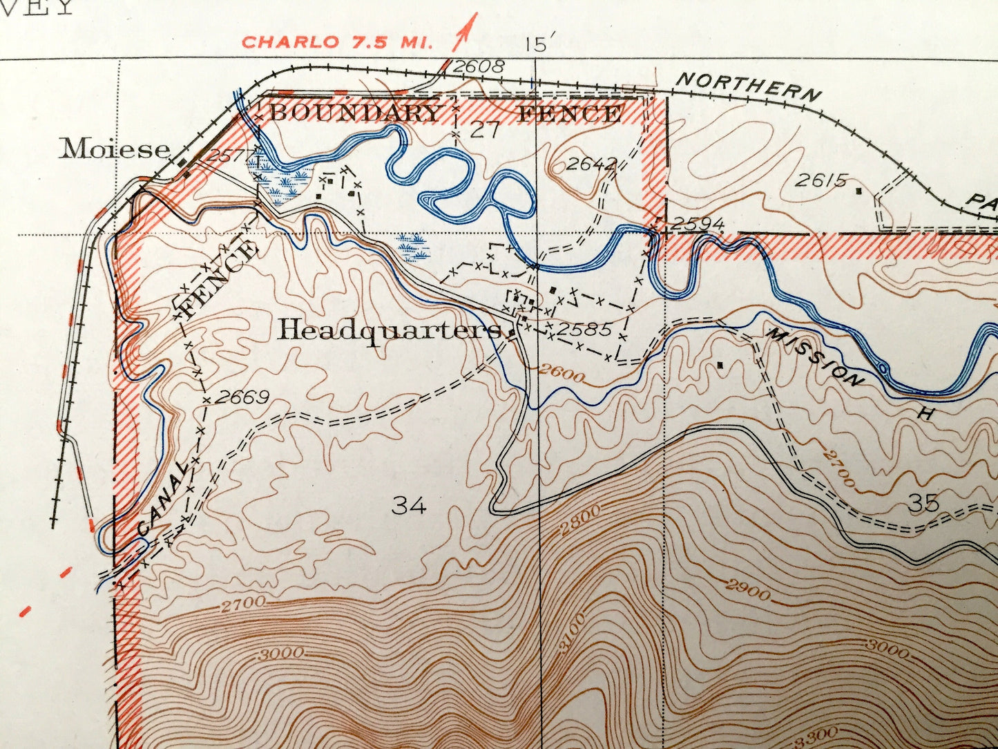
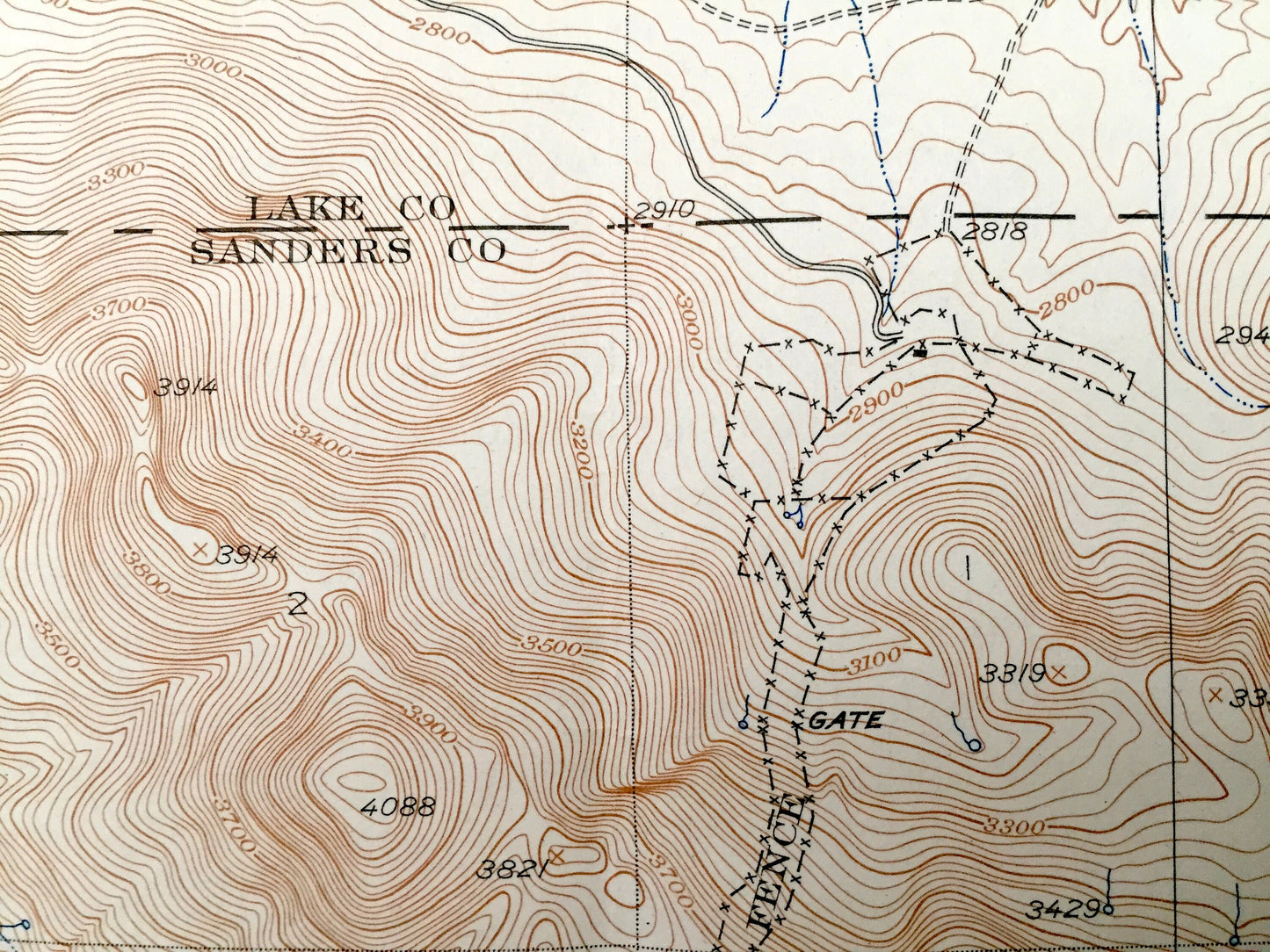
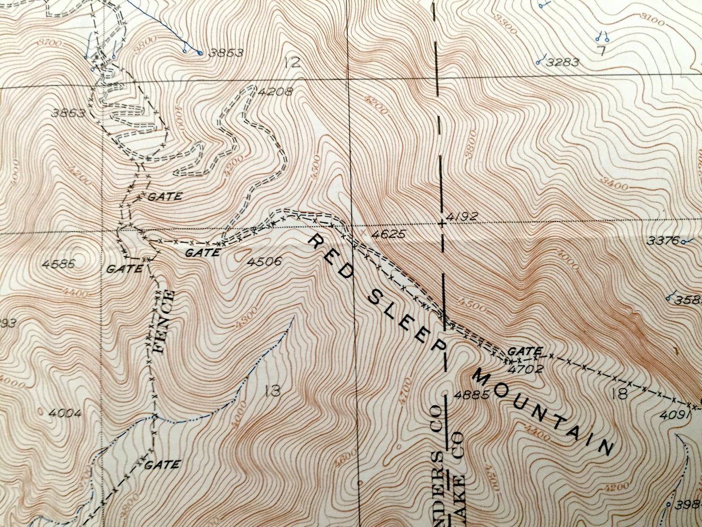
See what Montana looked like over 85 years ago. Lots of intricate details and geological contours. Map even has little squares for every house that existed at the time. The USGS cartographers were very thorough back then! On the back is a description of topographic symbols and map guide.
Perfect for the historian, map-lover, the curious or just as a conversation starter. Wonderful and rare. Vintage maps such as these make great gifts.
Edition of 1932, printed 1949
Dimensions: 17" width x 21" height
----
Features
Cities & Towns: Moiese.
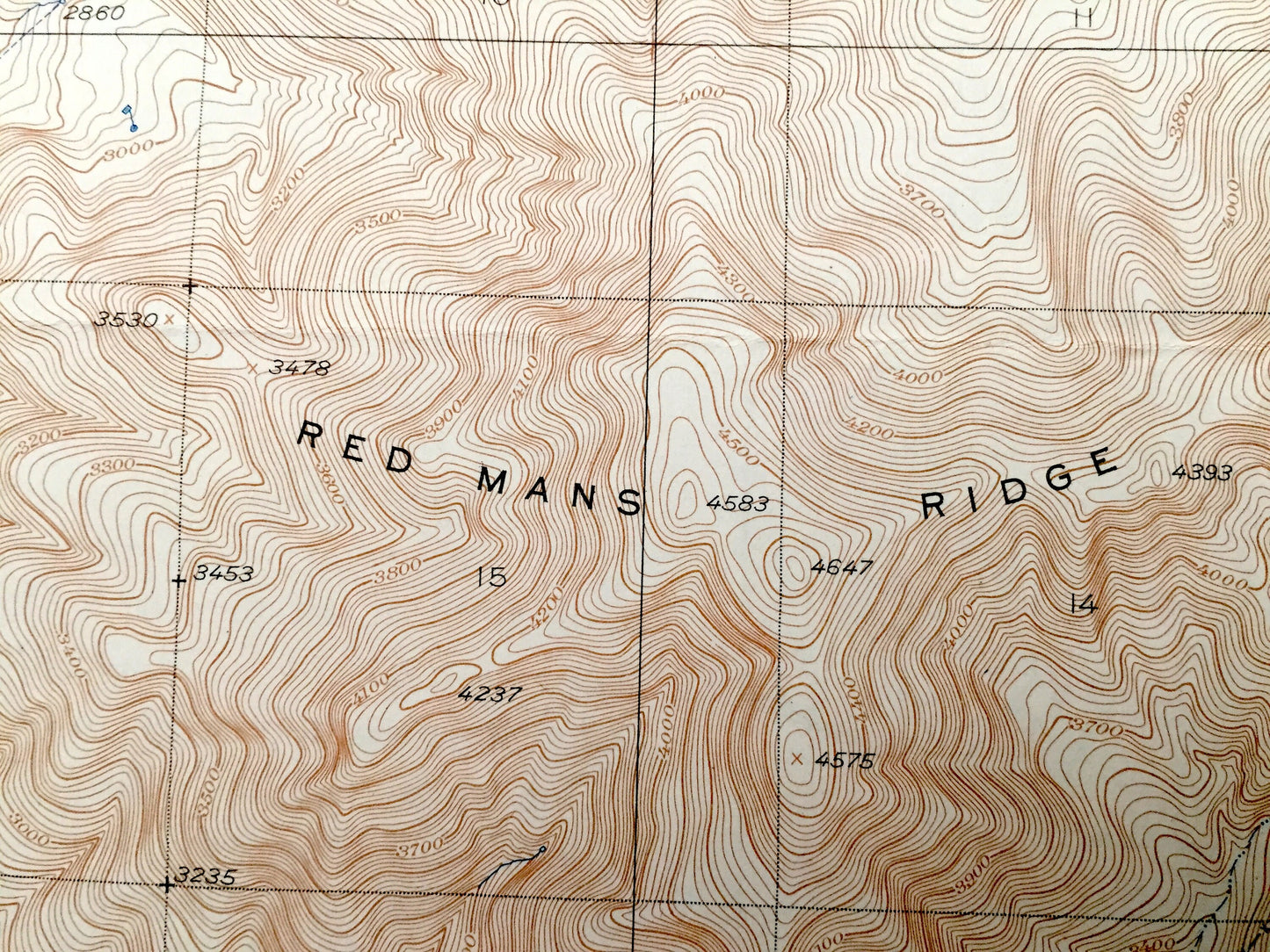
Points of Interest: National Bison Range, Lake County, Sanders County, Mission Creek, Jocko River, Alexander Basin, Red Mans Ridge, Red Sleep Mountain, Sheep Mountain, Pauline Creek, Park Headquarters, Elk Creek, Highway Reservoir, and lots more creeks, mountains, ranges, ranger stations, lakes, glaciers, houses and roads.
Condition: Very Good Vintage condition, commensurate with age. This map is in great shape for being over 70 years old. Has light edge-wear and folds as-issued, but these will flatten easily and all will read as vintage character when framed.
----
We will happily adjust shipping price for multiple purchases. Maps are rolled up and shipped in sturdy mailing tubes, never folded.
Couldn't load pickup availability
Share