My Store
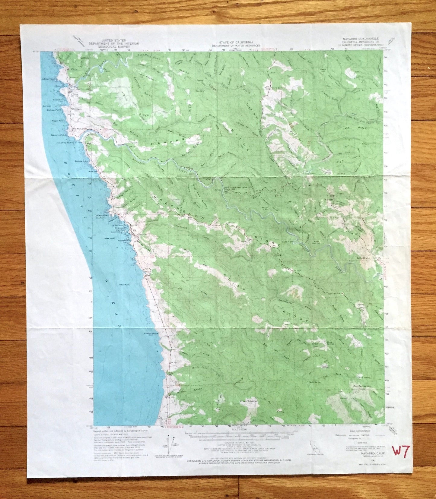
Antique Navarro, California 1961 US Geological Survey Topographic Map – Mendocino County, Albion, Whitesboro, Elk, Coast, Redwood Forest, CA
Antique Navarro, California 1961 US Geological Survey Topographic Map – Mendocino County, Albion, Whitesboro, Elk, Coast, Redwood Forest, CA
Beautiful, antique map of Navarro, California and surrounding Mendocino County area. This is an authentic 1961 edition, 1967 print from the U.S. Geological Survey and NOT a computer reproduction.
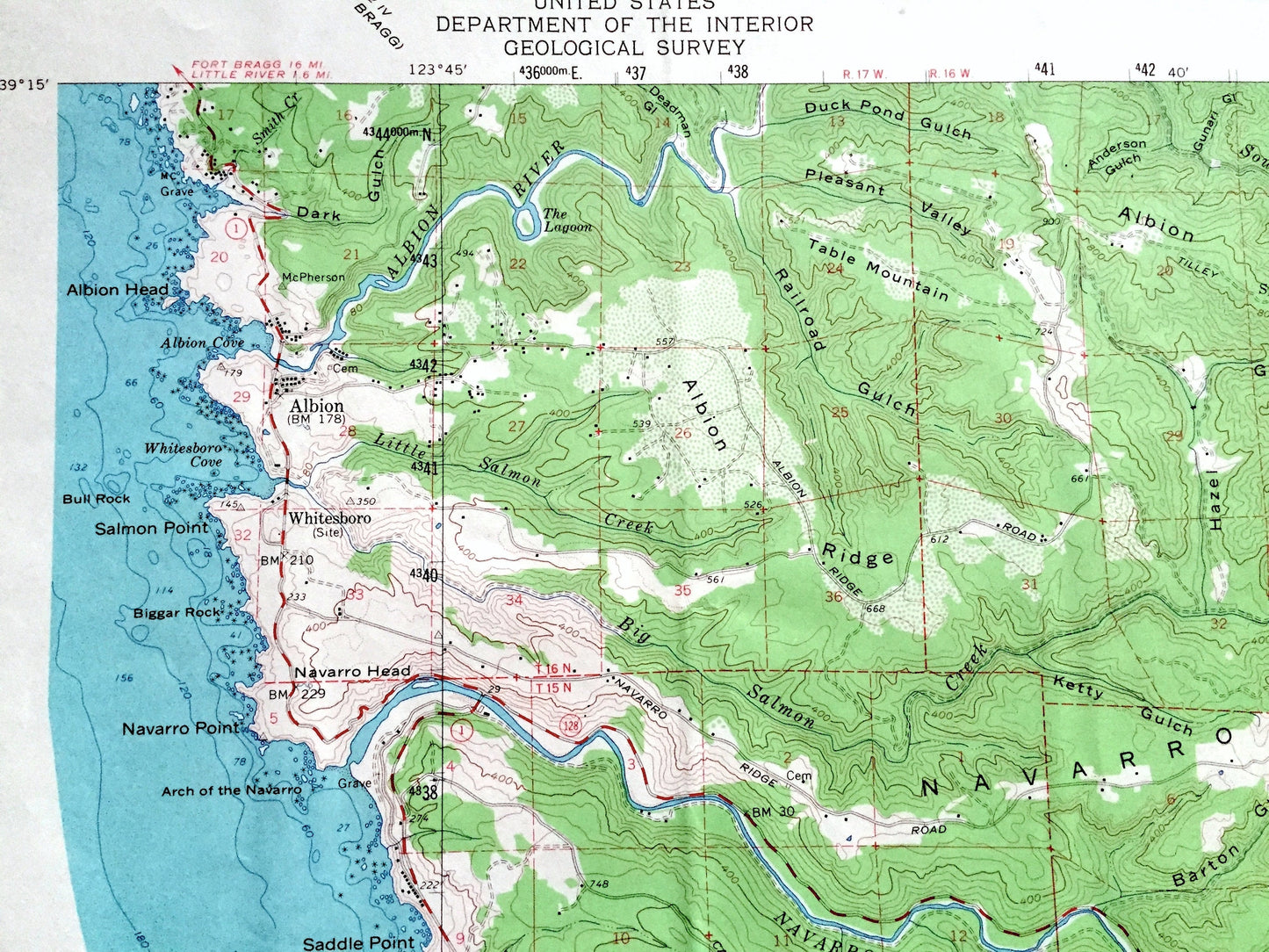
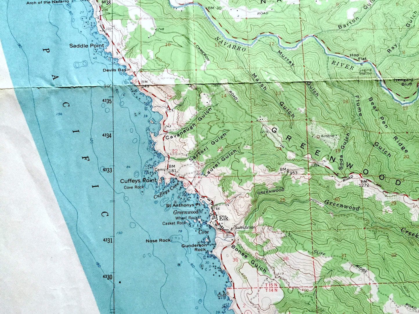
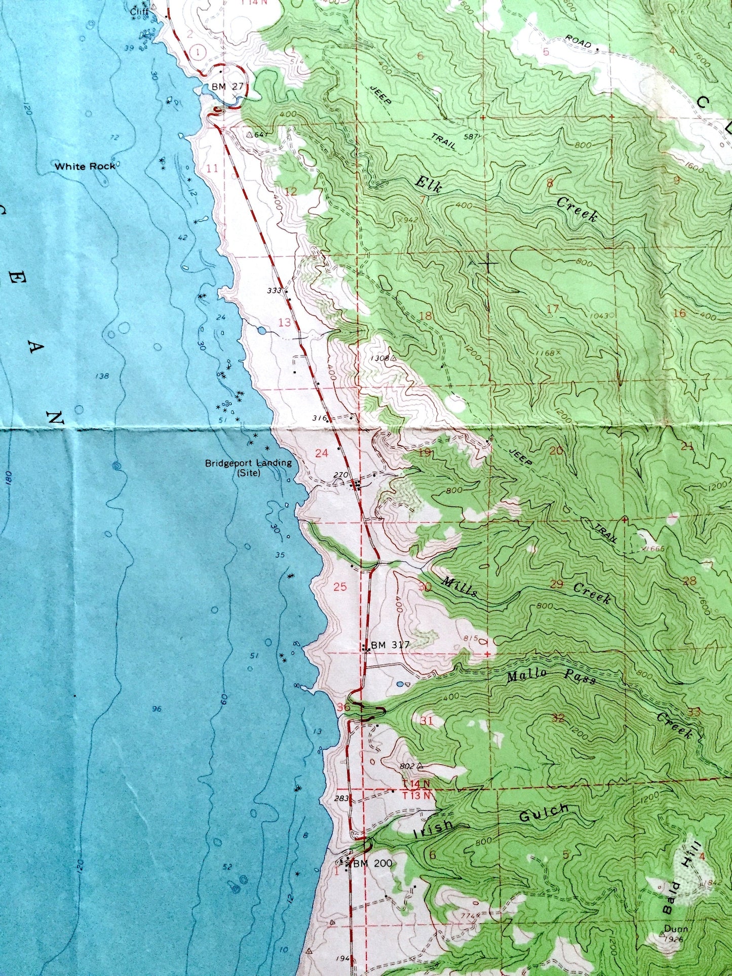
See what the California Coast looked like over 60 years ago. Lots of intricate details and geological contours. Map even has little squares for every house that existed at the time. The USGS cartographers were very thorough back then!
Perfect for the historian, map-lover, the curious or just as a conversation starter. Wonderful and rare. Vintage maps such as these make great gifts.
Edition of 1961, printed 1967
Dimensions: 18" width x 21" height
----
Features
Cities & Towns: Navarro, Albion, Whitesboro, Elk, Reilly Heights.
Points of Interest: Mendocino County, California Coast, Pacific Ocean, Dimmick Memorial Grove State Park, Albion Head, Salmon Point, Albion River, Greenwood Creek, Navarro Point, Saddle Point, Cuffeys Point, Gunderson Rock, Devils Basin, Nose Rock, White Rock, Bridgeport Landing, Navarro Ridge, Cliff Ridge, Greenwood Ridge and many more creeks, springs, hills, ridges, mountains, roads, houses, schools, churches, islands, points, beaches and rocks.
Condition: Good or "Very Vintage" condition, commensurate with age. This map is in great shape for being nearly 60 years old. Has some wear and toning, marker in bottom right corner and folds as-issued, but these will flatten easily and all will add to vintage character when framed.
----
We will happily adjust shipping price for multiple purchases. Maps are rolled up and shipped in sturdy mailing tubes, never folded.
Couldn't load pickup availability
Share