My Store
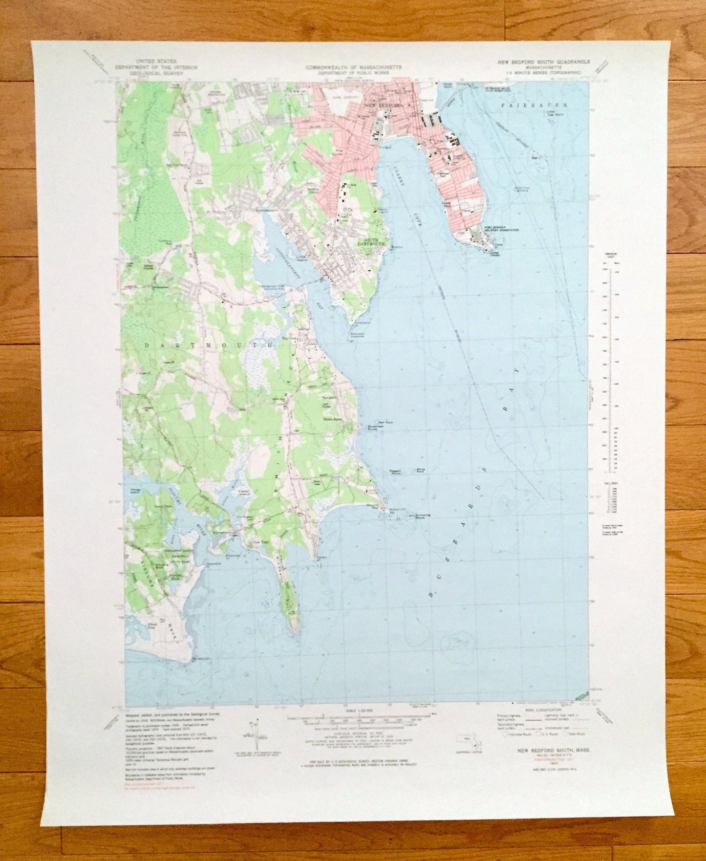
Antique New Bedford, Massachusetts 1977 US Geological Survey Topographic Map – Buzzards Bay, Dartmouth, Fairhaven, Slocum Neck, Smiths Neck
Antique New Bedford, Massachusetts 1977 US Geological Survey Topographic Map – Buzzards Bay, Dartmouth, Fairhaven, Slocum Neck, Smiths Neck
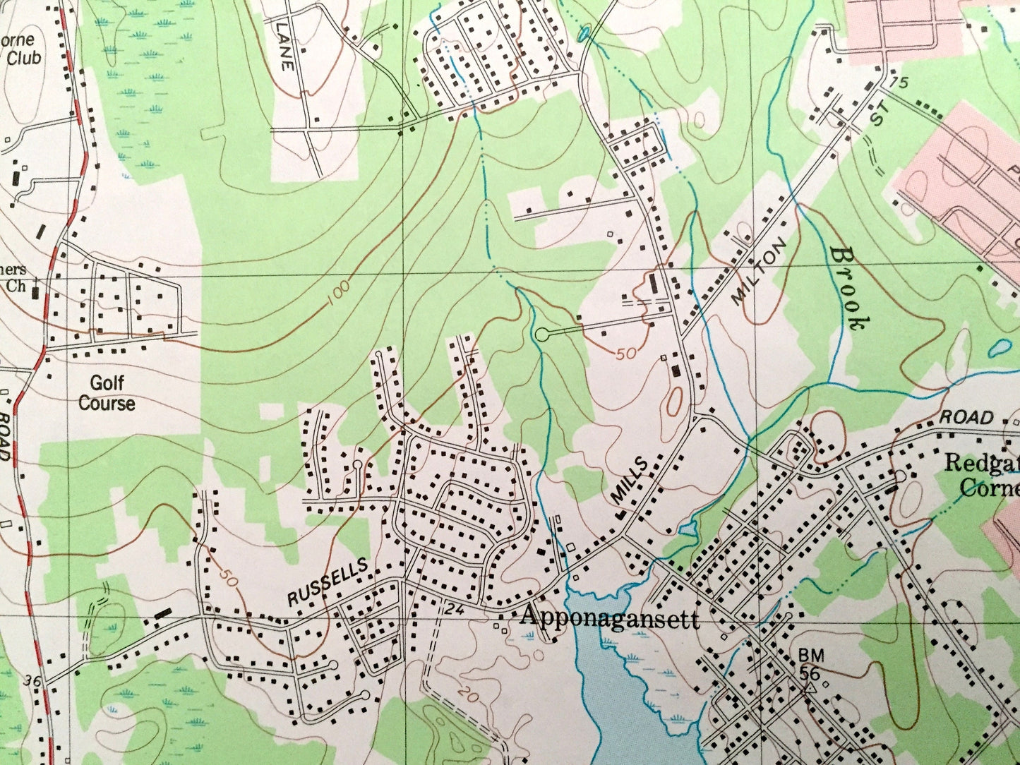
Beautiful, antique map of Dartmouth and New Bedford, Massachusetts and surrounding Bristol County area. This is an authentic 1977 edition, 1983 print from the U.S. Geological Survey and NOT a computer reproduction.
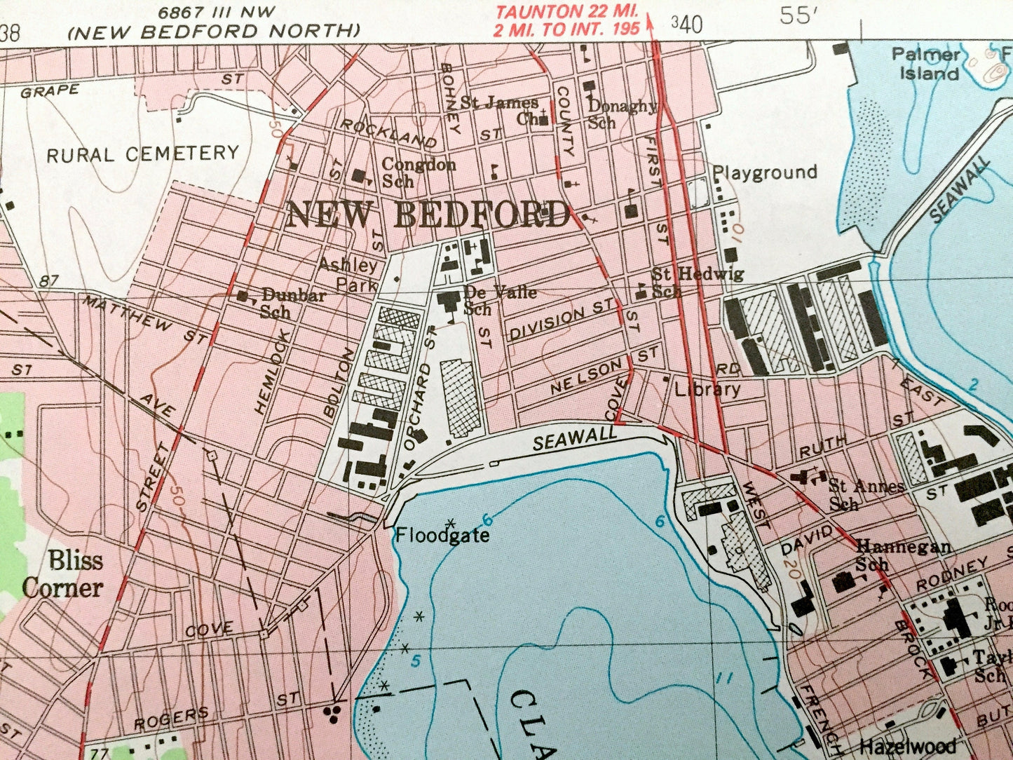
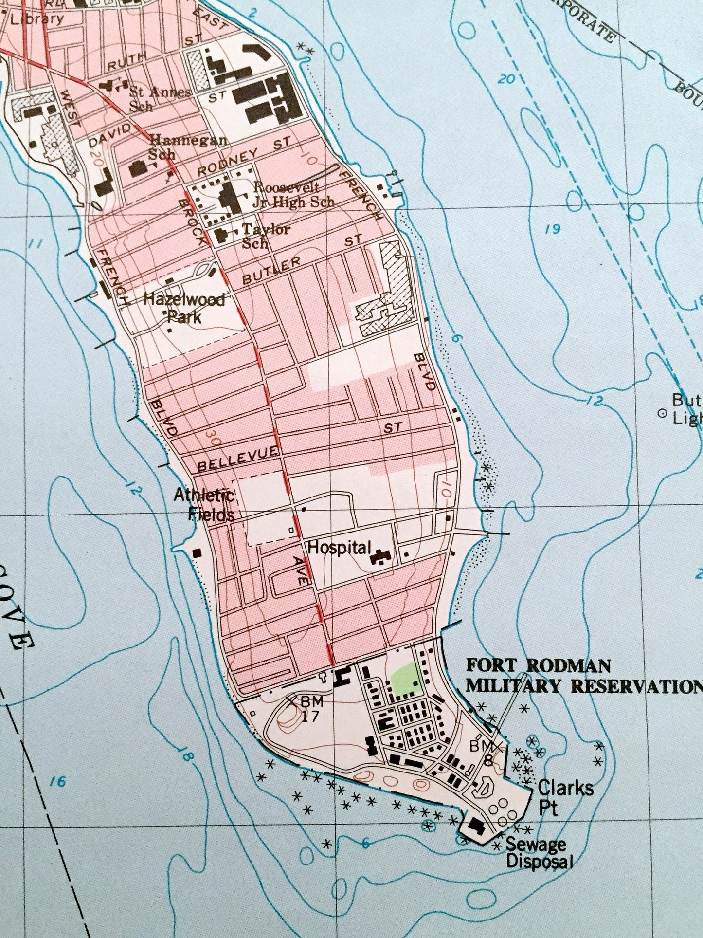
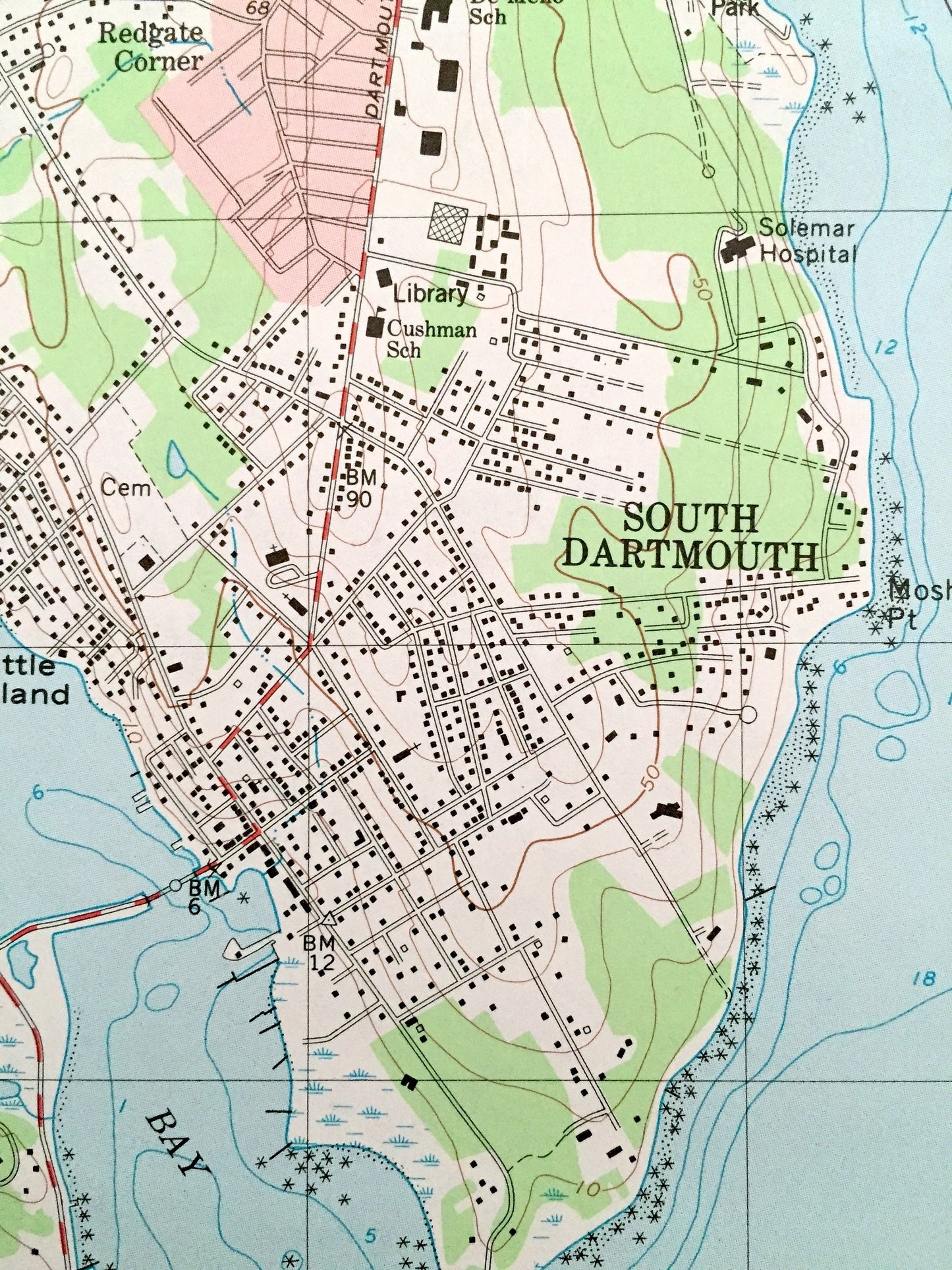
See what Buzzards Bay looked like more than 40 years ago. Lots of intricate details and geological contours. Map even has little squares for every house that existed at the time. The USGS cartographers were very thorough back then!
Perfect for the historian, map-lover, the curious or just as a conversation starter. Wonderful and rare. Vintage maps such as these make great gifts.
Edition of 1977, printed 1983
Dimensions: 22" width x 27" height
----
Features
Cities & Towns: Dartmouth, New Bedford, Fairhaven, Cranberry Bog Corner, Shore Acres, Bayview, Nonquitt, Wilburite Corner, Macomber Corner, Apponagansett, South Dartmouth, Bliss Corner, Fort Rodman.
Points of Interest: Buzzards Bay, Slocum Neck, Smiths Neck, Slocum River, Giles Creek, Goose Island, Potomska Point, Mishaum Point, Salters Point, Dumpling Rocks, Barkkneed Rocks, Padanaram Breakwater, Ricketsons Point, Apponagansett River, Solemar Hospital, Clark Cove, Fort Rodman, Clark Point, Butler Flats Lighthouse, Little Egg Island, Paskamanset River and lots more hills, brooks, marshes, villages, roads and train tracks.
Condition: Very Good condition, commensurate with age. This map is in incredible shape for being almost 40 years old.
----
We will happily adjust shipping price for multiple purchases. Maps are rolled up and shipped in sturdy mailing tubes, never folded.
Couldn't load pickup availability
Share