My Store
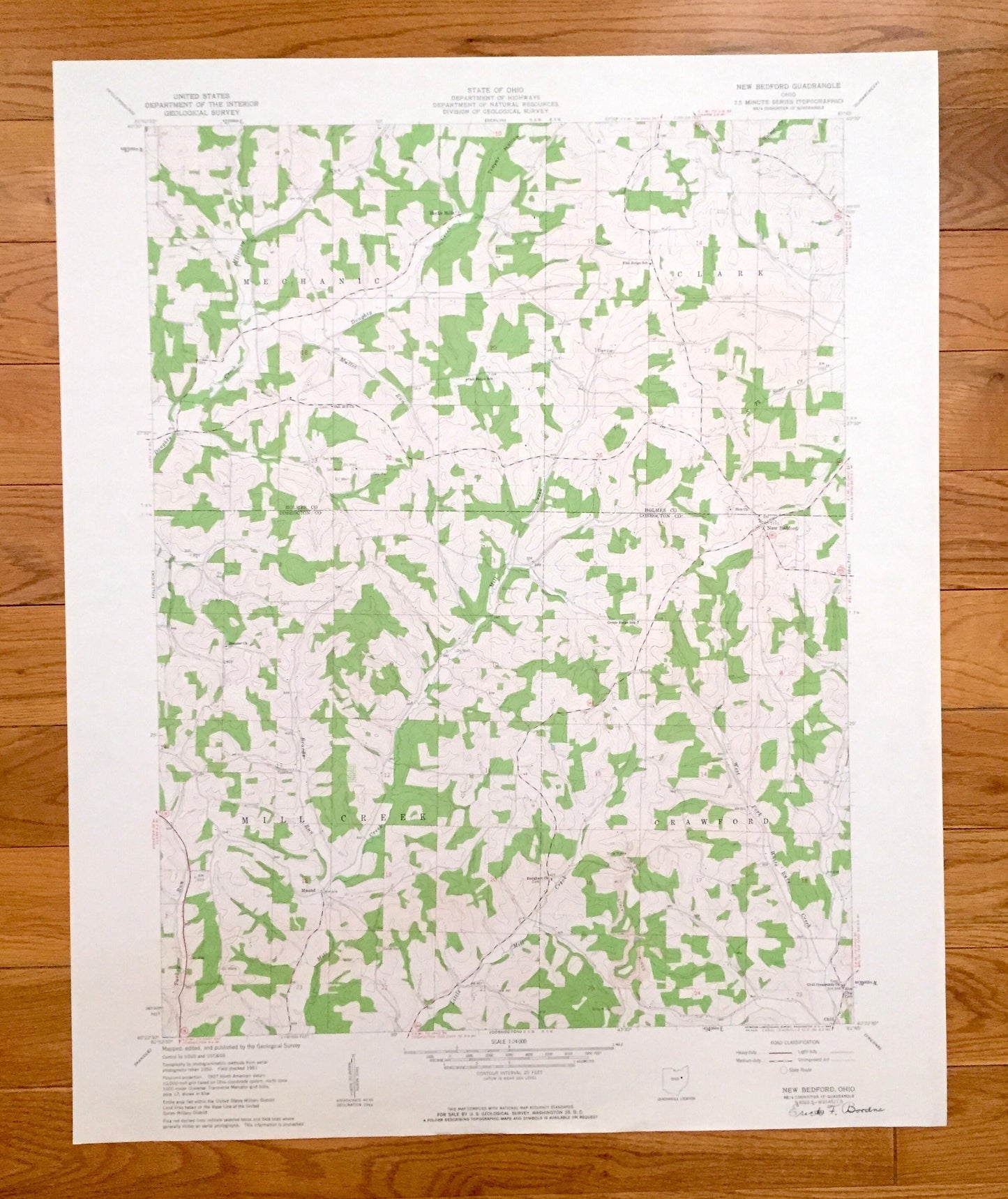
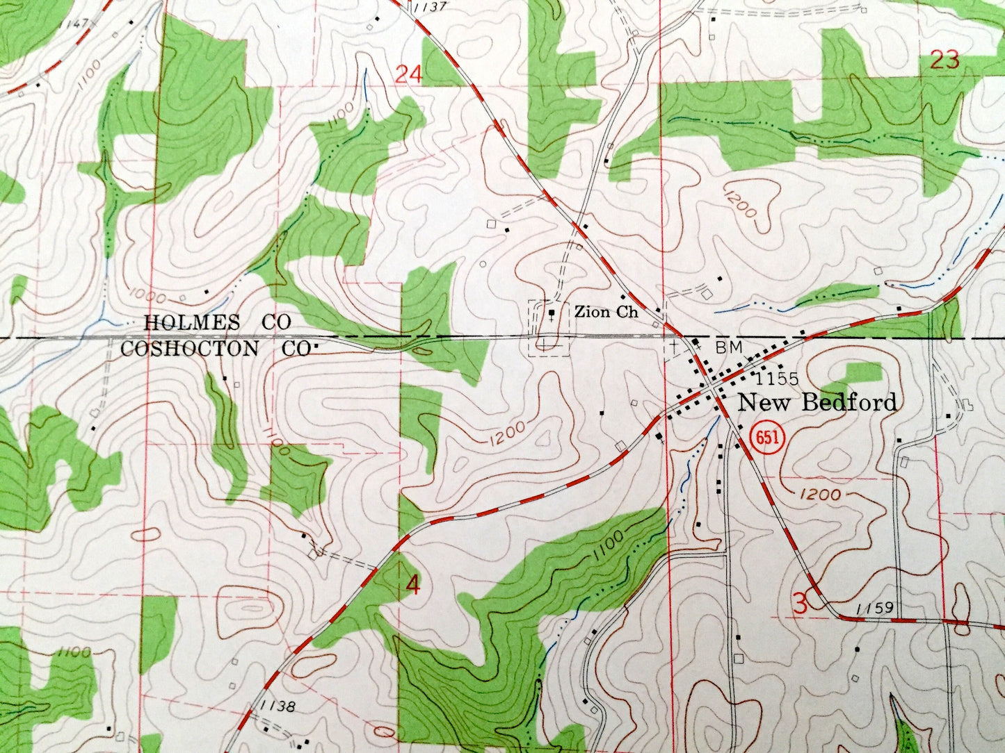
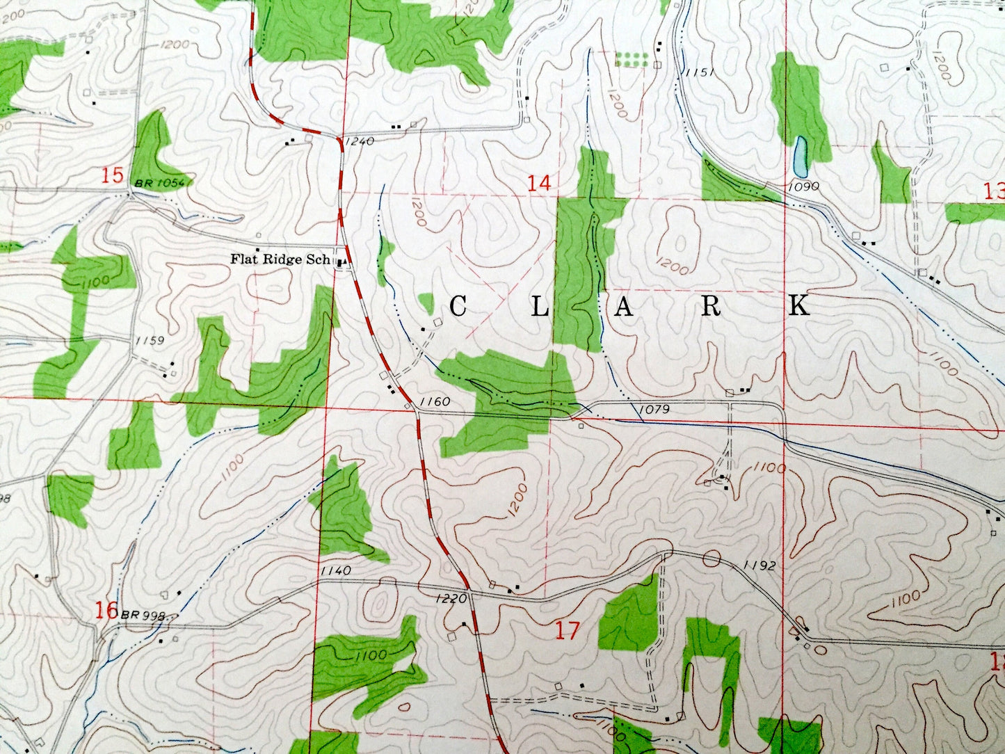
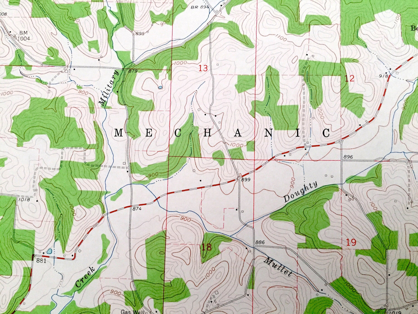
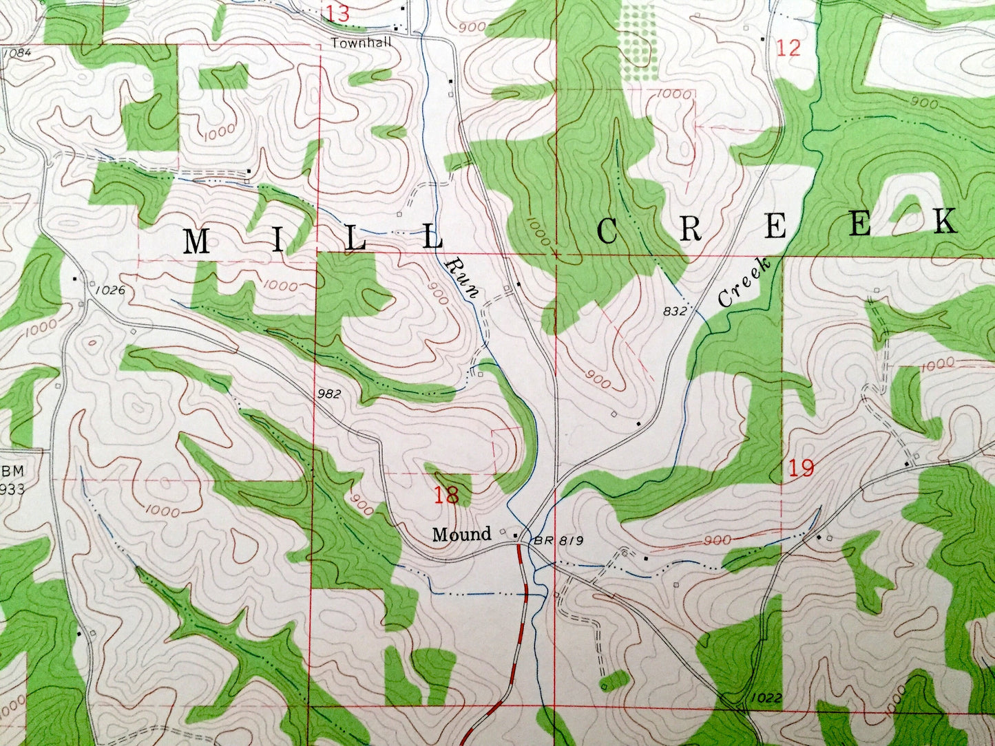
Antique New Bedford, Ohio 1961 US Geological Survey Topographic Map – Holmes, Coshocton County, Mechanic, Mill Creek, Crawford, Clark, OH
Antique New Bedford, Ohio 1961 US Geological Survey Topographic Map – Holmes, Coshocton County, Mechanic, Mill Creek, Crawford, Clark, OH
Beautiful, antique map of New Bedford, Ohio and surrounding Holmes County and Coshocton County areas. This is an authentic 1961 edition, 1963 print from the U.S. Geological Survey and NOT a computer reprint.
See what Ohio looked like over 55 years ago. Lots of intricate details and geological contours. Map even has little squares for every house that existed. The USGS cartographers were very thorough back then!
Perfect for the historian, map-lover, the curious or just as a conversation starter. Wonderful and rare. Vintage maps such as these make great gifts.
Edition of 1961, printed 1963
Dimensions: 22" width x 27" height
----
Features
Cities & Towns: Becks Mills, Mound, Chili.
Points of Interest: Troyer Hollow, Oil Wells, Gas Wells, Strip Mines, Military Run, Doughty Creek, Mullet Run, Mill Creek, Beards Run, Turkey Run, Little Mill Creek, White Eyes Creek, West Fork, and many more hills, ditches, streams, creeks, ponds, houses, schools, railroads, churches and roads.
Condition: Very Good Vintage condition, commensurate with age. This map is in incredible shape for being over 55 years old.
----
We will happily adjust shipping price for multiple purchases. Maps are rolled up and shipped in sturdy mailing tubes, never folded.
Couldn't load pickup availability
Share