My Store
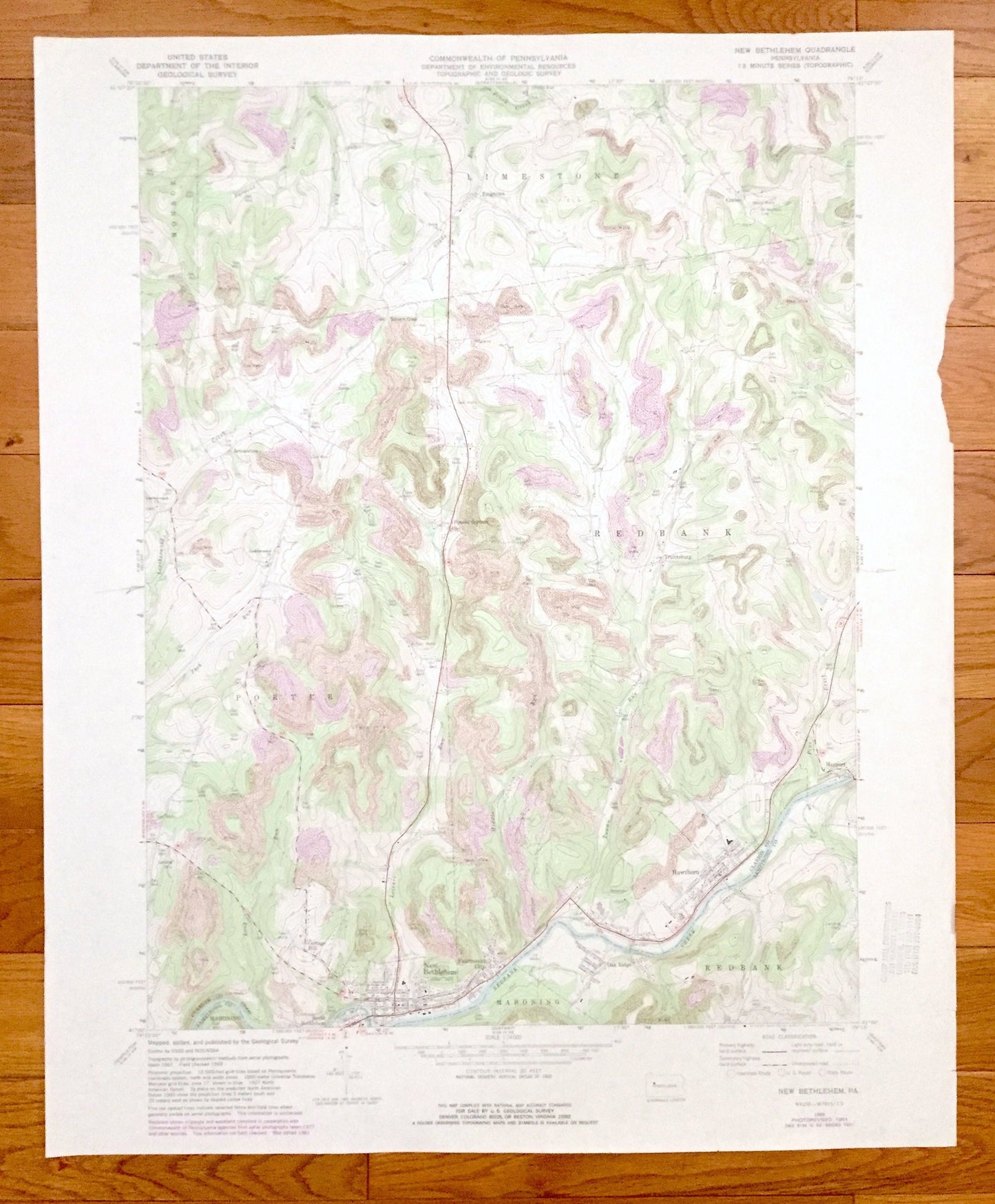
Antique New Bethlehem, Pennsylvania 1969 US Geological Survey Topographic Map – Clarion County, Armstrong County, Redbank, Porter, Limestone
Antique New Bethlehem, Pennsylvania 1969 US Geological Survey Topographic Map – Clarion County, Armstrong County, Redbank, Porter, Limestone
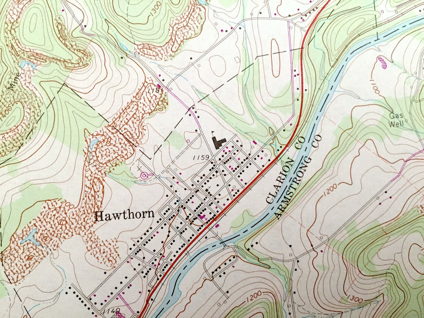
Beautiful, antique map of New Bethlehem, Pennsylvania and surrounding Clarion Country and Armstrong County areas. This is an authentic 1969 edition, 1981 print from the U.S. Geological Survey and NOT a computer reproduction.
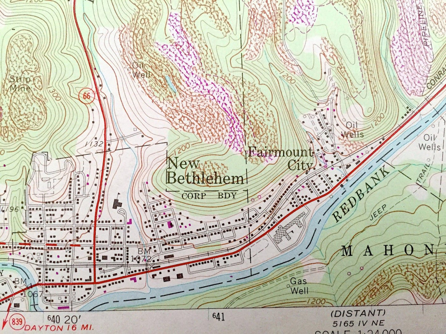
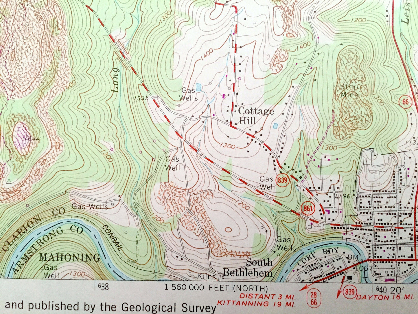
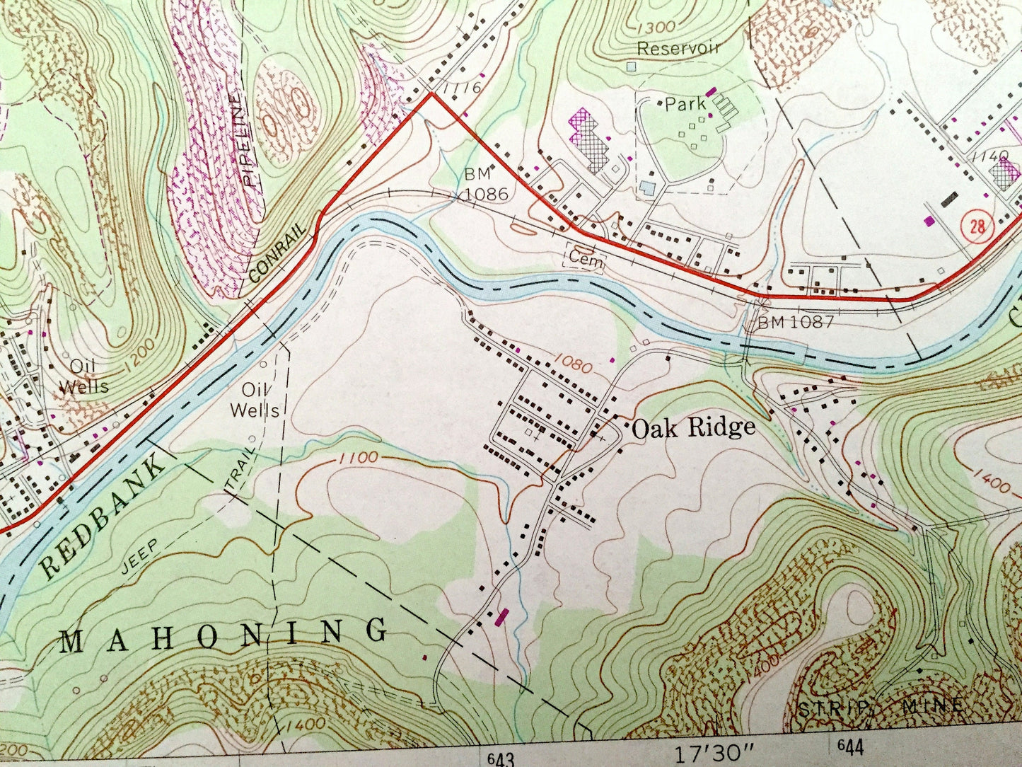
See what Pennsylvania looked like 50 years ago. Lots of intricate details and geological contours. Map even has little squares for every house that existed at the time. The USGS cartographers were very thorough back then!
Perfect for the historian, map-lover, the curious or just as a conversation starter. Wonderful and rare. Vintage maps such as these make great gifts.
Edition of 1969, printed 1981
Dimensions: 22" width x 27" height
----
Features
Cities & Towns: New Bethlehem, Mahoning, Hawthorn, Oak Ridge, Cottage Hill, Fairmount City, South Bethlehem, Mayport, Truittsburg, Spaces Corners, Brinkerton, Monroe, Frogtown, Crates.
Points of Interest: Clarion County, Armstrong County, Redbank Creek, Leatherwood Creek, Jack Run, Leisure Run, Sloan Gap and lots more hills, streams, ponds, schools, churches, houses, and roads.
Condition: Very Good condition, commensurate with age. This map is in incredible shape for being 35 years old. This map was most likely used in the field. Has light edge-wear, some tears, pencil markings and a stamp, all of which will read as vintage character when framed.
----
We will happily adjust shipping price for multiple purchases. Maps are rolled up and shipped in sturdy mailing tubes, never folded.
Couldn't load pickup availability
Share