My Store
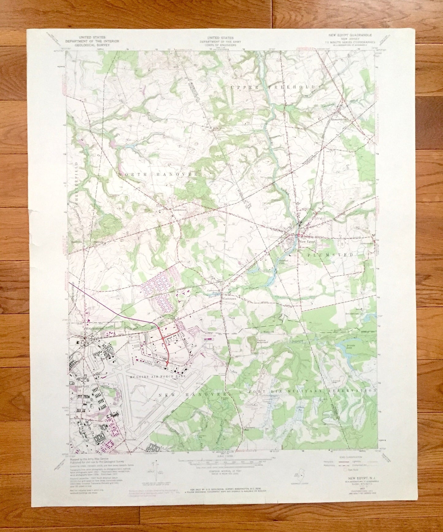
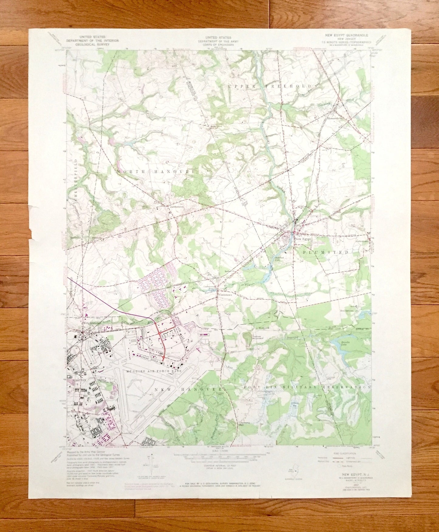
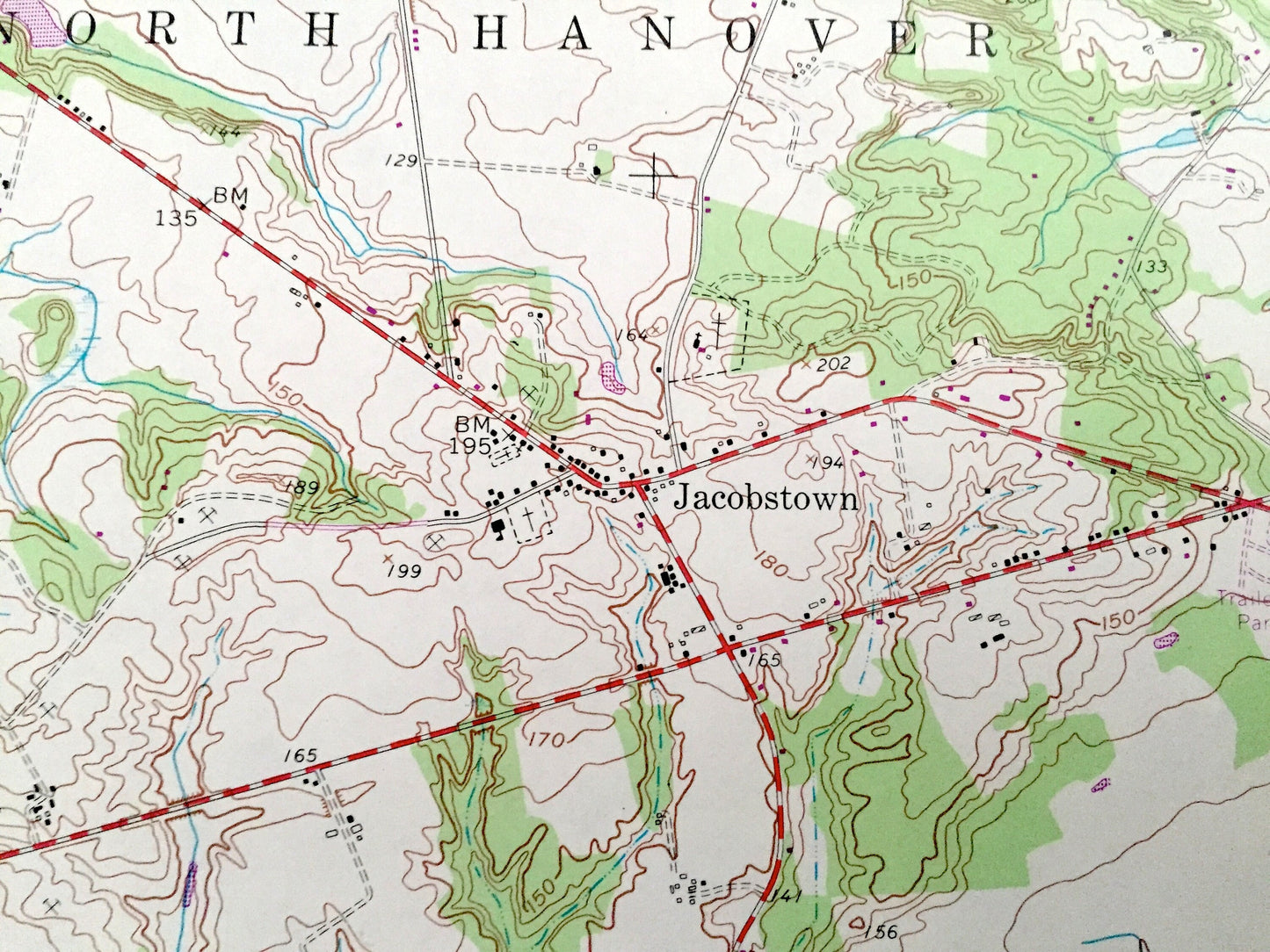
Antique New Egypt, New Jersey 1957 US Geological Survey Topographic Map - Upper Freehold, North Hanover, Plumsted, Fort Dix, Chesterfield NJ
Antique New Egypt, New Jersey 1957 US Geological Survey Topographic Map - Upper Freehold, North Hanover, Plumsted, Fort Dix, Chesterfield NJ
Beautiful, antique map of New Egypt, New Jersey and surrounding Ocean & Burlington County areas. This is an authentic 1957 edition, 1972 print from the U.S. Geological Survey and NOT a computer reproduction.
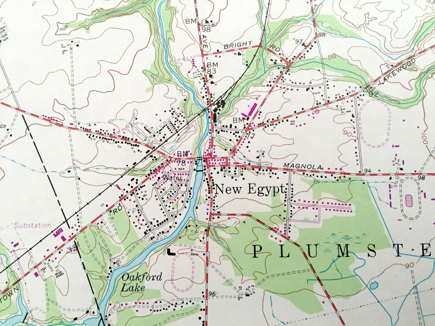
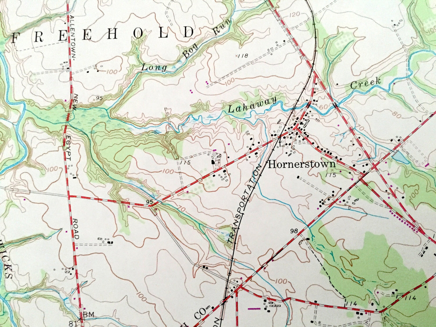
See what New Jersey looked like over 60 years ago. Lots of intricate details and geological contours. Map even has little squares for every house that existed at the time. The USGS cartographers were very thorough back then!
Perfect for the historian, map-lover, the curious or just as a conversation starter. Wonderful and rare. Vintage maps such as these make great gifts.
Edition of 1957, printed 1972
Dimensions: 22" width x 27" height
----
Features
Cities & Towns: New Hanover, Springfield, Hornerstown, Arneytown, Jacobstown, Sykesville, New Egypt, Archertown, Wrightstown, Cookstown, Brindletown, Hockamik, Pointville.
Points of Interest: Cranberry bogs, Cranberry Hall, Golf Course, Crosswicks Creek, Lahaway Creek, Fort Dix Military Reservation, McGuire Air Force Base, Taylors Mountain, Brindle Lake, Oakford Lake, Cookstown Pond, Larkins Run, Jacks Run, Bowkers Run, Long Bog Run, Jumping Brook, Union Transportation, Bunting Bridge Road, and many more hills, streams, ponds, houses, schools, railroads, churches and roads.
Condition: Good Vintage condition, commensurate with age. This map is in great shape for being over 60 years old. Has light edge-wear and a few pencil markings, but this will add to vintage character when framed.
----
We will happily adjust shipping price for multiple purchases. Maps are rolled up and shipped in sturdy mailing tubes, never folded.
Couldn't load pickup availability
Share